Safety Score: 4,2 of 5.0 based on data from 9 authorites. Meaning please reconsider your need to travel to Israel.
Travel warnings are updated daily. Source: Travel Warning Israel. Last Update: 2024-04-26 08:02:42
Delve into Kefar H̱asidim Bet
Kefar H̱asidim Bet in Haifa District is located in Israel about 68 mi (or 110 km) north of Jerusalem, the country's capital town.
Current time in Kefar H̱asidim Bet is now 06:07 AM (Saturday). The local timezone is named Asia / Jerusalem with an UTC offset of 3 hours. We know of 9 airports close to Kefar H̱asidim Bet, of which 3 are larger airports. The closest airport in Israel is Haifa International Airport in a distance of 5 mi (or 7 km), North-West. Besides the airports, there are other travel options available (check left side).
There are several Unesco world heritage sites nearby. The closest heritage site in Israel is Bahá’i Holy Places in Haifa and the Western Galilee in a distance of 9 mi (or 14 km), North-West. We encountered 5 points of interest near this location. If you need a hotel, we compiled a list of available hotels close to the map centre further down the page.
While being here, you might want to pay a visit to some of the following locations: Haifa, Nazareth, Bent Jbail, Tyre and Ash Shunah ash Shamaliyah. To further explore this place, just scroll down and browse the available info.
Local weather forecast
Todays Local Weather Conditions & Forecast: 19°C / 65 °F
| Morning Temperature | 16°C / 62 °F |
| Evening Temperature | 18°C / 64 °F |
| Night Temperature | 17°C / 62 °F |
| Chance of rainfall | 0% |
| Air Humidity | 69% |
| Air Pressure | 1011 hPa |
| Wind Speed | Gentle Breeze with 8 km/h (5 mph) from East |
| Cloud Conditions | Overcast clouds, covering 99% of sky |
| General Conditions | Overcast clouds |
Sunday, 28th of April 2024
21°C (69 °F)
17°C (63 °F)
Overcast clouds, gentle breeze.
Monday, 29th of April 2024
21°C (70 °F)
17°C (63 °F)
Moderate rain, gentle breeze, overcast clouds.
Tuesday, 30th of April 2024
21°C (69 °F)
18°C (64 °F)
Light rain, moderate breeze, clear sky.
Hotels and Places to Stay
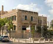
Colony Hotel Haifa
Eshkol Housing Serviced Apartments Haifa
Bay View Haifa
Rothschild Mansion
Videos from this area
These are videos related to the place based on their proximity to this place.
Hanging bridges at Nesher Park - קק״ל פארק נשר
The KKL Nesher Park, located about 500 meters down the road from the University of Haifa on Mt.Carmel, is the perfect place to entertain both children and adults. The park is full of trees,...
כביש 7212 מנשר עד למפגש עם כביש 672 - Road 7212 from Nesher up to Road 672
נסיעה בכביש 7212 מנשר (כביש 752) עד למפגש עם כביש 672 Driving on Road 7212 from Nesher (Road 752) to Road 672 אורך המסלול: 6.0 ק"מ Length of the...
כביש 752 ממחלף יגור לצומת הצק פוסט - .Road 752 from Yagur Interchange to CheckPost Junc
נסיעה בכביש 752 ממחלף יגור לצומת הצ'ק פוסט Driving on Road 752 from Yagur Interchange to CheckPost Junction אורך המסלול: 6.1 ק"מ Length of the trip:...
דירה למכירה בנשר, גבעת נשר, יפה נוף. גיל בקיש רי/מקס פירסט
"רימקס" בלעדי! דירת בוטיק 4 חד' כ100 מ"ר מעוצבת ע"י אדריכל ברמה הכי גבוהה שיש! מרפסת,ממד,2 חניות מקורות,יח' הורים...
Mountain biking. Israel. Reserves Mount Carmel and Little Switzerland
3.07.2009. Велопоходы по Израилю. Заповедники Гора Кармель и Маленькая Швейцария. Mountain biking. Israel. Biking trips. Велопох...
2012 Mandy at Mt Carmel
Mandy Worby at Mt Carmel on the UCB Israel Tour for April/May in 2012. Mandy is giving a brief commentary on some history that happened at mt Carmel from the Bible. Check out more information...
כביש 780 מצומת זבולון עד כביש 781 - Road 780 from Zevulun Juction to Road 781
נסיעה צפון בכביש 780 מצומת זבולון עד כביש 781 Driving north on Road 780 from Zevulun Junction to road 781 אורך המסלול: 5.0 ק"מ Length of the trip:...
Videos provided by Youtube are under the copyright of their owners.
Attractions and noteworthy things
Distances are based on the centre of the city/town and sightseeing location. This list contains brief abstracts about monuments, holiday activities, national parcs, museums, organisations and more from the area as well as interesting facts about the region itself. Where available, you'll find the corresponding homepage. Otherwise the related wikipedia article.
Usha, Israel
Usha is a kibbutz in the western Galilee area of Israel. Located near the city of Kiryat Atta, it falls under the jurisdiction of Zevulun Regional Council. In 2006 it had a population of 350.
Highway 70 (Israel)
Highway 70 is a highway in the coastal plain and Western Galilee in northern Israel. It connects the region of Zikhron Ya'akov to the Lower Galilee and to Kiryat Ata and Shlomi near Israel's border with Lebanon.
Zevulun Regional Council
Zevulun Regional Council is a regional council in the Haifa District of Israel. Founded in 1950, it had a population of 10,900 in 2006. The council borders Mateh Asher Regional Council to the north, Jezreel Valley Regional Council and Shefa-'Amr to the east, Carmel Nature Reserve national park and kiryat Tiv'on to the south and HaKerayot to the west.
Kfar HaMaccabi
Kfar HaMaccabi is a kibbutz in northern Israel. Located near Kiryat Ata, it falls under the jurisdiction of Zevulun Regional Council. In 2006 it had a population of 289. The village was founded in 1936 by members of the HaMaccabi HaTzair youth movement from Czechoslovakia and Germany who had immigrated with the help of Menahem Ussishkin for the first Maccabiah Games in 1932, and was named after the youth group.
Ibtin
Ibtin is a Bedouin village in northern Israel. Located in the Lower Galilee around half a kilometre from Kfar Hasidim, it falls under the jurisdiction of Zevulun Regional Council. In 2007 it had a population of 2,300. The village was established in 1965 as part of a plan to settle the Bedouin in the area in permanent settlements. Residents of the village are members of the Amria tribe.
Oranim Academic College
Oranim is a teacher training college in northern Israel. The college was founded in 1951 by the United Kibbutz Movement. It was named after the small forest of pine trees in the area. It trains kindergarten, elementary and upper school teachers and offers BA, BSc, BEd and MEd qualifications.
Knesses Chizkiyahu
Knesses Chizkiyahu was one of the first Lithuanian yeshivas founded after the establishment of the State of Israel and one of the first Torah institutions in the northern part of the country. Originally founded in Zikhron Ya'akov in 1949, it relocated to Kfar Hasidim in 1955, where it operates today with nearly 200 students and a kollel.
Mount Carmel forest fire (2010)
The Mount Carmel forest fire was a deadly forest fire that started on Mount Carmel in northern Israel, just south of Haifa. The fire began at about 11:00 local time on 2 December 2010, and spread quickly, consuming much of the Mediterranean forest covering the region. The fire claimed 44 lives, making it the deadliest in Israeli history. The dead were mostly Israel Prison Service officer cadets, as well as three senior police officers, among them the chief of Haifa's police.


