Safety Score: 3,0 of 5.0 based on data from 9 authorites. Meaning we advice caution when travelling to Germany.
Travel warnings are updated daily. Source: Travel Warning Germany. Last Update: 2024-05-19 08:11:23
Delve into Ahrweiler
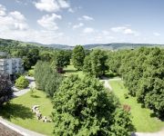
The district Ahrweiler of Bad Neuenahr-Ahrweiler in Rhineland-Palatinate is a district located in Germany about 304 mi south-west of Berlin, the country's capital town.
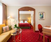
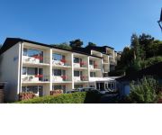
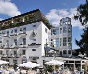
In need of a room? We compiled a list of available hotels close to the map centre further down the page.
Since you are here already, you might want to pay a visit to some of the following locations: Dernau, Rech, Schalkenbach, Mayschoss and Heckenbach. To further explore this place, just scroll down and browse the available info.
Local weather forecast
Todays Local Weather Conditions & Forecast: 19°C / 66 °F
| Morning Temperature | 11°C / 52 °F |
| Evening Temperature | 16°C / 61 °F |
| Night Temperature | 12°C / 53 °F |
| Chance of rainfall | 6% |
| Air Humidity | 68% |
| Air Pressure | 1012 hPa |
| Wind Speed | Gentle Breeze with 6 km/h (4 mph) from South-East |
| Cloud Conditions | Broken clouds, covering 84% of sky |
| General Conditions | Light rain |
Monday, 20th of May 2024
16°C (60 °F)
14°C (56 °F)
Light rain, light breeze, overcast clouds.
Tuesday, 21st of May 2024
20°C (67 °F)
14°C (57 °F)
Moderate rain, light breeze, overcast clouds.
Wednesday, 22nd of May 2024
18°C (64 °F)
12°C (53 °F)
Light rain, gentle breeze, overcast clouds.
Hotels and Places to Stay
SETA Hotel
Ahrtalapartments
Romantik Hotel Sanct Peter - Nichtraucherhotel
Ringhotel Giffels Goldener Anker
Dorint Parkhotel
Steigenberger
Villa Aurora
Eifelstube
Fürstenberg
Ahrbella
Videos from this area
These are videos related to the place based on their proximity to this place.
Julia Bertram, Gebietsweinkönigin der Ahr 2011
Julia Bertram aus Dernau wurde am 10. Juni 2011 zur Gebietsweinkönigin der Ahr 2011/2012 gewählt. Am 18. Juni 2010 war sie zur Dernauer Weinkönigin 2010/11 gewählt worden. Julia Bertram...
Ahrweiler Weinfest Umzug 02
Ahrweiler Weinfest 2011 Umzug 02 Festlicher Umzug mit Ahrwein Königinnen, Burgundia Stefanie Raths, Musik und Weinbau Motiven aus der Kultur der Region des Ahrtals mit Ahrweiler als der ...
Ahrweiler Weinfest Umzug 01
Ahrweiler Weinfest 2011 Umzug 01, Festlicher Umzug mit Ahrwein Königinnen, Musik und Weinbau Motiven aus der Kultur der Region des Ahrtals mit Ahrweiler als der Rotweinmetropole ....
Cabrio Autofahrt Ahrweiler - Ahrtal - Walporzheim 2012 GoPro
Cabrio Boxster Autofahrt von Ahrweiler nach Walporzheim mit GoPro Camera ...Dank für die unterlegte Musik an Markus Pitzer. Du möchtest mehr hören?: The Dreamweaver, Austria ... Porsche...
Martinsfeuer Ahrweiler - Hutenfeuer
Martinsfeuer Ahrweiler - Am 12.11.2011 war es mal wieder so weit : Show-down in der Weinberg-Arena Ahrweiler ! Wer der vier Huten, würde wohl dieses Jahr das schönste Martinsfeuer und Martinsbi.
Impressionen des Fronleichnamstages in Ahrweiler
Einer der Höhepunkte im Festkalender der historischen Kreisstadt Ahrweiler bildet die alljährliche Fronleichnamsprozession begleitet durch die drei Ahrweiler Schützengesellschaften. Das...
Ahrweiler | Stadt | Sehenswürdigkeiten | Rhein-Eifel.TV
http://www.rhein-eifel.tv/ahrweiler.htm - Geschichte und Sehenswürdigkeiten von Ahrweiler, Stadtteil von Bad Neuenahr-Ahrweiler. 1969 wurde die beiden Städte Bad Neuenahr und Ahrweiler mit...
GAUDI - nach dem Umzug...
Ahrweiler Weinfest 2011 Umzug - GAUDI nach dem Umzug, 125 Jahre Männergesangverein, De Krukskes am Marktbrunnen und mit dem Spielmannszug Ahrweiler im Winzerhof Körtgen ....
Ahrweiler Schützenfest 2013 - Parade der Junggesellen am Samstag
Die Parade der St. Laurentius-Junggesellen-Schützengesellschaft Ahrweiler 1612 e.V. am Schützenfest-Samstag, 01. Juni 2013 auf dem Ahrweiler Marktplatz.
Museum Römervilla | Ahrweiler | Rhein-Eifel.TV
http://www.rhein-eifel.tv/roemervilla.htm - Museum Römervilla Ahrweiler: Im März 1980 wurden bei Bauarbeiten für den Ausbau der B 267 bei Ahrweiler Räume eines Herrenhauses des 2. bis 3....
Videos provided by Youtube are under the copyright of their owners.
Attractions and noteworthy things
Distances are based on the centre of the city/town and sightseeing location. This list contains brief abstracts about monuments, holiday activities, national parcs, museums, organisations and more from the area as well as interesting facts about the region itself. Where available, you'll find the corresponding homepage. Otherwise the related wikipedia article.
Ahrweiler
Ahrweiler is a district in the north of Rhineland-Palatinate, Germany. It is bounded by (from the north and clockwise) the districts Euskirchen, Rhein-Sieg and the city Bonn in the state North Rhine-Westphalia, and the districts of Neuwied, Mayen-Koblenz and Vulkaneifel.
Ludendorff Bridge
The Ludendorff Bridge (known frequently by English speaking people during World War II as the Bridge at Remagen) was a railroad bridge across the Rhine River in Nazi Germany, connecting the villages of Remagen and Erpel between two ridges of hills flanking the river. Remagen is located close to and south of the city of Bonn.
Nette (Rhine)
The Nette is a small river in Rhineland-Palatinate, Germany, a left tributary of the Rhine. It rises in the Eifel, south of Nürburg. The Nette flows east through Mayen before reaching the Rhine between Weißenthurm and Andernach. Nette gives her name to one of the Königsbacher Pils beers.
Rolandseck
Rolandseck is a borough of Remagen in Rhineland-Palatinate, Germany. The place consists almost entirely of villas and is a favorite summer resort. Crowning the vine-clad hills behind it lie the ruins of the castle, a picturesque ivy-covered arch, whence a fine view is obtained of the Siebengebirge and the Rhine valley as far as Bonn. Immediately below Rolandseck in mid-river is the island of Nonnenwerth, on which is a nursing school under the conduct of Franciscan nuns, established in 1850.
Aloisiuskolleg
The Aloisiuskolleg is a co-educational, private and Catholic University-preparatory school in Bonn-Bad Godesberg, Germany with an affiliated boarding school directed by the Jesuits. The school is named for Saint Aloysius Gonzaga. It has an excellent reputation and is considered one of the most prestigious boarding schools in Germany. Since early 2010 the school has been at the centre of investigations into the sexual abuse of pupils.
Brohltal
Brohltal is a Verbandsgemeinde ("collective municipality") in the district of Ahrweiler, in Rhineland-Palatinate, Germany. It is situated approx. 30 km north-west of Koblenz. The seat of the municipality is in Niederzissen. The Verbandsgemeinde Brohltal consists of the following Ortsgemeinden ("local municipalities"):
Nonnenwerth
Nonnenwerth is an island near Bad Honnef in the Rhine, upriver from Cologne, administratively part of Remagen in Rhineland-Palatinate.
Bismarck tower
Bismarck towers are a unique genre of German monuments, built to honour the ex-chancellor of Prussia, Otto von Bismarck, according to a specific standard model. A total of 240 of these towers were built between German unification and the National Socialist takeover, i.e. between 1869 and 1934.
Rodderberg
The Rodderberg is an extinct volcano in the east of the municipality of Wachtberg near Bonn, Germany. The last eruption was 250,000 years ago. It is situated just above the Rhine-valley. Together with the Drachenfels directly opposite, the Rodderberg narrows the Rhine-valley. This gorge portion is the southern limit of the lowland-bay of Cologne. The Rodderberg offers views to the Siebengebirge, the Rhine-valley and up to the Cologne Cathedral, about 50 km away.
Swist
The Swist is a brook in North Rhine-Westphalia and Rhineland-Palatinate, Germany. It rises in Rhineland-Palatinate at the Eifel on 330 m sealevel. The brook is 43,6 km long, and joins the Erft at the mouth in North Rhine-Westphalia. It flows through the municipality Swisttal, the town Meckenheim and Flerzheim, a local part of the town Rheinbach. In this area are many cycle paths at the edge of the brook. The Swist gave its name to the municipality of Swisttal and the town of Weilerswist.
Rolandseck station
Rolandseck station in Rolandseck near Remagen, Germany, built in 1856, is considered an important part of the cultural heritage of the Rhineland and a significant early Germany railway building. It is the northernmost railway station on the West Rhine railway in Rhineland-Palatinate.
Altenahr (Verbandsgemeinde)
Altenahr is a Verbandsgemeinde ("collective municipality") in the district of Ahrweiler, in Rhineland-Palatinate, Germany. The seat of the municipality is in Altenahr. The Verbandsgemeinde Altenahr consists of the following Ortsgemeinden ("local municipalities"): Ahrbrück Altenahr Berg Dernau Heckenbach Hönningen Kalenborn Kesseling Kirchsahr Lind Mayschoß
Unkel (Verbandsgemeinde)
Unkel is a Verbandsgemeinde ("collective municipality") in the district of Neuwied, in Rhineland-Palatinate, Germany. The seat of the Verbandsgemeinde is in Unkel. The Verbandsgemeinde Unkel consists of the following Ortsgemeinden ("local municipalities"): Bruchhausen Erpel Rheinbreitbach
Government bunker (Germany)
The Government Bunker (Regierungsbunker) in Germany, officially named Ausweichsitz der Verfassungsorgane des Bundes im Krisen- und Verteidigungsfall zur Wahrung von deren Funktionstüchtigkeit (AdVB), in English: "Emergency Seat of the Federal Constitutional Organs for the State of Crisis or State of Defence to Maintain their Ability to Function" was a massive underground complex designed to house the German government, parliament and all federal personnel needed to keep the government working in the event of war or severe crisis.
Dieringhausen Railway Museum
The Dieringhausen Railway Museum (Eisenbahnmuseum Dieringhausen) is a railway history museum in Dieringhausen in the district of Oberbergischer Kreis in North Rhine-Westphalia, Germany. It is located on the site of the former Deutsche Bundesbahn locomotive depot at Dieringhausen and is a protected historical monument with 2.7 acres of land. After railway operations had ceased on 1 May 1982, a society was founded with the aim of forming and running a museum.
TIRA (System)
The Tracking & Imaging Radar (TIRA) system serves as the central experimental facility for the development and investigation of radar techniques for the detection and reconnaissance of objects in space, and to a certain degree also of air targets. The TIRA system gains radar data at 22.5 cm and 1.8 cm wavelengths. It is located at the FGAN-FHR site, in Wachtberg near Bonn, Germany .
Destruction of the Oberstift
The destruction of the Oberstift, which included Linz, Ahrweiler, and other small towns and villages, occurred in the opening months of the Cologne War, from Christmas Day, 1582 until the end of March, 1583. Over these few weeks, armies of the competing archbishops of Cologne burned the southern-most villages, cloisters, and small towns.
Siege of Godesberg
The Siege of Godesberg, 18 November – 17 December 1583, was the first major siege of the Cologne War (1583–1589). Seeking to wrest control of an important fortification, Bavarian and mercenary soldiers surrounded the Godesberg ("Wotan's Mountain"), and the village then of the same name, now Bad Godesberg ("Wotan's Mountain Spa"), located at its foot.
Godesburg
The Godesburg is a castle in Bad Godesberg, a formerly independent part of Bonn, Germany. Built in the early 13th century on the Godesberg, a hill of volcanic origin, it was largely destroyed following a siege in 1583 at the start of the Cologne War. In 1891, the German emperor Wilhelm II donated the castle's ruin to the city of Bad Godesberg. In 1959, the ruin was rebuilt according to plans by Gottfried Böhm, to house a hotel and restaurant.
Remagen station
Remagen station is on the Left Rhine line in the city of Remagen in the German state of Rhineland-Palatinate. It is classified by Deutsche Bahn as a category 4 station. The station is served by regular regional services as well as Intercity and EuroCity services. It is also the starting point of the Ahr Valley Railway (Ahrtalbahn).
List of Eiffel Tower replicas
As one of the most iconic images in the world, the Eiffel Tower has been the inspiration for the creation of over 30 duplicates and similar towers around the world.
Apollinariskirche, Remagen
The Apollinariskirche is a church on the site of a Roman temple on the Apollinarisberg, a hill above the German town of Remagen. That hill was known as the Martinsberg in the 5th and 6th centuries, presumably after a Frankish chapel there dedicated to Saint Martin, patorn of the Franks. In the 9th century this chapel was replaced by a Romanesque church. In 1110 the Benedictines of the Michaelsberg Abbey, on the initiative of the people of Remagen, set up a provost there.
Unkel station
Unkel station is on the East Rhine Railway and is the only station in the town of Unkel in the German state of Rhineland-Palatinate. It was built in 1870. The station has three platform tracks on two platforms. The regional rail services are organised by the Verkehrsverbund Rhein-Sieg (Rhine-Sieg transport association, VRS). The station is classified by Deutsche Bahn as a category 5 station.
Arzdorfer Bach
Arzdorfer Bach is a river of North Rhine-Westphalia, Germany.
Noßbach
Noßbach is a river of North Rhine-Westphalia, Germany.


