Safety Score: 3,0 of 5.0 based on data from 9 authorites. Meaning we advice caution when travelling to Germany.
Travel warnings are updated daily. Source: Travel Warning Germany. Last Update: 2024-05-06 08:04:52
Delve into Dycker Schelsen
The district Dycker Schelsen of Schelsen in Regierungsbezirk Düsseldorf (North Rhine-Westphalia) is a subburb in Germany about 309 mi west of Berlin, the country's capital town.
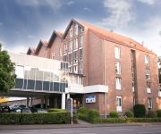
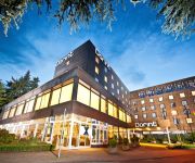
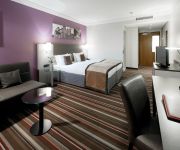
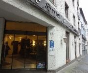
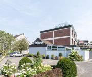
If you need a hotel, we compiled a list of available hotels close to the map centre further down the page.
While being here, you might want to pay a visit to some of the following locations: Juchen, Moenchengladbach, Viersen, Titz and Neuss. To further explore this place, just scroll down and browse the available info.
Local weather forecast
Todays Local Weather Conditions & Forecast: 18°C / 65 °F
| Morning Temperature | 12°C / 53 °F |
| Evening Temperature | 17°C / 63 °F |
| Night Temperature | 12°C / 54 °F |
| Chance of rainfall | 10% |
| Air Humidity | 59% |
| Air Pressure | 1017 hPa |
| Wind Speed | Gentle Breeze with 8 km/h (5 mph) from South |
| Cloud Conditions | Overcast clouds, covering 97% of sky |
| General Conditions | Moderate rain |
Wednesday, 8th of May 2024
13°C (55 °F)
12°C (54 °F)
Broken clouds, gentle breeze.
Thursday, 9th of May 2024
17°C (62 °F)
12°C (54 °F)
Overcast clouds, light breeze.
Friday, 10th of May 2024
19°C (67 °F)
13°C (56 °F)
Overcast clouds, gentle breeze.
Hotels and Places to Stay
Rosenmeer
Best Western Plus Crown Hotel
Dorint Parkhotel
Freiraum stattHotel
Leonardo
Spickhofen
St. Andreas
Fair Hotel
Select
Schürken's
Videos from this area
These are videos related to the place based on their proximity to this place.
2015-04-08 Jüchen: Großeinsatz der Feuerwehr - ABC-Alarm in Waat
Jüchen-Waat – Gegen 13:15 Uhr löste die Kreisleitstelle für den Bereich Jüchen Waat ABC Alarm aus. Auf einem Grundstück sollte eine unbekannte Flüssigkeit aus einem Übersee Container...
Agilitytunier EKV Übach-Palenberg 01.12.2013 Jumping 1
Unser erstes Tunier... 1 Vw weil Frauchen falsch gestanden hat :P Ansonsten Platz 7 mit 1Vw in 41,84 sec. Damit sind wir sehr zufrieden :)
89 RELOAD a few songclips
89-RELOAD Rock`n Blues Band from GOOD OLD GERMANY Mönchengladbach Rent a band! Rockband.89-reload@live.de.
Schützenfest in Korschenbroich 2012 (2)
1.Block der Parade an der Kirche anläßlich von Unges Pengste in Korschenbroich am 28.05.2012.
Pressekonferenz TV Korschenbroich - SV 64 Zweibrücken 10.01.2015
Pressekonferenz nach dem Spiel des TV Korschenbroich gegen den SV 64 Zweibrücken 32:30 (13:14) am 10.01.2015 in der 3. Liga West. Es sprechen Stefan Bullacher (Trainer SV 64 Zweibrücken)...
Schützenfest in Korschenbroich 2012 (6)
5.Block der Parade an der Kirche anläßlich von Unges Pengste in Korschenbroich am 28.05.2012.
Vorstellung der 1-a-Reinigung aus Korschenbroich
Die 1-a-Reinigung aus Korschenbroich stellt sich vor. Wir freuen uns auf Ihren Besuch in einer unserer Filialen in Korschenbroich.
Videos provided by Youtube are under the copyright of their owners.
Attractions and noteworthy things
Distances are based on the centre of the city/town and sightseeing location. This list contains brief abstracts about monuments, holiday activities, national parcs, museums, organisations and more from the area as well as interesting facts about the region itself. Where available, you'll find the corresponding homepage. Otherwise the related wikipedia article.
Rheydt
Rheydt is a borough of the German city Mönchengladbach, located in the west of North Rhine-Westphalia. Until 1918 and then again from 1933 (due to a split from Mönchengladbach arranged by Joseph Goebbels, who was born there) through 1975 it was an independent city. After merging with Mönchengladbach, the central station kept its original name, making Mönchengladbach the only city in Germany to have two stations called Hauptbahnhof.
Roer (department)
Roer is the name of a département of the First French Empire in present day Germany and the Netherlands. It was named after the river Rur, which flows through the département. It was formed in 1795, when the Southern Netherlands and the left bank of the Rhine were occupied by the French.
Bagger 288
Bagger 288 (Excavator 288), built by the German company Krupp for the energy and mining firm Rheinbraun, is a bucket-wheel excavator or mobile strip mining machine. When its construction was completed in 1978, Bagger 288 superseded NASA's Crawler-Transporter, used to carry the Space Shuttle and Apollo Saturn V launch vehicle (itself built by excavator manufacturer Marion Power Shovel Company), as the largest land vehicle in the world, at 13,500 tons.
Odenkirchen
Odenkirchen is a former town in Germany, presently part of the city Mönchengladbach. It is situated on the river Niers, 21 miles by rail south-west of Düsseldorf. It has a railway station, on the line from Mönchengladbach to Grevenbroich and Cologne. Pop. (2000) 19,993. Odenkirchen became a town in 1856. See Wiedemann, Geschichte der ehemaligen Herrschaft und des Hauses Odenkirchen (Odenkirchen, 1879).
Bökelbergstadion
The Bökelbergstadion was a football stadium in Mönchengladbach, Germany.
Rheydt Central Station
Rheydt Central Station (Rheydt Hauptbahnhof) is a railway station in Mönchengladbach, Germany. Mönchengladbach is the only city in Germany that has two stations called Hauptbahnhof, due to the merger of the city of Rheydt into Mönchengladbach in the late 1970s.
Warsteiner HockeyPark
Warsteiner HockeyPark is a multi-use stadium in Mönchengladbach, Germany. It is currently used mostly for american football and field hockey matches and hosted the 2006 World Hockey Cup. The stadium is run by former German field hockey international Michael Hilgers. It is also used by the American football team Mönchengladbach Mavericks.
Gladbach Abbey
Gladbach Abbey was a Benedictine abbey founded in 974 by Archbishop Gero of Cologne and the monk Sandrad from Trier. It was named after the Gladbach, a narrow brook that now runs underground. The abbey and its adjoining villages grew into the town of Gladbach, incorporated in the 1360s, the origin of the present city of Mönchengladbach in North Rhine-Westphalia. In 1802 the abbey was occupied by troops under the French occupation and secularised; its great library was dispersed.
Abteiberg Museum
The Museum Abteiberg is a municipal museum for contemporary art in the German city Mönchengladbach. Since the 1970s, the museum has been known for its experimental and avant-garde exhibitions, starting with director Johannes Cladders (1967-1985), and also its museum architecture, designed by Austrian architect Hans Hollein - a highpoint of postmodern design.
Lordship of Myllendonk
The Lordship of Myllendonk (sometimes spelled "Millendonk") was an estate of the Holy Roman Empire, located in western North Rhine-Westphalia, Germany. It was bordered by the Duchy of Jülich to the west and north, the Lordship of Dyck to the south, and the Archbishopric of Cologne to the east and southeast. The lordship contained Grevenbroich and the Castle of Myllendonk. From 1700 Myllendonk was an Imperial Estate with a vote in the Bench of Counts of Westphalia.
Lordship of Wickrath
The Lordship of Wickrath (sometimes spelled "Wykradt") was a Lordship of the Holy Roman Empire located in western North Rhine-Westphalia around the castle of Wickrath. The Lordship was bordered by Jülich to the south, west and north, and the Archbishopric of Cologne to the east. Wickrath became an immediate Lordship in 1488 afrer it passed to the Knights of Hompesch.
Mönchengladbach Central Station
Mönchengladbach Central Station (Mönchengladbach Hauptbahnhof) is a railway station in the city of Mönchengladbach in western Germany.
Mönchengladbach-Lürrip station
Mönchengladbach-Lürrip station is a through station in the town of Mönchengladbach in the German state of North Rhine-Westphalia. The station was opened in 1980 or 1981 on the Mönchengladbach–Düsseldorf railway opened between Mönchengladbach and Neuss by the Aachen-Düsseldorf-Ruhrort Railway Company on 16 December 1852. It has two platform tracks and it is classified by Deutsche Bahn as a category 6 station.
Korschenbroich station
Korschenbroich station is a through station in the town of Korschenbroich in the German state of North Rhine-Westphalia. The station was opened between 1868 and 1880 on the Mönchengladbach–Düsseldorf railway opened between Mönchengladbach and Neuss by the Aachen-Düsseldorf-Ruhrort Railway Company on 16 December 1852. It has two platform tracks and it is classified by Deutsche Bahn as a category 5 station.
Kleinenbroich station
Kleinenbroich station is a through station in the town of Korschenbroich in the German state of North Rhine-Westphalia. The station was opened on 17 January 1853 on the Mönchengladbach–Düsseldorf railway opened between Mönchengladbach and Neuss by the Aachen-Düsseldorf-Ruhrort Railway Company on 16 December 1852. It has two platform tracks and it is classified by Deutsche Bahn as a category 5 station.
Büttgen station
Büttgen is a railway station in the Büttgen neighbourhood of the city Kaarst in the German state of North Rhine-Westphalia. The station was opened on 8 January 1868 on the Mönchengladbach–Düsseldorf railway opened between Mönchengladbach and Neuss by the Aachen-Düsseldorf-Ruhrort Railway Company on 16 December 1852. It has two platform tracks and it is classified by Deutsche Bahn as a category 5 station.
Vierwinden
Vierwinden is a locality in the municipality Windhagen in the district of Neuwied in Rhineland-Palatinate, Germany.
Schloss Rheydt
Schloss Rheydt is a Renaissance palace in Rheydt, Mönchengladbach, North Rhine-Westphalia, Germany. Over the years the building has been the family seat of various noble families, including the Bylandt-Rheydt dynasty that ruled over Rheydt for over 300 years and gave the palace its present look.
Bunter Garten
The Bunter Garten (30 hectares) is a municipal park with botanical garden (5 hectares) and arboretum located along Lettow-Vorbeck Straße, Mönchengladbach, North Rhine-Westphalia, Germany. It is open daily without charge. The park contains three major sections: Kaiserpark, Colorful Garden, and Botanical Garden, including a rock garden, herb garden, and a fragrance garden, as well as the Kaiser-Friedrich-Halle and an aviary of some 200 birds.
Jahnstadion (Mönchengladbach)
Jahnstadion is a multi-use stadium in Mönchengladbach, Germany . It is used as the stadium of Rheydter Spielverein matches. The capacity of the stadium is 20,000 spectators.
Garzweiler surface mine
The Tagebau Garzweiler is a large surface mine in the German federated state of North-Rhine Westphalia. It is operated by RWE and used for mining lignite. The mine currently has a size of 48 km² and got its name from the village of Garzweiler which previously existed at this location.
Kaarster See station
Kaarster See station is located in the town of Kaarst in the German state of North Rhine-Westphalia on the remaining part of the Neuss–Viersen railway, opened by the Rhenish Railway Company on 15 November 1877. The station opened on 26 September 1999. The station is served by line S 28 of the Rhine-Ruhr S-Bahn, running between Mettmann Stadtwald and Kaarster See, operating every 20 minutes during the day.
Gladbach (Niers)
Gladbach (Niers) is a river of North Rhine-Westphalia, Germany.
Köhm
Köhm is a river of North Rhine-Westphalia, Germany.
Giesenkirchen
Giesenkirchen is a district in the city of Mönchengladbach in the eastern part of the Lower Rhine region, Germany. Up to 22 October 2009 it was a separate borough of Mönchengladbach. Previously it had been part of Rheydt, which was suburbanized with Mönchengladbach in 1975. On 30 June 2007, Giesenkirchen had 15,853 inhabitants. Of these, 9,130 lived in the district of Giesenkirchen-Mitte, 4,431 in Giesenkirchen-Nord and 2,292 in Schelsen.


