Safety Score: 3,0 of 5.0 based on data from 9 authorites. Meaning we advice caution when travelling to Germany.
Travel warnings are updated daily. Source: Travel Warning Germany. Last Update: 2024-05-12 08:29:37
Touring Altenkirchen
The district Altenkirchen of Möttau in Regierungsbezirk Gießen (Hesse) is a subburb located in Germany about 258 mi south-west of Berlin, the country's capital place.
Need some hints on where to stay? We compiled a list of available hotels close to the map centre further down the page.
Being here already, you might want to pay a visit to some of the following locations: Schoeffengrund, Gravenwiesbach, Weinbach, Ehringshausen and Wetzlar. To further explore this place, just scroll down and browse the available info.
Local weather forecast
Todays Local Weather Conditions & Forecast: 23°C / 74 °F
| Morning Temperature | 10°C / 51 °F |
| Evening Temperature | 22°C / 71 °F |
| Night Temperature | 14°C / 58 °F |
| Chance of rainfall | 0% |
| Air Humidity | 46% |
| Air Pressure | 1016 hPa |
| Wind Speed | Gentle Breeze with 6 km/h (4 mph) from West |
| Cloud Conditions | Few clouds, covering 11% of sky |
| General Conditions | Few clouds |
Monday, 13th of May 2024
22°C (71 °F)
13°C (56 °F)
Light rain, gentle breeze, scattered clouds.
Tuesday, 14th of May 2024
22°C (71 °F)
14°C (57 °F)
Sky is clear, gentle breeze, clear sky.
Wednesday, 15th of May 2024
19°C (66 °F)
12°C (54 °F)
Light rain, gentle breeze, overcast clouds.
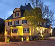
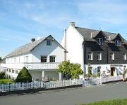
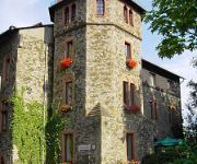
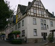
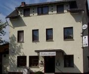
Hotels and Places to Stay
Im alten Forstamt
Landhaus Einhaus
Schloßhotel
Parkhotel Fürstenhof
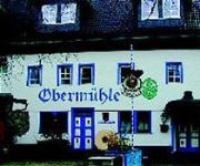
Brauhaus Obermühle
Gombel Gasthaus
Videos from this area
These are videos related to the place based on their proximity to this place.
Kinder in der Bütt - Weilmünster 2015 - Bambini
Die Kindertanzgruppe "Bambini" des TuS 03 Weilmünster brachte mit "Oben auf'm Berg" die Zwerge auf die "Kinder in der Bütt" Bühne am 01.02.2015.
persische hochflieger.mp4
die tauben sind auch zum verkauf... bei interesse, nummer finden sie in meinem profil !!!
Cold Water Challenge Feuerwehr Braunfels
Die Feuerwehr Braunfels wurde von den Kameraden der Feuerwehr Brandoberndorf für die Cold Water Challenge nominiert. Wir bedanken uns recht herzlich bei unseren Nachbarn! Wir haben die ...
Pfingstfliegen Braunfels 2013 - Oldtimer - by MmhSchinken
Oldtimer und Hotrod mit einem herrlichen Klang. Aufgenommen beim Pfingstfliegen in Braunfels am 19.05.2013. Schaut auch nach meinen anderen Videos vom Pfingstfliegen Braunfels.
Braunfels- Pferdesteuer - Aktionsbündnis Pro Pferd e. V. - 05.12.2013
Pferdesteuer Braunfels: Es wurde beschlossen, die Entscheidung über eine Pferdesteuer bis zum Ausgang des Normenkontrollverfahrens abzuwarten. Jetzt ist der richtige Zeitpunkt, mit den Stadtvero...
Schloss Braunfels
Rundflug mit eine DJI Phantom Quadrocopter bei Schloss Braunfels. Camera: GoPro Hero 3.
Pfingstfliegen Braunfels 2013 - Lanz Bulldog - by MmhSchinken
Ein schöner alter Lanz Bulldog mit einem herrlichen Klang. Aufgenommen beim Pfingstfliegen in Braunfels am 19.05.2013. Schaut auch nach meinen anderen Videos vom Pfingstfliegen Braunfels.
Pfingstfliegen Braunfels 2013 - Helicopter - by MmhSchinken
Beim Pfingstfliegen in Braunfels konnte man in diesem Jahr mit einem Helicopter einen Rundflug starten. Hier ein paar Aufnahmen der recht spektakulären Starts und Landungen des Helis.
Romaria em Braunfels - Alemanha (11/06/2009)
Romaria de Finados, nas ruas de Braunfels (Alemanha). A maioria das pessoas por aqui são protestante. A igreja católica da cidade tem apenas em torno de 50 anos.
Videos provided by Youtube are under the copyright of their owners.
Attractions and noteworthy things
Distances are based on the centre of the city/town and sightseeing location. This list contains brief abstracts about monuments, holiday activities, national parcs, museums, organisations and more from the area as well as interesting facts about the region itself. Where available, you'll find the corresponding homepage. Otherwise the related wikipedia article.
Leica Camera
Leica Camera AG, a German optics company, manufactures Leica cameras. The predecessor of the company, formerly known as Ernst Leitz GmbH, is now three companies: Leica Camera AG, Leica Geosystems AG, and Leica Microsystems GmbH, which manufacture cameras, geosurvey equipment, and microscopes, respectively. Leica Microsystems AG owns the Leica brand and licences the sister companies to use it.
Reichskammergericht
The Reichskammergericht (Imperial Chamber Court) was one of two highest judicial institutions in the Holy Roman Empire, the other one being the Aulic Council in Vienna. It was founded in 1495 by the Imperial Diet in Worms. All legal proceedings in the Holy Roman Empire could be brought to the Imperial Chamber Court, except if the ruler of the territory had a so-called privilegium de non appellando, in which case the highest judicial institution was found by the ruler of that territory.
Rittal Arena Wetzlar
Rittal Arena Wetzlar is an indoor sporting arena located in Wetzlar, Germany. The capacity of the arena is 5,000 people and it was opened in 2005. It is the home to the Handball Bundesliga club HSG Wetzlar. The arena previously carried the name Mittelhessen-Arena until the naming rights to the stadium were sold in March 2006 to the German company Rittal. The stadium was one of the venues for the 2007 World Men's Handball Championship.
Dill (river)
The Dill is a 55 km long river, flowing through central Hesse in Germany. It is a tributary to the Lahn, joining it on the right bank at the town of Wetzlar.
Phantastische Bibliothek Wetzlar
The Phantastische Bibliothek Wetzlar (Fantastic Library of Wetzlar) was founded in 1989 and has become one of the largest public libraries specialised in Fantasy literature worldwide, it is the largest in Europe. It is generally a reference library, open for the public and researchers.
Wetzlar Cathedral
Wetzlar Cathedral is a large church in the town of Wetzlar, located on the Lahn river some 50 km north of Frankfurt. Construction began in 1230 and is still unfinished, since the western front is still missing its northern belfry. Because of its long period of construction, the church combines romanesque, gothic and baroque architecture. The church has never been a bishop's seat, and therefore is not a cathedral in the English sense.
Katzenfurt
Katzenfurt is a local part of Ehringshausen. The name does not mean Katze, but the name comes from the Chatten or Katten, an ancient Germanic tribe.
Wetzlarer Kreuz
The Wetzlarer Kreuz is an Autobahn interchange in the city of Wetzlar in Hesse, Germany where the highways A45 and A480 meet. This junction is a stack interchange, which is the only full built stack interchange in Germany.
Selters (Lahn)
Selters is a village in the district Limburg-Weilburg, Hesse, Germany. It is situated at the Taunus side of the river Lahn and belongs to the municipality Löhnberg. The village has a total population of about 400 inhabitants. The village is famous for its natural springs of carbonated mineral water, which is sold as Selters water. In English, both Seltzer and Alka Seltzer refer to the toponym.
Weil (river)
The Weil is small 50 km long river in Hesse, Germany. It is a left tributary to the Lahn river and the city of Weilburg is located next to its mouth. The river flows exclusively through the Taunus mountain range with its source being located between the Kleiner Feldberg and Großer Feldberg mountains. It flows through Schmitten, Weilrod and Weilmünster. A hiking trail as well as a biking trail follow the course of the river.
Waldgirmes Forum
The Roman Forum of Lahnau-Waldgirmes (German: Das Römische Forum Lahnau-Waldgirmes) is a fortified Roman trading place, located at the edge of the modern village Waldgirmes, part of Lahnau on the Lahn, Hesse, Germany. The site has the oldest known stone buildings in Magna Germania.
Baitul Huda, Usingen
The Baitul Huda (House of Guidance) in Usingen is a mosque in Germany run by the Ahmadiyya Muslim Community (AMJ) and was inaugurated on September 7, 2004 by Mirza Masroor Ahmad. Its two prayer rooms are 77 m² each. The community in Usingen has 160 members. The mosque was partially burned in the morning of December 23, 2004. A lot of people of Usingen made donations for the reconstruction of the mosque. After the reconstruction a tree in the entrance was plant as a sign of friendship.
Leica Microsystems
Leica Microsystems GmbH is a leading global manufacturer of optical microscopes, equipment for the preparation of microscopic specimens and related products. There are ten plants in eight countries with distribution partners in over 100 countries. Leica Microsystems has emerged in 1997 as one of three successor companies of Ernst Leitz GmbH founded in 1869. It has been a subsidiary of Danaher since 2005. The company employed over 4,000 workers and had a $1 billion turnover in 2008.
Kanzel (Bavarian Forest)
Kanzel (Bayerischer Wald) is a mountain of Bavaria, Germany.
Hesselberg (Butzbach)
Hesselberg (Butzbach) is a mountain of Hesse, Germany.
Hühnerküppel
Hühnerküppel is a mountain of Hesse, Germany.
Koberg (Taunus)
Koberg (Taunus) is a mountain of Hesse, Germany.
Stoppelberg
Stoppelberg is a mountain of Hesse, Germany.
Stückelberg (Taunus)
Stückelberg is a Taunus mountain of Hesse, Germany.
Suterkopf
Suterkopf is a mountain of Hesse, Germany.
Wolfsküppel
Wolfsküppel is a mountain of Hesse, Germany.
Wetzlar station
Wetzlar station is a through station in the city of Wetzlar in the German state of Hesse on the Dill and Lahn Valley Railways. It is the most important public transport node in Wetzlar together with the adjacent bus station.
Langenbach (Eichelbach)
Langenbach (Eichelbach) is a river of Hesse, Germany.
Lemp (Dill)
Lemp (Dill) is a river of Hesse, Germany.
Solmsbach
Solmsbach is a river of Hesse, Germany.


