Safety Score: 3,0 of 5.0 based on data from 9 authorites. Meaning we advice caution when travelling to Germany.
Travel warnings are updated daily. Source: Travel Warning Germany. Last Update: 2024-04-28 08:22:10
Delve into Lixfeld
Lixfeld in Regierungsbezirk Gießen (Hesse) is located in Germany about 245 mi (or 394 km) south-west of Berlin, the country's capital town.
Current time in Lixfeld is now 08:13 PM (Sunday). The local timezone is named Europe / Berlin with an UTC offset of 2 hours. We know of 10 airports close to Lixfeld, of which 3 are larger airports. The closest airport in Germany is Siegerland Airport in a distance of 16 mi (or 26 km), South-West. Besides the airports, there are other travel options available (check left side).
There are several Unesco world heritage sites nearby. The closest heritage site in Germany is Upper Middle Rhine Valley in a distance of 54 mi (or 87 km), South-West. If you need a hotel, we compiled a list of available hotels close to the map centre further down the page.
While being here, you might want to pay a visit to some of the following locations: Siegbach, Breidenbach, Bad Endbach, Mittenaar and Bischoffen. To further explore this place, just scroll down and browse the available info.
Local weather forecast
Todays Local Weather Conditions & Forecast: 15°C / 60 °F
| Morning Temperature | 9°C / 48 °F |
| Evening Temperature | 13°C / 55 °F |
| Night Temperature | 9°C / 48 °F |
| Chance of rainfall | 0% |
| Air Humidity | 60% |
| Air Pressure | 1011 hPa |
| Wind Speed | Moderate breeze with 10 km/h (6 mph) from North-East |
| Cloud Conditions | Overcast clouds, covering 98% of sky |
| General Conditions | Light rain |
Monday, 29th of April 2024
12°C (54 °F)
10°C (51 °F)
Broken clouds, gentle breeze.
Tuesday, 30th of April 2024
21°C (69 °F)
14°C (57 °F)
Light rain, gentle breeze, scattered clouds.
Wednesday, 1st of May 2024
23°C (73 °F)
13°C (56 °F)
Light rain, gentle breeze, overcast clouds.
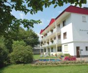
Hotels and Places to Stay
Lindenhof
Lang
Burk Pension
Videos from this area
These are videos related to the place based on their proximity to this place.
BECKER Bad Endbach
Wie von so manchem gewünscht ;) gibt es jetzt endlich mal ein Video über Becker und seine Busse. Es kann durchaus sein dass manche Busse die hier als angemeldet dabei sind, schon längst...
Flowtrail Bad Endbach Lift-Test (Ski-Club Hartenrod)
Das Flowtrail Bad Endbach Team dankt dem Ski Club Hartenrod. Ich habe dieses Video mit dem Video-Editor von YouTube (http://www.youtube.com/editor) erstellt.
Lahn-Dill-Bergland-Extratour-Viertälerweg - Bad Endbach
http://www.trailino.com - Your tracks online.
35080 Hartenrod-The Village Anthem (Raw cut)
Released August 12th 2013 Nach Marktprinzip: Neue Verpackung, alter Inhalt ;) Anthem of Hartenrod-Hessen/Germany My Hometown :-) Source: Wiki-Hartenrod: http://de.wikipedia.org/wiki/Hartenrod...
Linie MR-43
Ein Video zu Ehren einer der wichtigsten Linien des westlichen Hinterlandes: Linie MR-43. Die Schulbuslinie ist durchschnittlich pro Woche öfters unterwegs als einige andere Überlandlinien...
35080 Hartenrod
Anthem of Hartenrod-Hessen/Germany My Hometown :-) Source: Wiki-Hartenrod: http://de.wikipedia.org/wiki/Hartenrod Quelle Bilder: D. Kujawski, S. Freund, A. Schmidt Quelle Liedgut: MGV Hartenrod.
MR AZ 848 unterwegs
Der große OVG-MAN-Gelenkbus unterwegs im Gladenbacher Bergland auf Leerfahrt und Linie. Der ex.SWM-Gelenkbus in neuen Videos, neuen Ansichten, neuer Musik. Viel Spaß mit MR AZ 848!!!
RCHW Hartenrod Training
RC Hot Wheels Hartenrod, RC Car, Buggy, Truggy, RC Strecke, Blade mqx, Key cam 808 #16.
Videos provided by Youtube are under the copyright of their owners.
Attractions and noteworthy things
Distances are based on the centre of the city/town and sightseeing location. This list contains brief abstracts about monuments, holiday activities, national parcs, museums, organisations and more from the area as well as interesting facts about the region itself. Where available, you'll find the corresponding homepage. Otherwise the related wikipedia article.
Gladenbach Uplands
The Gladenbach Uplands, named after their central town of Gladenbach, is a range of hills up to 609 m high in the Rhine Massif in Germany, on the junction of the Rothaargebirge (north and northwest), Westerwald (southwest), (Eastern) Hintertaunus (in the south) and West Hesse Highlands in the east. It lies in Central Hesse within the districts of Marburg-Biedenkopf, Lahn-Dill and Gießen within the so-called Lahn-Dill-(Dietzhölze-) loop.


