Safety Score: 3,0 of 5.0 based on data from 9 authorites. Meaning we advice caution when travelling to Germany.
Travel warnings are updated daily. Source: Travel Warning Germany. Last Update: 2024-05-08 08:04:21
Discover Hartmannshain
Hartmannshain in Regierungsbezirk Gießen (Hesse) is a place in Germany about 227 mi (or 366 km) south-west of Berlin, the country's capital city.
Current time in Hartmannshain is now 05:13 PM (Wednesday). The local timezone is named Europe / Berlin with an UTC offset of 2 hours. We know of 12 airports near Hartmannshain, of which 5 are larger airports. The closest airport in Germany is Hanau Army Air Field in a distance of 25 mi (or 40 km), South-West. Besides the airports, there are other travel options available (check left side).
There are several Unesco world heritage sites nearby. The closest heritage site in Germany is Messel Pit Fossil Site in a distance of 45 mi (or 72 km), South-West. We encountered 1 points of interest in the vicinity of this place. If you need a hotel, we compiled a list of available hotels close to the map centre further down the page.
While being here, you might want to pay a visit to some of the following locations: Grebenhain, Lautertal, Birstein, Freiensteinau and Kefenrod. To further explore this place, just scroll down and browse the available info.
Local weather forecast
Todays Local Weather Conditions & Forecast: 14°C / 58 °F
| Morning Temperature | 8°C / 46 °F |
| Evening Temperature | 14°C / 57 °F |
| Night Temperature | 9°C / 49 °F |
| Chance of rainfall | 0% |
| Air Humidity | 59% |
| Air Pressure | 1024 hPa |
| Wind Speed | Gentle Breeze with 8 km/h (5 mph) from South-West |
| Cloud Conditions | Broken clouds, covering 82% of sky |
| General Conditions | Broken clouds |
Thursday, 9th of May 2024
18°C (64 °F)
11°C (52 °F)
Sky is clear, light breeze, clear sky.
Friday, 10th of May 2024
20°C (68 °F)
13°C (55 °F)
Scattered clouds, light breeze.
Saturday, 11th of May 2024
21°C (69 °F)
12°C (54 °F)
Light rain, light breeze, overcast clouds.
Hotels and Places to Stay
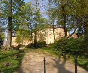
Gedern Schlosshotel
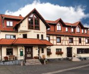
Deutsches Haus Landgasthof
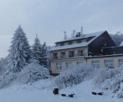
Hoherodskopf Berghotel
Videos from this area
These are videos related to the place based on their proximity to this place.
Blickpunkt Coburger Land - Gemeinde Lautertal - I. Quart. 2013
Die Gemeinde Lautertal im Landkreis Coburg stellt sich vor.
Energieautarkes Lautertal im Vogelsberg am 30. Mai 2014
Woher bezieht eine Gemeinde ihren Strom, wenn die auf dem Gemeindegebiet installierten unzähligen Windfabriken ausfallen, weil kein Wind weht? Aus französischen Atomkraftwerke? Oder wird...
20140131 stromautarkes Lautertal ohne Strom 161103
31. Januar 2014 Die Energiewende boomt und die Einspeisezahlen überschlagen sich gerade. Die Energieautarken Gemeinden, saugen sich zur Zeit mit Strom aus den Atom und Kohlekraftwerken ...
Das Knotenhalfter knoten und anpassen Extreme Trail Park Herbstein
Den richtigen Knoten machen. Das Knotenhalfter zuknoten und anpassen.
Extreme Trail Park Herbstein 2013
Extreme Trail Park Herbstein 2013: Dieses Video zeigt Ausschnitte der Bodenarbeit, wie die Pferde auf Distanz dirigiert werden zudem ist eine kleine Übersicht über einen Teil des Geländes...
Liberty im Extreme Trail Park Herbstein
Die ersten Aufnahmen von Liberty Arbeit in einem Extreme Trail Park! Auf knapp 2 Hektar Grünland arbeiten wir unsere Pferde gern auch mal ohne Seil und Halfter ... Diese Aufnahmen wurden am...
VS1400 Hardline Chopper
Angaben zum Diebstahl: gestohlen am 14./16.01.2006 | ca.5 Uhr gestohlen in Herbstein-Steinfurt Schwarzastrasse Firma LMC Wer kann hinweise geben oder hat etwas gehört über diesen vorfall...
Videos provided by Youtube are under the copyright of their owners.
Attractions and noteworthy things
Distances are based on the centre of the city/town and sightseeing location. This list contains brief abstracts about monuments, holiday activities, national parcs, museums, organisations and more from the area as well as interesting facts about the region itself. Where available, you'll find the corresponding homepage. Otherwise the related wikipedia article.
Herchenhainer Höhe
Herchenhainer Höhe is a mountain of Hesse, Germany.
Völzberger Köpfchen
Völzberger Köpfchen is a mountain of Hesse, Germany.
Weißer Stein (Vogelsberg)
Weißer Stein (Vogelsberg) is a mountain of Hesse, Germany.


