Safety Score: 3,0 of 5.0 based on data from 9 authorites. Meaning we advice caution when travelling to Germany.
Travel warnings are updated daily. Source: Travel Warning Germany. Last Update: 2024-05-15 08:00:47
Delve into Holzbronn
The district Holzbronn of Kohlerstal in Karlsruhe Region (Baden-Württemberg) with it's 750 habitants Holzbronn is a district located in Germany about 336 mi south-west of Berlin, the country's capital town.
In need of a room? We compiled a list of available hotels close to the map centre further down the page.
Since you are here already, you might want to pay a visit to some of the following locations: Calw, Deckenpfronn, Althengstett, Gechingen and Ebhausen. To further explore this place, just scroll down and browse the available info.
Local weather forecast
Todays Local Weather Conditions & Forecast: 14°C / 57 °F
| Morning Temperature | 12°C / 54 °F |
| Evening Temperature | 13°C / 56 °F |
| Night Temperature | 12°C / 53 °F |
| Chance of rainfall | 3% |
| Air Humidity | 83% |
| Air Pressure | 1007 hPa |
| Wind Speed | Light breeze with 5 km/h (3 mph) from South-West |
| Cloud Conditions | Overcast clouds, covering 100% of sky |
| General Conditions | Moderate rain |
Thursday, 16th of May 2024
14°C (57 °F)
11°C (52 °F)
Moderate rain, gentle breeze, overcast clouds.
Friday, 17th of May 2024
14°C (57 °F)
10°C (50 °F)
Light rain, gentle breeze, overcast clouds.
Saturday, 18th of May 2024
16°C (60 °F)
11°C (52 °F)
Moderate rain, light breeze, scattered clouds.
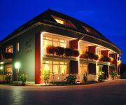
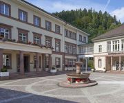
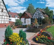
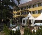
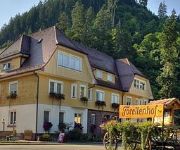
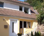
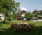
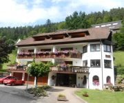
Hotels and Places to Stay
Löwen Landgasthof
Hotel Therme Bad Teinach
Berlin's Krone Lamm
Landhotel Pfrondorfer Mühle
Kloster Hirsau
Teinachtal
Hermanns Neue Post
Alte Post
Landgasthof Löwen
Wiesengrund
Videos from this area
These are videos related to the place based on their proximity to this place.
Jeffrey Gets High
Jeffrey dislocates his shoulder in Germany and gets a little too much morphine. The result that ensues is hilarious!
[E] - VORFAHRT MISSACHTET -- Unfall mit 4 Verletzen -- FEUERWEHR CALW -- Polizei -- TOTALSCHADEN
[E] - Die Vorfahrt missachtet hatte einen schweren Unfall mit 4 Verletzten zur Folge [+ Totalschaden]. Feuerwehr Calw, Polizei und Rettungsdienst waren im Einsatz. Der BMW-Mini war unterwegs...
35. Werner-Diefenbach-Gedächtnislauf 2015
Günter Krehls »Jubiläumslauf auf der Originalstrecke mit reizvollem Panorama« Calw-Stammheim, Sa, 29.03.2014, Start 14 Uhr ✓ Bericht: http://www.schwarzwaelder-bote.de/inhalt.calw-72-teilne...
Cold Water Challenge 2014 - Musikverein Stammheim
Vor einigen Tagen wurden wir vom Musikverein Merklingen e.V. aus der Sommerpause geweckt mit einer überraschenden Nominierung für die Coldwater Challenge 2014. Wir haben es uns aber nicht.
Wildberg Schäferlauf vergraben 2014
Die `Sackhüpfer`tragen mit einem beeindruckendem Trauerzug den Gottlieb Schäferlauf zu Grabe.
Wildberg Schäferlauf vergraben 1986
Die `Sackhüpfer`tragen mit einem beeindruckendem Trauerzug den Gottlieb Schäferlauf zu Grabe.
Videos provided by Youtube are under the copyright of their owners.
Attractions and noteworthy things
Distances are based on the centre of the city/town and sightseeing location. This list contains brief abstracts about monuments, holiday activities, national parcs, museums, organisations and more from the area as well as interesting facts about the region itself. Where available, you'll find the corresponding homepage. Otherwise the related wikipedia article.
Calw (district)
Calw is a district in the middle of Baden-Württemberg, Germany. Neighboring districts are (from north clockwise) Karlsruhe, Enz, the district-free city Pforzheim, Böblingen, Freudenstadt and Rastatt.
Kommando Spezialkräfte
The KSK Kommando Spezialkräfte (Special Forces Command, KSK) is an elite special forces military unit composed of Special Operations soldiers handpicked from each of the ranks of Germany’s Bundeswehr and organized as such under the Division Spezielle Operationen (Special Operations Division, DSO). The unit has received many decorations and awards from NATO, the USA and its affiliates. KSK operators are frequently requested for joint anti-terror operations, notably in the Balkans and Middle East.
Nordschwarzwaldturm
Nordschwarzwaldturm (Tower of Northern Black Forest) is the name of a 148 metre free standing steel framework tower near Schoemberg-Langenbrand at {{#invoke:Coordinates|coord}}{{#coordinates:48|48|31|N|8|37|31|E| | |name= }} in the Black Forest. The Nordschwarzwaldturm was built in 1974 and is used for directional radio services, FM- and TV-transmissions. The tower is not open for the public.
Transmission site Landespolizeidirektion Karlsruhe
The Transmission site Landespolizeidirektion Karlsruhe is a site with short wave aerial and an 81 metre tall telecommunication tower at {{#invoke:Coordinates|coord}}{{#coordinates:48|39|51|N|8|47|42|E| | |name= }} on Lerchenberg near Wildberg, 20 kilometre westwards of Stuttgart. The whole area is undertunneled and equipped with an entrance which can be passed by vehicles with a height of 3.8 metres.
Hirsau Abbey
Hirsau Abbey, formerly known as Hirschau Abbey, was once one of the most important Benedictine abbeys of Germany. It is located in the Hirsau borough of Calw on the northern slopes of the Black Forest mountain range, in the present-day state of Baden-Württemberg. In the 11th and 12th century, the monastery was a centre of the Cluniac Reforms, implemented as "Hirsau Reforms" in the German lands. The complex was devastated during the War of the Palatine Succession in 1692 and not rebuilt.
Kepler Launch Site
Kepler Launch Site is a site for the launch of low and medium power model rockets south of Weil der Stadt in Germany at {{#invoke:Coordinates|coord}}{{#coordinates:48|44|23|N|8|51|44|E| | |name= }}. Kepler Launch Site, which is named in honour of the astronomer Johannes Kepler born in 1571 in Weil der Stadt, was founded in 2001 on the area of a former site of midsummer fire celebrations, which was abandoned a few years ago.
Ammer (Neckar)
The Ammer is a small river in Baden-Württemberg, Germany, a tributary of the Neckar. It has its source southwest of Herrenberg. Along the southern edge of the Schönbuch, it flows through Herrenberg, Ammerbuch, Unterjesingen and Tübingen, before it discharges into the Neckar at Tübingen-Lustnau after 25 km.
Hohennagold Castle
Hohennagold Castle is a ruined castle situated on a hill, the so-called Schlossberg (castle mountain), overlooking the Black Forest town of Nagold. The hill consists predominantly of porphyritic rock. The ruins represent a relatively well-preserved 12th century castle. The keep behind the curtain walls, a tower in the north-western corner of the complex as well as the outer ward with half-round and angular towers, are still visible. Around the castle there appears to have been a moat.
Kapf (Egenhausen)
Kapf (Egenhausen) is a mountain of Baden-Württemberg, Germany.
Lerchenberg (Schwarzwald)
Lerchenberg (Schwarzwald) is a mountain of Baden-Württemberg, Germany.
Täfelberg
Täfelberg is a mountain of Baden-Württemberg, Germany.
Herrenberg station
Herrenberg station is located on the on the Gäu Railway and is at the start of the Ammer Valley Railway (Ammertalbahn). Because it is a stop for Regional-Express services and it is a terminus for both Stuttgart S-Bahn line S 1 and Regionalbahn services from Tübingen and Bondorf, it is an important transport node. It is located about 200 metres west of the old centre of Herrenberg in the German state of Baden-Württemberg.
Waldach
The Waldach is a river of Baden-Württemberg, southwestern Germany. It is a right tributary of the Nagold River.
Teinach
The Teinach is a river of Baden-Württemberg, southwestern Germany. It is a left tributary of the Nagold River and flows for 15 kilometres. It passes through Bad Teinach-Zavelstein.
Aid (Würm)
The Aid is a river in Baden-Württemberg, Germany.
Große Enz
Große Enz is a river of Baden-Württemberg, Germany.
Kleine Enz
Kleine Enz is a river of Baden-Württemberg, Germany.
Kochhart
Kochhart is a river of Baden-Württemberg, Germany.
Rankbach
Rankbach is a river of Baden-Württemberg, Germany.
Schwippe
Schwippe is a river of Baden-Württemberg, Germany. The Schwippe is a 15 km long tributary of the Würm in Baden-Württemberg and rises in Sindelfingen. Along the river are the towns of Dagersheim, Darmsheim and Grafenau. Smaller rivers flowing into the Schwippe include the Goldbach, Murken Bach, Aischbach, Hulbgraben and Buchentalgraben.
Tälesbach
Tälesbach is a river of Baden-Württemberg, Germany.
Ziegelbach (Brenz)
Ziegelbach (Brenz) is a river of Baden-Württemberg, Germany.
Weil der Stadt station
Weil der Stadt station is a station located at the terminus of the Black Forest Railway in the town of Weil der Stadt in the German state of Baden-Württemberg. The section to Calw is disused. The station is the terminus of line S 6 of the S-Bahn. It is classified by Deutsche Bahn as a category 4 station.
Malmsheim station
Malmsheim station is in the town of Malmsheim in the municipality of Renningen in the German state of Baden-Württemberg. It is located at kilometer 22.4 of the Black Forest Railway and it is served by line S 6 of the Stuttgart S-Bahn.






!['[E] - VORFAHRT MISSACHTET -- Unfall mit 4 Verletzen -- FEUERWEHR CALW -- Polizei -- TOTALSCHADEN' preview picture of video '[E] - VORFAHRT MISSACHTET -- Unfall mit 4 Verletzen -- FEUERWEHR CALW -- Polizei -- TOTALSCHADEN'](https://img.youtube.com/vi/DNBgHkYynfQ/mqdefault.jpg)


