Safety Score: 3,0 of 5.0 based on data from 9 authorites. Meaning we advice caution when travelling to Germany.
Travel warnings are updated daily. Source: Travel Warning Germany. Last Update: 2024-04-26 08:02:42
Delve into Unterstmatt
Unterstmatt in Freiburg Region (Baden-Württemberg) is located in Germany about 353 mi (or 568 km) south-west of Berlin, the country's capital town.
Current time in Unterstmatt is now 03:13 AM (Saturday). The local timezone is named Europe / Berlin with an UTC offset of 2 hours. We know of 10 airports close to Unterstmatt, of which 3 are larger airports. The closest airport in Germany is Karlsruhe Baden-Baden Airport in a distance of 12 mi (or 19 km), North-West. Besides the airports, there are other travel options available (check left side).
There are several Unesco world heritage sites nearby. The closest heritage site is Strasbourg – Grande île in France at a distance of 22 mi (or 35 km). The closest in Germany is Maulbronn Monastery Complex in a distance of 38 mi (or 35 km), West. We encountered 1 points of interest near this location. If you need a hotel, we compiled a list of available hotels close to the map centre further down the page.
While being here, you might want to pay a visit to some of the following locations: Buhlertal, Seebach, Sasbachwalden, Lauf and Ottenhofen im Schwarzwald. To further explore this place, just scroll down and browse the available info.
Local weather forecast
Todays Local Weather Conditions & Forecast: 18°C / 65 °F
| Morning Temperature | 6°C / 42 °F |
| Evening Temperature | 16°C / 61 °F |
| Night Temperature | 12°C / 54 °F |
| Chance of rainfall | 0% |
| Air Humidity | 40% |
| Air Pressure | 1007 hPa |
| Wind Speed | Gentle Breeze with 7 km/h (4 mph) from North-West |
| Cloud Conditions | Scattered clouds, covering 25% of sky |
| General Conditions | Scattered clouds |
Sunday, 28th of April 2024
13°C (56 °F)
11°C (52 °F)
Overcast clouds, gentle breeze.
Monday, 29th of April 2024
18°C (65 °F)
11°C (53 °F)
Light rain, light breeze, overcast clouds.
Tuesday, 30th of April 2024
21°C (71 °F)
14°C (56 °F)
Light rain, light breeze, scattered clouds.
Hotels and Places to Stay
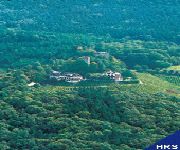
Burg Windeck
Breitmattstub
Nationalpark Schliffkopf
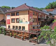
Grüner Baum
Brandbach
Engel
Pflug
Talmühle
Holzwurm Naturparkhotel
Schoenen Landhaus
Videos from this area
These are videos related to the place based on their proximity to this place.
11.02.2012 Skilanglauf im Eisschrank Nordschwarzwald (bitte HD 720 auswählen)
Minus 12 bis minus 16, Sonne, knallharte Spur, Wahnsinns-Grip am Berg Traumhafte Spur - vom Langlaufcenter Herrenwies gepflegt.
B500 Schwarzwald Hochstrasse, Germany, Black Forest, Ferrari California
The Black Forest with it's seemingly endless number of sweeping trails and deserted roads is a bikers and drivers dream. One of it's finest is the northern stretch of the elevated Schwarzwald...
Schwarzwald Hochstrasse - Forêt Noire - Black Forest - Road B500 1/2
The Schwarzwaldhochstraße begins in Baden-Baden and rises quickly to the main ridge of the northern Black Forest, reaching the top at the Bühlerhöhe. At the top is a luxury hotel, also named...
Am Mummelsee am 09.06.2014
Am Mummelsee am 09.06.2014 Zum Mummelsee kommt man von Baden-Baden aus, wenn man mit dem Auto auf der B500, Schwarzwaldhochstraße, über das Schloßhotel Bühlerhöhe und Kurhaus ...
Winterpanorama der Hornisgrinde vom Dreifürstenstein bis zum SWR-Sendeturm
Der Standort ist auf der "Obergrind", die östlich der Hornisgrinde liegt. Gut einen Kilometer misst die Luftlinie vom Standort bis zum SWR-Sendeturm. Das Video entstand an einem sonnigen Wintertag...
100 Jahre Hornisgrindeturm in Seebach im Schwarzwald
Feierlichkeiten am 10. August 2010 zum 100jährigen Bestehen des Seebacher Hornisgrindeturmes. Organisation und Bewirtung durch die Musikkapelle Seebach. Unterstützt durch die Freiwillige...
Hornisgrinde (Nordschwarzwald) im Dezember 2012
Auf dem Weg zur Hornisgrinde bzw. auf der Hornisgrinde entstanden die Fotos diesser Diashow. Zu sehen sind der Sender Hornisgrinde, der kleine Windpark, der Bismarckturm und Fotos zeigen auch.
Videos provided by Youtube are under the copyright of their owners.
Attractions and noteworthy things
Distances are based on the centre of the city/town and sightseeing location. This list contains brief abstracts about monuments, holiday activities, national parcs, museums, organisations and more from the area as well as interesting facts about the region itself. Where available, you'll find the corresponding homepage. Otherwise the related wikipedia article.
Falkenfelsen
The Falkenfelsen (Falcon Rock) is a granite rock formation in the northern Black Forest of Germany's Baden-Württemberg state. One side of the formation is a cliff about 200 feet high. From the Schwarzwaldhochstrasse (Black Forest Highway), two hiking trails lead through the formation and end at the shelter Herta-hut. The platform has a view over the northern Black Forest, with the Hornisgrinde in the south, Bühlerhöhe in the northeast and the valley of the Upper Rhine on the west.
Mummelsee
The Mummelsee is a 17-metre-deep lake at the western mountainside of the Hornisgrinde in the northern Black Forest of Germany. It is very popular with tourists travelling along the Schwarzwaldhochstraße. According to legends, the lake is inhabited by a Nix and the King of the Mummelsee.


