Safety Score: 3,0 of 5.0 based on data from 9 authorites. Meaning we advice caution when travelling to Germany.
Travel warnings are updated daily. Source: Travel Warning Germany. Last Update: 2024-05-04 08:22:41
Delve into Liptingen
The district Liptingen of Emmingen-Liptingen in Freiburg Region (Baden-Württemberg) is a district located in Germany about 374 mi south-west of Berlin, the country's capital town.
In need of a room? We compiled a list of available hotels close to the map centre further down the page.
Since you are here already, you might want to pay a visit to some of the following locations: Neuhausen ob Eck, Eigeltingen, Tuttlingen, Buchheim and Orsingen-Nenzingen. To further explore this place, just scroll down and browse the available info.
Local weather forecast
Todays Local Weather Conditions & Forecast: 12°C / 53 °F
| Morning Temperature | 9°C / 48 °F |
| Evening Temperature | 16°C / 61 °F |
| Night Temperature | 10°C / 51 °F |
| Chance of rainfall | 1% |
| Air Humidity | 90% |
| Air Pressure | 1015 hPa |
| Wind Speed | Light breeze with 4 km/h (3 mph) from North-East |
| Cloud Conditions | Overcast clouds, covering 100% of sky |
| General Conditions | Light rain |
Monday, 6th of May 2024
15°C (59 °F)
9°C (49 °F)
Moderate rain, gentle breeze, overcast clouds.
Tuesday, 7th of May 2024
9°C (48 °F)
8°C (47 °F)
Moderate rain, light breeze, overcast clouds.
Wednesday, 8th of May 2024
10°C (49 °F)
8°C (47 °F)
Light rain, light breeze, overcast clouds.
Hotels and Places to Stay
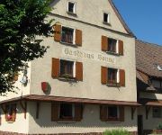
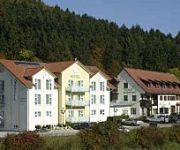
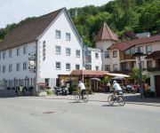
Zur Sonne
Seltenbacher Hof
Sonne Gasthof
Aircraft Services
Videos from this area
These are videos related to the place based on their proximity to this place.
Tutorial Feripro Neuhausen ob Eck 2013
Anleitung um sich auf http://neuhausen.feripro.de/ für das Kinder- und Jugendferienprogramm 2013 anzumelden.
PFF G-Force - Neuhausen ob Eck 6.9.2013 - Mazda RX 8 Drift versuche :-) Kurze Version!
Kurze Version! Hier geht's zur 74 Min. Version: http://youtu.be/qZ0hd4m1jGQ PFF G-Force Training vom 06.09.2013 in Neuhausen ob Eck. Gefilmt wurde aus meinem Mazda RX-8, danke an die ...
PFF G-Force - Neuhausen ob Eck 6.9.2013 - Mazda RX 8 Drift versuche :-) Lange Version!
Lange Version! Hier geht's zur 11 Min. Version: http://youtu.be/fifR0m9wZeg PFF G-Force Training vom 06.09.2013 in Neuhausen ob Eck. Gefilmt wurde aus meinem Mazda RX-8, danke an die Porsche ...
Drift Event 08.09.12 Neuhausen ob Eck - E30 cut
Drift Event der schnellen Schwaben in Neuhausen ob Eck am 08.09.12 Das erste Mal beim Driften mit meinem Cabrio. Setup E30 Cabrio: Motor S50B32 - Airbox & Alpha-N - 6-Gang - Diff 3,64S mit ...
Videotagebuch Teil 6, Southside Festival 22.06.2012 in Neuhausen ob Eck
Krise mit Kamerakind Karl über Southside Festival 22.06.2012 in Neuhausen ob Eck "kurze" Bewertung des 1. Tages beim Southside u.a. mit Zebrahead, The Computers, Lagwagon, Florence + The...
Freies Driften Neuhausen ob Eck Drift-Schule 31.03.2012 Nissan S14
Freies Driften in Neuhausen ob Eck mit der Drift-Schule (drift-schule.de) am 31.03.2012 - Nissan S14.
From Friedrichshafen (EDNY) to Neuhausen ob Eck (EDSN)
http://www.hebels.nl/flights Summer 2006. From Friedrichshafen (EDNY) to Neuhausen ob Eck (EDSN) with Piper Archer PH-AEC.
Videos provided by Youtube are under the copyright of their owners.
Attractions and noteworthy things
Distances are based on the centre of the city/town and sightseeing location. This list contains brief abstracts about monuments, holiday activities, national parcs, museums, organisations and more from the area as well as interesting facts about the region itself. Where available, you'll find the corresponding homepage. Otherwise the related wikipedia article.
Konstanz (district)
Konstanz (or Constance) is a district (Kreis) in the south of Baden-Württemberg on the German-Swiss border, stiuated along the shores of Lake Constance. Neighboring districts are (from west clockwise) Schwarzwald-Baar, Tuttlingen, Sigmaringen and Bodenseekreis. To the south it borders the Swiss canton Thurgau and Schaffhausen. The municipality of Büsingen is an exclave located inside the Kanton Schaffhausen.
Tuttlingen (district)
Tuttlingen is a county (Kreis) in the south of Baden-Württemberg, Germany. Neighboring counties are (from north clockwise) Rottweil, Zollernalbkreis, Sigmaringen, Constance and Schwarzwald-Baar.
Aachtopf
The Aachtopf is Germany's biggest natural spring, producing an average of 8,500 litres per second. Production varies seasonally and in response to the weather, but the spring never runs dry. The Aachtopf is a karst spring which is located south of the western end of the Swabian Jura, near the town Aach. The name Aachtopf is compounded from Aach (meaning water in Old High German); the name of the river created by the spring is in full the Radolfzeller Aach.
Southside Festival
The Southside Festival (or, simply, Southside) is a music festival that takes place near Tuttlingen, southern Germany, usually every June. The festival and its guests are generally associated with the alternative part of mainstream music, although the festival has been becoming more and more mainstream over the years.
Beuron Archabbey
Beuron Archabbey (in German Erzabtei Beuron, otherwise Erzabtei St. Martin; in Latin Archiabbatia Sancti Martini Beuronensis) is a major house of the Benedictine Order located at Beuron in the upper Danube valley in Baden-Württemberg in Germany. It was founded in 1863 by the brothers Maurus and Placidus Wolter, in buildings which until 1802 had housed an Augustinian monastery.
Hegau
The Hegau is a formerly volcanic landscape in southern Germany extending around the industrial city of Singen (Hohentwiel), between Lake Constance in the east, the Rhine River in the south, the Danube River in the north and the Randen—as the southwestern mountains of the Swabian Jura are called—in the west. The most famous sight of the Hegau is the Hohentwiel, a volcanic stub. On top of the mountain lies Hohentwiel fortress.
Battle of Stockach (1799)
The [First First] Battle of Stockach occurred on 25 March 1799, when French and Austrian armies fought for control of the geographically strategic Hegau region in present day Baden-Württemberg. In the broader military context, this battle constitutes a keystone in the first campaign in southwestern Germany during the Wars of the Second Coalition, part of the French Revolutionary Wars.
Upper Danube Nature Park
The Upper Danube Nature Park, founded in 1980, is located in the south of Baden-Württemberg in Germany and encloses primarily the districts of Tuttlingen and Sigmaringen. Its size encompassed initially 860 km² that were increased by about 500 km² in 2005. The headquarter of the nature reserve association is based at Beuron. The highest proportion of the nature park is taken up by the Heuberg, the south-western plateau of the Swabian Alb, and is punctuated by the Danube.
Wildenstein Castle (Leibertingen)
Burg Wildenstein, a fortified castle, built between 1200 - 1300 A.C. is situated above the Danube break-through at the Swabian Alb in Baden-Württemberg, Germany. It functions now as a hostel of the German Youth Hostel Federation ("Deutsches Jugendherbergswerk").
Hohenhewen
Hohenhewen is a mountain of Baden-Württemberg, Germany.
Hohenkrähen
Hohenkrähen is a mountain of Baden-Württemberg, Germany.
Hohenstoffeln
Hohenstoffeln is a mountain of Baden-Württemberg, Germany.
Höwenegg
Höwenegg is a mountain of Baden-Württemberg, Germany.
Klippeneck
Klippeneck is a mountain of Baden-Württemberg, Germany.
Mägdeberg
Mägdeberg is a mountain of Baden-Württemberg, Germany.
Schnaitkapf
Schnaitkapf is a mountain of Baden-Württemberg, Germany.
Witthoh
Witthoh is a mountain of Baden-Württemberg, Germany.
Tuttlingen station
Tuttlingen station is the most important of the eight railway stations in Tuttlingen in the German state of Baden-Württemberg. The station was built between 1928 and 1933 at a new location and replaced the original much smaller Tuttlingen station built in 1869. Tuttlingen station is a railway node at the intersection of the Gäu Railway and the Danube Valley Railway. The station is connected to the InterCity network and is one of the most important stations in the Ringzug ("Ring Train") network.
Radolfzeller Aach
The Radolfzeller Aach (also known as Hegauer Aach) is a right or north tributary of the Rhine in the south of Baden-Württemberg. It is approximately 32 km long.
Danube Sinkhole
The Danube Sinkhole (German: Donauversinkung or Donauversickerung) is an incipient underground stream capture in the Upper Danube Nature Park. Between Immendingen and Möhringen and also near Fridingen, the water of the Danube sinks into the riverbed in various places. The main sinkhole is next to a field named Brühl between Immendingen and Möhringen.
Elta (river)
The Elta is a river of Baden-Württemberg, Germany.
Faulenbach
Faulenbach is a river of Baden-Württemberg, Germany.
Stockacher Aach
Stockacher Aach is a river of Baden-Württemberg, Germany.
Untere Bära
Untere Bära is a river of Baden-Württemberg, Germany.
Marquardt Group
Marquardt Group is a family enterprise headquartered in Germany. It is a manufacturer in the field of electro-mechanical and electronic switches and switching systems. Its systems are found in household appliances and other industrial applications. The company has over 6,500 employees worldwide at 12 locations in nine countries on four continents. The annual turnover is more than 680 million Euros.


