Safety Score: 3,0 of 5.0 based on data from 9 authorites. Meaning we advice caution when travelling to Germany.
Travel warnings are updated daily. Source: Travel Warning Germany. Last Update: 2024-04-27 08:23:39
Delve into Irndorf
Irndorf in Freiburg Region (Baden-Württemberg) with it's 754 habitants is a town located in Germany about 365 mi (or 587 km) south-west of Berlin, the country's capital town.
Time in Irndorf is now 12:33 PM (Saturday). The local timezone is named Europe / Berlin with an UTC offset of 2 hours. We know of 8 airports closer to Irndorf, of which 3 are larger airports. The closest airport in Germany is Donaueschingen-Villingen Airport in a distance of 22 mi (or 35 km), West. Besides the airports, there are other travel options available (check left side).
There are several Unesco world heritage sites nearby. The closest heritage site in Germany is Monastic Island of Reichenau in a distance of 26 mi (or 42 km), South. We saw 1 points of interest near this location. In need of a room? We compiled a list of available hotels close to the map centre further down the page.
Since you are here already, you might want to pay a visit to some of the following locations: Beuron, Barenthal, Schwenningen, Leibertingen and Buchheim. To further explore this place, just scroll down and browse the available info.
Local weather forecast
Todays Local Weather Conditions & Forecast: 15°C / 60 °F
| Morning Temperature | 3°C / 37 °F |
| Evening Temperature | 14°C / 57 °F |
| Night Temperature | 8°C / 47 °F |
| Chance of rainfall | 0% |
| Air Humidity | 43% |
| Air Pressure | 1008 hPa |
| Wind Speed | Gentle Breeze with 6 km/h (4 mph) from North-West |
| Cloud Conditions | Scattered clouds, covering 25% of sky |
| General Conditions | Scattered clouds |
Sunday, 28th of April 2024
18°C (64 °F)
10°C (50 °F)
Overcast clouds, gentle breeze.
Monday, 29th of April 2024
18°C (64 °F)
11°C (52 °F)
Overcast clouds, light breeze.
Tuesday, 30th of April 2024
22°C (71 °F)
13°C (55 °F)
Light rain, light breeze, broken clouds.
Hotels and Places to Stay
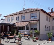
Unger Landgasthof
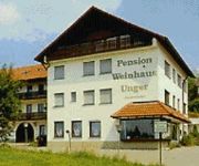
Unger Pension Weinhaus
Sonne Gasthof
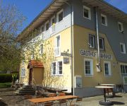
Bahnhof Gasthof
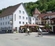
Stern Hotel Restaurant
Videos from this area
These are videos related to the place based on their proximity to this place.
Okzident Bahnreisen: Die Donautalbahn nahe Beuron
DB Regio Ulm Hbf - Neustadt (Schw) kurz vor dem Eintreffen in Beuron, gesehen vom Rauhen Stein, Irndorf.
Oberes Donautal on Kawasaki Z750 - March 2012
Motorbike Trip "Oberes Donautal L277" on Kawasaki Z750 - March 2012.
Jägerhaus Donau by Bike
Im Donautal am Jägerhaus gibts jetzt auch einen Steg - aber wofür? So machts mehr Spaß ;-)
nature sound runnel (kleiner Bach) Naturgeräusch
A little runnel, recorded in Winter with my SONY camcorder. Nature sound in high quality. Position where it is a tiny waterfall I recognized while hiking.
Narrenvogtei Kolbingen beim Narrentreffen in Königsheim
Narrenvogtei Kolbingen und die Musikkapelle beim Narrentreffen am 7.2.2010 im Umzug in Königsheim Fasnet.
D-MKIT Kitfox Flug über das Donautal und schwäbische Alb
Flight over the Swabian Alps and the Danube Valley.
Kolbinger Fasnet 2015 Wenn ich nicht auf der Bühne wär
Sketch beim Bunten Abend: "Wenn ich nicht auf der Bühne wär"
Heuberger 2013 Renquishausen
Szenen vom Heuberger 2013 in Renquishausen. Das größte Fussballturnier im Landkreis Tuttlingen.
Videos provided by Youtube are under the copyright of their owners.
Attractions and noteworthy things
Distances are based on the centre of the city/town and sightseeing location. This list contains brief abstracts about monuments, holiday activities, national parcs, museums, organisations and more from the area as well as interesting facts about the region itself. Where available, you'll find the corresponding homepage. Otherwise the related wikipedia article.
Beuron Archabbey
Beuron Archabbey (in German Erzabtei Beuron, otherwise Erzabtei St. Martin; in Latin Archiabbatia Sancti Martini Beuronensis) is a major house of the Benedictine Order located at Beuron in the upper Danube valley in Baden-Württemberg in Germany. It was founded in 1863 by the brothers Maurus and Placidus Wolter, in buildings which until 1802 had housed an Augustinian monastery.
Upper Danube Nature Park
The Upper Danube Nature Park, founded in 1980, is located in the south of Baden-Württemberg in Germany and encloses primarily the districts of Tuttlingen and Sigmaringen. Its size encompassed initially 860 km² that were increased by about 500 km² in 2005. The headquarter of the nature reserve association is based at Beuron. The highest proportion of the nature park is taken up by the Heuberg, the south-western plateau of the Swabian Alb, and is punctuated by the Danube.
Wildenstein Castle (Leibertingen)
Burg Wildenstein, a fortified castle, built between 1200 - 1300 A.C. is situated above the Danube break-through at the Swabian Alb in Baden-Württemberg, Germany. It functions now as a hostel of the German Youth Hostel Federation ("Deutsches Jugendherbergswerk").
Schnaitkapf
Schnaitkapf is a mountain of Baden-Württemberg, Germany.


