Safety Score: 4,0 of 5.0 based on data from 9 authorites. Meaning please reconsider your need to travel to Switzerland.
Travel warnings are updated daily. Source: Travel Warning Switzerland. Last Update: 2024-04-16 08:26:06
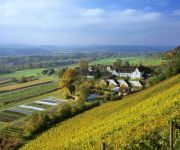
Delve into Etzwilen
The district Etzwilen of in Frauenfeld District (Thurgau) is a subburb in Switzerland about 81 mi north-east of Bern, the country's capital town.
If you need a hotel, we compiled a list of available hotels close to the map centre further down the page.
While being here, you might want to pay a visit to some of the following locations: Ohningen, Diessenhofen, Rielasingen-Worblingen, Gottmadingen and Hilzingen. To further explore this place, just scroll down and browse the available info.
Local weather forecast
Todays Local Weather Conditions & Forecast: 8°C / 47 °F
| Morning Temperature | 4°C / 39 °F |
| Evening Temperature | 6°C / 42 °F |
| Night Temperature | 4°C / 39 °F |
| Chance of rainfall | 4% |
| Air Humidity | 62% |
| Air Pressure | 1012 hPa |
| Wind Speed | Fresh Breeze with 15 km/h (9 mph) from East |
| Cloud Conditions | Overcast clouds, covering 97% of sky |
| General Conditions | Moderate rain |
Wednesday, 17th of April 2024
3°C (37 °F)
0°C (32 °F)
Rain and snow, gentle breeze, overcast clouds.
Thursday, 18th of April 2024
7°C (45 °F)
1°C (34 °F)
Light rain, light breeze, overcast clouds.
Friday, 19th of April 2024
9°C (49 °F)
5°C (40 °F)
Light rain, moderate breeze, overcast clouds.
Hotels and Places to Stay
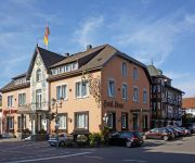
Krone
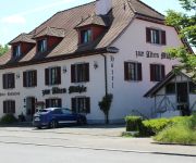
Löwen
Rheingold
Alte Mühle
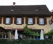
Fischerkeller Pension
Kartause Ittingen
Zapa
Krone
Alte Schreinerei Harlekin
Raben Gasthof
Videos from this area
These are videos related to the place based on their proximity to this place.
FPV Luftaufnahme über dem Bodensee zwischen Stein am Rhein und Öhningen
Gefilmt mit einem DJI F550 Modell-Hexakopter und einer GoPro-Kamera mit Gimbal.
FPV Luftaufnahme über dem Bodensee zwischen Stein am Rhein und Öhningen - inklusive Not-Wasserung
Leider war bei der Landung ein Ast im Weg, daher sind hier Flug-Unterwasser-Aufnahmen gegen Ende zu sehen. Glücklicherweise ging außer dem Landegestell nichts zu Bruch. Auch die GoPro ...
Stein am Rhein
my home video of my trip to the small town of Stein Am Rhein in Northern Switzerland.
Arrival at Stein am Rhein
Arriving at Stein am Rhein in July 2008. We were on board a boat travelling from Konstanz in Germany to Schaffhausen in Switzerland.
Bodensee-Radtour, Stein am Rhein in der Schweiz, Rathausplatz, mittelalterliche Gebäude
Bei unserer Bodensee-Radtour April/Mai 2013 mit unseren Klapp-Fahrrädern sind wir durch drei Länder gereist. Unter anderem auch in Stein am Rhein der schweizer Seite des Bodensee.
Hochzeit ♥ Heiraten auf der Burg Hohenklingen in Stein am Rhein - Hochzeits DJ Dubi
Eine neue Location auf unserer Hochzeitstournee, die Burg Hohenklingen im Stein am Rhein. Hier wird zuerst gemütlich im Rittersaal gegessen bevor dann im Obergaden die Party steigen kann....
Stein am Rhein - Schweiz Switzerland
Schönheiten von Stein am Rhein in der Schweiz Stein am Rhein ist eine Gemeinde im Kanton Schaffhausen in der Schweiz. Stein ist vor allem wegen des gut erhaltenen Altstadtkerns bekannt. Viele...
Schneider's go... presenting - Good night Irene....
"Re-opening Steinerhof", Stein am Rhein, Switzerland or .. Stone on the Rhine, 11.1.2013.
Videos provided by Youtube are under the copyright of their owners.
Attractions and noteworthy things
Distances are based on the centre of the city/town and sightseeing location. This list contains brief abstracts about monuments, holiday activities, national parcs, museums, organisations and more from the area as well as interesting facts about the region itself. Where available, you'll find the corresponding homepage. Otherwise the related wikipedia article.
Diessenhofen District
Diessenhofen District is a former district of the canton of Thurgau in Switzerland. It had a population of 6,621 (as of 2009). Its capital was the town of Diessenhofen. The former district contained the following municipalities:
Hüttwilersee
Hüttwilersee is a lake in the Canton of Thurgau, Switzerland. It is located near two other lakes, Nussbaumersee and Hasensee, on the border of the municipalities of Hüttwilen und Uesslingen-Buch.
St. George's Abbey, Stein am Rhein
St. George's Abbey, Stein am Rhein (Kloster Sankt Georgen, Stein am Rhein) was a Benedictine monastery in Stein am Rhein, Switzerland.
Hasensee
Hasensee is a lake in the canton of Thurgau, Switzerland. It is located in the same valley as Nussbaumersee and Hüttwilersee. Its surface area is 0.11 km² and the surface elevation is 434.16 m, after being lowered by 1.5 m in World War II. Hasensee is or was also known as Buchemer See or oberer See (upper lake).
Nussbaumersee
Nussbaumersee is a small lake between Nussbaumen and Uerschhausen, both in the municipality of Hüttwilen in the Canton of Thurgau, Switzerland. Its surface area is 0.252 km². Hüttwilersee and Hasensee are located in the same valley. Nussbaumer See is or was also known as Werdsee or Wertsee, Uerschhauser See or unterer See (lower lake). Together with Hasensee they formed the Helfenberger Seen or Ittinger Seen.
Basadingen
Basadingen is a village and former municipality in the canton of Thurgau, Switzerland. In 1999 the municipality was merged with the neighboring municipality Schlattingen to form a new and larger municipality Basadingen-Schlattingen.
Schlattingen
Schlattingen is a village and former municipality in the canton of Thurgau, Switzerland. In 1999 the municipality was merged with the neighboring municipality Basadingen to form a new and larger municipality Basadingen-Schlattingen.
Buch bei Frauenfeld
Buch bei Frauenfeld is a village and former municipality in the canton of Thurgau, Switzerland. It was first recorded in year 1260 as Buoch. The municipality also contained the villages Trüttlikon, Hueb, Vorderhorben and Hinterhorben. It had 380 inhabitants in 1850, which increased to 305 in 1900, 331 in 1950 and 333 in 1990. In 1995 the municipality was merged with the neighboring municipality Uesslingen to form a new and larger municipality Uesslingen-Buch.
Iselisberg
Iselisberg is a village in the canton of Thurgau, Switzerland. It is located just north of Uesslingen. In 1995 Uesslingen municipality merged with its neighbor to form a new and larger municipality Uesslingen-Buch. It used to be a centre of wine production.
Uesslingen
Uesslingen is a village and former municipality in the canton of Thurgau, Switzerland. In 1995 the municipality was merged with the neighboring municipality Buch bei Frauenfeld to form a new and larger municipality Uesslingen-Buch.
Trüttlikon
Trüttlikon is a village in the canton of Thurgau, Switzerland. It was first recorded in year 1155 as Truchtelincofen. Trüttlikon is located in the former municipality Buch bei Frauenfeld. In 1995 Buch bei Frauenfeld municipality merged with its neighbor to form a new and larger municipality Uesslingen-Buch.
Ittingen Charterhouse
Ittingen Charterhouse (Kartause Ittingen) is a former Carthusian monastery near Warth, Canton Thurgau, Switzerland. It is now used as an education and seminar centre with two museums and a farm.
Rosenegg (mountain)
Rosenegg is a mountain of Baden-Württemberg, Germany.
Schiener Berg
Schiener Berg is a mountain of Baden-Württemberg, Germany.
Alemannenring
The Alemannenring was an auto racing circuit in Southern Germany. The circuit was located on public roads around in the industrial area of Singen in Baden-Württemberg. It hosted its final motor race in 1995.
Werd (Lake Constance)
Werd Island is the main island of the small island group Werd Islands in the westernmost part of the Lower Lake of Lake Constance just before the High Rhine leaves the part of the lake known as Rheinsee. It is located on Swiss territory between Stein am Rhein and Eschenz.
Biber (Rhine)
The Biber is a small river on the border between Germany and Switzerland. The source is located at Watterdingen in the municipality Tengen, district of Constance in Baden-Wuerttemberg. After about 24 km the Biber river flows into the Rhine at the Biber Mill west of Hemishofen in the Canton of Schaffhausen. The Biber is the largest tributary of the High Rhine on the stretch between Stein am Rhein and Schaffhausen.
Unterhof Castle
Unterhof Castle is a castle in the municipality of Diessenhofen of the Canton of Thurgau in Switzerland. It is a Swiss heritage site of national significance.
Freudenfels Castle
Freudenfels Castle is a castle in the municipality of Eschenz of the Canton of Thurgau in Switzerland. It is a Swiss heritage site of national significance.
Liebenfels Castle
Liebenfels Castle is a castle in the municipality of Herdern of the Canton of Thurgau in Switzerland. It is a Swiss heritage site of national significance.
Mammern Castle
Mammern Castle is a castle in the municipality of Mammern of the Canton of Thurgau in Switzerland. It is a Swiss heritage site of national significance.
Hohenklingen Castle
Hohenklingen Castle is a castle in the municipality of Stein am Rhein of the Canton of Schaffhausen in Switzerland. It is a Swiss heritage site of national significance.
Stammheim railway station
Stammheim is a railway station in the Swiss canton of Zurich and municipality of Unterstammheim. The station is located on the Winterthur to Etzwilen line and is served by Zurich S-Bahn line S29, which links Winterthur and Stein am Rhein.
Etzwilen railway station
Etzwilen is a railway station in the Swiss canton of Thurgau and municipality of Wagenhausen. It takes its name from the nearby settlement of Etzwilen. The station is located on the Seelinie railway line, which links Schaffhausen with Konstanz, at its junction with the Winterthur to Etzwilen line and the Etzwilen to Singen freight line.
Ossingen railway station
Ossingen is a railway station in the Swiss canton of Zurich and municipality of Ossingen. The station is located on the Winterthur to Etzwilen line and is served by Zurich S-Bahn line S29, which links Winterthur and Stein am Rhein.


