Safety Score: 3,0 of 5.0 based on data from 9 authorites. Meaning we advice caution when travelling to Germany.
Travel warnings are updated daily. Source: Travel Warning Germany. Last Update: 2024-04-28 08:22:10
Explore Unter Blauen
The district Unter Blauen of Adelsberg in Freiburg Region (Baden-Württemberg) is located in Germany about 413 mi south-west of Berlin, the country's capital.
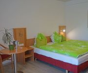
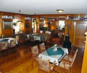
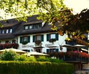
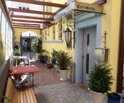
If you need a place to sleep, we compiled a list of available hotels close to the map centre further down the page.
Depending on your travel schedule, you might want to pay a visit to some of the following locations: Wembach, Bollen, Schonenberg, Hasel and Aitern. To further explore this place, just scroll down and browse the available info.
Local weather forecast
Todays Local Weather Conditions & Forecast: 15°C / 59 °F
| Morning Temperature | 8°C / 47 °F |
| Evening Temperature | 11°C / 51 °F |
| Night Temperature | 7°C / 45 °F |
| Chance of rainfall | 0% |
| Air Humidity | 56% |
| Air Pressure | 1014 hPa |
| Wind Speed | Gentle Breeze with 6 km/h (3 mph) from East |
| Cloud Conditions | Overcast clouds, covering 97% of sky |
| General Conditions | Light rain |
Monday, 29th of April 2024
16°C (60 °F)
11°C (52 °F)
Light rain, light breeze, overcast clouds.
Tuesday, 30th of April 2024
20°C (69 °F)
12°C (54 °F)
Light rain, light breeze, scattered clouds.
Wednesday, 1st of May 2024
20°C (67 °F)
12°C (54 °F)
Light rain, calm, overcast clouds.
Hotels and Places to Stay
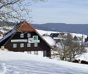
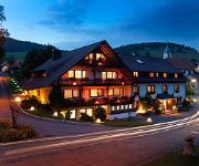
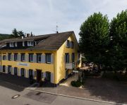
Andis Steakhuesli
Sonne Parkhotel
Hirschen Gasthof
City Hotel
Zum Waldhüter Schwarzwaldgasthof
Mühle zu Gersbach
Landgasthof Erdmannshöhle
Zum Goldenen Wagen
Videos from this area
These are videos related to the place based on their proximity to this place.
Vogeltjesdans in Parkhotel Sonne, Schönau im Schwarzwald
Muziek- en dansavond in Parkhotel Sonne, tijdens vakantiereis naar Zwarte Woud en Vogezen met EffeWeg. Leeftijd speelt geen rol, iedereen die kan doet mee. Super gezellig!
Holzer Kreuz - Südschwarzwald
Das Holzer Kreuz ist ein Ausflugsziel in der Nähe von Schönau im Südschwarzwald in Deutschland. Von dort aus führen wunderschöne Wanderwege mit Panoramablick durch die Natur. Die in...
2010-07-31 Tandemflug mit Peter vom Schneckenkopf
Tandem Gleitschirmflug vom Schneckenkopf bei Fröhnd mit Peter am 31.07.2010.
Gleitschirm Tandemflug vom Schneckenkopf mit Kornelia aus Leipzig
Gleitschirm Tandemflug vom Schneckenkopf bei Fröhnd mit Kornelia aus Leipzig am 31.07.2010.
Gleitschirm Tandemflug vom Ittenschwanderhorn mit Helena
Gleitschirm Tandemflug mit Helena vom Ittenschwanderhorn bei Fröhnd am 31.07.2010.
2010-10-03 Tandemflug mit Susann vom Ittenschwanderhorn
Tandem Gleitschirmflug mit Susann vom Ittenschwanderhorn bei Fröhnd am 03.10.2010.
roadbike passion
a glimpse of a little road bike trip in my home region..south blackwood forest with my simplon phasic.
Videos provided by Youtube are under the copyright of their owners.
Attractions and noteworthy things
Distances are based on the centre of the city/town and sightseeing location. This list contains brief abstracts about monuments, holiday activities, national parcs, museums, organisations and more from the area as well as interesting facts about the region itself. Where available, you'll find the corresponding homepage. Otherwise the related wikipedia article.
Lörrach (district)
Lörrach is a Kreis in the south-west of Baden-Württemberg, Germany. Neighboring districts are Breisgau-Hochschwarzwald and Waldshut. To the west it borders the French département Haut-Rhin; to the south the Swiss cantons Basel-Stadt, Basel-Landschaft and Aargau.
Swisscom-Sendeturm St. Chrischona
Swisscom-Sendeturm St. Chrischona is a communications tower built in 1980-1984 near Basel, Switzerland. It is located at {{#invoke:Coordinates|coord}}{{#coordinates:47|34|18|N|7|41|13|E|region:CH-BS_type:landmark |primary |name= }} east of St. Chrischona, on the territory of the municipality Bettingen, Basel-Stadt. It was built as replacement for a 136 metre tall lattice tower, which was erected at the site in 1962. This lattice tower was once a part of famous Beromünster transmitter.
St. Chrischona
St. Chrischona is a hamlet in the Swiss canton of Basel-Stadt. It is part of the municipality of Bettingen. The centre of the village is located on the highest point of the canton, at 522 metres above sea level. East of St. Chrischona, near the German border, is located a 250 m high communication tower.
Schweigmatt
Schweigmatt is a hamlet located in the southern Black Forest of Germany at an altitude of 780 metres. It belongs to the village of Raitbach and is part of the municipality of Schopfheim in the district of Lörrach. Schweigmatt lies beneath the 985 m peak of the Hohe Möhr, from which it is possible to see as far as the Swiss Alps and Jura Mountains across the Rhine River.
Sausenburg Castle
Sausenburg Castle is a German castle ruin at the foot of the Black Forest, just north of the city of Kandern in Baden-Württemberg, between the villages of Sitzenkirch and Malsburg-Marzell. The castle was originally the stronghold of the lords von Sausenburg. It sits on a hill 665 meters high, known as the Sausenberg.
St. Trudpert's Abbey
St. Trudpert's Abbey (Kloster St. Trudpert) is a former Benedictine monastery in Münstertal in the southern Black Forest, Baden-Württemberg, Germany, now the principal house of the Sisters of St. Joseph of St. Trudpert.
Canton of Fricktal
Fricktal was a canton of the Helvetic Republic from February 1802 to February 1803, consisting of that part of the Breisgau south of the Rhine. Now, the territories of Fricktal form the districts of Rheinfelden and Laufenburg in the canton of Aargau. In 1799, a year after the proclamation of the Helvetic Republic, French Revolutionary troops marched into the Fricktal.
Ägelsee (Zeiningen)
Ägelsee (or Egelsee) is a small lake in the municipality of Zeiningen, Canton of Aargau, Switzerland. The 7500 m² nature preserve is an amphibian spawning area of national importance.
Möhlinbach
The Möhlinbach is a 15 kilometer long stream in Aargau canton, Switzerland.
Eggberg
Eggberg is a mountain of Baden-Württemberg, Germany.
Hasenhorn
Hasenhorn is a mountain of Baden-Württemberg, Germany.
Hochkopf (Südschwarzwald)
Hochkopf (Südschwarzwald) is a mountain of Baden-Württemberg, Germany.
Hohe Flum
Hohe Flum is a mountain of Baden-Württemberg, Germany.
Hohe Möhr
Hohe Möhr is a mountain of Baden-Württemberg, Germany.
Rohrenkopf
Rohrenkopf is a mountain of Baden-Württemberg, Germany.
Stübenwasen
Stübenwasen is a mountain of Baden-Württemberg, Germany.
Dürrenbach
Durrenbach is a commune in the Bas-Rhin department in Alsace in north-eastern France.
Wehra
Wehra is a river of Baden-Württemberg, Germany.
Sissle
The Sissle is a 16-kilometer long river in the Swiss canton of Aargau in Switzerland. It is a tributary of the Rhine and drains the eastern part of the Fricktal. The largest town on the river is Frick. The river rises in the municipalities of Schinznach-Dorf and Thalheim at an altitude of 650 m above the sea (Switzerland) on the southern slope of Mount Dreierberg and the northern slope of Mount Zeiher Homberg, in the Jura Mountains.
Gersbach (Schopfheim)
Gersbach is a nationally recognized resort and district of Schopfheim, a town in the district of Lörrach in Baden-Württemberg, Germany. Gersbach is situated in a mountain valley basin to the south from the eponymous river in the Black Forest at an altitude of 800-1170 m above sea level. The old town of Schopfheim is roughly 17 km away. The formerly independent village, together with the six associated hamlets forms one of Baden-Württemberg's largest Gemarkung, with an area of 2009 hectares.


