Safety Score: 3,0 of 5.0 based on data from 9 authorites. Meaning we advice caution when travelling to Germany.
Travel warnings are updated daily. Source: Travel Warning Germany. Last Update: 2024-04-27 08:23:39
Delve into Raich
Raich in Freiburg Region (Baden-Württemberg) with it's 309 habitants is a town located in Germany about 413 mi (or 664 km) south-west of Berlin, the country's capital town.
Time in Raich is now 06:31 AM (Sunday). The local timezone is named Europe / Berlin with an UTC offset of 2 hours. We know of 12 airports closer to Raich, of which 5 are larger airports. The closest is airport we know is EuroAirport Basel-Mulhouse-Freiburg Airport in France in a distance of 17 mi (or 27 km). The closest airport in Germany is Donaueschingen-Villingen Airport in a distance of 37 mi (or 27 km), South-West. Besides the airports, there are other travel options available (check left side).
There are several Unesco world heritage sites nearby. The closest heritage site is Prehistoric Pile dwellings around the Alps in Austria at a distance of 38 mi (or 61 km). The closest in Germany is Monastic Island of Reichenau in a distance of 59 mi (or 61 km), South-East. We saw 7 points of interest near this location. In need of a room? We compiled a list of available hotels close to the map centre further down the page.
Since you are here already, you might want to pay a visit to some of the following locations: Bollen, Wembach, Schonenberg, Maulburg and Aitern. To further explore this place, just scroll down and browse the available info.
Local weather forecast
Todays Local Weather Conditions & Forecast: 14°C / 58 °F
| Morning Temperature | 8°C / 47 °F |
| Evening Temperature | 9°C / 48 °F |
| Night Temperature | 8°C / 46 °F |
| Chance of rainfall | 0% |
| Air Humidity | 65% |
| Air Pressure | 1014 hPa |
| Wind Speed | Gentle Breeze with 7 km/h (4 mph) from East |
| Cloud Conditions | Overcast clouds, covering 100% of sky |
| General Conditions | Light rain |
Monday, 29th of April 2024
16°C (60 °F)
10°C (50 °F)
Light rain, light breeze, overcast clouds.
Tuesday, 30th of April 2024
20°C (69 °F)
11°C (52 °F)
Light rain, light breeze, overcast clouds.
Wednesday, 1st of May 2024
19°C (67 °F)
13°C (55 °F)
Light rain, light breeze, overcast clouds.
Hotels and Places to Stay
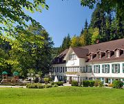
Waldhotel
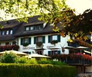
Hirschen Gasthof
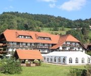
Zum fröhlichen Landmann
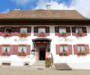
Zum Pflug
Videos from this area
These are videos related to the place based on their proximity to this place.
ALLEMAGNE VOGELPARK STEINEN SUDSWARZWALD MAI 2011
VOGELPARK79585 STEINEN EN ALLEMAGNE SUDSWARZWALD MAI 2011.
Gleitschirm Tandemflug vom Ittenschwanderhorn mit Helena
Gleitschirm Tandemflug mit Helena vom Ittenschwanderhorn bei Fröhnd am 31.07.2010.
2010-10-03 Tandemflug mit Susann vom Ittenschwanderhorn
Tandem Gleitschirmflug mit Susann vom Ittenschwanderhorn bei Fröhnd am 03.10.2010.
Schwarzwald aus der Vogelperspektive | Schloß Bürgeln | Kaltenbach | Sausenburg
Meine ersten Aufnahmen des Südschwarzwaldes aus der Vogelperspektive im Markräflerland Zu sehen sind: Der Tierpark in Kaltenbach mit Blick in Richtung Kandern. Tiere im Südschwarzwald.
Wembach - Neuenweg mit KTM 1190 Adventure
Fahrt von Wembach (Wiesental) nach Neuenweg (kleines Wiesental) im Landkreis Lörrach mit einer KTM 1190 Adventure. Schöne Kurven und nette Strecke.
Videos provided by Youtube are under the copyright of their owners.


