Safety Score: 3,0 of 5.0 based on data from 9 authorites. Meaning we advice caution when travelling to Germany.
Travel warnings are updated daily. Source: Travel Warning Germany. Last Update: 2024-04-19 08:03:45
Explore Atzenbach
Atzenbach in Freiburg Region (Baden-Württemberg) is a city in Germany about 413 mi (or 664 km) south-west of Berlin, the country's capital.
Local time in Atzenbach is now 01:30 PM (Friday). The local timezone is named Europe / Berlin with an UTC offset of 2 hours. We know of 12 airports in the vicinity of Atzenbach, of which 5 are larger airports. The closest is airport we know is EuroAirport Basel-Mulhouse-Freiburg Airport in France in a distance of 18 mi (or 29 km). The closest airport in Germany is Donaueschingen-Villingen Airport in a distance of 35 mi (or 29 km), South-West. Besides the airports, there are other travel options available (check left side).
There are several Unesco world heritage sites nearby. The closest heritage site is Prehistoric Pile dwellings around the Alps in Austria at a distance of 34 mi (or 55 km). The closest in Germany is Monastic Island of Reichenau in a distance of 55 mi (or 55 km), South-East. We found 9 points of interest in the vicinity of this place. If you need a place to sleep, we compiled a list of available hotels close to the map centre further down the page.
Depending on your travel schedule, you might want to pay a visit to some of the following locations: Wembach, Hasel, Schonenberg, Tunau and Aitern. To further explore this place, just scroll down and browse the available info.
Local weather forecast
Todays Local Weather Conditions & Forecast: 5°C / 40 °F
| Morning Temperature | 1°C / 33 °F |
| Evening Temperature | 5°C / 40 °F |
| Night Temperature | 4°C / 39 °F |
| Chance of rainfall | 12% |
| Air Humidity | 96% |
| Air Pressure | 1018 hPa |
| Wind Speed | Moderate breeze with 11 km/h (7 mph) from East |
| Cloud Conditions | Overcast clouds, covering 100% of sky |
| General Conditions | Rain and snow |
Saturday, 20th of April 2024
3°C (38 °F)
2°C (35 °F)
Rain and snow, gentle breeze, overcast clouds.
Sunday, 21st of April 2024
3°C (38 °F)
-1°C (31 °F)
Rain and snow, gentle breeze, overcast clouds.
Monday, 22nd of April 2024
6°C (42 °F)
1°C (34 °F)
Overcast clouds, moderate breeze.
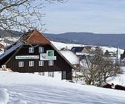
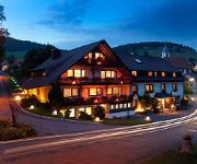
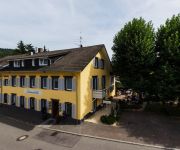
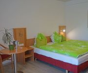
Hotels and Places to Stay
Zum Waldhüter Schwarzwaldgasthof
Mühle zu Gersbach
Landgasthof Erdmannshöhle
Andis Steakhuesli
Sonne Parkhotel
City Hotel
Klosterhof
Krone
Videos from this area
These are videos related to the place based on their proximity to this place.
Holzer Kreuz - Südschwarzwald
Das Holzer Kreuz ist ein Ausflugsziel in der Nähe von Schönau im Südschwarzwald in Deutschland. Von dort aus führen wunderschöne Wanderwege mit Panoramablick durch die Natur. Die in...
Gleitschirm Tandemflug vom Ittenschwanderhorn mit Helena
Gleitschirm Tandemflug mit Helena vom Ittenschwanderhorn bei Fröhnd am 31.07.2010.
2010-10-03 Tandemflug mit Susann vom Ittenschwanderhorn
Tandem Gleitschirmflug mit Susann vom Ittenschwanderhorn bei Fröhnd am 03.10.2010.
Bergfinken Schlafplatz Hasel - Teil 2 - mittendrin statt nur dabei
Abendlicher Einflug der Bergfinken zu ihrem Schlafplatz. Diese haben zwischen Januar und Anfang März 2015 im Südschwarzwald überwintert und kehrten dabei jeden Abend von ihren Futterplätzen.
Tropfsteinhoehle im Schwarzwald: Ausflugsziel Erdmannshoehle in Hasel
Die Erdmannshöhle in Hasel ist eine Tropfsteinhöhle im Schwarzwald. Dieses Ausflugsziel im Schwarzwald ist für die ganzen Familie mit Oma & Opa, Eltern und Kindern im Schwarzwaldurlaub ...
roadbike passion
a glimpse of a little road bike trip in my home region..south blackwood forest with my simplon phasic.
Schopfheim - Gersbach
Road from Schopfheim to Gersbach in the Black Forest riding a BMW R 1200 GS. Many turns during the 600m ascent.
Rosenmontagsumzug 2010 - Gemeinde Mittelstadt - Zell im Wiesental
Zeller Fasnacht 2010 - Biß uf d' Zäh, wenn chasch - Hürus Dirk vo altem Stamm - Umzug der Gemeinde Mittelstadt unter dem Motto "Unter Geiern"
Videos provided by Youtube are under the copyright of their owners.
Attractions and noteworthy things
Distances are based on the centre of the city/town and sightseeing location. This list contains brief abstracts about monuments, holiday activities, national parcs, museums, organisations and more from the area as well as interesting facts about the region itself. Where available, you'll find the corresponding homepage. Otherwise the related wikipedia article.
Schweigmatt
Schweigmatt is a hamlet located in the southern Black Forest of Germany at an altitude of 780 metres. It belongs to the village of Raitbach and is part of the municipality of Schopfheim in the district of Lörrach. Schweigmatt lies beneath the 985 m peak of the Hohe Möhr, from which it is possible to see as far as the Swiss Alps and Jura Mountains across the Rhine River.
Hohe Möhr
Hohe Möhr is a mountain of Baden-Württemberg, Germany.


