Safety Score: 3,0 of 5.0 based on data from 9 authorites. Meaning we advice caution when travelling to France.
Travel warnings are updated daily. Source: Travel Warning France. Last Update: 2024-05-18 08:26:29
Delve into Villaret
Villaret in Isère (Auvergne-Rhône-Alpes) is located in France about 316 mi (or 508 km) south-east of Paris, the country's capital town.
Current time in Villaret is now 10:36 PM (Saturday). The local timezone is named Europe / Paris with an UTC offset of 2 hours. We know of 12 airports close to Villaret, of which 4 are larger airports. The closest airport in France is L'alpe D'huez Airport in a distance of 19 mi (or 30 km), North-East. Besides the airports, there are other travel options available (check left side).
There are several Unesco world heritage sites nearby. The closest heritage site in France is Roman Theatre and its Surroundings and the "Triumphal Arch" of Orange in a distance of 73 mi (or 117 km), South-West. We encountered 2 points of interest near this location. If you need a hotel, we compiled a list of available hotels close to the map centre further down the page.
While being here, you might want to pay a visit to some of the following locations: Grenoble, Le Devoluy, Die, Gap and Chambery. To further explore this place, just scroll down and browse the available info.
Local weather forecast
Todays Local Weather Conditions & Forecast: 17°C / 63 °F
| Morning Temperature | 9°C / 47 °F |
| Evening Temperature | 13°C / 56 °F |
| Night Temperature | 8°C / 47 °F |
| Chance of rainfall | 5% |
| Air Humidity | 48% |
| Air Pressure | 1011 hPa |
| Wind Speed | Gentle Breeze with 6 km/h (4 mph) from North-East |
| Cloud Conditions | Broken clouds, covering 67% of sky |
| General Conditions | Moderate rain |
Sunday, 19th of May 2024
19°C (66 °F)
10°C (50 °F)
Light rain, light breeze, clear sky.
Monday, 20th of May 2024
19°C (67 °F)
11°C (52 °F)
Moderate rain, light breeze, scattered clouds.
Tuesday, 21st of May 2024
13°C (56 °F)
8°C (46 °F)
Moderate rain, light breeze, broken clouds.
Hotels and Places to Stay
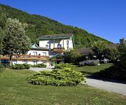
Murtel Logis
Videos from this area
These are videos related to the place based on their proximity to this place.
3/3 Moissons 2013 à Pierre-Châtel - La daye.
Vidéos et le son de la daye pour terminer avec un diaporama la "Fête des moissons" du 18 août 2013 à Pierre-Châtel. http://www.pierre-chatel.fr/ ◥◣◥◣ http://moissons2013.cypiee.fr/
Napoléon étape à Pierre-Châtel en 2014
Reconstitution autour du 199ème anniversaire du passage de l'Empereur sur ce qui est devenu "La Route Napoléon". Diaporama ...
7ème Ronde du Trièves à Pierre-Châtel
La Ronde Historique du Trièves a fait étape à Pierre-Châtel avant de prendre la direction de Cholonge.
Isolation par l'extérieur en bloc de chanvre CHANVRIBLOC
Isolation par l'extérieur d'une maison en pierre avec des blocs de chanvre. Finition enduit à la chaux.
FETES DES MOISSONS 2007 réalisé par Jérôme GIRARDON
Extrait du reportage réalisé par Jérôme Girardon à l'occasion de la fête des moissons à Pierre-Châtel, le 26 août 2007.
Brochet en Texan
Pêche au brochet en texan au one up shad et lunker city swimfish canne G Loomis NRX 804CJWR, Daiwa T3 1016SHL, Illex Element Rider S210MH, Shimano Twinpower 4000CI4SFA.
Brochets aux leurres
Pêche au brochet au Arnaud 100F Illex Chartreuse Shad, et Izumi shad alive 105SK Blue Shiner, canne Pezon & Michel Specialist Pro Séries C183M, Daiwa STEEZ 103HL Casse à la fin du noeud...
Perche au leurre de surface
Perche prise au Sammy115 MJ Herring, canne G Loomis NRX 6"8 Heavy Fast, Daiwa T3 SHL, Tresse Sufix Matrix pro 23/100e, Fluoro Berkley Trilene 34/100e, Hard Mono 80/100e Pezon&Michel.
Le Breuil à La Mure ce que le Boléro est à Ravel ♫ ♪ ♪
La Rue du Breuil et quelques anachronismes suite à un concours photo "Marché de La Mure" 【ツ】Pas triste ce diaporama explicatif ...
Videos provided by Youtube are under the copyright of their owners.
Attractions and noteworthy things
Distances are based on the centre of the city/town and sightseeing location. This list contains brief abstracts about monuments, holiday activities, national parcs, museums, organisations and more from the area as well as interesting facts about the region itself. Where available, you'll find the corresponding homepage. Otherwise the related wikipedia article.
Matheysine
Matheysine is a French Natural region located in the Alps at the south of the Isère département. Its relief is a plateau surroundered by mountains. Matheysine is also called Plateau Matheysin.
Pierre Percée
The Pierre Percée is a natural arch located on a hill of Matheysine, in the Isère département, upon the commune of Pierre-Châtel. It belongs to the so-called Seven Wonders of Dauphiné. Internal gap is 3m. high. Overall aspect evokes the one of a crouching monster and has been the origin of many local legends, where the Devil is usually involved.


