
Address & Contact
Contact Information:
Wikipedia page
GPS Coordinates:
Longitude: 6,038°
Latitude: 44,455°
Summary
Gap - Tallard Airport is a medium sized airport in France, serving the region of Avignon. The longest runway is 2.920 feet or 890 meters long.
Facts:
Airport size: small airport Serving area: Avignon Longest runway: 2920 (ft)
Codes:
IATA: GAT,
ICAO: LFNA
Flight information:
Departure times (FlightStats)
Flight times (FlightRadar24)
Location on map
Show bigger map on Openstreetmap
About the airport
Gap - Tallard Airport (IATA: GAT, ICAO: LFNA) is a small regional airport located in the beautiful region of Provence-Alpes-Côte d'Azur, France. Situated in the town of Tallard, approximately 20 kilometers south of Gap, this airport serves as a gateway to the stunning French Alps.
GAT Airport offers limited commercial flights, mainly catering to general aviation and private aircraft. It boasts a single asphalt runway and a range of facilities to ensure a comfortable experience for travelers. The airport provides car rental services, making it convenient for visitors to explore the surrounding areas.
The region surrounding Gap - Tallard Airport is renowned for its breathtaking natural beauty, offering a plethora of outdoor activities. From hiking and mountain biking in the summer to skiing and snowboarding in the winter, the French Alps provide endless opportunities for adventure enthusiasts.
Whether you're planning a thrilling mountain getaway or simply passing through the region, Gap - Tallard Airport offers a convenient and picturesque starting point for your journey into the heart of the French Alps.
Hotels and places to stay

Le Mas D'Estello

Muret Logis de France
'")
Avantici Citotel Gap (ex: Kyriad Gap)

LE CAP INTER-HOTEL

Première Classe GAP SUD - Micropolis
Videos from the area of the airport


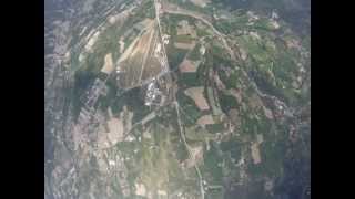
Soaring in the Alps 2010 Gap-Tallard
Saltando en paracaídas en Gap Tallard. Grabación subjetiva con una cámara GoPro.
Saltando en paracaídas en Gap Tallard. Grabación subjetiva con una cámara GoPro.

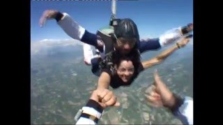
Saut en Parachute @Tallard
Saut en Parachute.
Saut en tandem à Tallard K-rell
Merci les zamis pour ce cadeau... fort en émotion ! :D que dis-je...inoubliable ! On recommence quand? Vidéo : jaerial-parachutisme.com... merci à eux pour leur accueil.
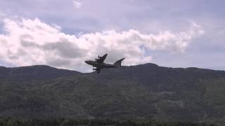
L' Airbus A 400 M passe au dessus de l'aérodrome de Tallard
Passage du nouveau A 400 M sur l'aérodrome de Gap-Tallard. (Images tournées par Thibaut de Rosnay)

Happy dad day
Saut a Gap pour la fete des peres.
Videos provided by Youtube are under the copyright of their owners. 
Webcams from the area of the airport

Webcams provided by webcam.travel are under the copyright of their owners.

 Barcelonnette - Saint-Pons Airport
Small airport - 29 mi (47 km)
Mont-Dauphin - St-Crépin AirportSmall airport - 33 mi (53 km)
L'alpe D'huez AirportSmall airport - 44 mi (71 km)
Valence-Chabeuil AirportMedium airport - 62 mi (100 km)
Courchevel AirportSmall airport - 71 mi (115 km)
Méribel AirportSmall airport - 71 mi (115 km)
Grenoble-Isère AirportMedium airport - 72 mi (116 km)
Nice-Côte d'Azur AirportLarge airport - 80 mi (130 km)
Marseille Provence AirportLarge airport - 81 mi (131 km)
 Torino / Caselle International Airport
Large airport - 94 mi (152 km)
 Geneva Cointrin International Airport
Large airport - 123 mi (199 km)
Genova / Sestri Cristoforo Colombo AirportLarge airport - 138 mi (223 km)
Bigger and popular cities in the wider vicinity are these:
- Apt
- Barcelonnette
- Bardonecchia
- Briancon
- Castellane
- Cesana Torinese
- Claviere
- Condorcet
- Die
- Digne-les-Bains
- Forcalquier
- Gap
- Grenoble
- Le Devoluy
- Oulx
- Saint-Jean-de-Maurienne
- Salbertrand
- Sauze d'Oulx
- Sauze di Cesana
- Sestriere
These are some smaller cities that might be interesting. They are all rather close.
- Aupx
- Chateauvieux
- Curbans
- Faucon-du-Caire
- Fouillouse
- Jarjayes
- La Curnerie
- La Freissinouse
- La Saulce
- Lardier-et-Valenca
- Le Caire
- Le Col de Blaux
- Les Combes
- Les Courtes
- Les Durandons
- Les Periers
- Les Tournieres
- Lettret
- Malcol
- Neffes
- Pelleautier
- Piegut
- Plan-de-Vitrolles
- Roche
- Rousset
- Sigoyer
- Tallard
- Urtis
- Venterol
- Vitrolles