Safety Score: 3,0 of 5.0 based on data from 9 authorites. Meaning we advice caution when travelling to France.
Travel warnings are updated daily. Source: Travel Warning France. Last Update: 2024-04-27 08:23:39
Discover Léaz
Léaz in Ain (Auvergne-Rhône-Alpes) with it's 508 citizens is a city in France about 252 mi (or 405 km) south-east of Paris, the country's capital city.
Local time in Léaz is now 05:06 PM (Saturday). The local timezone is named Europe / Paris with an UTC offset of 2 hours. We know of 10 airports in the vicinity of Léaz, of which 3 are larger airports. The closest is airport we know is Geneva Cointrin International Airport in Switzerland in a distance of 14 mi (or 23 km). The closest airport in France is Annecy-Haute-Savoie-Mont Blanc Airport in a distance of 16 mi (or 23 km), North-East. Besides the airports, there are other travel options available (check left side).
There are several Unesco world heritage sites nearby. The closest heritage site is Lavaux, Vineyard Terraces in Switzerland at a distance of 49 mi (or 79 km). The closest in France is Historic Site of Lyons in a distance of 55 mi (or 79 km), North-East. Looking for a place to stay? we compiled a list of available hotels close to the map centre further down the page.
When in this area, you might want to pay a visit to some of the following locations: Chancy, Saint-Julien-en-Genevois, Nantua, Geneva and Saint-Claude. To further explore this place, just scroll down and browse the available info.
Local weather forecast
Todays Local Weather Conditions & Forecast: 17°C / 62 °F
| Morning Temperature | 3°C / 38 °F |
| Evening Temperature | 15°C / 59 °F |
| Night Temperature | 9°C / 49 °F |
| Chance of rainfall | 0% |
| Air Humidity | 42% |
| Air Pressure | 1006 hPa |
| Wind Speed | Calm with 2 km/h (2 mph) from South-West |
| Cloud Conditions | Overcast clouds, covering 95% of sky |
| General Conditions | Overcast clouds |
Sunday, 28th of April 2024
10°C (49 °F)
10°C (49 °F)
Moderate rain, light breeze, overcast clouds.
Monday, 29th of April 2024
15°C (60 °F)
11°C (52 °F)
Light rain, light breeze, overcast clouds.
Tuesday, 30th of April 2024
18°C (65 °F)
11°C (52 °F)
Light rain, light breeze, overcast clouds.
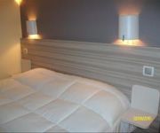
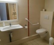
Hotels and Places to Stay
Kyriad Bellegarde Genève
Hôtel Pierre Blanche
Videos from this area
These are videos related to the place based on their proximity to this place.
TGV Bellegarde-sur-Valserine ベルガルド シュル ヴァルスリーヌ
ベルガルドデュロワレ Ain サルのローヌ ・ アルプス地方のコミューンです。 ベルガルドデュロワレの住民は、Bellegardiens と、Bellegardiennes と呼ば...
Tour De France 2012 in Bellegarde sur Valserine
Testing out Photoshop CS6 video editor on old Intel Core2 Duo processor no graphics card Sorry about the lulls in action. It was impossible to know if any riders were coming around that corner.
Test nouveau canoe gonflable PALAVA 400 Gumotex et kayak SOLAR 410 GUMOTEX sur la Valserine
La Valserine est une rivière du massif du Jura, ce parcours est classé 2 (3) avec une chute hors norme quand le niveau du plan d'eau du Rhône est bas. Nous avons exploré la Gorge sous les...
P92 LFHN (bellegarde) été 2014
Un petit tour avec un Tecnam P92 JS dans la région de Bellegarde-sur-Valserine.
Tour de France : la parade des 2CV Cochonou
La parade des 2CV Cochonou à Bellegarde sur Valserine, le 11 juillet 2012.
Le Rhône à Bellegarde 12-06-12.MOV
Chasses du rhône 2012 : le Rhône à Belgarde sur valserine le 12 juin 2012.
La Tine de Parnant
31 Octobre 2014: par une belle journée d'automne, descente du Rhône entre Fort l'Ecluse et le Barrage de Génissiat. (20 Km) Soulagement, le niveau d'eau est assez haut et la Tine de Parnant...
Bellegarde maison ferme rénovée 5 pièces T5 3 chambres de
Pour plus de détails sur ce bien : http://console.immozip.com/redirect?v=858136655ee1118dab1d0132e910 ...
Renault 4L drives past the Bellegarde SNCF station
A Renault 4L drives past the Bellegarde SNCF rail station. Bellegarde is in the department Ain, close to the Swiss canton Geneva.
Videos provided by Youtube are under the copyright of their owners.
Attractions and noteworthy things
Distances are based on the centre of the city/town and sightseeing location. This list contains brief abstracts about monuments, holiday activities, national parcs, museums, organisations and more from the area as well as interesting facts about the region itself. Where available, you'll find the corresponding homepage. Otherwise the related wikipedia article.
Fort l'Écluse
The Fort l'Écluse (or Fort de l'Écluse) is close to the village of Collonges, Ain in Eastern France. It commands the Rhone valley and is a natural entrance into France from Switzerland between the Vuache hills and the Jura Mountains. The fort was founded by a Duke of Savoy, and completed by Vauban in the reign of Louis XIV. It was destroyed by the Austrians in 1815, but was rebuilt by the French, and at the same time considerably strengthened and heightened.
Canton of Collonges
The canton of Collonges is an administrative division in eastern France. It includes the following communes: Commune Inhabitants Postal code INSEE code Challex 1 057 01630 01078 Chézery-Forens 369 01410 01104 Collonges 1 106 01550 01109 Confort 499 01200 01114 Farges 594 01550 01158 Lancrans 935 01200 01205 Léaz 481 01200 01209 Péron 1 579 01630 01288 Pougny 629 01550 01308 Saint-Jean-de-Gonville 1 182 01630 01360


