Explore Lysterfield
The district Lysterfield of in Yarra Ranges (Victoria) with it's 6,551 inhabitants Lysterfield is located in Australia about 280 mi south-west of Canberra, the country's capital.
If you need a place to sleep, we compiled a list of available hotels close to the map centre further down the page.
Depending on your travel schedule, you might want to pay a visit to some of the following locations: Melbourne, Currie, Hay, Canberra and . To further explore this place, just scroll down and browse the available info.
Local weather forecast
Todays Local Weather Conditions & Forecast: 16°C / 61 °F
| Morning Temperature | 7°C / 45 °F |
| Evening Temperature | 10°C / 50 °F |
| Night Temperature | 9°C / 48 °F |
| Chance of rainfall | 0% |
| Air Humidity | 47% |
| Air Pressure | 1029 hPa |
| Wind Speed | Light breeze with 4 km/h (2 mph) from East |
| Cloud Conditions | Broken clouds, covering 78% of sky |
| General Conditions | Broken clouds |
Thursday, 16th of May 2024
18°C (64 °F)
10°C (50 °F)
Sky is clear, light breeze, clear sky.
Friday, 17th of May 2024
16°C (61 °F)
9°C (49 °F)
Light rain, gentle breeze, scattered clouds.
Saturday, 18th of May 2024
12°C (54 °F)
5°C (41 °F)
Few clouds, light breeze.
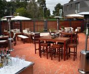
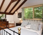
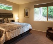
Hotels and Places to Stay
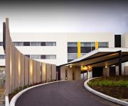
ATURA DANDENONG
Quality Inn & Suites Knox
Rocky Creek Art Garden B&B
Cambridge Cottages Bed & Breakfast
Mountain Element Retreats
Candlelight Cottage
Moulton Park Cottages
Lochiel Luxury Accommodation
Credo Cottages
RAMADA ENCORE DANDENONG
Videos from this area
These are videos related to the place based on their proximity to this place.
Drivers View From 901M X'Trapolis - Upper Ferntree Gully To Belgrave...
Drivers view from Upper Ferntree Gully To Belgrave filmed from X'Trapolis 901M in a 6 Car consist. The footage seems to make the journey look very fast. However, I can assure everyone that...
Upwey Billy Cart Race
Upwey Township Group in Victoria, Australia presents the Upwey Billy Cart Race every February. Participants ride billy karts in various categories and there's even a skateboard section.
Solar Space Heater- heats air in the house using the sun
Most people think of solar power panels- but this is much simpler and just takes air from a room in the house, heats it in a solar collector, and then returns it back to the room. The solar...
Riding the new Specialized Tarmac in Melbourne
Getting to ride the new Specialized Tarmac in Melbourne. Straight out of the car park and up a 5km climb in the Dandenong Hills! Great ride; awesome bike. Some good climbing - shame cars...
Ion Air Pro - Along Dargon Track through Birdsland Reserve
The ride along Dargon Track through Birdsland Reserve filmed using Ion Air Pro HD action sports video camera mounted on the handlebars. The ride details can be seen here: http://app.strava.com/act.
Ava's First Immunisation
My Babies first Immunisation At Rowville Medical centre. I don't think she liked it.
World Cup Cricket Qualifiers game in South Africa
Afghanistan Cricket team play to Qualifiy for 2011 world cup, and also Afghansitan beat a strong team Ireland which was beaten Pakistan in the last world cup.
Lysterfield Lake, Melbourne (during an algal bloom)
Lysterfield Lake is a recreational park in Melbourne's eastern suburbs. I shot this video on two different days in November. On both days the lake was closed for swimming due to a blue-green...
Lysterfield Lake scuba part 1
Ever wandered what was athe bottom of Lysterfield Lake? We did so we had a look. This movie was at the start of the dive. When: 23 Nov 2009 Who: Monash University Underwater Club (MONUC)....
New track at Lysterfield Aneurysm
Riding the new Aneurysm track at Lysterfield, downhill with lots of drops!!! Had to slow towards the end to check on my riding buddy Hodge who was on my tail and decided to go bush for a second,...
Videos provided by Youtube are under the copyright of their owners.
Attractions and noteworthy things
Distances are based on the centre of the city/town and sightseeing location. This list contains brief abstracts about monuments, holiday activities, national parcs, museums, organisations and more from the area as well as interesting facts about the region itself. Where available, you'll find the corresponding homepage. Otherwise the related wikipedia article.
Churchill National Park
Churchill is a national park in Victoria, Australia, 31 km southeast of Melbourne. Churchill NP is in the suburb of Lysterfield South, which lies between Rowville and Endeavour Hills in the far north of the City Of Casey. It is also near the Monash Freeway and Stud Road. Churchill National Park has fantastic woodland and lots of fauna. Churchill is joined onto Lysterfield Park, and joined, they cover around 16.68 km². There are tracks throughout Churchill for walking, cycling and jogging.
Puffing Billy Railway
The Puffing Billy Railway is a narrow gauge 30 gauge heritage railway in the Dandenong Ranges near Melbourne, Australia. The primary starting point, operations and administration centre, main refreshment room (also selling souvenirs) and ticket purchasing are located at Belgrave station. Journeys may also be commenced at out-stations of which some have limited facilities for the purchase of tickets, refreshments and souvenirs.
Endeavour Hills, Victoria
Endeavour Hills is a suburb in Melbourne, Victoria, Australia, 31 km south-east from Melbourne's central business district. Its Local Government Area is the City of Casey. At the 2011 Census, Endeavour Hills had a population of 24,574. Endeavour Hills is bordered by the Monash Freeway and Dandenong Creek to the west, Police Road and Churchill Park Drive to the north, Hallam North Road to the east, and Eumemmerring Creek to the south.
Ferntree Gully, Victoria
Ferntree Gully is a suburb in Melbourne, Victoria, Australia, in the Dandenong Ranges, 32 km south-east from Melbourne's central business district. It is in the Local Government Area and the City of Knox. At the 2011 Census, Ferntree Gully had a population of 25,585: 49.5% male and 50.5% female. The median/average age of a person was 38 years, 1 year above the Australian average. 75% of people living in Ferntree Gully were born in Australia. 48.5% of people are un-married.
Lysterfield, Victoria
Lysterfield is a suburb in Melbourne, Victoria, Australia, 32 km south-east from Melbourne's central business district. Its Local Government Area is the City of Knox and the Shire of Yarra Ranges. At the 2006 Census, Lysterfield had a population of 5,423.
Belgrave, Victoria
Belgrave is a suburb in Melbourne, Victoria, Australia, 35 km east from Melbourne's central business district. Its local government area is the Shire of Yarra Ranges. At the 2006 Census, Belgrave had a population of 4094. Belgrave is only 16 years younger than Melbourne CBD.
Belgrave Heights, Victoria
Belgrave Heights is a suburb in Melbourne, Victoria, Australia, 38 km south-east from Melbourne's central business district. Its Local Government Area is the Shire of Yarra Ranges. At the 2006 Census, Belgrave Heights had a population of 1441. Belgrave Heights Post Office opened on 1 August 1938 as settlement began in the area, and closed in 1977. In February 1983, the Ash Wednesday fires swept through the area, destroying many houses.
Belgrave South, Victoria
Belgrave South is a locality within, and a suburb of, Greater Melbourne mainly beyond the Melbourne metropolitan area Urban Growth Boundary, 39 km south-east from Melbourne's central business district. Its Local Government Area is the Shire of Yarra Ranges. At the 2006 Census, Belgrave South had a population of 1100. It is positioned at the foothills of the Dandenong Ranges and bordered by the suburbs of Belgrave, Belgrave Heights, Lysterfield and the localities of Narre Warren East and Selby.
Tecoma, Victoria
Tecoma is a town in Melbourne, Victoria, Australia, 34 km east from Melbourne's central business district. Its local government area is the Shire of Yarra Ranges. At the 2006 Census, Tecoma had a population of 2,189. The town is named after the shrub that grew in the area when the need was identified for a railway station for the timber mill that occupied the site where Tecoma Primary School now stands. The Post Office opened on 7 January 1929, closing in 1976.
Tremont, Victoria
Tremont is a suburb in Melbourne, Victoria, Australia, 31 km south-east of Melbourne's central business district. Its local government area is the Shire of Yarra Ranges. At the 2006 Census, Tremont had a population of 4094. Almost the entire suburban area is within the Dandenong Ranges National Park. The Post Office opened on 16 July 1913, was known as Dunstan's until 1919, and closed in 1977. Tremont was affected by the Dandenong Ranges fire of 22 January 1997.
Upwey, Victoria
Upwey is a suburb in Melbourne, Victoria, Australia, 32 kilometres east from Melbourne's central business district. Its local government area is the Shire of Yarra Ranges and City of Knox. At the 2006 Census, Upwey had a population of 6,760. Upwey South is a colloquial term for the area directly south of the township, but is not an official suburb.
Narre Warren North, Victoria
Narre Warren North is a suburb in Melbourne, Victoria, Australia, 37 km south-east from Melbourne's central business district. Its Local Government Area is the City of Casey. At the 2011 Census, Narre Warren North had a population of 6,212.
Ferntree Gully railway station
Ferntree Gully is a railway station in Melbourne, Victoria, Australia, located in the suburb of Ferntree Gully, on the Belgrave railway line. It is classed as a Premium Station and is in Metcard Zone 2.
Upper Ferntree Gully railway station
Upper Ferntree Gully is a railway station in Melbourne, Victoria, Australia, located in the suburb of Upper Ferntree Gully, on the Belgrave railway line. Upper Ferntree Gully is classed as a Premium Station and is in Metcard Zone 2.
Upwey railway station, Melbourne
Upwey is a railway station in Melbourne, Victoria, Australia, located in the suburb of Upwey, on the Belgrave railway line. Upwey is unstaffed and is in Metlink Zone 2.
Tecoma railway station
Tecoma is a railway station in Melbourne, Victoria, Australia, located in the suburb of Tecoma, on the Belgrave railway line. Tecoma is unmanned and is in Metlink Zone 2. In 2009 it was the fourth least used metropolitan railway station in Melbourne, with an average of 310 passenger boardings per day.
Belgrave railway station
This article is about the suburban railway station. For the Puffing Billy Railway station, see Belgrave (Puffing Billy) railway station Belgrave {{#invoke:InfoboxImage|InfoboxImage|image=BelgraveStation1.
Belgrave (Puffing Billy) railway station
Belgrave (Puffing Billy) railway station is situated in Belgrave, a suburb of Melbourne in the Australian state of Victoria. It is the inner terminal of the famous Puffing Billy heritage steam railway. It is adjacent to, and forms an interchange with, Belgrave suburban railway station which is the outer terminal of the Belgrave line of Melbourne's broad gauge (5 ft 3in) electric suburban network.
St. Joseph's College, Ferntree Gully
St. Josephs College is a Roman Catholic boys' secondary school in the eastern suburb of Ferntree Gully, Melbourne, Victoria, Australia.
Lysterfield Park
Lysterfield Park is a public park in Lysterfield, a suburb to the south-east of Melbourne, Victoria, Australia. It was the venue for mountain biking events of the 2006 Commonwealth Games. In 2008, several emergency markers were installed in the park to allow callers to emergency services to give their location more precisely.
Lysterfield South, Victoria
Lysterfield South is a rural locality in Melbourne, Victoria, Australia, 33 km south-east of Melbourne's central business district, and adjacent to the main urban area. Its Local Government Area is the City of Casey. At the 2011 Census, Lysterfield South had a population of 924. It is notable for containing Churchill National Park which can be entered via Army Road, from Churchill Park Drive.
Shire of Sherbrooke
The Shire of Sherbrooke was a local government area about 40 kilometres east of Melbourne, the state capital of Victoria, Australia. The shire covered an area of 191.66 square kilometres, and existed from 1963 until 1994. Its largest population centre was the town of Belgrave.
Swagman Restaurant
The Swagman Restaurant was a restaurant in Ferntree Gully, Melbourne, Australia, which opened in 1972 and burnt down in 1991. The restaurant was famous in Melbourne for its long-running television commercials, cabaret shows, and smorgasbord. The Swagman was located on Burwood Highway, Ferntree Gully. It was owned by Basil and Ina Dejong.
Rowville Secondary College
Rowville Secondary College is a co-educational, public high school, located in Rowville, Victoria, Australia. It is divided into two campuses, the East and the West. The eastern campus only goes to year 10 while the western goes right through. It started off as one campus but in November 1996 the eastern campus was opened.
Belgrave Heights Christian School
Belgrave Heights Christian School is a small primary and secondary school in Belgrave Heights near Belgrave in the Dandenong Ranges 36 km east of Melbourne, Victoria, Australia. It is located at the end of Wattle Valley Road which is off Mount Morton Road (a continuation of McNicol Road which intersects with Burwood Highway in Tecoma). There are around 250 secondary students and 200 primary students.


