Delve into Chirnside Park
The district Chirnside Park of Black Springs in Yarra Ranges (Victoria) with it's 9,092 habitants Chirnside Park is a district located in Australia about 271 mi south-west of Canberra, the country's capital town.
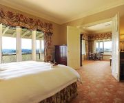
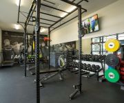
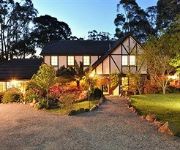
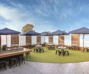
In need of a room? We compiled a list of available hotels close to the map centre further down the page.
Since you are here already, you might want to pay a visit to some of the following locations: Melbourne, Currie, Hay, Canberra and . To further explore this place, just scroll down and browse the available info.
Local weather forecast
Todays Local Weather Conditions & Forecast: 16°C / 62 °F
| Morning Temperature | 6°C / 43 °F |
| Evening Temperature | 10°C / 50 °F |
| Night Temperature | 8°C / 46 °F |
| Chance of rainfall | 0% |
| Air Humidity | 45% |
| Air Pressure | 1029 hPa |
| Wind Speed | Light breeze with 3 km/h (2 mph) from East |
| Cloud Conditions | Broken clouds, covering 56% of sky |
| General Conditions | Broken clouds |
Thursday, 16th of May 2024
18°C (64 °F)
9°C (48 °F)
Sky is clear, calm, clear sky.
Friday, 17th of May 2024
16°C (61 °F)
9°C (48 °F)
Moderate rain, gentle breeze, overcast clouds.
Saturday, 18th of May 2024
12°C (54 °F)
3°C (38 °F)
Light rain, light breeze, few clouds.
Hotels and Places to Stay
Chateau Yering Historic House Hotel
Yering Gorge Cottages by The Eastern Golf Club
Bungunyah Apartments
Holly Lodge
RINGWOOD ROYALE
Yarra Valley Motel
Dorset Gardens Hotel
York On Lilydale Resort
Yarra Valley Grand Hotel
Comfort Inn Ringwood Lake
Videos from this area
These are videos related to the place based on their proximity to this place.
OLD DISNEYLAND INTRO.
A TRIP DOWN MEMORY LANE.HERE IS A COMPLETE OPENING TO WALT DISNEY'S "DISNEYLAND"
Fletchers - 14 Oak Court, The Heritage, Chirnside Park - David Taylor
In the almost rural surrounds of The Heritage Golf and Country Club, this stunning new 2 bedroom, 2 storey townhouse offers 1st class accommodation and a qua...
Gardiners Run Golf Course
Come and see why everyone is so excited about Golf in the Yarra Valley, with the opening of the Gardiners Run Golf Course. Get Immersed in Golf and play Melbourne's newest and most golf friendly...
113 Partridge Way Mooroolbark 3138 VIC by Michael Muncey
Simply Stunning Family Entertainer Renovated interior where classic features blend with modern elements Huge open living and custom-built kitchen Dress circle location close to Chirnside...
8 Justin Court Croydon North 3136 VIC by Carl DeWacht
A Family Home That's Secluded & Spacious 2 storey layout with spacious living & cathedral ceilings Excellent outdoor entertaining Backs onto Hochkins Ridge Reserve.
Tyre Flipping Technique with Callum - Fitness Success
Watch as Callum demonstrates how to correctly flip a tyres safely in our new outdoor training area. Callum is doing this in front of his Monday 6pm Outdoor group. If you would like to book...
Coral the flyball groodle - Trick #1
Coral the flyball groodle sliding down the kids slide! Coral is a flyball dog from the croydon rockets team.
Mario's Scratchbuld F15 Maiden - Trying to take off on 3S battery.
The 8 takes before changing to 4S and take off!
Videos provided by Youtube are under the copyright of their owners.
Attractions and noteworthy things
Distances are based on the centre of the city/town and sightseeing location. This list contains brief abstracts about monuments, holiday activities, national parcs, museums, organisations and more from the area as well as interesting facts about the region itself. Where available, you'll find the corresponding homepage. Otherwise the related wikipedia article.
Chirnside Park, Victoria
Chirnside Park is a suburb in Melbourne, Victoria, Australia, 33 km north-east from Melbourne's central business district. Its Local Government Area is the Shire of Yarra Ranges. At the 2006 Census, Chirnside Park had a population of 9092.
Lilydale, Victoria
Lilydale is a suburb of Melbourne, Victoria, Australia, 35 km north-east from Melbourne's central business district situated in the Yarra Valley. At the 2006 Census, Lilydale had a population of 13,887. It began as a town within the Shire of Lillydale and is also notable as the burial site of Dame Nellie Melba (Lilydale Cemetery). It is both a residential area of metropolitan Melbourne and an industrial area on the city's rural-urban fringe.
Mooroolbark, Victoria
Mooroolbark is a suburb of Melbourne, Victoria, Australia, 31 km east of Melbourne's central business district. Its local government area is the Shire of Yarra Ranges. At the 2006 Census, Mooroolbark had a population of 19,335. Mooroolbark is at an altitude of approximately 93m.
Wonga Park, Victoria
Wonga Park is a locality within Greater Melbourne, beyond the Melbourne Metropolitan Urban Growth Boundary area, 29 km north-east from Melbourne's Central Business District. Its Local Government Area is the City of Manningham. At the 2011 Census, Wonga Park had a population of 3,833. Wonga Park is bounded in the west by Jumping Creek, in the north by the Yarra River, in the east by Brushy Park and Old Homestead Roads and in the south by Holloway Road.
Mooroolbark railway station
Mooroolbark is a railway station in Melbourne, Victoria, Australia, located in the suburb of Mooroolbark, on the Lilydale railway line. Mooroolbark is classed as a Premium Station and is in Metcard Zone 2.
Lilydale railway station
Lilydale is a railway station in Melbourne, Victoria, Australia. It is located at end of the Lilydale line, at Main Street in the suburb of Lilydale. It is 37.8 km from Flinders Street Station, the centre of the city's suburban railway network, and in Metcard ticketing Zone 2.
Coldstream railway station, Melbourne
Coldstream is a closed railway station, located in Station Street, Coldstream, Victoria, Australia, on the now-closed Healesville greater-metropolitan line. The station buildings were destroyed by fire in the late 1990s. The track from Coldstream to Yarra Glen was formerly leased by the Yarra Valley Tourist Railway, who discontinued their lease due to the poor condition of bridges along the line. An old platform in poor condition remains at the former station.
Kilsyth, Victoria
Kilsyth is a suburb in Melbourne, Victoria, Australia, 31 km east from Melbourne's central business district (CBD). The majority of Kilsyth is part of the Shire of Yarra Ranges, the rest is within the City of Maroondah. At the 2006 Census, Kilsyth had a population of 10,022.
Croydon Hills, Victoria
Croydon Hills is a suburb of Melbourne, Victoria, Australia, 32 km north-east from Melbourne's Central Business District. Its Local Government Area is the City of Maroondah. At the 2011 Census, Croydon Hills had a population of 5,185. Croydon Hills is bounded by Plymouth Road to the south, Yarra Road to the east and Bemboka Road to the west. The suburb is located in the outer east of Melbourne.
Lillydale Lake
Lillydale Lake (the name retaining the earliest spelling and the name of the former Lillydale Shire) is an artificial lake and wetlands area created in Lilydale, Melbourne, Australia. The park in which it is situated covers over 100 hectares and includes extensive recreational facilities. The lake covers 28 hectares with a 440 metre long dam wall. The ruins of the 1850s era Cashin's flour mill stand at the northern end of the dam wall.
Croydon North, Victoria
Croydon North is a suburb of Melbourne, Victoria, Australia, 29 km north-east from Melbourne's Central Business District. Its Local Government Area is the City of Maroondah. At the 2011 Census, Croydon North had a population of 7,693. The main shopping / retail strip is located on both sides of the Maroondah Highway and along Exeter Road.
Luther College (Victoria)
Luther College is a co-educational independent secondary school of the Lutheran Church of Australia located in the outer-eastern suburb of Croydon in Melbourne, Victoria, Australia. It maintains a close relationship with the Outer Eastern Lutheran Church parish of the Lutheran Church of Australia, which congregates in the school's chapel facilities. It provides education for years 7-12. Some year 10 and all year 11 and 12 students undertake the VCE program.
Billanook College
Billanook College is an independent co-ed school with an early learning program through to Year 12, located in Mooroolbark, Melbourne, Victoria, Australia. It is a school of the Uniting Church in Australia, and a member of Round Square. It was founded in 1980 by the founding principal Dr Peter Harris. The current principal is Roger Oates. Billanook College is a member of the Eastern Independent Schools of Melbourne.
Lilydale High School
Lilydale High School is a co-educational government secondary school located in Lilydale, Victoria. As of 2009, the school includes science, media, technology and multi-purpose learning areas. It also has three outdoor reptile enclosures which houses a collection of snakes, lizards and other reptiles.
Oxley College (Chirnside Park)
Oxley College is a private, co-educational Christian school, ranging from three-year-old kindergarten to year 12.
Lilydale Heights College
Lilydale Heights College is a government secondary school located in the suburb of Lilydale, east of Melbourne, Victoria, Australia. It covers both junior secondary and higher secondary curricula, and draws students from primary schools from the urban areas of Lilydale and the rural Yarra Valley. Gregory Hancock commenced as the school's principal in 2006 after the retirement in 2005 of the school's principal of 18 years, Peter Cowan.
The Heritage Golf and Country Club
The Heritage Golf and Country Club is located approximately 45 kilometres east-north-east from Melbourne's CBD, in the suburb of Chirnside Park, Victoria, Australia. It opened in 1999 with the release of Stage One residential development, with the Jack Nicklaus–designed St John Golf Course opening in 2000. Stage Two, the Henley Golf Course, designed by Tony Cashmore, opened on 8 October 2006.
Bend of Islands, Victoria
Bend of Islands is a rural locality in Victoria, Australia, 30 km north-east of Melbourne's Central Business District. Its Local Government Area is the Shire of Nillumbik. At the 2011 Census, Bend of Islands had a population of 279. The locality is located on the north bank of the Yarra River near the town of Yarra Glen. It was gazetted in 2000 after a petition from local residents, having previously been part of Christmas Hills and Kangaroo Ground.
Mooroolbark College
Mooroolbark College is a government secondary school situated in Victoria, Australia, near the Dandenong Ranges and the Yarra Valley. It has a student population of around 1160. The school operates a "House" system across all year levels. Vertical homegroups allow senior students to provide leadership and role models for younger students.
Mount Lilydale Mercy College
Mount Lilydale Mercy College (commonly known as Mount Lilydale or MLMC) is a Catholic co-educational College in Lilydale, Victoria, Australia which caters for the need of approximately 1500 students from the Yarra Valley and outer eastern suburbs of Melbourne. The school was conducted by the Sisters of Mercy since 1896.
Yarra Hills Secondary College
Yarra Hills Secondary College (formerly Pembroke Secondary College) is a secondary school in the outer eastern suburbs of Melbourne, Australia. The school has three campuses: junior campuses in Cambridge Road, Mooroolbark, and in Mount Evelyn, serve students in years 7-10, and a senior campus in Reay Road in Mooroolbark serves year 11 and 12 students.
Croydon Secondary College
Croydon Secondary College (CSC) is located on Croydon Road, Croydon in Croydon, Victoria. Croydon High School (as it was then) was established in 1958. 2008 was the College's 50th Year.
Sugarloaf Reservoir
Sugarloaf Reservoir is a reservoir located north-east of Melbourne. It was completed in 1981. Its total capacity is 96 GL. As of February 12, 2010 the reservoir sits at 67.1% of capacity. It reached nearly 80% in late 2009 after reaching nearly 10% in May. In February 2010, the North South Pipeline from the Goulburn River was connected to the reservoir. It is operated by Melbourne Water.
Lilydale Adventist Academy
Lilydale Adventist Academy is a K-12 school in Lilydale, Victoria. It operated by the Australian branch of the Seventh-day Adventist Church.
Chirnside Park Shopping Centre
Chirnside Park Shopping Centre is the shopping centre, located on Kimberly Drive, Chirnside Park, Melbourne, Australia and is owned by GPT Wholesale Shopping Centre Fund. It is situated approximately 32 kilometres east-north-east of the Melbourne CBD. The shopping centre opened in 1979 as a small convenience shopping centre which has grown over the years, opening stores such as Kmart, Target, Woolworths, Coles and Reading Cinemas.


