Delve into Mooroolbark
The district Mooroolbark of in Maroondah (Victoria) is a district located in Australia about 274 mi south-west of Canberra, the country's capital town.
In need of a room? We compiled a list of available hotels close to the map centre further down the page.
Since you are here already, you might want to pay a visit to some of the following locations: Melbourne, Currie, Hay, Canberra and . To further explore this place, just scroll down and browse the available info.
Local weather forecast
Todays Local Weather Conditions & Forecast: 16°C / 62 °F
| Morning Temperature | 6°C / 43 °F |
| Evening Temperature | 9°C / 49 °F |
| Night Temperature | 8°C / 46 °F |
| Chance of rainfall | 0% |
| Air Humidity | 46% |
| Air Pressure | 1029 hPa |
| Wind Speed | Light breeze with 3 km/h (2 mph) from East |
| Cloud Conditions | Broken clouds, covering 73% of sky |
| General Conditions | Broken clouds |
Thursday, 16th of May 2024
18°C (64 °F)
9°C (49 °F)
Sky is clear, calm, clear sky.
Friday, 17th of May 2024
16°C (61 °F)
9°C (48 °F)
Light rain, light breeze, scattered clouds.
Saturday, 18th of May 2024
12°C (54 °F)
4°C (39 °F)
Sky is clear, light breeze, few clouds.
Hotels and Places to Stay
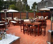
Quality Inn & Suites Knox
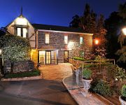
The Loft In The Mill Boutique Accommodation
Rocky Creek Art Garden B&B
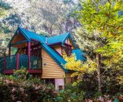
Moulton Park Cottages
Arnica Views
RINGWOOD ROYALE
Holly Lodge
Credo Cottages
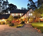
Cambridge Cottages Bed & Breakfast
Bungunyah Apartments
Videos from this area
These are videos related to the place based on their proximity to this place.
Mooroolbark Miniature Railway
Video of our ride on the Mooroolbark Miniature Railway, shot using an iphone on 22/4/2012.
3 Realms Of Worship That Open The Gates Of A City - Ps Andrew Magrath - 1/2/15 10:30AM
3 Realms Of Worship That Open The Gates Of A City Pastor Andrew Magrath 1/2/2015 10:30AM Hope City Church is a grace filled, Spirit led church living with a passion to daily encounter God...
9100 - flyby at Mooroolbark
A few seconds flying at Brice Ave Park , Mooroolbark showing what happens when you modify the swashplate on your 9100 helicopter. At last... full swashplate movement allows excellent speed control.
Mooroolbark Carpet Cleaning Melbourne - (03) 9111 5619 - Carpet Cleaning In Mooroolbark, VIC
Pocka Dola Carpet Cleaning Melbourne Mooroolbark Carpet Cleaning Melbourne - (03) 9111 5619 - Carpet Cleaning In Mooroolbark, VIC Hosted on the Pocka Dola Youtube Channel Carpet Cleaning ...
113 Partridge Way Mooroolbark 3138 VIC by Michael Muncey
Simply Stunning Family Entertainer Renovated interior where classic features blend with modern elements Huge open living and custom-built kitchen Dress circle location close to Chirnside...
Australian Navy Bell 429 Helicopter Landing on a School Oval in Mooroolbark, Victoria
Australian Navy Bell 429 Helicopter - Landing on the school oval of Rolling Hills Primary School in Mooroolbark, Victoria, Australia The Australian Navy have 3 of these choppers in service...
Mooroolbark 5-ways
It's the Mooroolbark 5 ways! A true local should circumnavigate it without use of the brake pedal.
Mooroolbark Miniature Railway - Night Run
Night run and BBQ at the Mooroolbark Miniature Railway for members and exhibitors at the Croydon Model Railway Club's 2009 Lilydale exhibition.
K153-K190 steamrail shuttle @ Mooroolbark 0715.MOV
K153 & K190 leaving Mooroolbark on a Steamrail shuttle to Mitcham 19-9-2010 - just love that multi chime whistle.
Night Run with a Maxitrak Planet at Mooroolbark Miniature Railway
As part of the activities for the Croydon Model Railway Club's Lilydale 2010 exhibition, a barbecue for exhibitors was held at the Mooroolbark Miniature Railway. I took along my Maxitrak Planet...
Videos provided by Youtube are under the copyright of their owners.
Attractions and noteworthy things
Distances are based on the centre of the city/town and sightseeing location. This list contains brief abstracts about monuments, holiday activities, national parcs, museums, organisations and more from the area as well as interesting facts about the region itself. Where available, you'll find the corresponding homepage. Otherwise the related wikipedia article.
Bayswater North, Victoria
Bayswater North is a suburb of Melbourne, Victoria, Australia, 28 km east from Melbourne's Central Business District. Its Local Government Area is the City of Maroondah. At the 2011 Census, Bayswater North had a population of 8,424. Bayswater North is part of a significant industrial and commercial precinct, which accommodates over 35,000 employees.
Chirnside Park, Victoria
Chirnside Park is a suburb in Melbourne, Victoria, Australia, 33 km north-east from Melbourne's central business district. Its Local Government Area is the Shire of Yarra Ranges. At the 2006 Census, Chirnside Park had a population of 9092.
Montrose, Victoria
Montrose is a suburb in Melbourne, Victoria, Australia, 33 km east of Melbourne's central business district. Its local government area is the Shire of Yarra Ranges. At the 2006 Census, Montrose had a population of 6464. Montrose varies in altitude, from about 91m to 324m above sea level. Montrose covers an area of about 1084 hectares or around 11 square kilometres (km2) (2680 acres) Montrose is situated at the picturesque foothills of Mount Dandenong.
Mooroolbark, Victoria
Mooroolbark is a suburb of Melbourne, Victoria, Australia, 31 km east of Melbourne's central business district. Its local government area is the Shire of Yarra Ranges. At the 2006 Census, Mooroolbark had a population of 19,335. Mooroolbark is at an altitude of approximately 93m.
Warranwood, Victoria
Warranwood is a suburb of Melbourne, Victoria, Australia, 27 km north-east from Melbourne's Central Business District. Its Local Government Area is the City of Maroondah. At the 2011 Census, Warranwood had a population of 4,791.
Croydon railway station, Melbourne
Croydon is a railway station in Melbourne, Victoria, Australia, located in the suburb of Croydon, on the Lilydale railway line. Croydon is classed as a Premium Station and is in Metcard Zone 2.
Mooroolbark railway station
Mooroolbark is a railway station in Melbourne, Victoria, Australia, located in the suburb of Mooroolbark, on the Lilydale railway line. Mooroolbark is classed as a Premium Station and is in Metcard Zone 2.
Croydon South, Victoria
Croydon South is a suburb of Melbourne, Victoria, Australia, 30 km east from Melbourne's Central Business District. Its Local Government Area is the City of Maroondah. At the 2011 Census, Croydon South had a population of 4,523. Croydon South has a small shopping strip, on the corner of Eastfield and Bayswater Roads, incorporating over 20 retail outlets and a Post Office. It is close to the foothills of Mount Dandenong and the Dandenong Ranges.
Kilsyth, Victoria
Kilsyth is a suburb in Melbourne, Victoria, Australia, 31 km east from Melbourne's central business district (CBD). The majority of Kilsyth is part of the Shire of Yarra Ranges, the rest is within the City of Maroondah. At the 2006 Census, Kilsyth had a population of 10,022.
Croydon Hills, Victoria
Croydon Hills is a suburb of Melbourne, Victoria, Australia, 32 km north-east from Melbourne's Central Business District. Its Local Government Area is the City of Maroondah. At the 2011 Census, Croydon Hills had a population of 5,185. Croydon Hills is bounded by Plymouth Road to the south, Yarra Road to the east and Bemboka Road to the west. The suburb is located in the outer east of Melbourne.
Croydon North, Victoria
Croydon North is a suburb of Melbourne, Victoria, Australia, 29 km north-east from Melbourne's Central Business District. Its Local Government Area is the City of Maroondah. At the 2011 Census, Croydon North had a population of 7,693. The main shopping / retail strip is located on both sides of the Maroondah Highway and along Exeter Road.
Luther College (Victoria)
Luther College is a co-educational independent secondary school of the Lutheran Church of Australia located in the outer-eastern suburb of Croydon in Melbourne, Victoria, Australia. It maintains a close relationship with the Outer Eastern Lutheran Church parish of the Lutheran Church of Australia, which congregates in the school's chapel facilities. It provides education for years 7-12. Some year 10 and all year 11 and 12 students undertake the VCE program.
Kilsyth South, Victoria
Kilsyth South is a suburb of Melbourne, Victoria, Australia, 32 km east from Melbourne's Central Business District. Its Local Government Area is the City of Maroondah. At the 2011 Census, Kilsyth South had a population of 3,053.
Croydon, Victoria
Croydon is a suburb of Melbourne, Victoria, Australia, 27 km east from Melbourne's Central Business District. Its Local Government Area is the City of Maroondah. At the 2011 Census, Croydon had a population of 23,553.
Billanook College
Billanook College is an independent co-ed school with an early learning program through to Year 12, located in Mooroolbark, Melbourne, Victoria, Australia. It is a school of the Uniting Church in Australia, and a member of Round Square. It was founded in 1980 by the founding principal Dr Peter Harris. The current principal is Roger Oates. Billanook College is a member of the Eastern Independent Schools of Melbourne.
Lilydale High School
Lilydale High School is a co-educational government secondary school located in Lilydale, Victoria. As of 2009, the school includes science, media, technology and multi-purpose learning areas. It also has three outdoor reptile enclosures which houses a collection of snakes, lizards and other reptiles.
Yarra Valley Grammar
Yarra Valley Grammar School is an independent, co-educational grammar school, located in Ringwood, a suburb of Melbourne, Victoria, Australia. The school was established in 1966 as Yarra Valley Church of England School, and catered for boys only. In 1973, Yarra Valley Anglican School established a Hearing Unit for the Deaf under the tutelage of Bill Robinson.
Oxley College (Chirnside Park)
Oxley College is a private, co-educational Christian school, ranging from three-year-old kindergarten to year 12.
Maroondah Secondary College
Maroondah Secondary College is located on Brentnall Road, off Maroondah Highway, in Croydon, Victoria. The first principal was Harry Fletcher, and the school was originally known as Croydon West high school until 1973 when the name was changed Maroondah High school. The school entrance is in Croydon west, but the School building itself is in Ringwood East. The school offers a full range of both VCE and VCAL programs to students, but with a limited range of subjects.
Mooroolbark College
Mooroolbark College is a government secondary school situated in Victoria, Australia, near the Dandenong Ranges and the Yarra Valley. It has a student population of around 1160. The school operates a "House" system across all year levels. Vertical homegroups allow senior students to provide leadership and role models for younger students.
Tarralla Creek Trail
No image available yet Tarralla Creek Trail Length 5.63km Difficulty Easy
City of Croydon
The City of Croydon was a local government area located about 30 kilometres east of Melbourne, the state capital of Victoria, Australia. The city covered an area of 34.32 square kilometres, and existed from 1961 until 1994.
Yarra Hills Secondary College
Yarra Hills Secondary College (formerly Pembroke Secondary College) is a secondary school in the outer eastern suburbs of Melbourne, Australia. The school has three campuses: junior campuses in Cambridge Road, Mooroolbark, and in Mount Evelyn, serve students in years 7-10, and a senior campus in Reay Road in Mooroolbark serves year 11 and 12 students.
Croydon Secondary College
Croydon Secondary College (CSC) is located on Croydon Road, Croydon in Croydon, Victoria. Croydon High School (as it was then) was established in 1958. 2008 was the College's 50th Year.
Chirnside Park Shopping Centre
Chirnside Park Shopping Centre is the shopping centre, located on Kimberly Drive, Chirnside Park, Melbourne, Australia and is owned by GPT Wholesale Shopping Centre Fund. It is situated approximately 32 kilometres east-north-east of the Melbourne CBD. The shopping centre opened in 1979 as a small convenience shopping centre which has grown over the years, opening stores such as Kmart, Target, Woolworths, Coles and Reading Cinemas.


