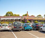
Discover Dandenong South
The district Dandenong South of in Greater Dandenong (Victoria) with it's 358 citizens Dandenong South is a district in Australia about 288 mi south-west of Canberra, the country's capital city.
Looking for a place to stay? we compiled a list of available hotels close to the map centre further down the page.
When in this area, you might want to pay a visit to some of the following locations: Melbourne, Currie, Hay, Canberra and . To further explore this place, just scroll down and browse the available info.
Local weather forecast
Todays Local Weather Conditions & Forecast: 15°C / 59 °F
| Morning Temperature | 13°C / 55 °F |
| Evening Temperature | 14°C / 57 °F |
| Night Temperature | 12°C / 53 °F |
| Chance of rainfall | 0% |
| Air Humidity | 58% |
| Air Pressure | 1026 hPa |
| Wind Speed | Gentle Breeze with 6 km/h (4 mph) from North-East |
| Cloud Conditions | Overcast clouds, covering 94% of sky |
| General Conditions | Light rain |
Saturday, 27th of April 2024
15°C (59 °F)
12°C (53 °F)
Sky is clear, light breeze, clear sky.
Sunday, 28th of April 2024
19°C (66 °F)
15°C (59 °F)
Overcast clouds, gentle breeze.
Monday, 29th of April 2024
14°C (57 °F)
12°C (53 °F)
Light rain, moderate breeze, overcast clouds.
Hotels and Places to Stay
ATURA DANDENONG
RAMADA ENCORE DANDENONG
QUEST DANDENONG SERVICED APTS
The Prince Mark Motor Inn
Comfort Inn Dandenong
Keysborough Hotel
Sandown Regency
Sandown Park Hotel
Waltzing Matilda Hotel
Videos from this area
These are videos related to the place based on their proximity to this place.
monaro COUNTRY AUSSIE ICONS PROUDLY
monaro BALLARAT DRAG RACING DRAGONSLiVED created this video monaro COUNTRY AUSSIE ICONS PROUDLY.
A Day in Melbourne - Nazareth City Experience 2007
Two high school nerds complain their way through Melbourne. 'A heartwrenching, yet educational day in the city. It was a school trip, and I felt sweaty, upset and empowered, in that order....
Derailed Train on the Cranbourne Line near Bombardier Transportation
A train derailed near Bombardier Transportation on Mon 1st June 2009. It was Pacific National ballast wagons and Country Links Passenger car. This was taken from a Connex train out of Cranbourne...
Central Dandenong promotional advertisement on Prime TV
This advertisement was recently filmed to promote central Dandenong on Prime TV Gippsland. For more information go to www.greaterdandenong.com.
LIVING TREES ORGANISATION
http://www.erdigroup.com.au Living Trees - Environmental Support From the Ground Up. Living Trees is an environmental initiative with a wealth of experience and expertise in large-scale...
GM HOLDEN HSV GTS WALKINSHAW SPECIAL SUPERCHARGED
HSV GTS CORVETTE POWERED it was announced 26th April 2013 the fastest ever production HOLDEN SEDAN will have over 400KW starting August 2013 this is the current model DRAGONSLiVED ...
Driving School Melbourne - Testimonial - Aaron Barlow
Hi my name is Aaron Barlow. I rang origin driving school. I got my licence I just passed today, the instructor that was introduced to me is a very good teacher and I will suggest anyone to...
monaro HK GTS DRAG RACING
monaro HK GTS DRAG RACING DRAGONSLiVED created this video for monaro & related videos 2013 Interceptor SEARCH is on track we are looking the best cars GM HOLDEN.
National Panasonic GX3 AM reception demonstration (review)
A demonstration of evening AM broadcast reception on a National Panasonic GX-3 portable receiver. The first test is trying to receive a weak signal on the same frequency of a local station...
Videos provided by Youtube are under the copyright of their owners.
Attractions and noteworthy things
Distances are based on the centre of the city/town and sightseeing location. This list contains brief abstracts about monuments, holiday activities, national parcs, museums, organisations and more from the area as well as interesting facts about the region itself. Where available, you'll find the corresponding homepage. Otherwise the related wikipedia article.
City of Greater Dandenong
The City of Greater Dandenong is a local government area in Victoria, Australia located in the southeastern suburbs of Melbourne. It has an area of just under 130 square kilometres (50 sq mi) and an estimated population of 135,605 people. It was formed in 1994 by the merger of parts of the former City of Dandenong and City of Springvale.
Doveton, Victoria
Doveton is a suburb in Melbourne, Australia, 31 km south-east from Melbourne's central business district. Its Local Government Area is the City of Casey. At the 2011 Census, Doveton had a population of 8,404. Doveton is bounded by Dandenong Creek and Power Road in the west, The Monash Freeway in the north, Eumemmerring Creek in the east, and Princes Highway in the south.
Eumemmerring, Victoria
This article is about the suburb of Eumemmerring. For the Secondary College, see Eumemmerring College.
Hallam, Victoria
Hallam is a suburb in Melbourne, Victoria, Australia, 35 km south-east from Melbourne's central business district. Its Local Government Area is the City of Casey. At the 2011 Census, Hallam had a population of 10,162. The suburb has its own railway station. Hallam is bounded by the South Gippsland Freeway in the west, Eumemmerring Creek and Hallam North Road in the north, a drain easement in the east, and Centre Road in the south.
Hampton Park, Victoria
Hampton Park is a suburb in Melbourne, Victoria, Australia, 36 km south-east from Melbourne's central business district. Its Local Government Area is the City of Casey. At the 2011 Census, Hampton Park had a population of 23,767. Hampton Park is bounded by the South Gippsland Freeway in the west, Centre Road in the north, a line generally parallel to Langbourne Drive in the east, and Glasscocks Road in the south.
Lynbrook, Victoria
Lynbrook is a suburb in Melbourne, Victoria, Australia, 36 km south-east from Melbourne's central business district. Its Local Government Area is the City of Casey. At the 2011 Census, Lynbrook had a population of 6,772. Lynbrook is positioned on the South Gippsland Highway, slightly north-west of Cranbourne, and just south of the residential suburb of Hampton Park.
Dandenong, Victoria
Dandenong is a suburb of Melbourne, Victoria, Australia, approximately 30 km south-east from Melbourne's central business district. Situated on the Dandenong Creek, it is at the foothill of the Dandenong Ranges and is the main administrative centre for the City of Greater Dandenong Local Government Area (LGA). At the 2011 Census, central Dandenong had a population of 24,919. It began as a township in 1852 and at the start of the 20th century was an important regional city with its own suburbs.
Keysborough, Victoria
Keysborough is a suburb in Melbourne, Victoria, Australia, 27 km south-east from Melbourne's central business district. Its Local Government Area is the City of Greater Dandenong. At the 2006 Census, Keysborough had a population of 16,368. Keysborough includes market gardens and semi-rural properties and is also a large residential/industrial suburb which started to grow in the 1960s and well into the 1990s.
Dandenong South, Victoria
Dandenong South is a suburb in Melbourne, Victoria, Australia, 31 km south-east from Melbourne's central business district. Its Local Government Area is the City of Greater Dandenong. At the 2006 Census, Dandenong South had a population of 4867. Dandenong South is a primarily industrialized suburb that borders Hallam and the City of Casey region. The suburb contains the closed General Motors railway station.
Lyndhurst, Victoria
Lyndhurst is a suburb in Melbourne, Victoria, Australia, 35 km south-east from Melbourne's central business district. Its Local Government Area is both the City of Casey and the city of Greater Dandenong. Lyndhurst Post Office opened on 1 January 1867 and closed in 1976. After the Bracks government's decisions to abandon plans for a toxic waste dump near Mildura, the continued use of the existing Lyndhurst facility was part of the replacement plan.
Yarraman railway station
Yarraman is a railway station in Melbourne, Victoria, Australia, located in the suburb of Noble Park, on the Pakenham and Cranbourne railway lines. Yarraman is unmanned and is in Myki Zone 2.
Dandenong railway station
Dandenong is a railway station located in Dandenong, Victoria, Australia. Located 30 km from Flinders Street Station in central Melbourne, the station serves as the junction of the Pakenham and Cranbourne railway lines, and is the terminus station for several peak services. It also serves V/Line trains along the Traralgon and Bairnsdale lines.
Hallam railway station
Hallam is a railway station in Melbourne, Victoria, Australia, located in the suburb of Hallam, on the Pakenham railway line. Hallam is unmanned and is in Metcard Zone 2.
Division of Isaacs
The Division of Isaacs is an Australian Electoral Division in the state of Victoria. It is located in the south-eastern suburbs of Melbourne, on the eastern shores of Port Phillip Bay. It covers the suburbs of Mordialloc, Keysborough, Noble Park, Chelsea, Bonbeach, Patterson Lakes and Carrum. The Division was named after Sir Isaac Isaacs, former Chief Justice of Australia and the first Australian-born Governor-General of Australia.
Chisholm Institute
Chisholm Institute is a Technical and Further Education (TAFE) Institute located in the south-east Melbourne Australia. It provides adult education in a number of areas including the arts, hospitality, information technology, trades and business. The Institute takes its name from Caroline Chisholm. Its name was also inspired by the Chisholm Institute of Technology, a tertiary institution that operated in southeast Melbourne from 1982 to 1990 before becoming part of Monash University.
St John's Regional College
St John's Regional College is a Catholic co-educational secondary school situated in Dandenong in the south-eastern suburbs of Melbourne.
Hallam Bypass Trail
No image available yet Hallam Bypass Trail Length 13.7 km Difficulty Easy
Lynbrook railway station
Lynbrook is a railway station on the Cranbourne railway line in the suburb of Lynbrook, Victoria. Lynbrook is located in Public Transport Victoria Zone 2, and currently is an unstaffed station. The station opened on 22 April 2012.
Dandenong High School
Dandenong High School is one of the largest co-educational government schools in Melbourne, Victoria, Australia. The school caters for students from Years 7 to 12. At the start of 2007, Dandenong High School, Cleeland Secondary College and Doveton Secondary College officially merged to become the new Dandenong High School, as part of the Federal Government's Building the Education Revolution.
General Motors railway station
General Motors is a disused railway station on the Pakenham line of the Melbourne suburban rail system. It is located between Dandenong and Hallam stations, in the suburb of Dandenong South.
Lyndhurst railway station
Lyndhurst is a former railway station on the South Gippsland line. In 1979, it had a single platform on the east side of the track, and a loop siding. In the 1969 Melbourne Transportation Plan, a new passenger line was proposed linking Frankston and Lyndhurst. Today the platform is demolished and is closed to passengers, with cement traffic from Waurn Ponds, near Geelong being the only traffic. This ended in 2009 after Pacific National increased the costs charged to Blue Circle Southern.
City of Dandenong
The City of Dandenong was a local government area about 35 kilometres southeast of Melbourne, the state capital of Victoria, Australia. The city covered an area of 36.26 square kilometres, and existed from 1857 until 1994.
Hampton Park Secondary College
Hampton Park Secondary College is a secondary college in Melbourne. It is next to River Gum Primary School.
George Andrews Reserve
George Andrews Reserve is an Australian football (soccer) stadium in Dandenong, a suburb of Melbourne, Victoria. It is currently the home of Dandenong Thunder. The stadium has a capacity of 5,000, with approximately 1,000 seats in its one grandstand.
Bend Road archaeological site
The Bend Road archaeological site is an open site in Melbourne, Australia, which was discovered during survey and archaeological testing for the proposed Scoresby Freeway (which became the EastLink Freeway. The site is located in two separate areas on either side of Bend Road, Dandenong South where the freeway now intersects the former road, and originally covered about 12 hectares.


