Discover Dandenong North
The district Dandenong North of in Greater Dandenong (Victoria) with it's 21,910 citizens Dandenong North is a district in Australia about 286 mi south-west of Canberra, the country's capital city.
Looking for a place to stay? we compiled a list of available hotels close to the map centre further down the page.
When in this area, you might want to pay a visit to some of the following locations: Melbourne, Currie, Hay, Canberra and . To further explore this place, just scroll down and browse the available info.
Local weather forecast
Todays Local Weather Conditions & Forecast: 14°C / 58 °F
| Morning Temperature | 10°C / 49 °F |
| Evening Temperature | 12°C / 53 °F |
| Night Temperature | 10°C / 49 °F |
| Chance of rainfall | 0% |
| Air Humidity | 57% |
| Air Pressure | 1029 hPa |
| Wind Speed | Light breeze with 3 km/h (2 mph) from East |
| Cloud Conditions | Overcast clouds, covering 94% of sky |
| General Conditions | Overcast clouds |
Wednesday, 15th of May 2024
16°C (61 °F)
10°C (50 °F)
Few clouds, light breeze.
Thursday, 16th of May 2024
17°C (63 °F)
12°C (54 °F)
Scattered clouds, calm.
Friday, 17th of May 2024
17°C (62 °F)
11°C (51 °F)
Light rain, gentle breeze, broken clouds.
Hotels and Places to Stay
ATURA DANDENONG
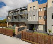
Lifestyle Apartments at Ferntree
QUEST GLEN WAVERLEY
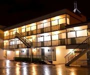
RAMADA ENCORE DANDENONG
Hotel Bruce County
Novotel Melbourne Glen Waverley
Park Avenue – Glen Central
Waverley International Hotel Melbourne
Gateway on Monash
QUEST DANDENONG SERVICED APTS
Videos from this area
These are videos related to the place based on their proximity to this place.
Australian Nativity Scene Display by creator & artist Wilson Fernandez (2012)
Nativity Scene at St. Elizabeth's Parish, Dandenong North 3175 Australia Creator & Artist: Wilson Fernandez +61 428 927 110.
DFM: Holiday Fun - Basketball
While we were at Dandenong Stadium for the Spike Zone Volleyball Holiday Program we managed to sneak over to the basketball court for a few shots during lunch break. Listen to Alex getting...
Best points: U14 final Wonthaggi vs Eltham on 28-07-2013
Vodafone Victorian Volleyball Schools Cup. Best points from U14s Eltham against Wonthaggi .
Best points: Premier Women Heidelberg Volleyball Team on 03-08-2013 - 3rd set
Best points from the Heidelberg Premier Women against Victoria University.
monaro COUNTRY AUSSIE ICONS PROUDLY
monaro BALLARAT DRAG RACING DRAGONSLiVED created this video monaro COUNTRY AUSSIE ICONS PROUDLY.
GM HOLDEN HSV GTS WALKINSHAW SPECIAL SUPERCHARGED
HSV GTS CORVETTE POWERED it was announced 26th April 2013 the fastest ever production HOLDEN SEDAN will have over 400KW starting August 2013 this is the current model DRAGONSLiVED ...
monaro HK GTS DRAG RACING
monaro HK GTS DRAG RACING DRAGONSLiVED created this video for monaro & related videos 2013 Interceptor SEARCH is on track we are looking the best cars GM HOLDEN.
HK HOLDEN monaro GTS 1968
HK HOLDEN monaro GTS 1968 , DRAGONSLiVED created this video for monaro69GTS on track looking at the best cars.
monaro HT GTS 350 BATHURST
monaro HT GTS 350 BATHURST DRAGONSLiVED created this video for monaro & related videos 2013 Interceptor SEARCH is on track we are looking the best cars MAD MAX INTERCEPTOR mad ...
Videos provided by Youtube are under the copyright of their owners.
Attractions and noteworthy things
Distances are based on the centre of the city/town and sightseeing location. This list contains brief abstracts about monuments, holiday activities, national parcs, museums, organisations and more from the area as well as interesting facts about the region itself. Where available, you'll find the corresponding homepage. Otherwise the related wikipedia article.
Rowville, Victoria
Rowville is a suburb in Melbourne, Victoria, Australia, 29 km south-east from Melbourne's central business district. Its Local Government Area is the City of Knox. At the 2011 Census, Rowville had a population of 34,145. Rowville is named after the Row family, whose property Stamford Park was established in 1882. The Stamford Park homestead has been restored in recent years by Knox Council. Geographically, Rowville is one of the largest suburbs south-east of Melbourne.
Doveton, Victoria
Doveton is a suburb in Melbourne, Australia, 31 km south-east from Melbourne's central business district. Its Local Government Area is the City of Casey. At the 2011 Census, Doveton had a population of 8,404. Doveton is bounded by Dandenong Creek and Power Road in the west, The Monash Freeway in the north, Eumemmerring Creek in the east, and Princes Highway in the south.
Dandenong, Victoria
Dandenong is a suburb of Melbourne, Victoria, Australia, approximately 30 km south-east from Melbourne's central business district. Situated on the Dandenong Creek, it is at the foothill of the Dandenong Ranges and is the main administrative centre for the City of Greater Dandenong Local Government Area (LGA). At the 2011 Census, central Dandenong had a population of 24,919. It began as a township in 1852 and at the start of the 20th century was an important regional city with its own suburbs.
Dandenong North, Victoria
Dandenong North is a suburb in Melbourne, Victoria, Australia, 29 km south-east from Melbourne's central business district. Its Local Government Area is the City of Greater Dandenong. At the 2006 Census, Dandenong North had a population of 21,965.
Noble Park North, Victoria
Noble Park North is a suburb in Melbourne which is an attachment of the suburb Noble Park and shares the same postcode, Victoria, Australia, 26 km south-east from Melbourne's central business district. Its Local Government Area is the City of Greater Dandenong. At the 2006 Census, Noble Park North had a population of 7510. The Council had organized to break up a small part of Noble Park in 1984 for the purpose of immigration.
Noble Park, Victoria
Noble Park is a suburb in Melbourne, Victoria, Australia, 26 km south-east of Melbourne's central business district. Its local government area is the City of Greater Dandenong. At the 2006 Census, Noble Park had a population of 26,282. Noble Park has a mixture of residential, commercial and industrial zones and is home to a highly multicultural population, with residents who have immigrated from Europe, Asia, the Americas, and Africa.
Noble Park railway station
Noble Park is a railway station in Melbourne, Victoria, Australia, located in the suburb of Noble Park, on the Pakenham and Cranbourne railway lines. Noble Park is classed a Premium Station and is in Public Transport Victoria Zone 2.
Yarraman railway station
Yarraman is a railway station in Melbourne, Victoria, Australia, located in the suburb of Noble Park, on the Pakenham and Cranbourne railway lines. Yarraman is unmanned and is in Myki Zone 2.
Dandenong railway station
Dandenong is a railway station located in Dandenong, Victoria, Australia. Located 30 km from Flinders Street Station in central Melbourne, the station serves as the junction of the Pakenham and Cranbourne railway lines, and is the terminus station for several peak services. It also serves V/Line trains along the Traralgon and Bairnsdale lines.
Chisholm Institute
Chisholm Institute is a Technical and Further Education (TAFE) Institute located in the south-east Melbourne Australia. It provides adult education in a number of areas including the arts, hospitality, information technology, trades and business. The Institute takes its name from Caroline Chisholm. Its name was also inspired by the Chisholm Institute of Technology, a tertiary institution that operated in southeast Melbourne from 1982 to 1990 before becoming part of Monash University.
Nazareth College (Australia)
Nazareth College is a Catholic, co-educational, secondary day school, located in Noble Park North, a south eastern suburb of Melbourne, Victoria, Australia. Established in 1986, the college currently caters for approximately 1000 students in Years seven through twelve.
Carwatha College
Carwatha College P-12 is a state co-educational school located in Noble Park North, Victoria, Australia. Alumni include Glenn Archer and Academy award winner Adam Elliot.
Spring Vale Cemetery railway line
The Spring Vale Cemetery railway line, in Melbourne, Australia, branched from the now Pakenham Line at Springvale railway station, for a short 1.16 mi journey to the Necropolis. The terminus was a railway station of the same name.
Stirling Theological College
Stirling Theological College is the national ministry and theological teaching college for the Conference of Churches of Christ in Australia.
Dandenong Creek
Dandenong Creek, originally known as Narra Narrawong, runs from the Dandenong Ranges in the Dandenong Ranges National Park, in the eastern suburbs of Melbourne, Australia, through the urban areas of Boronia and The Basin, eventually meeting Mordialloc Creek and the manmade Patterson River. The health of the creek in these urban areas ranges from moderate to very poor and has been the focus of a number of clean-up campaigns in recent years.
St John's Regional College
St John's Regional College is a Catholic co-educational secondary school situated in Dandenong in the south-eastern suburbs of Melbourne.
Noble Park Secondary College
Noble Park Secondary College is a year 7-12 co-educational school. In 2007, it is expected that 760 students will be attending the college, making it the largest (in terms of population) in the Springvale, Victoria, Australia, educational district.
Hallam Bypass Trail
No image available yet Hallam Bypass Trail Length 13.7 km Difficulty Easy
Waverley Gardens Shopping Centre
Waverley Gardens is a shopping centre with approximately 110 shops, located 25 km south-east of Melbourne, Australia, in the suburb of Mulgrave. The Mirvac owned district has the Monash Freeway on its north-east border, Police Road on its southern border and Hansworth Street on the western side. The centre contains the businesses of Woolworths, Target, Coles Supermarket and Big W; as well as Nandos, McDonald's and a Vegas room.
Springvale Botanical Cemetery
The Springvale Botanical Cemetery is the largest crematorium and memorial park in Victoria, Australia. It is located in Springvale, in the south eastern suburbs of Melbourne. Until 2006, it operated as The Necropolis Springvale. The Necropolis commenced operations in 1901. Between 1904 and 1952 it was served by its own railway station and line to transport coffins, passengers and staff to the cemetery.
Dandenong High School
Dandenong High School is one of the largest co-educational government schools in Melbourne, Victoria, Australia. The school caters for students from Years 7 to 12. At the start of 2007, Dandenong High School, Cleeland Secondary College and Doveton Secondary College officially merged to become the new Dandenong High School, as part of the Federal Government's Building the Education Revolution.
Oakwood Park Primary School
Oakwood Park Primary School is located in Noble Park North, Victoria, Australia. It has won National Literacy Awards in 2006 and 2007 It pioneered both the "Ready-Set-Prep" kinder to school transition program and the "It's Cool to be at School" program. In August 2008, the School Council of Oakwood Park and Yarraman Park Primary agreed to merge to form a new school to be located at the current Yarraman site.
City of Dandenong
The City of Dandenong was a local government area about 35 kilometres southeast of Melbourne, the state capital of Victoria, Australia. The city covered an area of 36.26 square kilometres, and existed from 1857 until 1994.
Lyndale Secondary College
Lyndale Secondary College is a co-educational government secondary school located in Dandenong North, Victoria. It has a student enrolment of approximately 1,200, and is known as one of the largest single campus schools in Victoria. The school is divided into two sub-schools—a middle school and senior school. Its principal is Mr Mark Moir, and there are also two vice principals.
George Andrews Reserve
George Andrews Reserve is an Australian football (soccer) stadium in Dandenong, a suburb of Melbourne, Victoria. It is currently the home of Dandenong Thunder. The stadium has a capacity of 5,000, with approximately 1,000 seats in its one grandstand.


