Delve into Narre Warren North
The district Narre Warren North of in Casey (Victoria) with it's 6,212 habitants Narre Warren North is a district located in Australia about 282 mi south-west of Canberra, the country's capital town.
In need of a room? We compiled a list of available hotels close to the map centre further down the page.
Since you are here already, you might want to pay a visit to some of the following locations: Melbourne, Currie, Hay, Canberra and . To further explore this place, just scroll down and browse the available info.
Local weather forecast
Todays Local Weather Conditions & Forecast: 16°C / 61 °F
| Morning Temperature | 7°C / 45 °F |
| Evening Temperature | 10°C / 50 °F |
| Night Temperature | 9°C / 48 °F |
| Chance of rainfall | 0% |
| Air Humidity | 47% |
| Air Pressure | 1029 hPa |
| Wind Speed | Light breeze with 4 km/h (2 mph) from East |
| Cloud Conditions | Broken clouds, covering 78% of sky |
| General Conditions | Broken clouds |
Thursday, 16th of May 2024
18°C (64 °F)
10°C (50 °F)
Sky is clear, light breeze, clear sky.
Friday, 17th of May 2024
16°C (61 °F)
9°C (49 °F)
Light rain, gentle breeze, scattered clouds.
Saturday, 18th of May 2024
12°C (54 °F)
5°C (41 °F)
Few clouds, light breeze.
Hotels and Places to Stay
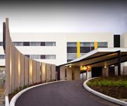
ATURA DANDENONG
QUEST NARRE WARREN SERVICED APTS
The Prince Mark Motor Inn
Belgrave Bed and Breakfast
Melaleuca Lodge
APARTMENTS AT GLEN CENTRAL
Videos from this area
These are videos related to the place based on their proximity to this place.
Riding the new Specialized Tarmac in Melbourne
Getting to ride the new Specialized Tarmac in Melbourne. Straight out of the car park and up a 5km climb in the Dandenong Hills! Great ride; awesome bike. Some good climbing - shame cars...
3 Larkrise Court, Narre Warren Victoria By Khalid Sarwari
Property Video shoot of 3 Larkrise Court, Narre Warren Victoria by PlatinumHD http://www.platinumhd.tv for Harcourts Narre Warren.
12 Trentwood Road, Narre Warren Victoria By Khalid Sarwari
Property Video shoot of 12 Trentwood Road, Narre Warren Victoria by PlatinumHD http://www.platinumhd.tv for Harcourts Narre Warren.
Campbelltown Passenger Railway Melbourne
Colin and Nancy Campbell have been providing a great day out for Melbourne families for over 20 years on this magnificent property in Narre Warren North. The 71/4" track winds its way around...
5 Westleigh Crescent, Narre Warren Victoria by Khalid Sarwari
Located in a prime pocket of Narre Warren, walking distance to Fountain Gate Shopping centre and public transport facilities this 3 bedroom family home is waiting for you. With a fully renovated...
Weird objects in sky over Melbourne seen with night vision
Some strange objects recorded with night vision over Narre Warren, Melbourne Australia in the last few weeks.
Family photo session, fusion by Sand Castle Portraits
http://fivecastles.com.au/ presents a http://sandcastle.fivecastles.com.au/ production: Family photography session by Arek Rainczuk of Five Castles Portraits- Melbourne portrait photographer....
3 Finley Court, Endeavour Hills Victoria By Zed Nasheet
Property Video shoot of 3 Finley Court, Endeavour Hills Victoria by PlatinumHD http://www.platinumhd.tv for Watson Realty.
38 Ryelands Drive, Narre Warren Victoria By Khalid Sarwari
Property Video shoot of 38 Ryelands Drive, Narre Warren Victoria by Khalid Sarwari call 0422 406 745 for all your real estate needs.
33 Prospect Hill Road, Narre Warren Victoria
Property Video shoot of 33 Prospect Hill Road, Narre Warren Victoria by platinumhd http://www.platinumhd.tv for Watson Realty.
Videos provided by Youtube are under the copyright of their owners.
Attractions and noteworthy things
Distances are based on the centre of the city/town and sightseeing location. This list contains brief abstracts about monuments, holiday activities, national parcs, museums, organisations and more from the area as well as interesting facts about the region itself. Where available, you'll find the corresponding homepage. Otherwise the related wikipedia article.
Churchill National Park
Churchill is a national park in Victoria, Australia, 31 km southeast of Melbourne. Churchill NP is in the suburb of Lysterfield South, which lies between Rowville and Endeavour Hills in the far north of the City Of Casey. It is also near the Monash Freeway and Stud Road. Churchill National Park has fantastic woodland and lots of fauna. Churchill is joined onto Lysterfield Park, and joined, they cover around 16.68 km². There are tracks throughout Churchill for walking, cycling and jogging.
Endeavour Hills, Victoria
Endeavour Hills is a suburb in Melbourne, Victoria, Australia, 31 km south-east from Melbourne's central business district. Its Local Government Area is the City of Casey. At the 2011 Census, Endeavour Hills had a population of 24,574. Endeavour Hills is bordered by the Monash Freeway and Dandenong Creek to the west, Police Road and Churchill Park Drive to the north, Hallam North Road to the east, and Eumemmerring Creek to the south.
Lysterfield, Victoria
Lysterfield is a suburb in Melbourne, Victoria, Australia, 32 km south-east from Melbourne's central business district. Its Local Government Area is the City of Knox and the Shire of Yarra Ranges. At the 2006 Census, Lysterfield had a population of 5,423.
Belgrave Heights, Victoria
Belgrave Heights is a suburb in Melbourne, Victoria, Australia, 38 km south-east from Melbourne's central business district. Its Local Government Area is the Shire of Yarra Ranges. At the 2006 Census, Belgrave Heights had a population of 1441. Belgrave Heights Post Office opened on 1 August 1938 as settlement began in the area, and closed in 1977. In February 1983, the Ash Wednesday fires swept through the area, destroying many houses.
Belgrave South, Victoria
Belgrave South is a locality within, and a suburb of, Greater Melbourne mainly beyond the Melbourne metropolitan area Urban Growth Boundary, 39 km south-east from Melbourne's central business district. Its Local Government Area is the Shire of Yarra Ranges. At the 2006 Census, Belgrave South had a population of 1100. It is positioned at the foothills of the Dandenong Ranges and bordered by the suburbs of Belgrave, Belgrave Heights, Lysterfield and the localities of Narre Warren East and Selby.
Berwick, Victoria
Berwick is a suburb in Melbourne, Victoria, Australia, 45 kilometres south-east from Melbourne's central business district. Its Local Government Area is the City of Casey. At the 2011 Census, Berwick had a population of 44,779. It was named by an early leaseholder after Berwick-on-Tweed in Northumberland.
Hallam, Victoria
Hallam is a suburb in Melbourne, Victoria, Australia, 35 km south-east from Melbourne's central business district. Its Local Government Area is the City of Casey. At the 2011 Census, Hallam had a population of 10,162. The suburb has its own railway station. Hallam is bounded by the South Gippsland Freeway in the west, Eumemmerring Creek and Hallam North Road in the north, a drain easement in the east, and Centre Road in the south.
Harkaway, Victoria
Harkaway is a suburb in Melbourne, Victoria, Australia, 40 km south-east from Melbourne's central business district. Its Local Government Area is the City of Casey. At the 2006 Census, Harkaway had a population of 772. The suburb is one which is home to many who wish to avoid the inner city clutter, yet remain relatively close to the city, and is characterised by its large distinguished homes and parkland.
Narre Warren East, Victoria
Narre Warren East is a suburb in Melbourne, Victoria, Australia, 38 km south-east of Melbourne's central business district. Its local government area is the Shire of Yarra Ranges. At the 2006 Census, Narre Warren East had a population of 491. Despite its name, Narre Warren East is actually located in a north-easterly direction from Narre Warren North. It is also separated from the rest of the Narre Warrens, which are a part of the City of Casey.
Narre Warren North, Victoria
Narre Warren North is a suburb in Melbourne, Victoria, Australia, 37 km south-east from Melbourne's central business district. Its Local Government Area is the City of Casey. At the 2011 Census, Narre Warren North had a population of 6,212.
Hallam railway station
Hallam is a railway station in Melbourne, Victoria, Australia, located in the suburb of Hallam, on the Pakenham railway line. Hallam is unmanned and is in Metcard Zone 2.
Narre Warren railway station
Narre Warren is a railway station in Melbourne, Victoria, Australia, located in the suburb of Narre Warren, on the Pakenham railway line. Narre Warren is classed as a Premium Station and is in Metcard Zone 2.
Berwick railway station, Melbourne
Berwick is a railway station in Melbourne, Victoria, Australia, located in the suburb of Berwick, on the Pakenham railway line. Berwick is classed as a Premium Station and is in Metcard Zone 2.
Division of Holt
The Division of Holt is an Australian Electoral Division in Victoria. The division was created in 1969 and is named for Harold Holt, who was Prime Minister of Australia 1966-67. It is located in the outer south-eastern suburbs of Melbourne, including Cranbourne, Doveton, Hampton Park, Endeavour Hills, Narre Warren, and Hallam.
Westfield Fountain Gate
Westfield Fountain Gate is a super regional shopping centre located in Narre Warren in the outer south-eastern suburbs of Melbourne, Australia. When measured by floor area, it is the second-largest shopping centre in Australia, behind another Melbourne shopping centre, Chadstone Shopping Centre.
Lysterfield Park
Lysterfield Park is a public park in Lysterfield, a suburb to the south-east of Melbourne, Victoria, Australia. It was the venue for mountain biking events of the 2006 Commonwealth Games. In 2008, several emergency markers were installed in the park to allow callers to emergency services to give their location more precisely.
Berwick Secondary College
Berwick Secondary College is situated in the outer Melbourne metropolitan suburb of Berwick. Until recently, it was the largest single campus government secondary college in Victoria. The College's official motto is We Shall Grow, however recently adopted another motto which symbolises what the school hopes to achieve: Excellence in learning, Positive Relationships, and Personal Growth. Recently the school started downsizing with the majority of a block of portables removed.
Wilson Botanic Park
This article refers to a botanic gardens in Australia. For the Wilson Botanical Gardens in Costa Rica, see Las Cruces Biological Station. Wilson Botanic Park is a botanic garden located on Princes Highway in Berwick in Victoria, Australia.
Lysterfield South, Victoria
Lysterfield South is a rural locality in Melbourne, Victoria, Australia, 33 km south-east of Melbourne's central business district, and adjacent to the main urban area. Its Local Government Area is the City of Casey. At the 2011 Census, Lysterfield South had a population of 924. It is notable for containing Churchill National Park which can be entered via Army Road, from Churchill Park Drive.
St Margaret's School, Melbourne
St Margaret's School is an independent, non-denominational day school with a co-educational primary school to Year 4 and for girls from Year 5 to Year 12. The school is located in Berwick, a suburb of Melbourne, Victoria, Australia. Established in 1926, the school has a non-selective enrolment policy and currently caters for approximately 900 students from Pre-Prep to Year 12, across the St Margaret's School campus in Berwick and the boys campus, Berwick Grammar School in Officer.
City of Berwick
The City of Berwick was a local government area about 40 kilometres southeast of Melbourne, the state capital of Victoria, Australia. The shire covered an area of 120.43 square kilometres, and existed from 1973 until 1994.
Narre Warren, Victoria
Narre Warren is a suburb of Melbourne, Victoria, Australia, 42 km south east from Melbourne's central business district. Its Local Government Area is the City of Casey. At the 2011 Census, Narre Warren had a population of 25,882. Narre Warren has a population density of over 2000 people per square kilometre. Narre Warren has its own railway station, located on Webb Street and is home to Australia's second largest shopping centre, Westfield Fountain Gate after Chadstone Shopping Centre.
Narre Warren Fire Brigade
The Narre Warren Fire Brigade is a fully volunteer brigade of the Victoria Country Fire Authority (CFA), located in the south-east Melbourne suburb of Narre Warren. The primary brigade area consists of 193,700 square metres of office, commercial and retail floor space, representing in 2001 12,300 houses and a population of 34,300. The brigade has over 8,800 cars registered in its area.
Nossal High School
Nossal High School is a state government selective school in Victoria, Australia. Located in the Berwick campus of Monash University and adjacent to Chisholm Institute and Berwick TEC (Technical Education Centre), the school opened in 2010 with 200 students (100 male, 100 female). They now take 208 students each year. It is one of three new selective entry schools in Victoria including John Monash Science School and Suzanne Cory High School.
Belgrave Heights Christian School
Belgrave Heights Christian School is a small primary and secondary school in Belgrave Heights near Belgrave in the Dandenong Ranges 36 km east of Melbourne, Victoria, Australia. It is located at the end of Wattle Valley Road which is off Mount Morton Road (a continuation of McNicol Road which intersects with Burwood Highway in Tecoma). There are around 250 secondary students and 200 primary students.


