Explore Lysterfield South
The district Lysterfield South of in Casey (Victoria) with it's 924 inhabitants Lysterfield South is located in Australia about 283 mi south-west of Canberra, the country's capital.
If you need a place to sleep, we compiled a list of available hotels close to the map centre further down the page.
Depending on your travel schedule, you might want to pay a visit to some of the following locations: Melbourne, Currie, Hay, Canberra and . To further explore this place, just scroll down and browse the available info.
Local weather forecast
Todays Local Weather Conditions & Forecast: 15°C / 58 °F
| Morning Temperature | 9°C / 48 °F |
| Evening Temperature | 10°C / 50 °F |
| Night Temperature | 9°C / 48 °F |
| Chance of rainfall | 0% |
| Air Humidity | 57% |
| Air Pressure | 1028 hPa |
| Wind Speed | Light breeze with 3 km/h (2 mph) from North-East |
| Cloud Conditions | Overcast clouds, covering 85% of sky |
| General Conditions | Overcast clouds |
Wednesday, 15th of May 2024
16°C (62 °F)
9°C (48 °F)
Broken clouds, light breeze.
Thursday, 16th of May 2024
18°C (64 °F)
10°C (50 °F)
Sky is clear, light breeze, clear sky.
Friday, 17th of May 2024
16°C (61 °F)
10°C (50 °F)
Moderate rain, gentle breeze, overcast clouds.
Hotels and Places to Stay
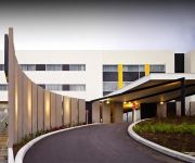
ATURA DANDENONG
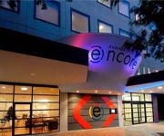
RAMADA ENCORE DANDENONG
QUEST DANDENONG SERVICED APTS
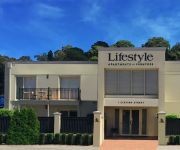
Lifestyle Apartments at Ferntree
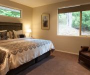
Mountain Element Retreats
The Prince Mark Motor Inn
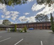
Comfort Inn Dandenong
Ferntree Gully Hotel Motel
QUEST NARRE WARREN SERVICED APTS
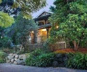
Belgrave Bed and Breakfast
Videos from this area
These are videos related to the place based on their proximity to this place.
2014 City of Knox District, Joey Scouts Heany Hop
City of Knox District, Joey Scouts Heany Hop, 'Once Upon A Time' Heany Park 18 May 2014.
World Cup Cricket Qualifiers game in South Africa
Afghanistan Cricket team play to Qualifiy for 2011 world cup, and also Afghansitan beat a strong team Ireland which was beaten Pakistan in the last world cup.
Vaporooter .This sewer is infested with tree roots vaprooter will stop these roots
http://www.longbeach.net.au The low-down on roots At Long Beach Plumbing, we spend a lot of time talking about tree roots. Adventitious roots, contractile roots, structural roots − you name...
3 Finley Court, Endeavour Hills Victoria By Zed Nasheet
Property Video shoot of 3 Finley Court, Endeavour Hills Victoria by PlatinumHD http://www.platinumhd.tv for Watson Realty.
Lysterfield Lake, Melbourne (during an algal bloom)
Lysterfield Lake is a recreational park in Melbourne's eastern suburbs. I shot this video on two different days in November. On both days the lake was closed for swimming due to a blue-green...
Lysterfield Lake scuba part 1
Ever wandered what was athe bottom of Lysterfield Lake? We did so we had a look. This movie was at the start of the dive. When: 23 Nov 2009 Who: Monash University Underwater Club (MONUC)....
New track at Lysterfield Aneurysm
Riding the new Aneurysm track at Lysterfield, downhill with lots of drops!!! Had to slow towards the end to check on my riding buddy Hodge who was on my tail and decided to go bush for a second,...
MTB Lysterfield - Upper Buckle
30-06-2013 Lysterfield Lake Park, Victoria, Australia. Upper Buckle from the Trailhead @ Follow Me Trail to SE Lower Buckle Trail. GoPro HD Hero 2 - GoPro Chest Mount. http://lysterfieldmtb.com/map/
Videos provided by Youtube are under the copyright of their owners.
Attractions and noteworthy things
Distances are based on the centre of the city/town and sightseeing location. This list contains brief abstracts about monuments, holiday activities, national parcs, museums, organisations and more from the area as well as interesting facts about the region itself. Where available, you'll find the corresponding homepage. Otherwise the related wikipedia article.
Churchill National Park
Churchill is a national park in Victoria, Australia, 31 km southeast of Melbourne. Churchill NP is in the suburb of Lysterfield South, which lies between Rowville and Endeavour Hills in the far north of the City Of Casey. It is also near the Monash Freeway and Stud Road. Churchill National Park has fantastic woodland and lots of fauna. Churchill is joined onto Lysterfield Park, and joined, they cover around 16.68 km². There are tracks throughout Churchill for walking, cycling and jogging.
Endeavour Hills, Victoria
Endeavour Hills is a suburb in Melbourne, Victoria, Australia, 31 km south-east from Melbourne's central business district. Its Local Government Area is the City of Casey. At the 2011 Census, Endeavour Hills had a population of 24,574. Endeavour Hills is bordered by the Monash Freeway and Dandenong Creek to the west, Police Road and Churchill Park Drive to the north, Hallam North Road to the east, and Eumemmerring Creek to the south.
Rowville, Victoria
Rowville is a suburb in Melbourne, Victoria, Australia, 29 km south-east from Melbourne's central business district. Its Local Government Area is the City of Knox. At the 2011 Census, Rowville had a population of 34,145. Rowville is named after the Row family, whose property Stamford Park was established in 1882. The Stamford Park homestead has been restored in recent years by Knox Council. Geographically, Rowville is one of the largest suburbs south-east of Melbourne.
Lysterfield, Victoria
Lysterfield is a suburb in Melbourne, Victoria, Australia, 32 km south-east from Melbourne's central business district. Its Local Government Area is the City of Knox and the Shire of Yarra Ranges. At the 2006 Census, Lysterfield had a population of 5,423.
Doveton, Victoria
Doveton is a suburb in Melbourne, Australia, 31 km south-east from Melbourne's central business district. Its Local Government Area is the City of Casey. At the 2011 Census, Doveton had a population of 8,404. Doveton is bounded by Dandenong Creek and Power Road in the west, The Monash Freeway in the north, Eumemmerring Creek in the east, and Princes Highway in the south.
Eumemmerring, Victoria
This article is about the suburb of Eumemmerring. For the Secondary College, see Eumemmerring College.
Hallam, Victoria
Hallam is a suburb in Melbourne, Victoria, Australia, 35 km south-east from Melbourne's central business district. Its Local Government Area is the City of Casey. At the 2011 Census, Hallam had a population of 10,162. The suburb has its own railway station. Hallam is bounded by the South Gippsland Freeway in the west, Eumemmerring Creek and Hallam North Road in the north, a drain easement in the east, and Centre Road in the south.
Narre Warren North, Victoria
Narre Warren North is a suburb in Melbourne, Victoria, Australia, 37 km south-east from Melbourne's central business district. Its Local Government Area is the City of Casey. At the 2011 Census, Narre Warren North had a population of 6,212.
Dandenong, Victoria
Dandenong is a suburb of Melbourne, Victoria, Australia, approximately 30 km south-east from Melbourne's central business district. Situated on the Dandenong Creek, it is at the foothill of the Dandenong Ranges and is the main administrative centre for the City of Greater Dandenong Local Government Area (LGA). At the 2011 Census, central Dandenong had a population of 24,919. It began as a township in 1852 and at the start of the 20th century was an important regional city with its own suburbs.
Dandenong North, Victoria
Dandenong North is a suburb in Melbourne, Victoria, Australia, 29 km south-east from Melbourne's central business district. Its Local Government Area is the City of Greater Dandenong. At the 2006 Census, Dandenong North had a population of 21,965.
Dandenong railway station
Dandenong is a railway station located in Dandenong, Victoria, Australia. Located 30 km from Flinders Street Station in central Melbourne, the station serves as the junction of the Pakenham and Cranbourne railway lines, and is the terminus station for several peak services. It also serves V/Line trains along the Traralgon and Bairnsdale lines.
Hallam railway station
Hallam is a railway station in Melbourne, Victoria, Australia, located in the suburb of Hallam, on the Pakenham railway line. Hallam is unmanned and is in Metcard Zone 2.
Westfield Fountain Gate
Westfield Fountain Gate is a super regional shopping centre located in Narre Warren in the outer south-eastern suburbs of Melbourne, Australia. When measured by floor area, it is the second-largest shopping centre in Australia, behind another Melbourne shopping centre, Chadstone Shopping Centre.
Chisholm Institute
Chisholm Institute is a Technical and Further Education (TAFE) Institute located in the south-east Melbourne Australia. It provides adult education in a number of areas including the arts, hospitality, information technology, trades and business. The Institute takes its name from Caroline Chisholm. Its name was also inspired by the Chisholm Institute of Technology, a tertiary institution that operated in southeast Melbourne from 1982 to 1990 before becoming part of Monash University.
St. Joseph's College, Ferntree Gully
St. Josephs College is a Roman Catholic boys' secondary school in the eastern suburb of Ferntree Gully, Melbourne, Victoria, Australia.
Lysterfield Park
Lysterfield Park is a public park in Lysterfield, a suburb to the south-east of Melbourne, Victoria, Australia. It was the venue for mountain biking events of the 2006 Commonwealth Games. In 2008, several emergency markers were installed in the park to allow callers to emergency services to give their location more precisely.
Lysterfield South, Victoria
Lysterfield South is a rural locality in Melbourne, Victoria, Australia, 33 km south-east of Melbourne's central business district, and adjacent to the main urban area. Its Local Government Area is the City of Casey. At the 2011 Census, Lysterfield South had a population of 924. It is notable for containing Churchill National Park which can be entered via Army Road, from Churchill Park Drive.
St John's Regional College
St John's Regional College is a Catholic co-educational secondary school situated in Dandenong in the south-eastern suburbs of Melbourne.
Hallam Bypass Trail
No image available yet Hallam Bypass Trail Length 13.7 km Difficulty Easy
Dandenong High School
Dandenong High School is one of the largest co-educational government schools in Melbourne, Victoria, Australia. The school caters for students from Years 7 to 12. At the start of 2007, Dandenong High School, Cleeland Secondary College and Doveton Secondary College officially merged to become the new Dandenong High School, as part of the Federal Government's Building the Education Revolution.
General Motors railway station
General Motors is a disused railway station on the Pakenham line of the Melbourne suburban rail system. It is located between Dandenong and Hallam stations, in the suburb of Dandenong South.
Narre Warren, Victoria
Narre Warren is a suburb of Melbourne, Victoria, Australia, 42 km south east from Melbourne's central business district. Its Local Government Area is the City of Casey. At the 2011 Census, Narre Warren had a population of 25,882. Narre Warren has a population density of over 2000 people per square kilometre. Narre Warren has its own railway station, located on Webb Street and is home to Australia's second largest shopping centre, Westfield Fountain Gate after Chadstone Shopping Centre.
City of Dandenong
The City of Dandenong was a local government area about 35 kilometres southeast of Melbourne, the state capital of Victoria, Australia. The city covered an area of 36.26 square kilometres, and existed from 1857 until 1994.
Rowville Secondary College
Rowville Secondary College is a co-educational, public high school, located in Rowville, Victoria, Australia. It is divided into two campuses, the East and the West. The eastern campus only goes to year 10 while the western goes right through. It started off as one campus but in November 1996 the eastern campus was opened.
Lyndale Secondary College
Lyndale Secondary College is a co-educational government secondary school located in Dandenong North, Victoria. It has a student enrolment of approximately 1,200, and is known as one of the largest single campus schools in Victoria. The school is divided into two sub-schools—a middle school and senior school. Its principal is Mr Mark Moir, and there are also two vice principals.


