Safety Score: 2,7 of 5.0 based on data from 9 authorites. Meaning we advice caution when travelling to United States.
Travel warnings are updated daily. Source: Travel Warning United States. Last Update: 2024-04-28 08:22:10
Delve into Blue Ridge Acres
Blue Ridge Acres in Albemarle County (Virginia) is a town located in United States about 113 mi (or 181 km) south-west of Washington DC, the country's capital town.
Time in Blue Ridge Acres is now 08:56 PM (Sunday). The local timezone is named America / New York with an UTC offset of -4 hours. We know of 10 airports closer to Blue Ridge Acres, of which 5 are larger airports. The closest airport in United States is Shenandoah Valley Regional Airport in a distance of 17 mi (or 27 km), North. Besides the airports, there are other travel options available (check left side).
There is one Unesco world heritage site nearby. It's Monticello and the University of Virginia in Charlottesville in a distance of 71 mi (or 114 km), East. Also, if you like the game of golf, there are some options within driving distance. We saw 4 points of interest near this location. In need of a room? We compiled a list of available hotels close to the map centre further down the page.
Since you are here already, you might want to pay a visit to some of the following locations: Waynesboro, Lovingston, Staunton, Charlottesville and Harrisonburg. To further explore this place, just scroll down and browse the available info.
Local weather forecast
Todays Local Weather Conditions & Forecast: 27°C / 81 °F
| Morning Temperature | 15°C / 59 °F |
| Evening Temperature | 23°C / 74 °F |
| Night Temperature | 16°C / 61 °F |
| Chance of rainfall | 0% |
| Air Humidity | 48% |
| Air Pressure | 1017 hPa |
| Wind Speed | Gentle Breeze with 6 km/h (4 mph) from North-East |
| Cloud Conditions | Scattered clouds, covering 27% of sky |
| General Conditions | Scattered clouds |
Monday, 29th of April 2024
26°C (78 °F)
15°C (59 °F)
Moderate rain, moderate breeze, overcast clouds.
Tuesday, 30th of April 2024
24°C (75 °F)
18°C (65 °F)
Sky is clear, light breeze, clear sky.
Wednesday, 1st of May 2024
24°C (75 °F)
16°C (60 °F)
Sky is clear, light breeze, clear sky.
Hotels and Places to Stay
Rockfish Valley Inn
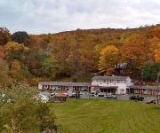
Colony House Motel
Videos from this area
These are videos related to the place based on their proximity to this place.
Trip to the Crozet Tunnel
An afternoon hike to the Claudius Crozet Blue Ridge Tunnel near Waynesboro, VA. My friend and I explored the now-abandoned railroad tunnel from its western entrance to the midway point beneath...
Virginia Metalcrafters Part 1
History and Products of Virginia Metalcrafters, Waynesboro Virginia Part 1.
Skyline Parkway Southern Entrance Near Shenandoah National Park
Passenger view of the Skyline Parkway's southern entrance Just south of the breathtaking Shenandoah National Park of Virginia, USA.. A road hog shows us why the speed limit is only 35mph.
Fog on I-64 at Afton Mountain
Dash cam footage of heavy fog on I-64 on Afton Mountain just east of Waynesboro, VA.
Amtrak Cardinal Meets Cardinal
Amtrak train #51 (the Cardinal) pulls in to the siding near Afton, VA to allow train #50 (also the Cardinal) to pass.After #50 cleared the block #51 reversed back on to the main and continued west.
Charlottesville by Dave Visits Blue Mountain Brewery
Quick trip by Blueridge Brewery on a road tip on Charlottesville by Dave.
McCormick Gap Overlook Shenandoah National Park
McCormick Gap Overlook Shenandoah National Park http://www.skylinedriveoverlooks.com http://www.mountaintvguide.com Distributed by Tubemogul.
Wintergreen Resort on Eastern Golf TV
LVP performed all post production editing/finishing for this segment of Eastern Golf TV.
Videos provided by Youtube are under the copyright of their owners.
Attractions and noteworthy things
Distances are based on the centre of the city/town and sightseeing location. This list contains brief abstracts about monuments, holiday activities, national parcs, museums, organisations and more from the area as well as interesting facts about the region itself. Where available, you'll find the corresponding homepage. Otherwise the related wikipedia article.
WCYK-FM
WCYK-FM is a Country formatted broadcast radio station licensed to Staunton, Virginia, though has studios located in Charlottesville. WCYK serves the Harrisonburg/Staunton and Charlottesville, Virginia areas. WCYK is owned and operated by Monticello Media.
Avon, Virginia
Avon is an unincorporated community in Nelson County, Virginia, United States.
Onan, Virginia
Onan is an unincorporated community in Nelson County, Virginia, United States.
Greenwood Tunnel
The Greenwood Tunnel is a historic railroad tunnel constructed in 1853 by Claudius Crozet during the construction of the Blue Ridge Railroad. The tunnel was the easternmost tunnel in a series of four tunnels used to cross the Blue Ridge Mountains of Virginia. Located near Greenwood in Albemarle County, Virginia, the tunnel was used by the Chesapeake and Ohio Railway (C&O) until its abandonment in 1944.
Brookville Tunnel
The Brookville Tunnel (also Brooksville Tunnel) was a historic railroad tunnel engineered by Claudius Crozet during the construction of the Blue Ridge Railroad in the 1850s. The tunnel was part of a series of four tunnels used to cross the Blue Ridge Mountains of Virginia for the Virginia Central Railroad of the United States.


