Safety Score: 2,7 of 5.0 based on data from 9 authorites. Meaning we advice caution when travelling to United States.
Travel warnings are updated daily. Source: Travel Warning United States. Last Update: 2024-04-28 08:22:10
Discover Mittersill
Mittersill in Grafton County (New Hampshire) is a town in United States about 457 mi (or 736 km) north-east of Washington DC, the country's capital city.
Current time in Mittersill is now 03:39 PM (Sunday). The local timezone is named America / New York with an UTC offset of -4 hours. We know of 12 airports near Mittersill, of which 5 are larger airports. The closest airport in United States is Lebanon Municipal Airport in a distance of 48 mi (or 78 km), South-West. Besides the airports, there are other travel options available (check left side).
Also, if you like playing golf, there are a few options in driving distance. Looking for a place to stay? we compiled a list of available hotels close to the map centre further down the page.
When in this area, you might want to pay a visit to some of the following locations: North Haverhill, Lancaster, Saint Johnsbury, Guildhall and Lyme Town Offices. To further explore this place, just scroll down and browse the available info.
Local weather forecast
Todays Local Weather Conditions & Forecast: 18°C / 65 °F
| Morning Temperature | 8°C / 46 °F |
| Evening Temperature | 19°C / 67 °F |
| Night Temperature | 15°C / 60 °F |
| Chance of rainfall | 6% |
| Air Humidity | 64% |
| Air Pressure | 1017 hPa |
| Wind Speed | Gentle Breeze with 6 km/h (4 mph) from East |
| Cloud Conditions | Overcast clouds, covering 99% of sky |
| General Conditions | Moderate rain |
Sunday, 28th of April 2024
14°C (58 °F)
8°C (46 °F)
Light rain, gentle breeze, broken clouds.
Monday, 29th of April 2024
8°C (47 °F)
9°C (47 °F)
Moderate rain, light breeze, overcast clouds.
Tuesday, 30th of April 2024
9°C (48 °F)
9°C (49 °F)
Moderate rain, calm, overcast clouds.
Hotels and Places to Stay
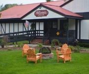
HILLWINDS LODGE
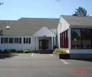
Stonybrook Motel & Lodge
DELETE - CANNON MOUNTAIN VIEW
BEST WESTERN WHITE MOUNTAIN
Videos from this area
These are videos related to the place based on their proximity to this place.
MLS 4189464 - 258 Old County Road, Franconia, NH
http://www.coldwellbanker.com/property?action=detail&brandType=CB&propertyId=269472318 Woodworkers Paradise with a beautiful country home in the New Hampshire White Mountains.
Snow plow in Fraconia Notch
We were out with the snow plows today on Rt 93 in Northern New Hampshire.
Glider Ride (3D)
Highlights from John Savage's glider ride, Franconia, New Hampshire, September 28, 2014. Thanks to Franconia Soaring Association for the flight: http://www.franconiasoaring.org/
New Ski Lift Towers- Canon Mountain Ski Area, New
New ski lift towers being hoisted and installed by helicopter at the Mittersill expansion of Cannon Mountain Ski Area, Franconia Notch State Park, White Mountain National Forest, New Hampshire.
Hyperlapse: Canon Mountain Aerial Tramway Ascent
This video is a timelapse made with the Instagram Hyperlapse App. This is the latter 2/3rds of the trip up the mountain. The first passenger aerial tramway in North America began operation...
Artist's Bluff (Trimble outdoors)
This Video was recorded and geotagged using TrimbleOutdoors on my DROIDX. Check out the whole trip at http://www.trimbleoutdoors.com/ViewTrip/1056195.
Reach The Beach 2009
One team's 210 mile journey from Cannon Mountain in Franconia, NH through the White Mountains past fields, lakes, mountain top vistas, and the occasional covered bridge finishing along the...
Dave at Cannon Mtn. NH
Dave tears up the bumps at Cannon Mtn. Also hike up to the Mittersill mtn area with no lifts and ungroomed trails.
Videos provided by Youtube are under the copyright of their owners.
Attractions and noteworthy things
Distances are based on the centre of the city/town and sightseeing location. This list contains brief abstracts about monuments, holiday activities, national parcs, museums, organisations and more from the area as well as interesting facts about the region itself. Where available, you'll find the corresponding homepage. Otherwise the related wikipedia article.
Old Man of the Mountain
The Old Man of the Mountain, also known as the Great Stone Face or the Profile, was a series of five granite cliff ledges on Cannon Mountain in the White Mountains of New Hampshire, United States, that, when viewed from the north, appeared to be the jagged profile of a face. The rock formation was 1,200 feet above Profile Lake, and measured 40 feet tall and 25 feet wide. The site is located in the town of Franconia. The first recorded mention of the Old Man was in 1805.
Franconia Notch
Franconia Notch is a major mountain pass through the White Mountains of New Hampshire. Dominated by Cannon Mountain to the west and Mount Lafayette to the east, it lies principally within Franconia Notch State Park and is traversed by the Franconia Notch Parkway. The notch was home to the Old Man of the Mountain, a rock formation whose profile is a symbol of the state of New Hampshire, until 2003, when the formation collapsed.
High Huts of the White Mountains
The High Huts of the White Mountains are a series of eight mountain huts in the White Mountains, in the U.S. state of New Hampshire, owned and maintained by the Appalachian Mountain Club. Modeled after similar huts in the Alps, they are positioned at intervals along the Appalachian Trail, allowing "thru-hikers" (those who hike the entire Appalachian Trail) to benefit from their services. They are generally separated by six to eight miles, about a day's hike.
New England Ski Museum
The New England Ski Museum is a non-profit operation in Franconia, New Hampshire designed to preserve the history of commercial and recreational skiing, both alpine and cross-country, in the northeastern United States. Founded in 1977, in 1982 it moved into its permanent building near the tramway of Cannon Mountain ski area, in Franconia Notch State Park. It is one of four ski museums in the United States that are recognized by the United States Ski and Snowboard Association.
Profile Lake
Profile Lake is a 13-acre water body located in Franconia Notch in the White Mountains of New Hampshire, at the foot of Cannon Mountain. The lake was given its name due to its location directly beneath the Old Man of the Mountain, a famous rock formation which collapsed in 2003. The lake is near the height of land in Franconia Notch; the lake's outlet is the Pemigewasset River, which flows south to the Merrimack River and ultimately the Gulf of Maine at Newburyport, Massachusetts.
Echo Lake (Franconia Notch)
Echo Lake is a 38.2-acre water body located in Franconia Notch in the White Mountains of New Hampshire, at the foot of Cannon Mountain. The lake is in the Connecticut River watershed, near the height of land in Franconia Notch; water from the lake's outlet flows north via Lafayette Brook to the Gale River, then the Ammonoosuc River, and finally the Connecticut River to Long Island Sound, an arm of the Atlantic Ocean. Echo Lake lies in Franconia Notch State Park.
Lonesome Lake (New Hampshire)
Lonesome Lake is a 12.2-acre water body located in Franconia Notch in the White Mountains of New Hampshire, south of Cannon Mountain. The lake is reachable by hiking trails from the Franconia Notch Parkway and features an Appalachian Mountain Club hut on its southwest shore. The lake lies in the Merrimack River watershed. Its outlet, Cascade Brook, flows south over ledges and waterfalls to the Pemigewasset River near "The Basin" in Franconia Notch.
Franconia Airport
Franconia Airport is a public airport located in Franconia, New Hampshire, two miles (3 km) south of the central business district of Franconia, in Grafton County, New Hampshire, USA. The airport is the home of the Franconia Soaring Association. There are no commercial flights available.


