Safety Score: 2,7 of 5.0 based on data from 9 authorites. Meaning we advice caution when travelling to United States.
Travel warnings are updated daily. Source: Travel Warning United States. Last Update: 2024-04-30 08:30:35
Explore Mashapaug
Mashapaug in Tolland County (Connecticut) is located in United States about 336 mi (or 541 km) north-east of Washington DC, the country's capital.
Local time in Mashapaug is now 08:35 PM (Tuesday). The local timezone is named America / New York with an UTC offset of -4 hours. We know of 10 airports in the wider vicinity of Mashapaug, of which 3 are larger airports. The closest airport in United States is Worcester Regional Airport in a distance of 21 mi (or 34 km), North-East. Besides the airports, there are other travel options available (check left side).
Also, if you like golfing, there are multiple options in driving distance. If you need a place to sleep, we compiled a list of available hotels close to the map centre further down the page.
Depending on your travel schedule, you might want to pay a visit to some of the following locations: Worcester, Hartford, Johnston, North Providence and Cranston. To further explore this place, just scroll down and browse the available info.
Local weather forecast
Todays Local Weather Conditions & Forecast: 10°C / 50 °F
| Morning Temperature | 7°C / 45 °F |
| Evening Temperature | 14°C / 58 °F |
| Night Temperature | 9°C / 49 °F |
| Chance of rainfall | 0% |
| Air Humidity | 86% |
| Air Pressure | 1015 hPa |
| Wind Speed | Light breeze with 5 km/h (3 mph) from West |
| Cloud Conditions | Overcast clouds, covering 100% of sky |
| General Conditions | Light rain |
Wednesday, 1st of May 2024
15°C (59 °F)
9°C (49 °F)
Light rain, moderate breeze, overcast clouds.
Thursday, 2nd of May 2024
14°C (57 °F)
9°C (48 °F)
Overcast clouds, light breeze.
Friday, 3rd of May 2024
10°C (49 °F)
8°C (47 °F)
Overcast clouds, light breeze.
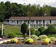
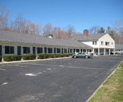
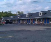
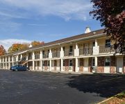
Hotels and Places to Stay
Sturbridge Lodge
Old Sturbridge Inn and Reeder Family Lodges
Hampton Inn Sturbridge
Days Inn Sturbridge
RED CARPET INN ASHFORD
SCOTTISH INNS STURBRIDGE
PUBLICK HOUSE HISTORIC INN COUNTRY LODGE
The Fox Tower
Econo Lodge Sturbridge
SUPER 8 STURBRIDGE
Videos from this area
These are videos related to the place based on their proximity to this place.
Rattlesnake LMP 30 lap race
This Bassmans track.He just addaed a new section and the track now flows like water coming down a mountain during a spring thaw reaching it's destination as fast as it can.
Thanksgiving Day at Old Sturbridge Village
Sights and sounds of the village from flintlock shooting to cooking to horse and coach rides on 11/26/09.
Seafood Festival at Old Sturbridge Village
A Squantum Fest, also known as a Seafood Festival was held at Old Sturbridge Village in MAssachusetts on 9/25 & 26/2010. Five kinds of chowders: New England, Rhode Island, Seafood, Lobster...
Punch-and-Judy-Part2
Punch and Judy Show Part 2: The demise of the executioner and the devil. Performed by Claire Gregoire at Old Sturbridge Village, Massachusetts on December 26, 2008. See also Part1: http://www.y...
Cracker Barrel
Through the suggestion from a fellow YouTuber, Civilwarcat, I tried the Saturday Special, Chicken and Rice. It was fantastic! Took two side veggies: Fried Okra and Country Green Beans. The...
A&B Limo In C&R car wash
Got bored after the 800 or so maneuvers to get the Limo in the wash lane at C&R. Got a legit sticker and shes on the road.
Antique Sampler Collection
A beautiful selection of antique samplers has just arrived. You can buy some of theses antiques online bu going to our website http://shop.showcaseantiques.com/index.php/cPath/8. Antique...
Videos provided by Youtube are under the copyright of their owners.
Attractions and noteworthy things
Distances are based on the centre of the city/town and sightseeing location. This list contains brief abstracts about monuments, holiday activities, national parcs, museums, organisations and more from the area as well as interesting facts about the region itself. Where available, you'll find the corresponding homepage. Otherwise the related wikipedia article.
Holland (CDP), Massachusetts
Holland is a census-designated place (CDP) in the town of Holland in Hampden County, Massachusetts, United States. The population was 1,444 at the 2000 census. It is part of the Springfield, Massachusetts Metropolitan Statistical Area.
Leadmine Wildlife Management Area
Leadmine Wildlife Management Area is a 640-acre wildlife conservation area located in Holland and Sturbridge, Massachusetts. The conservaton area abuts the Tantiusques reservation and the its satellite Crowd Site, owned by The Trustees of Reservations. It is managed by the Massachusetts Department of Fish and Game. Hunting (in season), hiking, and other outdoor recreational pursuits are enjoyed on the property.
Quinebaug River
The Quinebaug River is a river in south-central Massachusetts and eastern Connecticut, with watershed extending into western Rhode Island. The name "Quinebaug" comes from the southern New England Native American term, spelled variously Qunnubbâgge, Quinibauge, etc. , meaning "long pond", from qunni-, "long", and -paug, "pond".
Mashapaug Lake
Mashapaug Lake is a 300-acre lake surrounded by Bigelow Hollow State Park and Nipmuck State Forest in Union, Connecticut.
Nipmuck State Forest
Nipmuck State Forest, in Union, Connecticut is a Connecticut State Forest. Its 9,000 acres surrounds Bigelow Hollow State Park and includes parcels in Stafford and Ashford. The forest is part of a larger network of forest lands making up some 40,000 acres in all.
Natchaug State Forest
Natchaug State Forest, in Ashford, Connecticut, Chaplin, Connecticut and Eastford, Connecticut is a Connecticut State Forest. Its 13,000 acres are part of a larger network of forest lands making up some 40,000 acres in all. The Natchaug River runs from North to South along (and in a few cases through) the western border of the main forest parcel.
Natchaug Trail
The Natchaug Trail is a Blue-Blazed hiking trail "system" which meanders through 19.5 miles of forests in northeast Connecticut—primarily in Windham County. It is maintained by the Connecticut Forest and Park Association. Its southern trailhead begins in the James L. Goodwin State Forest in the towns of Chaplin, Connecticut and Hampton, Connecticut and the northern terminus is at its intersection with the Nipmuck Trail in Natchaug State Forest in Eastford, Connecticut.
Breakneck Pond
Breakneck Pond is a 92-acre lake surrounded by the Nipmuck State Forest in Union, Connecticut. A small portion of the lake extends into Sturbridge, Massachusetts. The maximum depth of the lake is 12'. The entire lake shore is undeveloped and motorized vehicles and boats are prohibited. The lake is accessible through trails from Bigelow Hollow State Park and camping is permitted at two locations around the lake. It is also the northern terminus for the Nipmuck Trail.


