Safety Score: 2,7 of 5.0 based on data from 9 authorites. Meaning we advice caution when travelling to United States.
Travel warnings are updated daily. Source: Travel Warning United States. Last Update: 2024-04-30 08:30:35
Discover Robinson Crusoe Camp
Robinson Crusoe Camp in Worcester County (Massachusetts) is a city in United States about 341 mi (or 548 km) north-east of Washington DC, the country's capital city.
Local time in Robinson Crusoe Camp is now 07:44 PM (Tuesday). The local timezone is named America / New York with an UTC offset of -4 hours. We know of 10 airports in the vicinity of Robinson Crusoe Camp, of which 3 are larger airports. The closest airport in United States is Worcester Regional Airport in a distance of 16 mi (or 26 km), North-East. Besides the airports, there are other travel options available (check left side).
Also, if you like golfing, there are a few options in driving distance. Looking for a place to stay? we compiled a list of available hotels close to the map centre further down the page.
When in this area, you might want to pay a visit to some of the following locations: Worcester, Johnston, North Providence, Hartford and Cranston. To further explore this place, just scroll down and browse the available info.
Local weather forecast
Todays Local Weather Conditions & Forecast: 15°C / 58 °F
| Morning Temperature | 11°C / 52 °F |
| Evening Temperature | 16°C / 61 °F |
| Night Temperature | 9°C / 49 °F |
| Chance of rainfall | 1% |
| Air Humidity | 65% |
| Air Pressure | 1015 hPa |
| Wind Speed | Gentle Breeze with 6 km/h (4 mph) from North-West |
| Cloud Conditions | Overcast clouds, covering 100% of sky |
| General Conditions | Light rain |
Tuesday, 30th of April 2024
10°C (50 °F)
9°C (49 °F)
Light rain, light breeze, overcast clouds.
Wednesday, 1st of May 2024
15°C (60 °F)
10°C (49 °F)
Light rain, moderate breeze, overcast clouds.
Thursday, 2nd of May 2024
14°C (57 °F)
9°C (48 °F)
Overcast clouds, light breeze.
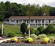
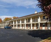
Hotels and Places to Stay
Old Sturbridge Inn and Reeder Family Lodges
STURBRIDGE HOST HOTEL AND CONFERENCE CEN
Hampton Inn Sturbridge
Comfort Inn & Suites Sturbridge
Sturbridge Lodge
SOUTHBRIDGE HOTEL AND CONFERENCE CENTER
PUBLICK HOUSE HISTORIC INN COUNTRY LODGE
SCOTTISH INNS STURBRIDGE
Days Inn Sturbridge
Econo Lodge Sturbridge
Videos from this area
These are videos related to the place based on their proximity to this place.
Thanksgiving Day at Old Sturbridge Village
Sights and sounds of the village from flintlock shooting to cooking to horse and coach rides on 11/26/09.
5th Annual Old Sturbridge Village Gala - 2012
Highlights from the 2012 Old Sturbridge Village Gala, "It Takes a Village" featuring celebrity emcee Eddie Brill and members of the OSV community.
Seafood Festival at Old Sturbridge Village
A Squantum Fest, also known as a Seafood Festival was held at Old Sturbridge Village in MAssachusetts on 9/25 & 26/2010. Five kinds of chowders: New England, Rhode Island, Seafood, Lobster...
An 1830s Thanksgiving Dinner at OSV
Old Sturbridge Village historians demonstrate a 19th-century Thanksgiving dinner.
A Thanksgiving Shooting Match at OSV
Shooting matches, traditional 19th-century Thanksgiving entertainment, demonstrated at Old Sturbridge Village.
Punch-and-Judy-Part2
Punch and Judy Show Part 2: The demise of the executioner and the devil. Performed by Claire Gregoire at Old Sturbridge Village, Massachusetts on December 26, 2008. See also Part1: http://www.y...
Cracker Barrel
Through the suggestion from a fellow YouTuber, Civilwarcat, I tried the Saturday Special, Chicken and Rice. It was fantastic! Took two side veggies: Fried Okra and Country Green Beans. The...
Mosquito Boogie
Johanna Barnes leads the Mosquito Boogie, at NELOL 2014. Choreographed by Johanna Barnes, Cato Larsen, Michael Barr, Jo Kinser, John Kinser and Ivonne Verhagen.
Videos provided by Youtube are under the copyright of their owners.
Attractions and noteworthy things
Distances are based on the centre of the city/town and sightseeing location. This list contains brief abstracts about monuments, holiday activities, national parcs, museums, organisations and more from the area as well as interesting facts about the region itself. Where available, you'll find the corresponding homepage. Otherwise the related wikipedia article.
Fiskdale, Massachusetts
Fiskdale (or Fiskedale) is a census-designated place (CDP) in the town of Sturbridge in Worcester County, Massachusetts, United States. The population was 2,583 at the 2010 census.
Sturbridge (CDP), Massachusetts
Sturbridge is a census-designated place (CDP) in the town of Sturbridge in Worcester County, Massachusetts, United States. The population was 2,253 at the 2010 census.
Old Sturbridge Village
Old Sturbridge Village (OSV) is a living museum located in Sturbridge, Massachusetts, in the United States, which re-creates life in rural New England during the 1790s through 1830s. It is the largest living museum in New England, covering more than 200 acres (80 hectares). The Village includes 59 antique buildings, three water-powered mills, and a working farm. The museum is a popular tourist and educational field trip destination.
Leadmine Wildlife Management Area
Leadmine Wildlife Management Area is a 640-acre wildlife conservation area located in Holland and Sturbridge, Massachusetts. The conservaton area abuts the Tantiusques reservation and the its satellite Crowd Site, owned by The Trustees of Reservations. It is managed by the Massachusetts Department of Fish and Game. Hunting (in season), hiking, and other outdoor recreational pursuits are enjoyed on the property.
East Brimfield Dam
The East Brimfield Dam is located on the Quinebaug River in Sturbridge, Massachusetts, approximately 20 miles southwest of Worcester, Massachusetts. Designed and constructed by the United States Army Corps of Engineers, this dam substantially reduces flooding along the Quinebaug and Thames rivers. Construction of the project began in 1958 with completion in 1960 at a cost of US$7,020,000.
Westville Dam
The Westville Dam is located on the Quinebaug River between Southbridge and Sturbridge, about 1.3 miles west of the Southbridge town center and 18 miles southwest of Worcester, Massachusetts. Designed and constructed by the United States Army Corps of Engineers, this dam substantially reduces flooding along the Quinebaug and Thames rivers. Construction of the project began in June 1960 with completion in August 1962 at a cost of US$5.6 million.
Burgess Elementary School
Burgess Elementary School is a public school in Sturbridge, Massachusetts.


