Safety Score: 3,0 of 5.0 based on data from 9 authorites. Meaning we advice caution when travelling to Slovenia.
Travel warnings are updated daily. Source: Travel Warning Slovenia. Last Update: 2024-05-01 08:01:32
Touring Črnotiče
Črnotiče in Koper with it's 89 residents is a town located in Slovenia about 45 mi (or 73 km) south-west of Ljubljana, the country's capital place.
Time in Črnotiče is now 07:15 AM (Thursday). The local timezone is named Europe / Ljubljana with an UTC offset of 2 hours. We know of 10 airports nearby Črnotiče, of which 4 are larger airports. The closest airport in Slovenia is Portoroz Airport in a distance of 15 mi (or 24 km), South-West. Besides the airports, there are other travel options available (check left side).
There are several Unesco world heritage sites nearby. The closest heritage site in Slovenia is Škocjan Caves in a distance of 9 mi (or 15 km), North-East. We collected 5 points of interest near this location. Need some hints on where to stay? We compiled a list of available hotels close to the map centre further down the page.
Being here already, you might want to pay a visit to some of the following locations: Dolina, Kozina, Muggia, Divaca and Trieste. To further explore this place, just scroll down and browse the available info.
Local weather forecast
Todays Local Weather Conditions & Forecast: 15°C / 59 °F
| Morning Temperature | 14°C / 58 °F |
| Evening Temperature | 13°C / 55 °F |
| Night Temperature | 12°C / 54 °F |
| Chance of rainfall | 24% |
| Air Humidity | 89% |
| Air Pressure | 1009 hPa |
| Wind Speed | Gentle Breeze with 8 km/h (5 mph) from North-East |
| Cloud Conditions | Overcast clouds, covering 98% of sky |
| General Conditions | Moderate rain |
Friday, 3rd of May 2024
11°C (51 °F)
12°C (53 °F)
Moderate rain, light breeze, overcast clouds.
Saturday, 4th of May 2024
14°C (57 °F)
11°C (52 °F)
Light rain, light breeze, overcast clouds.
Sunday, 5th of May 2024
17°C (63 °F)
13°C (55 °F)
Light rain, light breeze, overcast clouds.
Hotels and Places to Stay
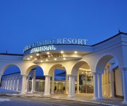
Hotel & Casino Resort Admiral
La Fontana
Videos from this area
These are videos related to the place based on their proximity to this place.
28 ottobre 2012
28 ottobre 2012 Arriva la bora, un assaggio d'inverno con il nevischio che cade a San Servolo.
S Črnega Kala v Strunjan
Svetlana in otroka so me pustili na začetku črnokalskega klanca, da sem lahko pribajkal za njimi na plažo v Strunjanu. trp: 36.16 km / rid: 1:56:04 (neto) / avg: 18.60 km/h / trip alti:...
A1 Tunnel Kastelec - Slovenia 2240 meter
A1 Tunnel Kastelec - Slovenia 2240 meter At the border of the city of Koper.
Golfe de Trieste depuis Grad Socerb (Slovénie)
Découvrez le Golfe de Trieste depuis le château de Socerb en Slovénie. http://legoutduvoyage.com/grad-socerb-vue-exceptionnelle-golfe-de-trieste/
Crni kal, Slovenia
Gita in Slovenia, alle porte di Trieste. Crni Kal e il ciglione carsico dei climbers. Parte del testo è tratto dal libro di Ettore Tomasi. Video di Dario Gasparo.
Panorama di Trieste dal Castello di San Servolo [Grad Socerb]
Castello di San Servolo [Grad Socerb] Slovenia - Slovenija (2012) una magnifica panoramica da Pirano fino a giungere a Grado, Monfalcone, i versanti del Carso sloveno ed i monti della Slovenia...
Videos provided by Youtube are under the copyright of their owners.
Attractions and noteworthy things
Distances are based on the centre of the city/town and sightseeing location. This list contains brief abstracts about monuments, holiday activities, national parcs, museums, organisations and more from the area as well as interesting facts about the region itself. Where available, you'll find the corresponding homepage. Otherwise the related wikipedia article.
Mišja Peč
Mišja Peč is a climbing area located on the Karst Rim in Slovenia. Together with the faces of Osp, the rocky amphitheatre of Mišja Peč forms an almost continuous single climbing area. In recent years this overhang semicircular wall has represented an important challenge to the numerous top climbers who come from all over the world.
Črni Kal Viaduct
The Črni Kal Viaduct (Slovene: Viadukt Črni Kal) is the longest and the highest viaduct in Slovenia. It is located on the A1 motorway above the Osp Valley near the village of Gabrovica, about 20 kilometres east of Koper. It is named after the village of Črni Kal. The viaduct is 1,065 metres long and is mounted on 11 Y-shaped columns (its distinguishing feature), the highest reaching 87.5 m . The viaduct was designed by Janez Koželj and Marjan Pippenbaher, who was also its constructor.
Slovenian Istria
Slovenian Istria is a region in southwest of Slovenia. It comprises the northern part of the Istrian peninsula, and it is part of the wider geographical-historical region known as the Slovenian Littoral (Primorska). Its largest urban center is Koper. Other larger settlements are Izola, Piran and Portorož. The whole region has around 120 settlements. In its coastal area, both the Slovene and Italian language are official.


!['Panorama di Trieste dal Castello di San Servolo [Grad Socerb]' preview picture of video 'Panorama di Trieste dal Castello di San Servolo [Grad Socerb]'](https://img.youtube.com/vi/SabX2Eqczmk/mqdefault.jpg)


