Safety Score: 3,0 of 5.0 based on data from 9 authorites. Meaning we advice caution when travelling to Slovenia.
Travel warnings are updated daily. Source: Travel Warning Slovenia. Last Update: 2024-04-28 08:22:10
Delve into Beka
Beka in Hrpelje-Kozina with it's 9 habitants is a city located in Slovenia about 43 mi (or 69 km) south-west of Ljubljana, the country's capital town.
Current time in Beka is now 02:09 PM (Sunday). The local timezone is named Europe / Ljubljana with an UTC offset of 2 hours. We know of 10 airports closer to Beka, of which 4 are larger airports. The closest airport in Slovenia is Portoroz Airport in a distance of 16 mi (or 26 km), South-West. Besides the airports, there are other travel options available (check left side).
There are several Unesco world heritage sites nearby. The closest heritage site in Slovenia is Škocjan Caves in a distance of 7 mi (or 11 km), North-East. We saw 5 points of interest near this location. In need of a room? We compiled a list of available hotels close to the map centre further down the page.
Since you are here already, you might want to pay a visit to some of the following locations: Dolina, Kozina, Sezana, Divaca and Muggia. To further explore this place, just scroll down and browse the available info.
Local weather forecast
Todays Local Weather Conditions & Forecast: 19°C / 66 °F
| Morning Temperature | 11°C / 52 °F |
| Evening Temperature | 16°C / 61 °F |
| Night Temperature | 13°C / 55 °F |
| Chance of rainfall | 0% |
| Air Humidity | 61% |
| Air Pressure | 1020 hPa |
| Wind Speed | Light breeze with 5 km/h (3 mph) from East |
| Cloud Conditions | Overcast clouds, covering 100% of sky |
| General Conditions | Overcast clouds |
Monday, 29th of April 2024
22°C (72 °F)
15°C (58 °F)
Sky is clear, light breeze, few clouds.
Tuesday, 30th of April 2024
26°C (79 °F)
16°C (60 °F)
Few clouds, light breeze.
Wednesday, 1st of May 2024
19°C (66 °F)
15°C (59 °F)
Light rain, light breeze, overcast clouds.
Hotels and Places to Stay
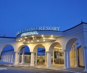
Hotel & Casino Resort Admiral
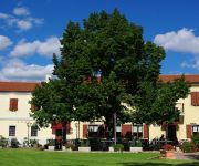
Center Hotel
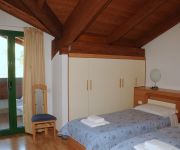
La Fontana
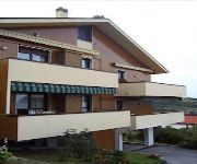
Oasi
Cassio
Videos from this area
These are videos related to the place based on their proximity to this place.
Grotte in Val Rosandra con la classe I A - Aprile 2012
Visita alla grotta Bac ed alla grotta dei pipistrelli nella Riserva della Val Rosandra, San Dorligo della Valle, provincia di Trieste. Studenti di prima media della "Caprin" di Trieste accompagnat...
28 ottobre 2012
28 ottobre 2012 Arriva la bora, un assaggio d'inverno con il nevischio che cade a San Servolo.
My first MTB race.
Mtb Zimska Liga, 2014-2015. Kozina (Slo). Minimaraton, 26km. The video editing is very homemade, please forgive me. My GoPro Hero 1 was not well attached to the handlebars. P. S. I'm a amateur,...
La ferrovia Trieste-Erpelle
Una giornata in Valrosandra camminando sulla ex ferrovia Trieste-Erpelle.
Wanderung nach Strunjan
Strunjan an der Slowenischen Adriaküste besitzt eine geologisch interessante Steilküste.
LUCE OLTRE IL PONTE
Dopo il ponte di legno che attraversa il Rosandra, l'acqua del fiume sembra giocare con la luce. Della serie "Come è bella la nostra Valle"
Cascata val Rosandra - Canon EOS 7D - Full HD 1080p
Dopo circa un'ora di cammino lungo il sentiero che corre lungo un fianco del canyon della val Rosandra, compare questa spettacolare cascata - Video Full HD Canon EOS 7D.
Volare Senza Frontiere 2014
Gemmellaggio tra Polet Nova Gorica e Volo Libero Monte Carso Trieste, tenutosi a Socerb (Monte Carso) il 10 maggio 2014. Nell'occasione esibizione della "Pattuglia paramotoristi Audace" della...
Videos provided by Youtube are under the copyright of their owners.
Attractions and noteworthy things
Distances are based on the centre of the city/town and sightseeing location. This list contains brief abstracts about monuments, holiday activities, national parcs, museums, organisations and more from the area as well as interesting facts about the region itself. Where available, you'll find the corresponding homepage. Otherwise the related wikipedia article.
Mišja Peč
Mišja Peč is a climbing area located on the Karst Rim in Slovenia. Together with the faces of Osp, the rocky amphitheatre of Mišja Peč forms an almost continuous single climbing area. In recent years this overhang semicircular wall has represented an important challenge to the numerous top climbers who come from all over the world.
Obalno-kraška Statistical Region
The Coastal-Karst Statistical Region (Slovene: Obalno-kraška statistična regija) is a statistical region in the south-west of Slovenia. The region compromises 7 municipalities: Divača, Hrpelje-Kozina, Izola, Komen, Koper, Piran and Sežana. It has an area of 1,044 km² and an estimated 106,000 inhabitants (at 1 January 2006) - of whom almost half live in the coastal city of Koper - and the second highest GDP per capita of the Slovenian regions.
Val Rosandra
Val Rosandra is a valley centered on the river with the same name in the municipality of Dolina in the Italian region of Friuli Venezia Giulia, between the city of Trieste and the border with Slovenia. It is also included into a natural park, mostly set around the river Rosandra and the surrounding hills reach an altitude of 412 metres. The northern end of the valley crosses the Italian-Slovenian border. The Val Rosandra is part of the Kras geographical region.
Foibe killings
The Foibe killings or Foibe massacres refers to the killings that took place mainly in Istria during and shortly after World War II from 1943 to 1949, perpetrated mainly by Yugoslav Partisans. The name derives from a local geological feature, a type of deep karst sinkhole called a foiba. The term includes by extension killings in other subterranean formations, such as the Basovizza "foiba", which is not a true foiba but a mine shaft.


