Safety Score: 3,0 of 5.0 based on data from 9 authorites. Meaning we advice caution when travelling to New Zealand.
Travel warnings are updated daily. Source: Travel Warning New Zealand. Last Update: 2024-04-26 08:02:42
Explore Crofton Downs
The district Crofton Downs of Wellington in Wellington City (Wellington) is located in New Zealand and is a district of the nations capital.
If you need a place to sleep, we compiled a list of available hotels close to the map centre further down the page.
Depending on your travel schedule, you might want to pay a visit to some of the following locations: Blenheim, Palmerston North, Nelson, Richmond and New Plymouth. To further explore this place, just scroll down and browse the available info.
Local weather forecast
Todays Local Weather Conditions & Forecast: 13°C / 55 °F
| Morning Temperature | 8°C / 46 °F |
| Evening Temperature | 10°C / 51 °F |
| Night Temperature | 10°C / 49 °F |
| Chance of rainfall | 0% |
| Air Humidity | 55% |
| Air Pressure | 1017 hPa |
| Wind Speed | Gentle Breeze with 9 km/h (5 mph) from South |
| Cloud Conditions | Few clouds, covering 20% of sky |
| General Conditions | Few clouds |
Sunday, 28th of April 2024
14°C (57 °F)
11°C (53 °F)
Few clouds, gentle breeze.
Monday, 29th of April 2024
14°C (57 °F)
12°C (54 °F)
Sky is clear, moderate breeze, clear sky.
Tuesday, 30th of April 2024
14°C (57 °F)
13°C (56 °F)
Overcast clouds, fresh breeze.
Hotels and Places to Stay
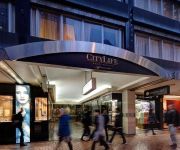
CITYLIFE WELLINGTON
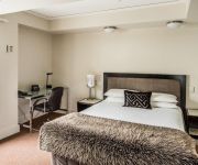
Bolton Hotel
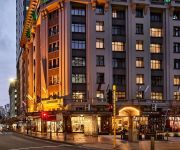
Sofitel Wellington
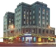
Acorns Wellington Apartment
DoubleTree by Hilton Wellington
Hotel Waterloo & Backpackers (formerly Downtown Backpackers)
JAMES COOK GRAND CHANCELLOR
RYDGES WELLINGTON
QUEST ATRIUM SERVICED APTS
Novotel Wellington
Videos from this area
These are videos related to the place based on their proximity to this place.
Wellington Phoenix vs Melbourne Victory: Hyundai A League 2013/2014 (Round 15)
Wellington Phoenix 5 - 0 Melbourne Victory, goals and highlights. C. Hernandez 18' K. Cunningham 45' C. Hernandez (PG) 45'+3 J. Brockie 86' S. Huysegems 88'
Licensed Building Practicioner CJ Duff Construction Khandallah Wellington phone 04 4793444 video
http://wellington-builders.com/ Welcome to Wellington Builders At C. J. Duff Construction in Khandallah, Wellington, you always get expert advice even before your whole building project starts....
Real Estate Karori Home - 69 Old Karori Road, Karori - City End Wellington - Just Paterson
Set behind an electronic security gate, this smart, stylish and spacious family home imparts safety and peace of mind. Cleverly connected to beautifully landscaped outdoors there is a keen...
North Island kaka, Zealandia (Karori Wildlife Sanctuary), Wellington New Zealand
http://en.wikipedia.org/wiki/New_Zealand_Kaka The New Zealand Kaka, also known as Kākā, (Nestor meridionalis) is a New Zealand parrot endemic to the native forests of New Zealand. http://www.vi...
Flight Auckland to Dunedin
I was early at the Auckland Domestic Terminal, so I indulged in getting videos from the goings-on on the tarmac outside the departing lounge. The flight took me first to Wellington, then on...
Mount Kaukau television transmitter closer look
Mount Kaukau television transmitter. The summit is 445 metres above sea level and is the most visible high point in the Wellington landscape further accentuated by Wellington's main television...
i-Go-2 New Zealand - Wellington Cable Cars & Capital
i-Go-2 New Zealand - Wellington Cable Cars & Capital A great trip and a wonderful city. A very enjoyable ride up and down.
500D — Time lapse test take 2
60sec interval My second attempt at doing a time lapse. This time I cleaned the window, unfortunately I can't clean the other side. So when night falls, you can see how dirty it is. The...
Videos provided by Youtube are under the copyright of their owners.
Attractions and noteworthy things
Distances are based on the centre of the city/town and sightseeing location. This list contains brief abstracts about monuments, holiday activities, national parcs, museums, organisations and more from the area as well as interesting facts about the region itself. Where available, you'll find the corresponding homepage. Otherwise the related wikipedia article.
The Correspondence School
Te Aho o Te Kura Pounamu or Te Kura (formerly The Correspondence School) is New Zealand's largest school with around 25,000 students enrolled each year, from early childhood to secondary level. It is headquartered in Portland Crescent in Thorndon, Wellington. In addition to its ordinary full-time students, Te Kura provides programmes to students at other state-owned schools where a subject is unavailable, and to adults. Te Kura is Ministry of Education funded.
Khandallah
Khandallah is a suburb of Wellington, the capital city of New Zealand. It is located four kilometres northeast of the city centre, on hills overlooking Wellington Harbour. The suburb's name, which means "Resting place of God", comes from a homestead built in the area in 1884 by Captain James Andrew, who had recently returned from duty in India. For this reason the suburb and those surrounding it have many place names connected with the Indian subcontinent.
Ngaio, New Zealand
Ngaio is an inner suburb of Wellington, the capital city of New Zealand. It is situated on the slopes of Mount Kaukau, 3500 metres north of the city's CBD. It was settled at the same time as the neighbouring suburb of Khandallah, and like its neighbour many of its streets are named after places on the Indian subcontinent. Ngaio was originally a logging community.
Premier House
Premier House, on Tinakori Road in Wellington, New Zealand, is the official residence of the Prime Minister of New Zealand. The original building, constructed in the early days of the New Zealand colony in 1843 is located at the southern end of the current building, and was greatly expanded two decades later. The house was bought for use by the country's Premier in 1865 and was converted to a more fitting building for a national leader in 1872.
Mount Kaukau
Mount Kaukau, also known as Tarikaka, is in Wellington, New Zealand on the western side of Wellington harbour near Johnsonville and Khandallah. The summit is 445 metres above sea level and is the most visible high point in the Wellington landscape further accentuated by Wellington's main television transmitter tower the Kordia TV transmitter mast, which stands a little over 100m tall. There is also a compass pedestal placed at the top.
Futuna Chapel
Futuna Chapel is a building in the suburb of Karori, Wellington designed by the architect John Scott. Built by the brothers of the Society of Mary, the chapel is named after the Pacific Island of Futuna on which the missionary Peter Chanel, to whom the project is dedicated, was martyred in 1841. It was awarded the New Zealand Institute of Architects gold medal in 1968 and its 25-year Award in 1986. The Historic Places Trust has placed it on its register as a Category 1 Historic Site.
Samuel Marsden Collegiate School
Samuel Marsden Collegiate School is located in the Wellington suburb of Karori in New Zealand. It has a socio-economic decile of 10 and provides private preschool to year 13 education for girls, but with co-educational kindergarten facilities. It is renowned for being a very academic school with exam results ranking consistently in the top three schools throughout New Zealand.
Otari-Wilton's Bush
Otari Native Botanic Garden and Wilton's Bush Reserve (Otari-Wilton's Bush) is the only public botanic garden in New Zealand dedicated solely to New Zealand native plants. It is located in Wellington's suburb of Wilton.
Crofton Downs Railway Station
|} Crofton Downs railway station is one of eight stations on the Johnsonville Branch, a commuter branch railway north of Wellington in New Zealand’s North Island. It serves the suburbs of Crofton Downs and Chartwell. Its name is similar to, and should not be confused with, the original name for Ngaio station (Crofton).
Korimako Stream
The Korimako Stream is a stream in the North Island of New Zealand, located in the northern suburbs of the national capital, Wellington. It rises in Khandallah and Ngaio and is the Kaiwharawhara Stream's main tributary. The two meet in the lower reaches of the Kaiwharawhara River in parkland.
Embassy of Germany, Wellington
The German Embassy in Wellington is Germany's diplomatic mission to New Zealand. It is located at 90-92 Hobson Street, Thorndon, Wellington, New Zealand. The current German ambassador to New Zealand is Thomas Hermann Meister.
Cardinal McKeefry Catholic Primary School
Cardinal McKeefry is a Catholic primary school and intermediate school for girls and boys catering from Year 1 to Year 8 (5 to 13 years old). The school traces its origins to the Marist Brothers' first school opened in New Zealand in 1876. The current school was opened in 1970 by Cardinal McKeefry and named after him.
Northland, Wellington
Northland, a small suburb in western Wellington, New Zealand. The suburb is served by two state primary schools, Northland School and Cardinal McKeefry Catholic Primary School.
Northland School
Northland School is a small state primary school in western Wellington. It is in the suburb of Northland, thus its name. Northland School is situated at 14 Harbour View Road (on the corner of Northland Road and Harbour View Road). It is a decile ten school. Northland School was established in 1906. In 2006 northland school held a 100 year anniversairy.
Wilton, New Zealand
Wilton is a small suburb in Wellington. It is best known for Otari-Wilton's Bush, a large reserve that is situated in the suburb. Otari-Wilton's bush is the only public botanic garden in New Zealand dedicated solely to native plants. It features 14 km of walking tracks and a 'canopy walkway'. The canopy walkway is a raised walkway that provides a unique chance to view life in, and from, the top level of trees such as mature tawa, rewarewa and hinau.
Embassy of the United States, Wellington
The Embassy of the United States in Wellington, New Zealand along with the consulate general in Auckland provides assistance to American citizens and issues travel visas to foreign nationals who wish to visit the United States. There have been many United States Ambassadors to New Zealand since the post was created in 12 October, 1838. The current U.S. Ambassador is David Huebner.
Ngaio Railway Station
|} Ngaio Railway Station is one of eight railway stations on the Johnsonville Branch, a commuter branch railway north of Wellington in New Zealand’s North Island, and serves the suburb of Ngaio. The station was erected and operated by the Wellington and Manawatu Railway Company (WMR) on their line from Wellington to Longburn. The area served by this station used to be called Crofton, until the suburb was renamed to Ngaio in 1908.
Awarua Street Railway Station
Awarua Street railway station is one of eight stations on the Johnsonville Branch, a branch railway north of Wellington in New Zealand’s North Island, and serves the suburb of Ngaio. It is one of two stations that were added to the line when it was upgraded prior to being reopened as the Johnsonville Branch, and one of the four stations on the line to be located on a curve.
Simla Crescent Railway Station
Simla Crescent railway station is one of eight stations on the Johnsonville Branch, a branch railway north of Wellington in New Zealand’s North Island, and is one of two stations that were added to the line when it was upgraded prior to being reopened as the Johnsonville Branch. It serves the suburbs of Ngaio and Te Kainga.
Otari School
Otari school is a state primary school in Wellington, New Zealand, formerly known as Wilton school. It is divided into three strands: one that teaches in the manner conventional to New Zealand schools, a Māori immersion stream, and a stream based around the principles of Montessori teaching. It has a focus on the environment. The school is located next to Otari, a botanical garden dedicated to native plants. The school is also the site of Otari Preschool.
St Mary's College, Wellington
St Mary's College Wellington is situated in the suburb of Thorndon in Wellington, New Zealand. The school is an integrated all-girls Catholic secondary school for years 9-13.
Alington House
Alington House is a historic building in Karori, Wellington, New Zealand. It is "an important New Zealand example of Modern Movement architecture. " The house was designed by William Alington for his family as a private job while working for the New Zealand Government's Ministry of Works immediately after returning from his overseas experience.
Chew Cottage
Chew Cottage is an historic building in Wellington, New Zealand. The house, originally named "Millwood", was built in 1865 for John and Ester Chew. The cottage is one of Wellington's remaining houses from the 1860s. It resembles a traditional English stone cottage adapted for timber construction. The building, is classified as a "Category I" ("places of special or outstanding historical or cultural heritage significance or value") historic place by the New Zealand Historic Places Trust.
Banana House
Banana House (also known as 4 Goldies Brae) is a historic building in Wadestown, Wellington, New Zealand. This house was designed by its original owner Dr Alexander Johnston, the Provincial Surgeon of Wellington. The building is classified as a "Category I" ("places of special or outstanding historical or cultural heritage significance or value") historic place by the New Zealand Historic Places Trust.
Wadestown, New Zealand
Wadestown is a northern suburb of Wellington, (the capital city of New Zealand), located about 2-3 km by road from the Wellington central business district and the New Zealand Parliament Buildings. Wadestown is a largely residential suburb located on the northern flanks of Tinakori Hill (or Te Ahumairangi Hill), above the Ngaio Gorge. It includes an area on the eastern end of the suburb known as Highland Park.


