Safety Score: 3,0 of 5.0 based on data from 9 authorites. Meaning we advice caution when travelling to New Zealand.
Travel warnings are updated daily. Source: Travel Warning New Zealand. Last Update: 2024-07-26 08:00:33
Discover Mangere
Mangere in Auckland (Auckland) with it's 55,266 citizens is a place in New Zealand about 298 mi (or 480 km) north of Wellington, the country's capital city.
Current time in Mangere is now 05:11 PM (Saturday). The local timezone is named Pacific / Auckland with an UTC offset of 12 hours. We know of 8 airports near Mangere, of which one is a larger airport. The closest airport in New Zealand is Auckland International Airport in a distance of 3 mi (or 4 km), South. Besides the airports, there are other travel options available (check left side).
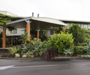
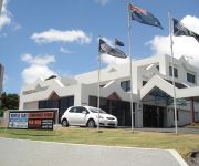
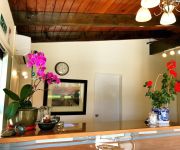
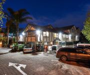
We encountered 3 points of interest in the vicinity of this place. If you need a hotel, we compiled a list of available hotels close to the map centre further down the page.
While being here, you might want to pay a visit to some of the following locations: Auckland, Hamilton, Whangarei, Tauranga and Rotorua. To further explore this place, just scroll down and browse the available info.
Local weather forecast
Todays Local Weather Conditions & Forecast: 13°C / 56 °F
| Morning Temperature | 9°C / 48 °F |
| Evening Temperature | 12°C / 54 °F |
| Night Temperature | 11°C / 52 °F |
| Chance of rainfall | 0% |
| Air Humidity | 73% |
| Air Pressure | 1027 hPa |
| Wind Speed | Calm with 2 km/h (1 mph) from North-West |
| Cloud Conditions | Few clouds, covering 17% of sky |
| General Conditions | Few clouds |
Sunday, 28th of July 2024
14°C (58 °F)
11°C (52 °F)
Broken clouds, light breeze.
Monday, 29th of July 2024
13°C (56 °F)
13°C (56 °F)
Light rain, moderate breeze, broken clouds.
Tuesday, 30th of July 2024
12°C (54 °F)
12°C (54 °F)
Moderate rain, fresh breeze, overcast clouds.
Hotels and Places to Stay
GREENLANE MANOR MOTEL
Auckland Airport Lodge
Jet Park Airport Hotel and Conference Centre
BEST WESTERN ELLERSLIE INTL
Grange Lodge Motel
Mount Richmond Hotel
540 on Great South Motel
Airport Harbour View Motel
Sudima Auckland Airport
Novotel Auckland Airport
Videos from this area
These are videos related to the place based on their proximity to this place.
Mangere Mountain, walk the present discover the past
Mangere Mountain, walk the present, discover the past.
#EverythingYouNeed - 2/29 Miro Road, Mangere Bridge
2/29 Miro Road, Mangere Bridge Proudly Marketed by Jared Cooksley & Jared Hards 021 913 518 jaredcooksley.co.nz.
#YourNextMove 1/3 Dunstall Place, Mangere Bridge
1/3 Dunstall Place, Mangere Bridge Proudly Marketed by Jared Cooksley 021 913 518 More info at JaredCooksley.co.nz.
Manukau City Hotels - OneStopHotelDeals.com
http://www.onestophoteldeals.com/ Compare Manukau City accommodation and Manukau City hotel deals from world's leading reservation websites with option to compare and select the best deal...
Dollar Dash Mangere Bridge
Fun Run Walk around Mangere Bridge Auckland New Zealand. Participants weigh in at the beginning and end of the course. There are activities to be completed t...
Air NZ Future taking flight - The Hangar 9 Design Story
http://www.futuretakingflight.com. An insider's view of the journey to get this stunning new inflight experience off the ground.
Bhajan Samarat 2010 - Bhajan by Sunil Dutt
Organised by Rugs R Us & Radio Tarana @ Skipton Hall, Mangere on 3rd Dec 2010 Dholak by Vimal Yadho.
Pre hire video final
Rebel Car Rental is dedicated to making sure our clients have all the information they could possibly need throughout the hire process. This Pre-Hire video ensures all clients have ready access...
Bhajan Samarat 2010 - Bhajan by Nitin Rajneel Deo
Organised by Rugs R Us & Radio Tarana @ Skipton Hall, Mangere on 3rd Dec 2010 Dholak by Mithun Vikash Deo Winner of Best Dholak Player, Chrous and Saj by Jyoti Ramayan Bhajan Faag ...
Videos provided by Youtube are under the copyright of their owners.
Attractions and noteworthy things
Distances are based on the centre of the city/town and sightseeing location. This list contains brief abstracts about monuments, holiday activities, national parcs, museums, organisations and more from the area as well as interesting facts about the region itself. Where available, you'll find the corresponding homepage. Otherwise the related wikipedia article.
Mangere
Māngere (frequently written Mangere) is one of the largest suburbs in Auckland, in northern New Zealand. The suburb is located on flat land at the northeastern shore of the Manukau Harbour, to the northwest of the centre of Manukau city and 15 kilometres south of Auckland city centre.
Mangere Mountain
Mangere Mountain (also Mangere Domain, for the park) is one of the largest volcanic cones in the Auckland Volcanic Field, with a peak 106 metres above sea level, and was the site of a major pā. Many of the pā's earthworks are still very evident. It offers spectacular panoramic views of Auckland. The mountain features two large craters. The volcano has a wide crater with a lava dome near its centre, a feature shared by no other volcano in Auckland.
Southern Cross Campus
Southern Cross Campus (Te Kura Taki o Autahi) is a composite school that caters for students in Years 1-13 in the suburb of Mangere East in Manukau City, South Auckland, New Zealand. The school (also referred to as 'SCC', 'The Campus' or 'The Cross') has deep ties to the Mangere East community by providing education, facilities, and programmes for the wider use of the whole school.
Mangere Lagoon
Mangere Lagoon is a lagoon in the Manukau Harbour, New Zealand. It occupies a volcanic crater or maar which is part of the Auckland volcanic field. Oval and about 600m long, it has a small restored scoria island remaining in the centre. In the 1930s efforts were made to drain the swamp for conversion to pasture, while in the late 1950s, earthworks for sewage sludge ponds in the lagoon removed the scoria cone and the crater was divided into ponds.
Auckland Seventh-day Adventist High School
Auckland Seventh-day Adventist High School (ASDAH) is a secondary school (years 9–13) in Mangere suburb of Manukau city, Auckland Region, New Zealand. It is owned by the Seventh-day Adventist church. In the 2007 ERO report, it was recommended that the Secretary for Education intervene in order to bring about improvements to school management and governance, with particular reference to improving the management of the curriculum, personnel, and the provision of a safe environment.
Pukaki Lagoon
Pukaki Lagoon is one of the volcanoes in the Auckland Volcanic Field. It has a 600 m wide explosion crater, with a surrounding tuff ring. After eruption about 65,000 yrs ago the crater filled with freshwater and became a lake. It was breached by the sea as sea-level rise after the end of the Last Ice Age about 8,000 yrs ago and became a tidal lagoon. This was dammed and drained and used as a speedway from 1929 into the 1930s (Henning's Speedway). It is now farmland.
Centre Park
Centre Park is a stadium located in Mangere, Auckland, New Zealand. The stadium hosted the 2011 OFC U-20 Championship.
Boggust Park Crater
Boggust Park Crater is a volcano in Auckland, New Zealand. Located in the Favona area of the Mangere suburb, it is one of Auckland city's older volcanoes. It was first recognised as a volcano in 2011. The park in which it is located is named after Ralph Boggust, former superintendent of Manukau Parks Dept. The volcano has a 300–400 m diameter crater surrounded on three sides by a 6–8 m high semi-circular tuff ring with steep inner slopes and gentler outer slopes.


