Safety Score: 3,0 of 5.0 based on data from 9 authorites. Meaning we advice caution when travelling to New Zealand.
Travel warnings are updated daily. Source: Travel Warning New Zealand. Last Update: 2024-04-24 08:14:40
Touring OTAHUHU
OTAHUHU in Auckland (Auckland) is a town located in New Zealand about 300 mi (or 484 km) north of Wellington, the country's capital place.
Time in OTAHUHU is now 07:31 PM (Thursday). The local timezone is named Pacific / Auckland with an UTC offset of 12 hours. We know of 8 airports nearby OTAHUHU, of which one is a larger airport. The closest airport in New Zealand is Auckland International Airport in a distance of 6 mi (or 9 km), South-West. Besides the airports, there are other travel options available (check left side).
We collected 3 points of interest near this location. Need some hints on where to stay? We compiled a list of available hotels close to the map centre further down the page.
Being here already, you might want to pay a visit to some of the following locations: Auckland, Hamilton, Whangarei, Tauranga and Rotorua. To further explore this place, just scroll down and browse the available info.
Local weather forecast
Todays Local Weather Conditions & Forecast: 18°C / 64 °F
| Morning Temperature | 12°C / 54 °F |
| Evening Temperature | 17°C / 63 °F |
| Night Temperature | 15°C / 59 °F |
| Chance of rainfall | 0% |
| Air Humidity | 63% |
| Air Pressure | 1015 hPa |
| Wind Speed | Gentle Breeze with 7 km/h (4 mph) from South |
| Cloud Conditions | Overcast clouds, covering 100% of sky |
| General Conditions | Overcast clouds |
Friday, 26th of April 2024
17°C (63 °F)
15°C (59 °F)
Light rain, moderate breeze, broken clouds.
Saturday, 27th of April 2024
16°C (61 °F)
13°C (55 °F)
Light rain, moderate breeze, overcast clouds.
Sunday, 28th of April 2024
17°C (62 °F)
15°C (59 °F)
Scattered clouds, light breeze.
Hotels and Places to Stay
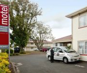
GREENLANE MANOR MOTEL
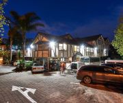
Mount Richmond Hotel
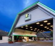
Holiday Inn AUCKLAND AIRPORT
Novotel Auckland Ellerslie
BEST WESTERN BKS PIONEER MOTOR
Auckland Airport Lodge
Airport Harbour View Motel
Proximity Apartments Manukau
BEST WESTERN ELLERSLIE INTL
540 on Great South Motel
Videos from this area
These are videos related to the place based on their proximity to this place.
shunt loco pushing freight at westfield yard
DH class locomotive pushing freight the length of westfield yard auckland. 900+HP V12 twin turbo cat engine. pushing aprox 1000t remote controlled, piloted from westfield to southdown freight...
rerail nz style.TOD
Westfield derailment many thanks to the people involved with this video, Gunner Si, Thomas the tank, Tungy Balls, Uncle Bob and a special thank you tribute to the legend John Martin Ontrac...
Veolia Transport Auckland ADK/ADB class DMU
Eastern Lines train depart from Westfield station. This train bound for Britomart, via Glen Innes. Next train is ADL class DMU. ベオリア・トランスポート・オークランドの東線ウ...
ニュージーランド貨物列車 New Zealand Freight Train
オークランド近郊のウェストフィールド駅横のヤードを走行する貨物列車 Freight train running at Westfield station, South Auckland. Next is Veolia Eastern Lines...
Mount Richmond Hotel Video
Here at Mount Richmond Hotel we would love to help make your wedding day memorable. We consider it a privilege to be involved in such an important event in your life. We offer a more intimate...
NZ Football 2011 Whole Football Club of the Year
A typical Saturday morning at Pukekohe Football Club, demonstrating the benefits of the Junior Framework as part of New Zealand Football's Whole of Football Plan.
Open Masters Challenge October 2010
The Work Climb and Open Masters Challenge tree climbing event in Auckland on Saturday 30 October, 2010 organized by Matt Glen and sponsored by Treetools.
Epic Orcon - the making of ...
Internet + Beer = Awesome. NZ ISP Orcon and ace beer maker Epic collaborate to make Orcon Pale Ale. Enjoy! http://www.epicorcon.co.nz/epic.html.
CloverPark2023|Chiropractor|Chiropractic|Pain Management|Shoulder Pain||emergency|Lower Back Pain
chiropractic chiropractor neck pain herniated disc sciatica pain treatment foot pain decompression chiropractors wellness center herniated disk inversion tab...
Videos provided by Youtube are under the copyright of their owners.
Attractions and noteworthy things
Distances are based on the centre of the city/town and sightseeing location. This list contains brief abstracts about monuments, holiday activities, national parcs, museums, organisations and more from the area as well as interesting facts about the region itself. Where available, you'll find the corresponding homepage. Otherwise the related wikipedia article.
Westfield Railway Station
Westfield Railway Station is located on the Eastern and Southern Lines of the Auckland Railway Network. It is near Westfield Junction, which is the junction of the Eastern and Southern Lines. It has an island platform layout and can be reached from a pedestrian overbridge at the end of Portage Road. The overbridge also spans the adjacent Westfield marshalling yards and gives access to KiwiRail's operations centre and locomotive facility.
Southdown Railway Station
Southdown Railway Station is an unused station at Southdown on the Southern Line of the Auckland suburban railway network. It is double tracked and has an island platform layout. Services were withdrawn by the Auckland Regional Transport Authority (ARTA) on 30 May 2004 due to low patronage and safety reasons.
Westfield, New Zealand
Suburb:Westfield City:Auckland City Island:North Island Surrounded by - to the north - to the east - to the south - to the west Mount Wellington, Southdown Tamaki River, Pakuranga Otahuhu Mangere Inlet Westfield is an Auckland suburb. This was once the site of the Westfield Freezing Works, part of a large industrial zone located near the main trunk railway at this point.
Otahuhu
Otahuhu is a suburb of Auckland. It is located 13 kilometres to the southeast of the city centre, on a narrow isthmus between an arm of the Manukau Harbour to the west and the Tamaki River estuary to the east. The isthmus is the narrowest connection between the North Auckland Peninsula and the rest of the North Island, being only some 1200 metres wide at its narrowest point, between the Otahuhu Creek and the Mangere Inlet.
Otahuhu College
Otahuhu College is a secondary school in Auckland, New Zealand for students years 9 to 13.
Otahuhu Railway Station
Otahuhu Railway Station is located on the Eastern and Southern Lines of the Auckland rail network. It has an island platform layout and can be reached by pedestrian overbridges from Walmsey Road Road and Titi Street. Otahuhu station features a signal box and is the point where both freight and passenger trains enter and exit the main line from the Westfield locomotive depot.
Otahuhu Workshops
Otahuhu Railway Workshops were a major rolling stock maintenance and repair facility operated by New Zealand Railways, in the south Auckland suburb of Otahuhu in New Zealand's North Island. The workshops were opened in 1928, and were closed in 1992 as part of a rationalisation of workshop facilities throughout the country.
McAuley High School (New Zealand)
McAuley High School is a Catholic girls’ secondary school in Otahuhu, New Zealand. The school was founded by the Sisters of Mercy in 1962, and run by the order until the 1990s. Students at the school achieve highly compared to the national average and to students at schools with a similar decile rating. Attendance figure are very high compared to most low decile schools because the principal gives this a very high priority.
Mount Richmond
Mount Richmond (also Ōtāhuhu) is one of the volcanoes of the Auckland Volcanic Field. A group of scoria mounds up to 50 m high, it has two 50 m wide craters. It was the site of a pā, and retains some Māori earthworks from that time such as kumara pits and terracing.
Robertson Hill
Robertson Hill (also Sturges Park or Mount Robertson) is one of the volcanoes in the Auckland Volcanic Field. It's scoria cone reaches 78 metres above sea level (around 28 m above the surrounding land). The scoria cone crater was reshaped into an oval sports field with terraced seating. The scoria cone sits in the centre of a large explosion (maar) crater with the tuff ring arc still present around the south and east sides.
McLennan Hills
McLennan Hills (also Te Aponga o Tainui) is one of the volcanoes in the Auckland Volcanic Field. It was a group of cratered scoria mounds up to 45 m high, before it was quarried away. A 1940 aerial photo (in Searle's book) shows a crater around 100 m wide, one around 50 m wide, and 2 or 3 smaller craters. The photo also shows terracing on the hills' slopes consistent with it being the site of a pā. The former quarry site is now used for greenhouses.


