Safety Score: 3,0 of 5.0 based on data from 9 authorites. Meaning we advice caution when travelling to New Zealand.
Travel warnings are updated daily. Source: Travel Warning New Zealand. Last Update: 2024-04-19 08:03:45
Touring Newtown
The district Newtown of Wellington in Wellington City (Wellington) is a subburb located in New Zealand and is a district of the nations capital.
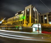
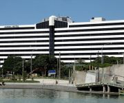
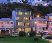
Need some hints on where to stay? We compiled a list of available hotels close to the map centre further down the page.
Being here already, you might want to pay a visit to some of the following locations: Blenheim, Palmerston North, Nelson, Richmond and New Plymouth. To further explore this place, just scroll down and browse the available info.
Local weather forecast
Todays Local Weather Conditions & Forecast: 16°C / 61 °F
| Morning Temperature | 12°C / 54 °F |
| Evening Temperature | 13°C / 56 °F |
| Night Temperature | 13°C / 55 °F |
| Chance of rainfall | 0% |
| Air Humidity | 55% |
| Air Pressure | 1016 hPa |
| Wind Speed | Gentle Breeze with 6 km/h (4 mph) from South-West |
| Cloud Conditions | Overcast clouds, covering 100% of sky |
| General Conditions | Overcast clouds |
Sunday, 21st of April 2024
16°C (60 °F)
11°C (53 °F)
Sky is clear, moderate breeze, clear sky.
Monday, 22nd of April 2024
16°C (60 °F)
11°C (52 °F)
Sky is clear, moderate breeze, clear sky.
Tuesday, 23rd of April 2024
16°C (60 °F)
14°C (58 °F)
Broken clouds, strong breeze.
Hotels and Places to Stay
QT Museum Wellington Previously Museum Art Hotel
YHA Wellington City - Hostel
AMORA HOTEL WELLINGTON
Apollo Lodge Motel
Ohtel
At Home Wellington City
Victoria Court Motor Lodge
The Bay Plaza Hotel
The Setup on Dixon - Hostel
BRENTWOOD HOTEL
Videos from this area
These are videos related to the place based on their proximity to this place.
2014 Swindale Shield: Round Ten - Marist St Pats vs Wellington
Highlights from the round ten match between MSP and Wellington. Played at Hataitai Park on Wellington's Old Timers Day. msprugby.co.nz (c) Holden Bros. Media.
Haunted Places - Mount Victoria Tunnel, Wellington New Zealand
http://www.thetraveltart.com/ Haunted Places - Mount Victoria Tunnel, Wellington New Zealand. The legend here was that a woman was murdered and buried within the tunnel foundations during the...
Club Rugby: Melting Moments #3 - Marist St Pats vs Oriental-Rongotai
Bite-sized clips of Wellington club rugby. Marist St Pats vs Oriental-Rongotai holdenbrosmedia.com.
Nice Day Wellington City from Mount Victoria
DJI test flight from Mt Vic after my first good crash ... (luckily all ok)
Earth People 2010
Ada Nally, Multicultural Community Customer Specialist at Wellington City Libraries, welcomes you to Earth People 2010! Each year 21 March is observed around the globe as the International...
Wellington College Promo (New Zealand)
Come to Wellington College, in the heart of Wellington - the capital city of New Zealand!
Driving in Wellington, New Zealand - 1
Time-lapse drive through Wellington, New Zealand. Drive out of the city then up the Kapiti Coast a way.
The Queen of Atlantis Part 2
Of course you'll have realised by now that this is not a lost 1920s silent movie, but a modern attempt to make a film in that style. The film is the work of students studying in Wellington,...
In the Company of Strangers - Leaving, First Fall
Masters in Art and Design majoring in dance and video by Mike Baker (aka Rollo Kohime). I am investigating how our connections, meetings and engagements in the city (and indeed, our lives)...
Videos provided by Youtube are under the copyright of their owners.
Attractions and noteworthy things
Distances are based on the centre of the city/town and sightseeing location. This list contains brief abstracts about monuments, holiday activities, national parcs, museums, organisations and more from the area as well as interesting facts about the region itself. Where available, you'll find the corresponding homepage. Otherwise the related wikipedia article.
Wellington City
Wellington City Council is a territorial authority in the Wellington region of New Zealand. Wellington city extends as far north as Linden, and includes the rural areas of Makara and Ohariu. It is New Zealand's third-largest city, behind Auckland and Christchurch. Wellington attained city status in 1886. The settlement had become the capital of New Zealand in 1865, and since then has hosted New Zealand's Parliament and Government.
Berhampore, New Zealand
Berhampore is a suburb of Wellington, the capital city of New Zealand. It lies towards the south of the city, seven kilometres from the city centre, and two kilometres from the coast of Cook Strait. It is surrounded by the suburbs of Vogeltown, Newtown, Melrose, Island Bay, Kingston, and Mornington. The suburb was named after Berhampore in Bengal, one of the battlefields at the start of the Battle of Plassey of 1757.
Basin Reserve
The Basin Reserve (commonly known as "The Basin"), is a cricket ground in Wellington, New Zealand, used for Test, first-class and one-day cricket. Some argue that its proximity to the city, its Historic Place status and its age make it the most famous cricket ground in New Zealand. The Basin Reserve is the only cricket ground in New Zealand to have Historic Place status .
Gifford Observatory
The Gifford Observatory is an astronomical observation facility located in Mount Victoria, Wellington, New Zealand. Operated by the Gifford Observatory Trust with the intent of making it available for use to Wellington school children, it is primarily used by secondary school students, and members of the Wellington Astronomical Society.
Wellington High School (New Zealand)
Wellington High School is a co-educational (since 1905) secondary school in downtown Wellington, New Zealand. In 2005 the roll was approximately 1100 students. It was founded, as Wellington College of Design, in the 1880s with the intention of providing a more appropriate education for the Dominion than the narrow academic training provided by the existing schools. It is the first co-educational secondary in New Zealand.
Wellington East Girls' College
Wellington East Girls' College is on the lower slopes of Mount Victoria. It was built on reserve land bordering Wellington College in 1925, to cope with the demand for female education in Wellington at the time. By the end of the First World War, there were over 800 pupils at Wellington Girls’ High School in Thorndon, so a new school was founded on the other side of the city. The College primarily serves families of the eastern and southern suburbs and inner city Wellington.
Mount Victoria, Wellington
Mount Victoria, locally abbreviated to Mt. Vic, is a prominent hill (height 196 metres) to the east of the centre of Wellington, New Zealand, and its associated suburb. To the south of it is a spur, Mount Albert, and the two are linked by a ridge. Mount Victoria's original Māori name is Tangi Te Keo. The suburb of Mount Victoria is a mixture of residential and commercial activity on the western flank of the ridge above the southern end of the Wellington CBD, Te Aro.
New Zealand Tomb of the Unknown Warrior
The New Zealand Tomb of the Unknown Warrior is at the National War Memorial in Buckle Street, Wellington. The remains of the Warrior, one of the 18,166 New Zealand casualties of World War I, were exhumed on 10 October 2004 from the Caterpillar Valley Cemetery, near where the New Zealand Division fought in 1916.
St Mark's Church School
St Mark's Church School is the only independent Anglican co-educational school in Wellington, New Zealand for children aged from two (Early Childhood) to Year 8. The school is often seen on cricket match broadcasts from Basin Reserve. To its front is the modern, 1970s-era church building, the parish church to which the school is attached. A wooden church stood in its place prior to the 1970s' redevelopment.
Brooklyn, New Zealand
Brooklyn, a suburb of Wellington, the capital city of New Zealand. Brooklyn is a blend of circa 1900 weatherboard villa / bungalow houses around the central part of Brooklyn, blending more recent subdivisions built in the 1970s and 1990s. The shops / bars / cinema / food outlets have created a village atmosphere.
Freedom Shop
The Freedom Shop is the name of an anarchist collective for the distribution of books and information based in Wellington New Zealand. It operates on a non profit basis, injecting income back into the project. They mainly sell books on anarchism, feminism, indigenous struggle, ecology and a range of activist issues. It also carries patches, badges, clothing and music.
Mount Victoria Tunnel
The Mount Victoria Tunnel in the New Zealand capital city of Wellington is 623 metres (slightly more than a third of a mile) long and 5 metres (16.4 ft) in height, connecting Hataitai to the centre of Wellington and the suburb of Mount Victoria, under the mount of the same name. It is part of State Highway 1.
Mornington, Wellington
Mornington is a suburb of Wellington, New Zealand, on the southern hills behind Brooklyn. It is named after the Duke of Wellington's father, the Earl of Mornington. The original Mornington is in County Meath, and was the Irish seat of the Duke's father. It was named in 1878 from the time when J.F.E. Wright (1827-1891) subdivided his land in the south-west of the city in partnership with Jacob Joseph, and created the suburbs of Mornington and Vogeltown.
Mount Cook, Wellington
The suburb of Mount Cook in Wellington in New Zealand stands on the southern fringe of the central city alongside Te Aro and to the north of Newtown. At the time of the 2006 census it had a population of 4,851 — an increase of 1,326 people since 2001 due to its proximity to educational facilities and to the central city. The suburb contains a small hill named Mount Cook, the origin-point of the original survey marks through Wellington. The hill took its name from Captain James Cook.
Berhampore State Flats
The Berhampore State Flats (also known as the Centennial Flats) at 493–507 Adelaide Road, Berhampore, Wellington, New Zealand, are an example of mass housing designed in the international style. The flats were designed by F. Gordon Wilson (1900–1959), chief architect at the Department of Housing Construction.
Wellington Zoo
Distinguished from the fictional Wellington Zoo near the Forest of Dean in England in the Primeval (TV series). Wellington Zoo is nestled in the green belt of Wellington, New Zealand. Now over 100 years old, it was the country’s first Zoo and has 13-hectare dedicated to over 100 different species of fauna from across the globe.
National War Memorial (New Zealand)
The New Zealand National War Memorial is located next to the New Zealand Dominion Museum building on Buckle Street, in Wellington, the nation's capital. It was dedicated in 1932 on Anzac Day in commemoration of the First World War. The memorial also officially remembers the New Zealanders who gave their lives in the South African War, World War II and the wars in Korea, Malaysia and Vietnam.
Wellington Hospital, New Zealand
Wellington Hospital is Wellington, New Zealand's main hospital located in the suburb of Newtown. It is the main hospital run by Capital & Coast District Health Board (C&CDHB), the others including Kapiti Health Centre, and Kenepuru Hospital.
Athletic Park, Wellington
Athletic Park was a well-known ground used mostly for rugby matches in Wellington, New Zealand. The ground was also the inaugural home of New Zealand's principal knockout football tournament, the Chatham Cup (first held in 1923). It has now been demolished and replaced with a retirement village. It was famous for a very steep grandstand (the Millard Stand) which used to sway a little in the regular strong winds that Wellington is famous for.
The Colonial Cottage Museum
The Colonial Cottage Museum is the oldest building in Wellington City, New Zealand. It's classified as a "Category I" ("places of 'special or outstanding historical or cultural heritage significance or value'") historic place by the New Zealand Historic Places Trust. The cottage was built in 1858 and is located on Nairn Street in the suburb of Mount Cook, Wellington. The Cottage was built in a late Georgian style and is similar to other houses built from that time through to about 1870.
Newtown Park
Newtown Park is a multi-purpose stadium in Wellington, New Zealand. It is currently used mostly for football (soccer) matches and athletic events. The main pitch has a 400 metre, all-weather rubberized athletics track around it, as well as the spectator stands and the corporate loungue. A second, rectangular pitch (Newtown Park 2) is attached south of the main facility.
New Zealand Dominion Museum building
The New Zealand Dominion Museum building was completed in 1936, and is located on Buckle Street in Wellington next to the National War Memorial. The building originally housed the National Museum, the National Art Gallery of New Zealand and the New Zealand Academy of Fine Arts. It currently houses part of the Massey University Wellington Campus. Prior to 1913, the Dominion Museum was known as the Colonial Museum.
St Catherine's College, Wellington
St Catherine's College, a Catholic secondary school for girls, operates in the Wellington suburb Kilbirnie in New Zealand. It was founded in 1950 by the Sisters of Mercy. There was formerly a primary school on the site opened by the Sisters of Mercy in 1918. On 30 March 1983, St Catherine's College became an integrated school under the Private Schools Conditional Integration Act of 1975. The Board of Trustees was first elected in 1989 and is responsible for the governance of the College.
Elliott House, Wellington
Elliott House is a historic building in Wellington, New Zealand. The house was built for James Sands Elliott, a medical professional, in 1913. The north side served as the family residence, while the Kent Terrace side served as his consultancy room and surgery. The building was renovated in 1988. The building, is classified as a "Category I" ("places of special or outstanding historical or cultural heritage significance or value") historic place by the New Zealand Historic Places Trust.
Newtown, New Zealand
The suburb of Newtown lies in the southern part of Wellington in New Zealand. The population at the last census (2006) was recorded as 8,409. The suburb lies east of Vogeltown, between Mount Cook and Berhampore. The main thoroughfares of Newtown are Riddiford St. , leading from Mount Cook to Berhampore and Melrose, and Constable St. , leading from Newtown to Kilbirnie.


