Safety Score: 3,0 of 5.0 based on data from 9 authorites. Meaning we advice caution when travelling to New Zealand.
Travel warnings are updated daily. Source: Travel Warning New Zealand. Last Update: 2024-04-19 08:03:45
Discover Hataitai
The district Hataitai of Wellington in Wellington City (Wellington) is a district in New Zealand and is a district of the nations capital.
Looking for a place to stay? we compiled a list of available hotels close to the map centre further down the page.
When in this area, you might want to pay a visit to some of the following locations: Blenheim, Palmerston North, Nelson, Richmond and New Plymouth. To further explore this place, just scroll down and browse the available info.
Local weather forecast
Todays Local Weather Conditions & Forecast: 16°C / 61 °F
| Morning Temperature | 12°C / 54 °F |
| Evening Temperature | 13°C / 56 °F |
| Night Temperature | 13°C / 55 °F |
| Chance of rainfall | 0% |
| Air Humidity | 55% |
| Air Pressure | 1016 hPa |
| Wind Speed | Gentle Breeze with 6 km/h (4 mph) from South-West |
| Cloud Conditions | Overcast clouds, covering 100% of sky |
| General Conditions | Overcast clouds |
Sunday, 21st of April 2024
16°C (60 °F)
11°C (53 °F)
Sky is clear, moderate breeze, clear sky.
Monday, 22nd of April 2024
16°C (60 °F)
11°C (52 °F)
Sky is clear, moderate breeze, clear sky.
Tuesday, 23rd of April 2024
16°C (60 °F)
14°C (58 °F)
Broken clouds, strong breeze.
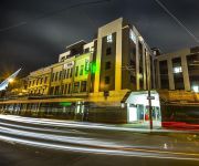
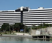
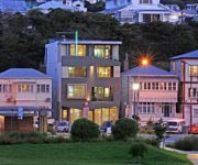
Hotels and Places to Stay
YHA Wellington City - Hostel
QT Museum Wellington Previously Museum Art Hotel
AMORA HOTEL WELLINGTON
At Home Wellington City
Apollo Lodge Motel
Ohtel
Quality Hotel Wellington
Gourmet Stay
The Setup on Dixon - Hostel
Southgate Motor Inn
Videos from this area
These are videos related to the place based on their proximity to this place.
Lightning Strikes Wellington Zephyrometer! (original)
Lightning Strikes Wellington Zephyrometer! 14 Aug 2014, 2;17pm Lightning Damage to Wellington Zephyrometer - https://www.youtube.com/watch?v=Tt1ou3zI3m4& ...
2014 Swindale Shield: Round Ten - Marist St Pats vs Wellington
Highlights from the round ten match between MSP and Wellington. Played at Hataitai Park on Wellington's Old Timers Day. msprugby.co.nz (c) Holden Bros. Media.
ContourHD 1080p Downhill, Mt. Victoria Wellington NZ
ContourHD 1080p Downhill, Mt. Victoria Wellington NZ. First test run of the new camera strapped to my helmet. Mad Mike Jones. Props Pro's. Riding a Giant Glory 8 Comp Maestro.
Downhill MTB - Half Damian's track, Mt Vic Wellington
A run down half Damien's track up Mt Vic in Wellington. Riding a Giant Glory DH0. Please excuse the rattles as I had a clamp loose on the mount which I didn't realise untill the end of...
Haunted Places - Mount Victoria Tunnel, Wellington New Zealand
http://www.thetraveltart.com/ Haunted Places - Mount Victoria Tunnel, Wellington New Zealand. The legend here was that a woman was murdered and buried within the tunnel foundations during the...
Club Rugby: Melting Moments #3 - Marist St Pats vs Oriental-Rongotai
Bite-sized clips of Wellington club rugby. Marist St Pats vs Oriental-Rongotai holdenbrosmedia.com.
2013 Ed Chaney Cup: Round Four - Marist St Pats vs Oriental Rongotai
The Red Machine: In Motion. The scoring plays from the Senior One match between Marist St Pats and Oriental Rongotai in the 2013 Ed Chaney Cup. Follow us on Facebook: facebook.com/msprugby...
2012 Swindale Shield: Round Six - Marist St Pats vs Oriental Rongotai
The Red Machine: In Motion. Highlights of the sixth round matchup between Marist St Pats and defending Jubilee Cup winners Oriental Rongotai in the 2012 Swindale Shield. This game was on Marist.
Hataitai Beach Wellington City
Right by Hataitai Beach, this a small, quiet and friendly place within Evans Bay just below the ridge of Hataitai. Also nearby, located at Rongotai, is Wellington Airport , as you can see,...
Hillbillies vs Flatliners - W4C State of Origin 2012
Highlights from the 2012 edition of the annual Hillbillies vs Flatliners "State of Origin" Rugby League match for the W4C Cup. The Hillbillies hail from the hills of Strathmore. The Flatliners...
Videos provided by Youtube are under the copyright of their owners.
Attractions and noteworthy things
Distances are based on the centre of the city/town and sightseeing location. This list contains brief abstracts about monuments, holiday activities, national parcs, museums, organisations and more from the area as well as interesting facts about the region itself. Where available, you'll find the corresponding homepage. Otherwise the related wikipedia article.
Wellington City
Wellington City Council is a territorial authority in the Wellington region of New Zealand. Wellington city extends as far north as Linden, and includes the rural areas of Makara and Ohariu. It is New Zealand's third-largest city, behind Auckland and Christchurch. Wellington attained city status in 1886. The settlement had become the capital of New Zealand in 1865, and since then has hosted New Zealand's Parliament and Government.
Berhampore, New Zealand
Berhampore is a suburb of Wellington, the capital city of New Zealand. It lies towards the south of the city, seven kilometres from the city centre, and two kilometres from the coast of Cook Strait. It is surrounded by the suburbs of Vogeltown, Newtown, Melrose, Island Bay, Kingston, and Mornington. The suburb was named after Berhampore in Bengal, one of the battlefields at the start of the Battle of Plassey of 1757.
Basin Reserve
The Basin Reserve (commonly known as "The Basin"), is a cricket ground in Wellington, New Zealand, used for Test, first-class and one-day cricket. Some argue that its proximity to the city, its Historic Place status and its age make it the most famous cricket ground in New Zealand. The Basin Reserve is the only cricket ground in New Zealand to have Historic Place status .
Gifford Observatory
The Gifford Observatory is an astronomical observation facility located in Mount Victoria, Wellington, New Zealand. Operated by the Gifford Observatory Trust with the intent of making it available for use to Wellington school children, it is primarily used by secondary school students, and members of the Wellington Astronomical Society.
Wellington East Girls' College
Wellington East Girls' College is on the lower slopes of Mount Victoria. It was built on reserve land bordering Wellington College in 1925, to cope with the demand for female education in Wellington at the time. By the end of the First World War, there were over 800 pupils at Wellington Girls’ High School in Thorndon, so a new school was founded on the other side of the city. The College primarily serves families of the eastern and southern suburbs and inner city Wellington.
Mount Victoria, Wellington
Mount Victoria, locally abbreviated to Mt. Vic, is a prominent hill (height 196 metres) to the east of the centre of Wellington, New Zealand, and its associated suburb. To the south of it is a spur, Mount Albert, and the two are linked by a ridge. Mount Victoria's original Māori name is Tangi Te Keo. The suburb of Mount Victoria is a mixture of residential and commercial activity on the western flank of the ridge above the southern end of the Wellington CBD, Te Aro.
St Mark's Church School
St Mark's Church School is the only independent Anglican co-educational school in Wellington, New Zealand for children aged from two (Early Childhood) to Year 8. The school is often seen on cricket match broadcasts from Basin Reserve. To its front is the modern, 1970s-era church building, the parish church to which the school is attached. A wooden church stood in its place prior to the 1970s' redevelopment.
Hataitai
Hataitai is an inner-city suburb of Wellington, the capital of New Zealand, 3.5 kilometres southeast of the city centre. The suburb extends over the southeastern flank of Mount Victoria and down a valley between the Town Belt and a ridge along the shoreline of Evans Bay. Hataitai is bounded by Hepara Street, Grafton Road and the suburb of Roseneath in the north, Wellington Harbour in the east, Cobham Drive, Wellington Road and Crawford Road in the south, and Alexandra Road in the west.
Oriental Bay
Oriental Bay is a suburb of Wellington, the capital city of New Zealand. Located close to the CBD on Wellington Harbour, it has the closest beaches to the central city and is thus a popular spot both for living and for visiting. Oriental Bay is situated against the northern slope of Mount Victoria, 1.5 kilometres southeast of the city centre, at the start of a coastal route which continues past Hataitai around Evans Bay.
BATS Theatre
BATS Theatre is New Zealand's leading venue for the development of new theatre practitioners and plays. Most of the productions at BATS Theatre are New Zealand works. Ninety per cent of its annual programme of 50 to 60 shows are New Zealand and world premieres. Despite its small size, BATS has a significant effect on the country's cultural landscape and complements the work of the other larger venues in the capital, Circa Theatre and Downstage Theatre.
Mount Victoria Tunnel
The Mount Victoria Tunnel in the New Zealand capital city of Wellington is 623 metres (slightly more than a third of a mile) long and 5 metres (16.4 ft) in height, connecting Hataitai to the centre of Wellington and the suburb of Mount Victoria, under the mount of the same name. It is part of State Highway 1.
Courtenay Place, Wellington
Courtenay Place is the main street of the Courtenay Quarter in the Wellington, New Zealand inner-city district of Te Aro. Courtenay Place is known for its entertainment and nightlife. Many restaurants are open late and most of the bars stay open until dawn. It contains offices, accommodation, tourist shopping, entertainment, food, art and buskers offering many genres of free performance. Pedestrian traffic is substantial around the clock.
St. Patrick's College, Wellington
St Patrick's College is the oldest Catholic boys' secondary school in New Zealand.
Wellington Hospital, New Zealand
Wellington Hospital is Wellington, New Zealand's main hospital located in the suburb of Newtown. It is the main hospital run by Capital & Coast District Health Board (C&CDHB), the others including Kapiti Health Centre, and Kenepuru Hospital.
Embassy Theatre, Wellington
The Embassy Theatre is a movie theatre in Wellington, New Zealand, located at the Eastern end of Courtenay Place in the shadow of Mt. Vic. Originally built in 1924 http://www. historic. org. nz/news/media_releases/2001_12_11. htm, the building has undergone a series of remodels and changes in ownership. It is currently owned by the Wellington City Council and temporarily administered by the Embassy Theatre Trust.
Downstage Theatre
The Downstage Theatre is a theatre in Wellington, New Zealand, and the country's longest running professional theatre, established in 1964. The founders at the inaugural meeting in the Wellington Public Library on 15 May 1964 were actors Peter Bland, Tim Elliott and Martyn Sanderson, with restauranteur Harry Seresin for the business arrangements. Sanderson believed in a small professional company in Wellington performing challenging works in an intimate venue.
Zephyrometer
The Zephyrometer is a civic sculpture by Evans Bay, Wellington. It was made by Christchurch artist Phil Price and installed in 2003. It is a kinetic sculpture consisting of a concrete cylinder holding a 26m tall needle which sways to show wind direction and speed (Wellington is known to Kiwis as "Windy Wellington"). The needle consists of fiberglass exterior around a wooden framework.
Kilbirnie, New Zealand
Kilbirnie (from Scottish Gaelic: Cille Bhraonaidh), a suburb of Wellington in New Zealand, lies 3 kilometers to the south-east of the city centre. Travellers can reach Kilbirnie from the Wellington central business district either via the Mount Victoria Tunnel and Hataitai; over Mount Victoria; or around the coast. Kilbirnie sits on the eastern flank of the ridge which becomes Mount Victoria and on the flat of the Rongotai isthmus between Evans Bay to the north and Lyall Bay to the south.
Museum Hotel de Wheels
The Museum Art Hotel is located in Wellington, New Zealand. It is one of the largest buildings to have been moved from one site to another. Weighing an estimated 3500 tonnes, this reinforced concrete building was moved from its original site, now the location of the Museum of New Zealand Te Papa Tongarewa to a site some 180 metres down and across a major road. The relocation started in May 1993 and was completed just over five months later.
St Catherine's College, Wellington
St Catherine's College, a Catholic secondary school for girls, operates in the Wellington suburb Kilbirnie in New Zealand. It was founded in 1950 by the Sisters of Mercy. There was formerly a primary school on the site opened by the Sisters of Mercy in 1918. On 30 March 1983, St Catherine's College became an integrated school under the Private Schools Conditional Integration Act of 1975. The Board of Trustees was first elected in 1989 and is responsible for the governance of the College.
Former Post and Telegraph Building, Wellington
The Former Post and Telegraph Building is a building located in Wellington, New Zealand. The building, located on Herd Street, was designed by Edmund Anscombe and built in 1939. It originally had two full-size tennis courts on the roof. The courts were later demolished to make way for a sixth storey. The building ceased being used as the post office in the late 1980s and is currently a mix of apartments, restaurants and shops.
Belvedere (Wellington)
The Belvedere is a four storied concrete apartment building in Wellington, New Zealand. Edmund Anscombe designed the art deco building in 1937, and it was constructed the same year. Located at 82 Majoribanks St, Mount Victoria, Wellington, Belvedere has nine apartments spread over three floors, with ground floor garages.
Elliott House, Wellington
Elliott House is a historic building in Wellington, New Zealand. The house was built for James Sands Elliott, a medical professional, in 1913. The north side served as the family residence, while the Kent Terrace side served as his consultancy room and surgery. The building was renovated in 1988. The building, is classified as a "Category I" ("places of special or outstanding historical or cultural heritage significance or value") historic place by the New Zealand Historic Places Trust.
Newtown, New Zealand
The suburb of Newtown lies in the southern part of Wellington in New Zealand. The population at the last census (2006) was recorded as 8,409. The suburb lies east of Vogeltown, between Mount Cook and Berhampore. The main thoroughfares of Newtown are Riddiford St. , leading from Mount Cook to Berhampore and Melrose, and Constable St. , leading from Newtown to Kilbirnie.
Te Aro Railway Station
Te Aro Railway Station was a station in Wellington, New Zealand, near the corner of Wakefield and Tory Streets. It was the terminus of the short-lived Te Aro Extension of the Hutt Valley Line and Wairarapa Line, opened in 1893, which can also be regarded as a branch line. The line was provided to extend Wellington passenger services through the centre of the Wellington CBD from the main Lambton Railway Station on the northern side of Wellington.


