Safety Score: 3,0 of 5.0 based on data from 9 authorites. Meaning we advice caution when travelling to New Zealand.
Travel warnings are updated daily. Source: Travel Warning New Zealand. Last Update: 2024-04-18 08:12:24
Explore Cashmere
The district Cashmere of Wellington in Wellington City (Wellington) is located in New Zealand and is a district of the nations capital.
If you need a place to sleep, we compiled a list of available hotels close to the map centre further down the page.
Depending on your travel schedule, you might want to pay a visit to some of the following locations: Blenheim, Palmerston North, Nelson, Richmond and New Plymouth. To further explore this place, just scroll down and browse the available info.
Local weather forecast
Todays Local Weather Conditions & Forecast: 15°C / 59 °F
| Morning Temperature | 13°C / 55 °F |
| Evening Temperature | 14°C / 57 °F |
| Night Temperature | 14°C / 58 °F |
| Chance of rainfall | 0% |
| Air Humidity | 67% |
| Air Pressure | 1014 hPa |
| Wind Speed | Moderate breeze with 13 km/h (8 mph) from South |
| Cloud Conditions | Few clouds, covering 17% of sky |
| General Conditions | Few clouds |
Friday, 19th of April 2024
15°C (59 °F)
13°C (56 °F)
Scattered clouds, fresh breeze.
Saturday, 20th of April 2024
16°C (61 °F)
11°C (52 °F)
Overcast clouds, gentle breeze.
Sunday, 21st of April 2024
15°C (59 °F)
14°C (57 °F)
Scattered clouds, moderate breeze.
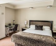
Hotels and Places to Stay
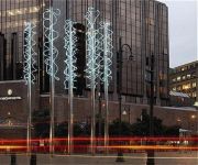
InterContinental Hotels WELLINGTON
Bolton Hotel
Sofitel Wellington
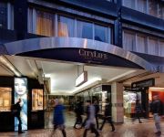
CITYLIFE WELLINGTON
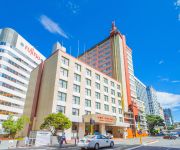
JAMES COOK GRAND CHANCELLOR
Park Hotel Lambton Quay
Novotel Wellington
DoubleTree by Hilton Wellington
Quest on Thorndon
QUEST ON THE TERRACE SERVICED APTS
Videos from this area
These are videos related to the place based on their proximity to this place.
Licensed Building Practicioner CJ Duff Construction Khandallah Wellington phone 04 4793444 video
http://wellington-builders.com/ Welcome to Wellington Builders At C. J. Duff Construction in Khandallah, Wellington, you always get expert advice even before your whole building project starts....
Ngauranga Gorge, Wellington, New Zealand.
State Highway 1 runs through the gorge, a vital link between Wellington City and the Kapiti Coast and the main route north out of Wellington. It is 2 kilometres long and has a grade of approximatel...
Flight Auckland to Dunedin
I was early at the Auckland Domestic Terminal, so I indulged in getting videos from the goings-on on the tarmac outside the departing lounge. The flight took me first to Wellington, then on...
Wellington Harbour From the Mt Kau Kau foothills
Wellington Harbour is off Cook Strait, covering some 76 km², 7600 hectares with a two-km wide entrance at its southern end between Pencarrow Head and Palmer Head on the tip of Miramar Peninsula.
View to Wellington from Mount Kaukau, New Zealand
http://en.wikipedia.org/wiki/Mount_Kaukau Mount Kaukau is in Wellington, New Zealand on the western side of Wellington harbour near Johnsonville and Khandallah. The summit is 445 metres above...
Tranz Metro FP/FT class EMU depart from Johnsonville station
Johnsonville Lines commuter train "Matangi" departing. This train bound for Wellington. トランツメトロ・ジョンソンビル線ウェリントン行き普通列車が出発する。車両...
Drive from Wellington to Mana on SH1 timelapse
From Wellington Central to Mana in under 3 minutes(time lapse, all legal :-) Filmed with a GoPro camera and sped up in post.
Mount Kaukau television transmitter closer look
Mount Kaukau television transmitter. The summit is 445 metres above sea level and is the most visible high point in the Wellington landscape further accentuated by Wellington's main television...
Videos provided by Youtube are under the copyright of their owners.
Attractions and noteworthy things
Distances are based on the centre of the city/town and sightseeing location. This list contains brief abstracts about monuments, holiday activities, national parcs, museums, organisations and more from the area as well as interesting facts about the region itself. Where available, you'll find the corresponding homepage. Otherwise the related wikipedia article.
Fort Buckley
The remains of Fort Buckley, in Wellington, New Zealand, overlook the Interislander ferry terminal. The fort was built in 1885, and included two rifled muzzle loading guns, which had a range of about three kilometres. During World War 2 an anti-aircraft gun was installed. Today the concrete foundations of the two RML guns remain, but the anti-aircraft gun's location is harder to spot.
Johnsonville, New Zealand
Johnsonville is a large suburb in northern Wellington, New Zealand. It is seven kilometres north of the city centre, at the top of the Ngauranga Gorge, on the main route to Porirua. The population of "J'ville" (as it is commonly known) was about 6,500 at the 2001 census.
Onslow College
Onslow College is a decile‑10 co-educational state secondary school located in Johnsonville, a suburb of Wellington, New Zealand. The school opened in 1956 to serve the city's rapidly growing northern suburbs. The current principal is Mr Peter Leggat.
Khandallah
Khandallah is a suburb of Wellington, the capital city of New Zealand. It is located four kilometres northeast of the city centre, on hills overlooking Wellington Harbour. The suburb's name, which means "Resting place of God", comes from a homestead built in the area in 1884 by Captain James Andrew, who had recently returned from duty in India. For this reason the suburb and those surrounding it have many place names connected with the Indian subcontinent.
Ngaio, New Zealand
Ngaio is an inner suburb of Wellington, the capital city of New Zealand. It is situated on the slopes of Mount Kaukau, 3500 metres north of the city's CBD. It was settled at the same time as the neighbouring suburb of Khandallah, and like its neighbour many of its streets are named after places on the Indian subcontinent. Ngaio was originally a logging community.
Mount Kaukau
Mount Kaukau, also known as Tarikaka, is in Wellington, New Zealand on the western side of Wellington harbour near Johnsonville and Khandallah. The summit is 445 metres above sea level and is the most visible high point in the Wellington landscape further accentuated by Wellington's main television transmitter tower the Kordia TV transmitter mast, which stands a little over 100m tall. There is also a compass pedestal placed at the top.
Newlands, New Zealand
Newlands is one of the northern suburbs of Wellington, New Zealand. It lies approximately 8km north of the city centre and to the east of its nearest neighbour Johnsonville. Newlands is located in a valley and covers two ridgelines, the side of one of which overlooks Wellington Harbour and up to the Hutt Valley. This leaves many of the houses exposed to either the cold southerly or the predominant north-westerly winds, or both, that Wellington is known for.
Churton Park
Churton Park is a suburb located 1.5 km north of Johnsonville in the Northern Suburbs district of Wellington, the capital city of New Zealand. It was established in the 1970s, and as of 2009 has a population of 6,260 residents. The suburb includes over 1500 households, 'Churton Park' (a recreational sports field), two primary schools and a kindergarten. A local community center with shops is planned and construction began in February 2011.
Ngauranga Gorge
The Ngauranga Gorge is in the Wellington Region of New Zealand. State Highway 1 runs through the gorge, a vital link between Wellington City and the Kapiti Coast and the main route north out of Wellington. It is 2 kilometres long and has a grade of approximately 8%. 65,000 vehicles a day travel through it, and it connects the Wellington Urban Motorway with the Johnsonville–Porirua Motorway. The road up the gorge was upgraded in 1940 as the Centennial Highway.
Kaiwharawhara Railway Station
Kaiwharawhara railway station is a dual island platform railway station on the North Island Main Trunk (NIMT) and the Wairarapa Line in Wellington, New Zealand. It is the first station north of Wellington, and is served by trains operated by Tranz Metro as part of the Metlink network on the Melling Line, the Hutt Valley Line and the Kapiti Line. Three diesel-hauled carriage trains, the Wairarapa Connection, Capital Connection and Overlander services pass through the station but do not stop.
Ngauranga
Ngauranga is a suburb of New Zealand's capital city, Wellington, in the lower North Island. Situated on the western bank of Wellington Harbour, it lies to the north of the centre of the city. It is a Maori name meaning "the landing place", and the original spelling was "Nga-Uranga". The Ngauranga Railway Station was known as "Ngahauranga" when it opened in 1874. It is lightly populated, and for statistical purposes is divided into Ngauranga East and Ngauranga West by Statistics New Zealand.
Ngauranga Railway Station
Ngauranga railway station is a single island platform railway station in the mainly industrial and commercial suburb of Ngauranga on the Wairarapa Line in Wellington, New Zealand. It is served by the trains of the Melling Line and Hutt Valley Line of the Wellington suburban rail network. Wairarapa Connection trains pass this station but do not stop. All trains are run by KiwiRail under the Tranz Metro brand as part of the Metlink network.
Kaiwharawhara
Kaiwharawhara, formerly known as Kaiwarra, is an urban seaside suburb of Wellington in New Zealand's North Island. It is located north of the centre of the city on the western shore of Wellington Harbour, where the Kaiwharawhara Stream reaches the sea from its headwaters in Karori. It is a largely commercial and industrial area and thus has little residential population. The 2001 New Zealand Census of Population and Dwellings gave the suburb's resident population as merely 15.
Kaiwharawhara Stream
The Kaiwharawhara Stream is a stream located in the North Island of New Zealand on the northwestern side of the national capital, Wellington. Its headwaters are within the suburb of Karori and it passes through other suburbs before reaching the western shore of Wellington Harbour in Kaiwharawhara near the terminal of the Interislander Ferry.
Ngaio Railway Station
|} Ngaio Railway Station is one of eight railway stations on the Johnsonville Branch, a commuter branch railway north of Wellington in New Zealand’s North Island, and serves the suburb of Ngaio. The station was erected and operated by the Wellington and Manawatu Railway Company (WMR) on their line from Wellington to Longburn. The area served by this station used to be called Crofton, until the suburb was renamed to Ngaio in 1908.
Awarua Street Railway Station
Awarua Street railway station is one of eight stations on the Johnsonville Branch, a branch railway north of Wellington in New Zealand’s North Island, and serves the suburb of Ngaio. It is one of two stations that were added to the line when it was upgraded prior to being reopened as the Johnsonville Branch, and one of the four stations on the line to be located on a curve.
Simla Crescent Railway Station
Simla Crescent railway station is one of eight stations on the Johnsonville Branch, a branch railway north of Wellington in New Zealand’s North Island, and is one of two stations that were added to the line when it was upgraded prior to being reopened as the Johnsonville Branch. It serves the suburbs of Ngaio and Te Kainga.
Box Hill Railway Station, Wellington
Box Hill railway station is one of eight stations on the Johnsonville Branch, a commuter branch railway north of Wellington in New Zealand's North Island. It serves the suburbs of Khandallah and Te Kainga. It is the only station on the line to be set below street level, and one of four on the line which is on a curve.
Khandallah Railway Station
Khandallah railway station is one of eight stations on the Johnsonville Line, a commuter branch railway north of Wellington in New Zealand’s North Island. The station was erected and operated by the Wellington and Manawatu Railway Company (WMR) on their line from Wellington to Longburn. From the acquisition of the WMR by the New Zealand Railways Department in 1908 until the opening of the Tawa Flat deviation in 1937, the station was on the North Island Main Trunk Railway.
Raroa Railway Station
|} Raroa Railway Station is one of eight stations on the Johnsonville Branch, a commuter branch railway north of Wellington in New Zealand's North Island. It serves the suburbs of Raroa and Broadmeadows, and is one of four stations on the line to be located on a curve. Electric multiple unit trains are operated by Tranz Metro under the Metlink brand through this station in both directions to Johnsonville (to the north) and Wellington (to the south).
Johnsonville Railway Station
Johnsonville railway station is the terminus of the Johnsonville Line, one of eight stations on the commuter branch railway north of Wellington in New Zealand’s North Island. It serves the suburb of Johnsonville, and as a bus interchange attracts traffic from other suburbs to the north and east. The station is beside Johnsonville Mall, a major regional shopping centre, which incorporates a Countdown supermarket.
Ngauranga Interchange
The Ngauranga Interchange is a major interchange in the suburb of Ngauranga, in Wellington City, New Zealand. The Ngauranga interchange connects State Highways 1 and 2 with each other, and also allows traffic to connect to Hutt Road, for access to the interisland ferry terminals. The majority of traffic in and out of Wellington City use this interchange. It is the southern terminus of State Highway 2.
Chew Cottage
Chew Cottage is an historic building in Wellington, New Zealand. The house, originally named "Millwood", was built in 1865 for John and Ester Chew. The cottage is one of Wellington's remaining houses from the 1860s. It resembles a traditional English stone cottage adapted for timber construction. The building, is classified as a "Category I" ("places of special or outstanding historical or cultural heritage significance or value") historic place by the New Zealand Historic Places Trust.
Daisy Hill Farm House
Daisy Hill Farm House is a historic building in Johnsonville, Wellington, New Zealand. The house was built in about 1860 for Robert Bould, a pioneer farmer. He came to New Zealand with the New Zealand Company in the early 1840s and bought land, for a sheep farm, in Johnsonville in 1853. Built in a simplified Georgian style it is one of the few remaining houses of this type in Wellington.
Churton Park School
Churton Park School is a primary school in Wellington, the capital city of New Zealand. It will be one of two primary schools in Churton Park when Amesbury Drive School opens in 2012.


