Safety Score: 3,0 of 5.0 based on data from 9 authorites. Meaning we advice caution when travelling to Germany.
Travel warnings are updated daily. Source: Travel Warning Germany. Last Update: 2024-04-28 08:22:10
Touring Elbingen
The district Elbingen of Elbingen-Mähren in Rhineland-Palatinate with it's 289 residents Elbingen is a subburb located in Germany about 274 mi south-west of Berlin, the country's capital place.
Need some hints on where to stay? We compiled a list of available hotels close to the map centre further down the page.
Being here already, you might want to pay a visit to some of the following locations: Haertlingen, Kaden, Kolbingen, Brandscheid and Meudt. To further explore this place, just scroll down and browse the available info.
Local weather forecast
Todays Local Weather Conditions & Forecast: 13°C / 55 °F
| Morning Temperature | 5°C / 42 °F |
| Evening Temperature | 14°C / 58 °F |
| Night Temperature | 9°C / 49 °F |
| Chance of rainfall | 0% |
| Air Humidity | 68% |
| Air Pressure | 1022 hPa |
| Wind Speed | Gentle Breeze with 6 km/h (4 mph) from North-West |
| Cloud Conditions | Broken clouds, covering 78% of sky |
| General Conditions | Light rain |
Tuesday, 30th of April 2024
19°C (67 °F)
13°C (55 °F)
Light rain, gentle breeze, scattered clouds.
Wednesday, 1st of May 2024
21°C (69 °F)
13°C (55 °F)
Moderate rain, gentle breeze, overcast clouds.
Thursday, 2nd of May 2024
12°C (54 °F)
8°C (47 °F)
Light rain, gentle breeze, overcast clouds.
Hotels and Places to Stay
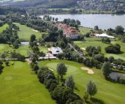
Lindner Hotel & Sporting Club Wiesensee
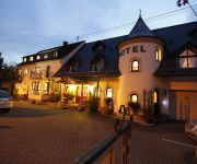
Ringhotel Villa Moritz Landhotel
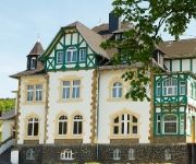
Alte Landratsvilla Bender
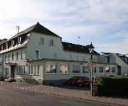
St. Hubertus
Serways Hotel Heiligenroth
Corner‘s Inn
Videos from this area
These are videos related to the place based on their proximity to this place.
Einfahrt Sonderzug mit Dampflok 50 3708-0
Einfahrt eines Dampfsonderzuges mit der Dampflok 50 3708-0 von Limburg an der Lahn nach Westerburg (Westerwald) in Westerburg. Aufgrund nasser Schienen und leichter Steigung, schleuderte ...
Oktoberfest Härtlingen mit den Tiroler Alpenbummlern
Feuerwehr Härtlingen: http://www.ff-haertlingen.de/ Die Feuerwehr bei facebook: https://www.facebook.com/ffhaertlingen Original Tiroler Alpenbummler: http://www.alpenbummler.at/ Karnevalsverein...
Westerwälder Visionen - die Westerburger Querbahn und ihre Bundeswehr-Loks
Die glorreichen Zeiten der Westerwald Querbahn liegen schon fast ein halbes Jahrhundert zurück -- damals rollten Güter-Dampfloks mit den Schätzen des Westerwaldes -- Basalt, Schiefer --...
Bilder eines Spazierganges Dornburg- Thalheim Molsberg,,Salz,Thalheim
Oktober 2010, tolle Aussichten im Westerwald.
KANUPROJEKT Clip 6: LAHN-Tour Tag 4 - made bei kanukassel
Meine legendären, erlebnispädagogischen Kanuprojekte auf der LAHN bestehen standardmäßig aus 8 Tagen mit 7 Zeltübernachtungen. Dieser Clip 6 dokumentiert den 4. Projekttag vom Zeltplatz...
KANUPROJEKT Clip 11 LAHN-Tour - Tag 8: FINALE am Rhein - made bei kanukassel.mpg
Tag 8 des legendären KANUPROJEKTS von kanukassel auf der LAHN. Es ist das Ende des 15-jährigen Projektjubiläums, aber noch nicht das Ende von kanukassel und seinen erlebnispädagogischen ...
Winter 2010 im Westerwald/Westerburg - Foto+Film
Ein Paar Winterbilder aus dem verschneiten Westerwald.Aufgenommen im Januar 2010 in Westerburg.Viel Spass :)
Abwehr gegen den Schwinger
Hier ein kleiner Ausschnitt aus unserem Reality - Self - Defense (RSD) Training. Viel Spaß dabei!
Videos provided by Youtube are under the copyright of their owners.
Attractions and noteworthy things
Distances are based on the centre of the city/town and sightseeing location. This list contains brief abstracts about monuments, holiday activities, national parcs, museums, organisations and more from the area as well as interesting facts about the region itself. Where available, you'll find the corresponding homepage. Otherwise the related wikipedia article.
Westerwaldkreis
The Westerwaldkreis is a district (Kreis) in the east of Rhineland-Palatinate, Germany. Neighbouring districts are (from north clockwise) Altenkirchen, Lahn-Dill, Limburg-Weilburg, Rhein-Lahn, the district-free city Koblenz, Mayen-Koblenz and Neuwied.
Hadamar Euthanasia Centre
The Hadamar Euthanasia Centre was a psychiatric hospital in the German town of Hadamar. It was used by the Nazis as a site of the T-4 Euthanasia Programme, which performed mass sterilizations and mass murder of "undesirable" members of German society, specifically those with physical and mental disabilities. The programme started in 1939 and lasted until the German surrender in 1945.
Römer 2-4-6
The Römer 2-4-6 is a Gothic timbered house constructed in 1289. It is located in the historical old German town of Limburg an der Lahn. In its garden, a mikvah was found. \t\t \t\t\tLimburg Römer246 1. jpg \t\t\t \t\t\t \t\t \t\t \t\t\tLimburg Römer246 2. jpg
Limburg Cathedral
The Catholic Cathedral of Limburg, also known as Georgsdom or Limburger Dom in German after its dedication to Saint George, is located above the old town of Limburg in Hesse, Germany. Its high location on a rock above the Lahn provides its visibility from far away. The building is one of the most accomplished buildings of the late Romanesque style.
Montabaur station
Montabaur is a railway station in Montabaur, Germany, situated on the Cologne-Frankfurt high-speed rail line. The station consists of three platform tracks, two through tracks and five shunting tracks.
Niederhadamar
Niederhadamar is a German village belonging to the municipality of Hadamar, with 4,000 inhabitants. It is located between several other communities: Elz to the south, Hundsangen to the west, Hadamar to the north, and Offheim to the east. There is also a forest to the west of the city. Niederhadamar has two kindergartens, one Protestant and one Catholic, and a Catholic church, St. Peter's. It also has a school with an enrollment of approximately 2000 pupils as well as a ground school.
Diez (Verbandsgemeinde)
Diez is a Verbandsgemeinde ("collective municipality") in the Rhein-Lahn-Kreis, in Rhineland-Palatinate, Germany. Its seat is in Diez. The Verbandsgemeinde Diez consists of the following Ortsgemeinden ("local municipalities"):
Bad Marienberg (Verbandsgemeinde)
Bad Marienberg (Westerwald) is a Verbandsgemeinde ("collective municipality") in the district Westerwaldkreis, in Rhineland-Palatinate, Germany. The seat of the Verbandsgemeinde is in Bad Marienberg. The Verbandsgemeinde Bad Marienberg (Westerwald) consists of the following Ortsgemeinden ("local municipalities"):
Hachenburg (Verbandsgemeinde)
Hachenburg is a Verbandsgemeinde ("collective municipality") in the district Westerwaldkreis, in Rhineland-Palatinate, Germany. The seat of the Verbandsgemeinde is in Hachenburg. The Verbandsgemeinde Hachenburg consists of the following Ortsgemeinden ("local municipalities"):
Montabaur (Verbandsgemeinde)
Montabaur is a Verbandsgemeinde ("collective municipality") in the district Westerwaldkreis, in Rhineland-Palatinate, Germany. The seat of the Verbandsgemeinde is in Montabaur. The Verbandsgemeinde Montabaur consists of the following Ortsgemeinden ("local municipalities"):
Rennerod (Verbandsgemeinde)
Rennerod is a Verbandsgemeinde ("collective municipality") in the district Westerwaldkreis, in Rhineland-Palatinate, Germany. The seat of the Verbandsgemeinde is in Rennerod. The Verbandsgemeinde Rennerod consists of the following Ortsgemeinden ("local municipalities"):
Selters (Verbandsgemeinde)
Selters (Westerwald) is a Verbandsgemeinde ("collective municipality") in the district Westerwaldkreis, in Rhineland-Palatinate, Germany. The seat of the Verbandsgemeinde is in Selters. The Verbandsgemeinde Selters (Westerwald) consists of the following Ortsgemeinden ("local municipalities"):
Westerburg (Verbandsgemeinde)
Westerburg is a Verbandsgemeinde ("collective municipality") in the district Westerwaldkreis, in Rhineland-Palatinate, Germany. The seat of the Verbandsgemeinde is in Westerburg. The Verbandsgemeinde Westerburg consists of the following Ortsgemeinden ("local municipalities"):
Wirges (Verbandsgemeinde)
Wirges is a Verbandsgemeinde ("collective municipality") in the district Westerwaldkreis, in Rhineland-Palatinate, Germany. The seat of the Verbandsgemeinde is in Wirges. The Verbandsgemeinde Wirges consists of the following Ortsgemeinden ("local municipalities"): Bannberscheid Dernbach Ebernhahn Helferskirchen Leuterod Mogendorf Moschheim Niedersayn Ötzingen Siershahn Staudt
Roman Catholic Diocese of Limburg
The Diocese of Limburg is a diocese of the Roman Catholic Church in Germany. It was erected in 1821 from the Diocese of Trier and is a suffragan of the Archdiocese of Cologne. The Holy Cross Church in Bornheim, Frankfurt am Main, is a part of the diocese. The current bishop is Franz-Peter Tebartz-van Elst who was appointed in 2007.
Wiesensee
The Wiesensee is an artificial lake, dammed up in 1971, in the Westerwald low mountain range. The lake covers about 80 hectares and lies in the area of Stahlhofen am Wiesensee's various centres on the lake's west shore, and Pottum on the north shore in the Westerwaldkreis. The community of Winnen borders on the lake to the southeast. The lake is a nature conservation area, and only parts of the water surface are open for recreational use. It is a holiday and tourist destination.
Aar (Lahn)
The Aar is a 60 km-long river in western Germany, left tributary of the Lahn. It rises in the Taunus mountains, near Taunusstein. It flows generally north through the towns Taunusstein, Bad Schwalbach, Aarbergen and Hahnstätten. It flows into the Lahn in Diez.
Limburg Airfield
Limburg Airfield is an abandoned World War II military airfield located in Germany approximately 2 miles north-northwest of Limburg an der Lahn (Hessen); approximately 275 miles southwest of Berlin. The airfield was built by the Luftwaffe in 1944 to protect the Limburg railroad marshalling yards from aerial attack by Eighth Air Force heavy bombers. It was captured in late March 1945 by American forces, one of the first airfields to be taken by the Americans east of the Rhine River.
Limburg (Lahn) station
Limburg (Lahn) station is a station of the city of Limburg an der Lahn in the German state of Hesse. It is on the Lahn Valley Railway, running between Koblenz and Gießen. The only section of this that is electrified in the Limburg area is between Limburg freight yard and Eschhofen station. At the west end of station a two-track branch line branches off towards Staffel, where it separates into two single-track lines to Siershahn and to Au (Sieg).
5th Panzer Division (Bundeswehr)
The 5th Armoured Division (5. Panzer-Division) was a West German armored formation. It was part of the III Corps of the Bundeswehr, which also incorporated in 1985 the 2nd Panzergrenadier Division and 12th Panzer Division. III Corps was part of NATO's Central Army Group (CENTAG), along with the Bundeswehr's II Corps and the American V and VII Corps.
Elzer Berg
Elzer Berg is a mountain of Hesse, Germany.
Elbbach (Lahn)
Elbbach is a river of Hesse, Germany.
Erbach (Blies)
Erbach (Blies) is a river of Saarland, Germany.


