Safety Score: 3,0 of 5.0 based on data from 9 authorites. Meaning we advice caution when travelling to Germany.
Travel warnings are updated daily. Source: Travel Warning Germany. Last Update: 2024-04-27 08:23:39
Discover Langhecke
Langhecke in Regierungsbezirk Gießen (Hesse) is a town in Germany about 266 mi (or 427 km) south-west of Berlin, the country's capital city.
Current time in Langhecke is now 07:34 PM (Saturday). The local timezone is named Europe / Berlin with an UTC offset of 2 hours. We know of 7 airports near Langhecke, of which 3 are larger airports. The closest airport in Germany is Wiesbaden Army Airfield in a distance of 23 mi (or 38 km), South. Besides the airports, there are other travel options available (check left side).
There are several Unesco world heritage sites nearby. The closest heritage site in Germany is Upper Middle Rhine Valley in a distance of 30 mi (or 48 km), South-West. We discovered 2 points of interest in the vicinity of this place. Looking for a place to stay? we compiled a list of available hotels close to the map centre further down the page.
When in this area, you might want to pay a visit to some of the following locations: Weinbach, Villmar, Lohnberg, Waldems and Gravenwiesbach. To further explore this place, just scroll down and browse the available info.
Local weather forecast
Todays Local Weather Conditions & Forecast: 18°C / 64 °F
| Morning Temperature | 6°C / 43 °F |
| Evening Temperature | 17°C / 62 °F |
| Night Temperature | 12°C / 53 °F |
| Chance of rainfall | 0% |
| Air Humidity | 62% |
| Air Pressure | 1008 hPa |
| Wind Speed | Moderate breeze with 9 km/h (6 mph) from North-East |
| Cloud Conditions | Overcast clouds, covering 100% of sky |
| General Conditions | Light rain |
Sunday, 28th of April 2024
17°C (62 °F)
9°C (48 °F)
Overcast clouds, moderate breeze.
Monday, 29th of April 2024
13°C (55 °F)
12°C (53 °F)
Light rain, light breeze, overcast clouds.
Tuesday, 30th of April 2024
21°C (70 °F)
15°C (58 °F)
Light rain, gentle breeze, broken clouds.
Hotels and Places to Stay
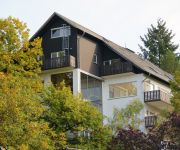
Seminarhaus am Liebfrauenberg
Videos from this area
These are videos related to the place based on their proximity to this place.
Lahnbrücke bei Gräveneck via Quadrocopter Drohne
Gräveneck, Gemeinde Weinbach im Landkreis Limburg-Weilburg in Hessen. Lahnbrücke L3452. DJI Quadcopter + GoPro Hero3 Cam.
Ritterspiele Freienfels 2009 - Schwenk vom Burgfried
Ritterspiele Freienfels 2009 - Schwenk vom Burgfried.
Die Cratzer in Freienfels - 2009
Die Cratzer in Freienfels - 29. April - 03. Mai 2009. Schwertkampfgruppe lagert bei den Freienfelser Ritterfestspielen. Lager- und Kampfszenen mit Wach-und Knappenerhebung. - Schnitt: Björn...
Das Sandmännchen auf Weltreise in Rostock - Januar 2014 | www.Laura21.de
Abonnieren nicht vergessen! ◅ □ Facebook : http://www.facebook.com/MinnimisWelt21 □ Google Plus: http://plus.google.com/+Laura21Deutschland □ Twitter: http://twitter.com/DownSyndrom21...
Videos provided by Youtube are under the copyright of their owners.
Attractions and noteworthy things
Distances are based on the centre of the city/town and sightseeing location. This list contains brief abstracts about monuments, holiday activities, national parcs, museums, organisations and more from the area as well as interesting facts about the region itself. Where available, you'll find the corresponding homepage. Otherwise the related wikipedia article.
Koberg (Taunus)
Koberg (Taunus) is a mountain of Hesse, Germany.


