Safety Score: 3,0 of 5.0 based on data from 9 authorites. Meaning we advice caution when travelling to Germany.
Travel warnings are updated daily. Source: Travel Warning Germany. Last Update: 2024-05-01 08:01:32
Explore Oberlauchringen
The district Oberlauchringen of Lauchringen in Freiburg Region (Baden-Württemberg) is located in Germany about 407 mi south-west of Berlin, the country's capital.
If you need a place to sleep, we compiled a list of available hotels close to the map centre further down the page.
Depending on your travel schedule, you might want to pay a visit to some of the following locations: Bad Zurzach, Wutoeschingen, Uhlingen-Birkendorf, Weilheim and Eggingen. To further explore this place, just scroll down and browse the available info.
Local weather forecast
Todays Local Weather Conditions & Forecast: 10°C / 49 °F
| Morning Temperature | 12°C / 54 °F |
| Evening Temperature | 9°C / 48 °F |
| Night Temperature | 8°C / 47 °F |
| Chance of rainfall | 20% |
| Air Humidity | 97% |
| Air Pressure | 1006 hPa |
| Wind Speed | Gentle Breeze with 8 km/h (5 mph) from East |
| Cloud Conditions | Overcast clouds, covering 100% of sky |
| General Conditions | Heavy intensity rain |
Friday, 3rd of May 2024
11°C (52 °F)
7°C (45 °F)
Light rain, gentle breeze, overcast clouds.
Saturday, 4th of May 2024
15°C (59 °F)
9°C (49 °F)
Light rain, light breeze, broken clouds.
Sunday, 5th of May 2024
12°C (54 °F)
10°C (51 °F)
Light rain, gentle breeze, overcast clouds.
Hotels and Places to Stay
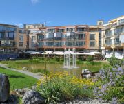
Park-Hotel
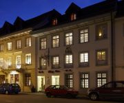
Bercher
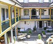
Private-Apartments
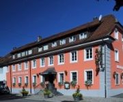
Zur Post
Tenedo Swiss Quality Hotel
Zur Waag
zur Therme Swiss Quality Hotel
Zurzacherhof Swiss Quality Hotel
Brauerei Walter
Wasserstelz
Videos from this area
These are videos related to the place based on their proximity to this place.
Umzug Schwerzen 2012
Fasnacht in Schwerzen. Wieder einmal war der Umzug der freien Narrenzunft der Gwaagen einer der schönsten Umzüge am Hochrhein. Diesmal zeigen wir die besten Bilder vor der Kulisse der ...
Desenchante - Kohlrütti - Chlöpfer Horre - Schwerzen 2013
Die Guggenmusik Kohlrütti Chlöpfer Horre e.V. - die Rüttis - am Umzug in Schwerzen 2013 http://guggenmusik-horheim.de/
Hundebox
Der Transport der geliebten Vierbeiner gestaltet sich ohne eine solche Vorrichtung schwierig. Das Tier hat einen ganz anderen Halt, vor allem bei einem Unfall sind das Tier sowie die anderen...
Walking on Sunshine - Kohlrütti - Chlöpfer Horre - Schwerzen 2013
Die Guggenmusik Kohlrütti Chlöpfer Horre e.V. - die Rüttis - am Umzug in Schwerzen 2013 http://guggenmusik-horheim.de/
Joints - general tips
When riveting, ensure that the pieces being riveted are laid on top of each other in exactly the same plane. When welding you must use a welding shield or welding goggles to protect your eyes...
Bunter Abend 2009 Vereinsgemeinschaft Horheim Schwerzen
Bunter Abend der Vereinsgemeinschaft Horheim Schwerzen am 6.2. und 7.2.2009. Es waren wieder 2 schöne Abende. Es ist toll, was diese engagierte Gemeinschaft wieder auf die Beine gestellt hat....
Africa - Kohlrütti - Chlöpfer Horre - Schwerzen 2013
Die Guggenmusik Kohlrütti Chlöpfer Horre e.V. - die Rüttis - am Umzug in Schwerzen 2013 http://guggenmusik-horheim.de/
Kohlrütti Chlöpfer 2010, Der Film
Die Kohlrütti Chlöpfer beim Umzug in Schwerzen. Fetter Sound, tolle Show. Immer wieder sehenswert.
Polonaise der Hexen vom TV Rheinheim beim Küssaberger Narrentreffen
Bei herrlichem Wetter fand das 33. Küssaberger Narrentreffen am Sonntag, 6.3.2011 in Rheinheim statt. Mit dabei waren auch dieses Mal die Frauen des TV Rheinheim mit ihren tollen Kostümen.
Videos provided by Youtube are under the copyright of their owners.
Attractions and noteworthy things
Distances are based on the centre of the city/town and sightseeing location. This list contains brief abstracts about monuments, holiday activities, national parcs, museums, organisations and more from the area as well as interesting facts about the region itself. Where available, you'll find the corresponding homepage. Otherwise the related wikipedia article.
Aar
The Aar, a tributary of the High Rhine, is the longest river that both rises and ends entirely within Switzerland. Its total length from its source to its junction with the Rhine comprises about 295 km (183 miles), during which distance it descends 1,565 m, draining an area of 17,779 km, including the whole of central Switzerland.
Limmat
The Limmat is a river in Switzerland. It is the continuation of the Linth river, known as Limmat from the point of effluence from Lake Zurich, in the city of Zurich. From Zurich it flows in a northwesterly direction, after 35 km reaching the river Aare. The confluence is located north of the small town of Brugg, Aargau and shortly after the mouth of the Reuss. The main towns along the Limmat Valley downstream of Zurich are Dietikon, Wettingen, and Baden.
Waldshut (district)
Waldshut is a district (Kreis) in the south of Baden-Württemberg, Germany. Neighbouring districts are (clockwise from the west) Lörrach, Breisgau-Hochschwarzwald and Schwarzwald-Baar; followed in the south by the Swiss cantons of Schaffhausen, Zürich and Aargau.
Paul Scherrer Institute
The Paul Scherrer Institute (PSI) is a multi-disciplinary research institute which belongs to the Swiss ETH-Komplex covering also the ETH Zurich and EPFL. It was established in 1988 by merging in 1960 established EIR (Eidgenössisches Institut für Reaktorforschung = Federal Institute for Reactor Research) and in 1968 established SIN (Schweizerisches Institut für Nuklearphysik = Swiss Institute for Nuclear Physics).
Zurzach District
Zurzach District is a district in the Swiss Canton of Aargau with the administrative capital of Zurzach. It covers the Studenlands and is located in the northeastern part of the canton. The district capital is Bad Zurzach. The main valleys are the Surb and the Aare. It has a population of 32,481 (as of 30 June 2012).
Klingnauer Stausee
The Klingnauer Stausee (or "Klingnau reservoir") is a reservoir near Böttstein, canton of Aargau, Switzerland, at {{#invoke:Coordinates|coord}}{{#coordinates:47|35|N|8|14|E|region:CH-AG_type:waterbody|| | |name= }}. The lake with a surface of 1.16 km² was formed at the construction of a power plant on the Aar river in the 1930s.
Wutach (river)
The Wutach is a river in Baden-Württemberg, Germany, partly located on the border with the canton of Schaffhausen, Switzerland. It is formed in the southern part of the Black Forest by the confluence of two smaller rivers, the Haslach and the Gutach, near the town of Lenzkirch.
Riedern am Wald
Riedern am Wald is an Ortsteil in the Waldshut district of Baden-Württemberg, Germany. Notable people from the area include artist Heinrich Ernst Kromer and Pope Benedict XVI's personal secretary, Msgr. Georg Gänswein.
Gustav Siewerth Academy
The Gustav-Siewerth Academy (GSA) is a private university with state recognition, based in Weilheim-beer Bronnen in Baden-Wuerttemberg. The Academy is named after the philosopher and pedagogue Gustav Siewerth. With only 16 students, it is the smallest state-recognized institution of higher education in Germany. The Academy was created in an effort to the neo-Marxism of the Frankfurt School of Theodor W. Adorno and Max Horkheimer counteract.
Alitalia Flight 404
Alitalia Flight 404, flown by a McDonnell Douglas DC-9-32 aircraft, crashed near the Zurich-Kloten Airport, Switzerland on 14 November 1990. The airplane with 46 people on board made a controlled flight into the mountain Stadlerberg, 5 miles short of the runway, because of a faulty ILS receiver. All on board died.
Limmat Valley
The Limmat Valley is a river valley and a region in the cantons of Zürich and Aargau in Switzerland.
Klingnau Castle
Klingnau Castle is a castle in the municipality of Klingnau in the Swiss canton of Aargau. The construction of the castle, originally the seat of the Klingen family, was started in 1240. Until 1269 a manor house stood on the grounds. After 1331 the outer walls were added. In the second half of the 14th century the Bishop of Constance was often a resident in the castle. He ordered further improvements and expansions.
Waldshut–Koblenz Rhine Bridge
The Waldshut–Koblenz Rhine Bridge is a single-track railway bridge on the Turgi–Koblenz–Waldshut railway, between Waldshut and Koblenz AG, crossing the Rhine and the border between Germany and Switzerland. It was the first railway bridge built over the Rhine below Lake Constance. It is the only major railway bridge over the Rhine, which is completely preserved in its original condition and is one of Europe's few lattice truss bridges.
Klingengraben
Klingengraben is a river of Baden-Württemberg, Germany.
Mettma
Mettma is a river of Baden-Württemberg, Germany.
Schlücht
Schlücht is a river of Baden-Württemberg, Germany.
Liederbach (Main)
Liederbach (Main) is a river of Hesse, Germany.
Niederweningen railway station
Niederweningen is a terminal railway station in the Swiss canton of Zurich and municipality of Niederweningen. The station is located close to the border of both the municipality and the canton, and serves as the terminus of Zurich S-Bahn lines S5 and S55. Niederweningen station, and the end of the line, was originally located closer to the centre of Niederweningen, at the location now occupied by Niederweningen Dorf station.
Niederweningen Dorf railway station
Niederweningen Dorf is a railway station in the Swiss canton of Zurich and municipality of Niederweningen. The station is located close to the centre of the municipality, on the Wehntal railway line, and is served by Zurich S-Bahn lines S5 and S55. Niederweningen Dorf station was opened in 1891 as the terminus of the Swiss Northeastern Railway's Wehntal line, and was originally simply known as Niederweningen station.
Koblenz railway station (Switzerland)
Koblenz is a railway station in the Swiss canton of Aargau and municipality of Koblenz. The station is located at junction of the Turgi to Waldshut railway line with the Winterthur to Koblenz line and the Stein-Säckingen to Koblenz line. The station is served by Zurich S-Bahn line S41, which links Winterthur and Waldshut, and Aargau S-Bahn line S27, which links Baden and Koblenz, with alternate trains continuing to either Waldshut or Bad Zurzach.
Koblenz Dorf railway station
Koblenz Dorf is a railway station in the Swiss canton of Aargau and municipality of Koblenz. The station is located on the Winterthur to Koblenz line and is served by Zurich S-Bahn line S41, which links Winterthur and Waldshut, and by alternate trains on Aargau S-Bahn line S27, which link Baden and Bad Zurzach. Koblenz Dorf station should not be confused with Koblenz station, which is situated rather further from the centre of Koblenz.
Koblenz Aar railway bridge
The Koblenz Aar railway bridge, also known as the Koblenz–Felsenau railway bridge or the Aarebrücke Koblenz, is a single-track railway bridge which carries the Stein-Säckingen to Koblenz line across the River Aar in Switzerland. The bridge dates from 1892 and is listed as a Swiss heritage site of national significance. The bridge links the municipalities of Koblenz and Leuggern, both of which are in the canton of Aargau.
Bad Zurzach railway station
Bad Zurzach is a railway station in the Swiss canton of Aargau and municipality of Bad Zurzach. The station is located on the Winterthur to Koblenz line and is served by Zurich S-Bahn line S41, which links Winterthur and Waldshut, and by alternate trains on Aargau S-Bahn line S27, which link Baden and Bad Zurzach.
Kaiserstuhl AG railway station
Kaiserstuhl AG is a railway station in the Swiss canton of Aargau and municipality of Kaiserstuhl. The station is located on the Winterthur to Koblenz line and is served by Zurich S-Bahn line S41, which links Winterthur and Waldshut. The ZVV busline 515 connects Kaiserstuhl with Bülach as well. The station should not be confused with Kaiserstuhl OW station, on the Brünig railway line in the canton of Obwalden.
Baden railway station
Baden railway station serves the municipality of Baden, in the canton of Aargau, Switzerland. Opened in 1847, it is owned and operated by SBB-CFF-FFS. The station forms part of the Bözberg railway line, which links Basel with Zürich.


