Safety Score: 3,0 of 5.0 based on data from 9 authorites. Meaning we advice caution when travelling to France.
Travel warnings are updated daily. Source: Travel Warning France. Last Update: 2024-05-13 08:03:22
Delve into Ailefroide
Ailefroide in Hautes-Alpes (Provence-Alpes-Côte d'Azur Region) is located in France about 335 mi (or 540 km) south-east of Paris, the country's capital town.
Current time in Ailefroide is now 07:22 PM (Monday). The local timezone is named Europe / Paris with an UTC offset of 2 hours. We know of 13 airports close to Ailefroide, of which 5 are larger airports. The closest airport in France is Mont-Dauphin - St-Crépin Airport in a distance of 15 mi (or 24 km), South-East. Besides the airports, there are other travel options available (check left side).
There are several Unesco world heritage sites nearby. The closest heritage site is Residences of the Royal House of Savoy in Italy at a distance of 62 mi (or 99 km). The closest in France is Roman Theatre and its Surroundings and the "Triumphal Arch" of Orange in a distance of 96 mi (or 99 km), East. If you need a hotel, we compiled a list of available hotels close to the map centre further down the page.
While being here, you might want to pay a visit to some of the following locations: Briancon, Claviere, Bardonecchia, Cesana Torinese and Saint-Jean-de-Maurienne. To further explore this place, just scroll down and browse the available info.
Local weather forecast
Todays Local Weather Conditions & Forecast: 10°C / 50 °F
| Morning Temperature | 5°C / 40 °F |
| Evening Temperature | 10°C / 50 °F |
| Night Temperature | 5°C / 41 °F |
| Chance of rainfall | 6% |
| Air Humidity | 63% |
| Air Pressure | 1013 hPa |
| Wind Speed | Light breeze with 3 km/h (2 mph) from North-East |
| Cloud Conditions | Broken clouds, covering 79% of sky |
| General Conditions | Light rain |
Tuesday, 14th of May 2024
7°C (44 °F)
3°C (37 °F)
Rain and snow, light breeze, overcast clouds.
Wednesday, 15th of May 2024
5°C (41 °F)
3°C (38 °F)
Rain and snow, light breeze, overcast clouds.
Thursday, 16th of May 2024
5°C (40 °F)
3°C (37 °F)
Rain and snow, light breeze, overcast clouds.
Hotels and Places to Stay
Hôtel Club mmv Serre Chevalier L'Alpazur
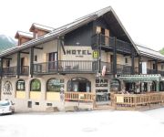
Chalet Hôtel d'Ailefroide
Hôtel Les Vallois
Auberge de Violaine
Videos from this area
These are videos related to the place based on their proximity to this place.
le Rocher de Yret 2830m - le vallon de la Montagnolle
sortie à ski de randonnée dans le massif des Ecrins au départ du domaine skiable de Monêtier les bains.
2014.01 - Serre Chevalier - #03
Quelques instants de ski hors piste sur le domaine de Serre Chevalier / Monêtier (Vallon de la Montagnole & chemin du Torrent du Grand Tabuc). ------------------ Few off-piste moments on the...
2014.01 - Serre Chevalier - #02
Quelques instants de ski hors piste sur le domaine de Serre Chevalier / Monêtier (Vallon de la Montagnole). ------------------ Few off-piste moments on the areas of Serre Chevalier / Monêtier...
Poudreuse à Serre Chevalier - le col du Grand Pré
Jamais déçu par le vallon du Grand Pré à Serre Chevalier! Du très bon ski: neige très froide, poudreuse, ciel bleu : que du bon... www.skitouring.fr - ski@skitouring.fr.
Parapente Trip 2014
Vacances parapentes dans les Alpes du Sud, découverte des sites de Vallouise et Ceillac. Informations : Caméra : GoPro Hero 3+ Aile : Hook2 Niviuk Sites de vol : Vallouise & Ceillac Musique...
Chasse au sanglier Pelvoux-Vallouise
Pour une fois que ça me sort comme ça......je me les mords encore. je ferai mieux la prochaine fois (5 ou 6 coup)
River Gyr (raw footage) 30/6/12
Raw footage of a quick afternoon blast down the river Gyr in Vallouise, France.
session snowboard a pelvoux
session de snowboard dans la petite station de ski de pelvoux vallouise.
LA CASCADE DE LA PISSETTE
Superbe promenade en raquettes à une demi-heure de Vallouise, 05. Maravilhosa cachoeira gelada, na França.
Videos provided by Youtube are under the copyright of their owners.
Attractions and noteworthy things
Distances are based on the centre of the city/town and sightseeing location. This list contains brief abstracts about monuments, holiday activities, national parcs, museums, organisations and more from the area as well as interesting facts about the region itself. Where available, you'll find the corresponding homepage. Otherwise the related wikipedia article.
Lac de l'Eychauda
Lac de l'Eychauda is a lake in Hautes-Alpes, France.
Refuge du Pelvoux
Refuge du Pelvoux is a refuge in the Alps.


