Safety Score: 2,8 of 5.0 based on data from 9 authorites. Meaning we advice caution when travelling to Canada.
Travel warnings are updated daily. Source: Travel Warning Canada. Last Update: 2024-04-27 08:23:39
Delve into Highwater
Highwater in Estrie (Québec) is a town located in Canada about 161 mi (or 260 km) east of Ottawa, the country's capital town.
Time in Highwater is now 03:24 AM (Sunday). The local timezone is named America / Toronto with an UTC offset of -4 hours. We know of 11 airports closer to Highwater, of which 4 are larger airports. The closest airport in Canada is Bromont Airport in a distance of 24 mi (or 38 km), North-West. Besides the airports, there are other travel options available (check left side).
Also, if you like the game of golf, there are some options within driving distance. In need of a room? We compiled a list of available hotels close to the map centre further down the page.
Since you are here already, you might want to pay a visit to some of the following locations: Newport, Hyde Park, Saint-Pie, Saint Albans and Saint Johnsbury. To further explore this place, just scroll down and browse the available info.
Local weather forecast
Todays Local Weather Conditions & Forecast: 13°C / 55 °F
| Morning Temperature | 8°C / 46 °F |
| Evening Temperature | 14°C / 58 °F |
| Night Temperature | 12°C / 53 °F |
| Chance of rainfall | 11% |
| Air Humidity | 86% |
| Air Pressure | 1017 hPa |
| Wind Speed | Gentle Breeze with 7 km/h (5 mph) from South |
| Cloud Conditions | Overcast clouds, covering 100% of sky |
| General Conditions | Moderate rain |
Sunday, 28th of April 2024
10°C (51 °F)
5°C (41 °F)
Light rain, gentle breeze, broken clouds.
Monday, 29th of April 2024
10°C (50 °F)
7°C (44 °F)
Overcast clouds, gentle breeze.
Tuesday, 30th of April 2024
15°C (58 °F)
6°C (44 °F)
Sky is clear, light breeze, clear sky.
Hotels and Places to Stay
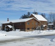
The Jay Village Inn
Videos from this area
These are videos related to the place based on their proximity to this place.
Big Falls
Big Falls is located south of the Vermont town of North Troy. The falls are located on River Road, about 1.5 miles south of Route 105. The total height of the falls is 40 feet with the tallest...
Jay Peak 2011/2012 Season
Dear Jay Peakers, As a way to commemorate this winter, here is a brief chronicle of stills highlighting our season together. Thank you for coming out to see us.
Flow Wave jam session @ Jay Peak
In my sweet 3 day stay at Jay Peak I spend plenty of time on the Flow Wave... this was my first time on one, and I want more!!!
Powder Day - Jay Peak - March 22nd 2014
Jay got 3 feet of snow, then 7 days later it another 14 inches, and then we stomped it.
Jay Peak Resort Vermont March 2013 Snowboarding Skiing GoPro
"Ontario Week" at Jay Peak Resort, Vermont, March 2013. Great facilities, excellent staff, and a fun time! Special thanks to Grandma for her support and coming along! See you next year!
Jay Peak Resort Ski Lift
Jay Peak Ski Resort in Vermont Going up to the highest mountain in the ski lift.
Videos provided by Youtube are under the copyright of their owners.
Attractions and noteworthy things
Distances are based on the centre of the city/town and sightseeing location. This list contains brief abstracts about monuments, holiday activities, national parcs, museums, organisations and more from the area as well as interesting facts about the region itself. Where available, you'll find the corresponding homepage. Otherwise the related wikipedia article.
North Troy, Vermont
North Troy is a village in Troy, Orleans County, Vermont, United States. The population was 593 at the 2000 census.
North Troy-Highwater Border Crossing
The North Troy-Highwater Border Crossing connects the town of Highwater, Quebec with North Troy, Vermont. Canada first established a Customs operations for this crossing in 1844, when it opened an office four miles north in the town of Potton. In 1933, the office was moved to its present location at the border. The US border station was constructed shortly thereafter. Canada rebuilt its station in 1966, and the US rebuilt its station in 2009.


