Touring Taggerty
Taggerty in Murrindindi (Victoria) is a town located in Australia about 237 mi (or 381 km) south-west of Canberra, the country's capital place.
Time in Taggerty is now 07:21 PM (Monday). The local timezone is named Australia / Melbourne with an UTC offset of 10 hours. We know of 8 airports nearby Taggerty, of which one is a larger airport. The closest airport in Australia is Melbourne Essendon Airport in a distance of 52 mi (or 84 km), South-West. Besides the airports, there are other travel options available (check left side).
There is one Unesco world heritage site nearby. It's Royal Exhibition Building and Carlton Gardens in a distance of 89 mi (or 143 km), North-West. Need some hints on where to stay? We compiled a list of available hotels close to the map centre further down the page.
Being here already, you might want to pay a visit to some of the following locations: Melbourne, Hay, Currie, Canberra and . To further explore this place, just scroll down and browse the available info.
Local weather forecast
Todays Local Weather Conditions & Forecast: 19°C / 67 °F
| Morning Temperature | 7°C / 44 °F |
| Evening Temperature | 12°C / 54 °F |
| Night Temperature | 8°C / 47 °F |
| Chance of rainfall | 0% |
| Air Humidity | 42% |
| Air Pressure | 1030 hPa |
| Wind Speed | Light breeze with 3 km/h (2 mph) from North |
| Cloud Conditions | Clear sky, covering 0% of sky |
| General Conditions | Sky is clear |
Tuesday, 7th of May 2024
18°C (65 °F)
8°C (46 °F)
Sky is clear, calm, clear sky.
Wednesday, 8th of May 2024
19°C (66 °F)
10°C (51 °F)
Sky is clear, calm, clear sky.
Thursday, 9th of May 2024
21°C (69 °F)
10°C (50 °F)
Broken clouds, light breeze.
Hotels and Places to Stay
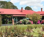
Stonelea Country Estate
Videos from this area
These are videos related to the place based on their proximity to this place.
Melbourne Cottage: Rose Cottage, Fern Cottage: South Cathedral Farm-Country B&B Cottages
South Cathedral Farm - Country B&B Cottages (http://www.southcathedralfarm.com) is the best kept secret in country Victoria. Our luxury private country cottages are the perfect breakaway escape...
Team Wombat Mountainbike - Buxton Australia Downhill Cut
Team Wombat Mountainbike ride the Buxton Bike Park as part of their campaign "Chase the Flow 2013". (DH cut includes all the good downhill bits. Great singletrack and long flowing downhills...
Wipe-out at Buxton MTB Park
Buxton MTB Park, Victorian Enduro Series 2014 Round 7 - The Buxton Bootcamp, My front wheel slipped, my old GoPro1 attached to the seat post captured some of the fall. My front facing GoPro...
Lets Ride - CX500 Scrambler around country Victoria
A few mates and I took our bikes out for a ride around rural Victoria!
Buxton Australia -Team Wombat Mountainbike
Team Wombat Mountainbike ride the Buxton Bike Park as part of their campaign "Chase the Flow 2013". Great singletrack and long flowing downhills are on the Buxton menu. If you are in Australia...
Australia Giant Buxton Burger at Igloo Road House, Buxton, Victoria
Australia Giant Buxton Burger at Igloo Road House at 2216 Maroondah Highway, Buxton, Victoria. It taste really good :)
Buxton MTB Tracks (Vic, Australia) Sept 2014 - Spring is Here!
Fantastic sweeping single-track curves and berms of the Buxton MTB Complex's 'Acherton Ridge' (2) and 'Off Camber'(4) tracks.
Cruiser's birthday ride in Buxton
Cruiser's birthday organised ride in Buxton. Was a challenging one for me especially with my (now gone) tired cr125.
Cathedral Range Ridge Walk Trekking From Sugarloaf Saddle
Cathedral Range Ridge Walk Trekking From Sugarloaf Saddle If you would like any more information on this video please leave a comment below and we will reply. We are now on Twitter so please...
Cathedral Ranges
The top of mount sugarloaf, in the cathedral ranges near Buxton Victoria. Shot with the iPhone 4s!!
Videos provided by Youtube are under the copyright of their owners.
Attractions and noteworthy things
Distances are based on the centre of the city/town and sightseeing location. This list contains brief abstracts about monuments, holiday activities, national parcs, museums, organisations and more from the area as well as interesting facts about the region itself. Where available, you'll find the corresponding homepage. Otherwise the related wikipedia article.
Taggerty
Taggerty is a town in central Victoria, Australia. It is located at the intersection of Maroondah Highway and Thornton Road. The Acheron River also crosses the highway at Taggerty. It is thought to be named after the Aboriginal word for blue clay. At the 2006 Census, Taggerty and the surrounding area had a population of 612. A pastoral run called Taggerty Run was established in 1846. The homestead of the run was called Taggerty House.
Cathedral Range (Victoria)
Cathedral Range is a mountain range in Victoria, Australia, located in Cathedral Range State Park. The range is formed from a 7km ridge of upturned sedimentary rock, consisting mainly of Sandstone, Mudstone and Conglomerates of the Devonian Period. This has given the range steep sides, and a narrow razorback ridge. The plateau on the eastern boundary of the park continues to the nearby Lake Mountain cross country ski area. Much of the park was burnt in the Black Saturday bushfires.
Cathedral Range State Park
Cathedral Range State Park is a state park in Victoria, Australia which encompasses the spectacular Cathedral Range and adjacent Little River valley. It is located to the east of the Maroondah Highway, between Buxton and Taggerty, approximately 150 km north-east of Melbourne. The Cathedral Range State Park is a popular bushwalking destination for Victorians, as it provides a wide variety of terrain and is easily accessed from Melbourne.


