Explore Hazelwood South
The district Hazelwood South of Churchill in Latrobe (Victoria) is located in Australia about 256 mi south-west of Canberra, the country's capital.
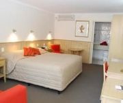
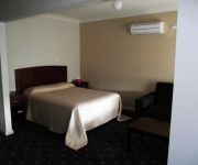
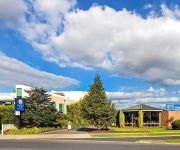
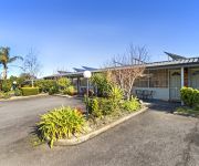
If you need a place to sleep, we compiled a list of available hotels close to the map centre further down the page.
Depending on your travel schedule, you might want to pay a visit to some of the following locations: Melbourne, Currie, Canberra, Hay and . To further explore this place, just scroll down and browse the available info.
Local weather forecast
Todays Local Weather Conditions & Forecast: 16°C / 61 °F
| Morning Temperature | 10°C / 50 °F |
| Evening Temperature | 11°C / 51 °F |
| Night Temperature | 7°C / 45 °F |
| Chance of rainfall | 0% |
| Air Humidity | 58% |
| Air Pressure | 1025 hPa |
| Wind Speed | Light breeze with 5 km/h (3 mph) from North-East |
| Cloud Conditions | Broken clouds, covering 83% of sky |
| General Conditions | Broken clouds |
Saturday, 27th of April 2024
17°C (63 °F)
8°C (47 °F)
Sky is clear, calm, clear sky.
Sunday, 28th of April 2024
20°C (69 °F)
11°C (51 °F)
Overcast clouds, calm.
Monday, 29th of April 2024
18°C (65 °F)
9°C (49 °F)
Light rain, gentle breeze, overcast clouds.
Hotels and Places to Stay
Farnham Court
Morwell Coal Valley Motor Inn
503 On Princes Drive
Comfort Inn Cedar Lodge
Comfort Inn Cedar Lodge
Always Welcome Motel
Morwell Hotel
HAZELWOOD MOTEL
Videos from this area
These are videos related to the place based on their proximity to this place.
Cooks Construction (Ex SECV) train at Morwell.
Cooks Construction (Ex SECV) empty brown coal train returning to Yallourn from Morwell 4 August 1996. I was actually waiting for steam loco R 761which was due soon after. On this line, empty...
The Next Day of the Morwell Fire (Hazelwood Open Cut Mine Smokes)
The Next Day of the Morwell Fire - Hazelwood Open Cut Mine Smokes Will You Survive a Disaster! http://finditwithusonline.com/FamilySurvivalCourse See more photos of the Gippsland Fires here:...
vline reopen Moe to Morwell after bushfires 11 february 2014
This video is about vline reopen Moe to Morwell after bushfires 11 february 2014 - Better view than a coach movie I did, more to keep it for history, good old youtube. The smell travelling...
Morwell Victoria Florist - Flowers in the Valley
Flowers in the Valley are your friendly team of experienced florists in Morwell, Victoria. We are focused on providing high quality service and achieving customer satisfaction. We take pride...
LCBTA Stop Stay Do! HiRes
The Latrobe City Business Tourism Association works across all towns in Latrobe Valley to promote Business and the tourism in the region, and we need your help. Stop - while you are passing...
Vacant town block now a stunning sea of sunflowers by Fairfax Media
A disused former petrol station site in Morwell is now making people smile, thanks to thousands of blooming sunflowers. By Darren Gray for Fairfax Media.
Project Willan Done Concreting Melbourne
A job in stages done in Morwell, VIC, by Done Concreting in Dandenong, Melbourne (Done Constructions Pty Ltd) Done Concreting specialise in Domestic and Commercial Concreting: House Slabs,...
Helicopters flying over my house during February fires
Recorded: 28 February 2014 Footage of a Sikorsky S61 Coulson helicopter and Bell 212 (or variant) flying over my house during 2014 February fires, near Morwell, Victoria.
Videos provided by Youtube are under the copyright of their owners.
Attractions and noteworthy things
Distances are based on the centre of the city/town and sightseeing location. This list contains brief abstracts about monuments, holiday activities, national parcs, museums, organisations and more from the area as well as interesting facts about the region itself. Where available, you'll find the corresponding homepage. Otherwise the related wikipedia article.
Traralgon
Traralgon is a city located in the east of the Latrobe Valley in the Gippsland region of Victoria, Australia. At the 2006 census, the population of the urban area was 21,960. It is administered by the City of Latrobe. The greater Latrobe Valley urban area of which Traralgon is part has a population of approximately 125,000. The origin of the name Traralgon is uncertain.
Morwell National Park
Morwell National Park is a 560–hectare national park in Victoria, Australia, 140 km east of Melbourne. It is 16 km south of Morwell in the Strzelecki Ranges and preserves a remnant of previously widespread wet sclerophyll forests and some rainforest remnants restricted to deep creek gullies. 320 plant species have been recorded for this park, including five rare or threatened species and 44 orchid species.
Morwell, Victoria
Morwell is a city located in the Latrobe Valley area of Gippsland in the east of the state of Victoria in Australia approximately 149 km (93 mi) east of the state capital. The population at the 2006 Census was 13,399. It is both the seat of local government and administrative centre for the City of Latrobe.
City of Latrobe
The City of Latrobe is a local government area in the Gippsland region in eastern Victoria, Australia. It has an area of 1,422 square kilometres and at the 2006 Census, had a population of 69,329. The Latrobe City Council governs the City under the Local Government Act 1993. The seat of local government is the council chambers at Morwell and City's administrative headquarters is also in Morwell.
HM Prison Morwell River
HM Prison Morwell River, opened in 1951, was an open prison located near Morwell, Victoria. Inmates and prison officers (normally bitter enemies, "crims" and "screws") called a truce while working on the project. Prisoners were taken to shopping centers in Morwell and left unattended, at total liberty and on trust, to rattle their tins. Civilian clothes (rather than the shapeless "prison green" tracksuits and Dunlop sneakers) were worn.
Morwell railway station
Morwell is a railway station on the Bairnsdale V/Line rail service in Morwell, Victoria, Australia. The station is located on Princes Drive and is 144 km from Southern Cross station. A disused second line exists opposite the single platform, this was used in the past when SEC company trains ran and rail freight was more common. It is located in Zone 11 of the Myki ticketing system.
Traralgon railway station
Traralgon is a major railway station on the Bairnsdale railway line in Traralgon Victoria, Australia. The station is located on the Princes Highway. Passenger are catered for by the Traralgon V/Line rail service. Traralgon was formerly the junction of the cross country branch line to Maffra and Stratford (closed between 1987-1994) and has historically been the Gippsland region's principal operational location. It is located in the Zone 12 and 13 overlap of the Myki ticketing system.
Energy Brix Power Station
Energy Brix Power Station is a brown coal powered power station located at Morwell, in Victoria, Australia. The power station is used to supply electricity for the retail market, as well as the production of briquettes in the adjacent Energy Brix briquette works.
Hazelwood North, Victoria
Hazelwood North is a locality in Victoria, Australia. It has a population of 1220 (as of the 2006 census). Max Cranwell, who died in a 2009 plane crash in Papua New Guinea, resided in Hazelwood North until his death. Nearly exclusively inhabited by graziers and farmers, Hazelwood North is so named due to its geographical orientation from the town "Hazelwood" - Now known as Churchill.
TRFM
TRFM (formally 3TRFM) is an Australian radio station operating west of Traralgon, Victoria. It is owned by Ace Radio and shares studios with sister station GOLD 1242, formerly 1242 3GV. The station broadcasts on FM 99.5 MHz from Mount Tassie near Traralgon into Sale and the Latrobe Valley and on FM 99.9 MHz from Mount Taylor into Bairnsdale and East Gippsland.
Eastern Victoria Region
The electoral district of Eastern Victoria Region is one of the eight electoral divisions of the state of Victoria, Australia, each of which elects five members to the upper house of the Parliament of Victoria, the Victorian Legislative Council, by proportional representation. It was created in 2006 following the reform of the Legislative Council by the Australian Labor Party state government of Steve Bracks.
Yinnar, Victoria
Yinnar is a tranquil rural township located in the Latrobe Valley, in central Gippsland, Victoria, Australia. At the 2006 census, Yinnar had a population of 585. The origin of the name Yinnar is believed to have been derived from the Aboriginal term yinnar, meaning 'woman'. \t\t \t\t\tYinnar Signs. JPG \t\t\t Yinnar Signs \t\t\t \t\t \t\t \t\t\tYinnar Main Street 1. JPG \t\t\t Main Street \t\t\t \t\t \t\t \t\t\tYinnar Main Street 2. JPG \t\t\t Main Street \t\t\t \t\t \t\t \t\t\tJumbuk Rd Yinnar. JPG \t\t\t View SE from Main Street
Traralgon College
Traralgon College, previously called Traragon Secondary College, is a co-educational public high school in Gippsland, Victoria, Australia. It consists of two campuses, east and west which are located at either end of the town.
Jeeralang Power Station
Jeeralang Power Station is a gas turbine power station near Morwell, Victoria, Australia. It was constructed in two stages and has a capacity of 449 megawatts. The station is a peaking facility which is utilised only during periods of peak demand, it is also used as a black start facility to restore power to the grid in the event of major system failure. As a result the actual capacity factor of the station is less than 5%. It is currently operated by Ecogen Energy.
Shire of Traralgon
The Shire of Traralgon was a local government area about 160 kilometres east-southeast of Melbourne, the state capital of Victoria, Australia. The shire covered an area of 4,650 square kilometres, and existed from 1879 until 1994. From 1961 onwards, it did not actually administer the town of Traralgon, which was the responsibility of a separate authority.
City of Traralgon
The City of Traralgon was a local government area about 160 kilometres east-southeast of Melbourne, the state capital of Victoria, Australia, in the Latrobe Valley region. The City covered an area of 22.37 square kilometres, and existed from the time of its severance from the Shire of Traralgon in 1961 until 1994.
Goombala Road
Goombala Road is a major throughway within Tarra-Bulga National Park in South Gippsland, Australia. It runs the inside border of the park. http://www. dse. vic. gov. au/planningschemes/latrobe/maps/latrobe132wmo. pdf It roughly parallels Traralgon Creek. A recent program has provided time-lapse photo monitoring on Goombala Road to track changes in the ecosystem. A camera has been placed at the intersection of Goombala Road and Grand Ridge Road.
Yinnar South, Victoria
Yinnar South is a small rural town in the Latrobe Valley in Victoria, Australia. At the 2006 census, Yinnar South had a population of 1,148. The first school in Yinnar South, School No. 2730, was opened 11 January 1886. It currently operates as a primary school. Henry Collins set up his saw mill in Mill Road c. 1911 and built a tramline along Whitelaw's Track. The town has a small church, approximately four metres by five metres, known as Holy Innocents.
Callignee, Victoria
Callignee is a locality in the Gippsland region of Victoria, Australia. The locality is 175 kilometres east of the state capital, Melbourne. At the 2006 census, Callignee and the surrounding area had a population of 495. The locality was severely affected by the Black Saturday bushfires, including four fatalities plus another fatality at nearby Upper Callignee.
Jeeralang, Victoria
Jeeralang is a locality in the Gippsland region of Victoria, Australia. The locality is 176 kilometres east of the state capital, Melbourne. At the 2006 census, Jeeralang and the surrounding area had a population of 589. The locality was severely affected by the Black Saturday bushfires, including a fatality.
Commercial Road Primary School
The Commercial Road Primary School is located on the main road in Morwell, Victoria, Australia. It was founded in 1879, and has undergone a number of changes over the years.
Churchill, Victoria
Churchill is a town in the Latrobe Valley, located in central Gippsland in the east of Victoria, Australia. The town had a population of 4,588 at the 2006 census, and is part of the Latrobe City local government area. The town was named in honour of former British leader Sir Winston Churchill.
Morwell River
The Morwell River is a river of Gippsland in southeastern Victoria, Australia. It arises in the Strzelecki Ranges and flows in a northerly direction close to the townships of Boolarra and Yinnar to Morwell. The lower section of the river has been diverted around open-cut coal mines by channels and pipelines until it enters the Latrobe River.
Hazelwood, Victoria
Hazelwood is an area of Gippsland at the foot of the Strzelecki Ranges in Victoria, Australia. In the beginning the area acted as a service centre for the Hazelwood Power Station. Following the death of Sir Winston Churchill the town centre was renamed to Churchill, however many of the surrounding areas continue to carry the name Hazelwood.
Traralgon Showgrounds
Traralgon Showground is a cricket ground in Traralgon, Victoria, Australia. The first recorded match held on the ground came when WSC Australia played WSC Cavaliers in the 1978 World Series Cricket. A List A match was held there in the 2007–08 Ford Ranger Cup between Victoria and South Australia, which Victoria won by 4 wickets.


