Safety Score: 2,7 of 5.0 based on data from 9 authorites. Meaning we advice caution when travelling to United States.
Travel warnings are updated daily. Source: Travel Warning United States. Last Update: 2024-05-06 08:04:52
Explore White Rock
White Rock in Nelson County (Virginia) is located in United States about 130 mi (or 209 km) south-west of Washington DC, the country's capital.
Local time in White Rock is now 10:17 AM (Monday). The local timezone is named America / New York with an UTC offset of -4 hours. We know of 10 airports in the wider vicinity of White Rock, of which 5 are larger airports. The closest airport in United States is Shenandoah Valley Regional Airport in a distance of 27 mi (or 44 km), North. Besides the airports, there are other travel options available (check left side).
There is one Unesco world heritage site nearby. It's Monticello and the University of Virginia in Charlottesville in a distance of 86 mi (or 138 km), East. Also, if you like golfing, there are multiple options in driving distance. We found 10 points of interest in the vicinity of this place. If you need a place to sleep, we compiled a list of available hotels close to the map centre further down the page.
Depending on your travel schedule, you might want to pay a visit to some of the following locations: Lovingston, Waynesboro, Staunton, Amherst and Buena Vista. To further explore this place, just scroll down and browse the available info.
Local weather forecast
Todays Local Weather Conditions & Forecast: 23°C / 73 °F
| Morning Temperature | 15°C / 58 °F |
| Evening Temperature | 18°C / 64 °F |
| Night Temperature | 16°C / 62 °F |
| Chance of rainfall | 12% |
| Air Humidity | 73% |
| Air Pressure | 1014 hPa |
| Wind Speed | Gentle Breeze with 6 km/h (4 mph) from East |
| Cloud Conditions | Overcast clouds, covering 100% of sky |
| General Conditions | Moderate rain |
Monday, 6th of May 2024
24°C (76 °F)
17°C (63 °F)
Moderate rain, strong breeze, broken clouds.
Tuesday, 7th of May 2024
28°C (82 °F)
18°C (64 °F)
Scattered clouds, moderate breeze.
Wednesday, 8th of May 2024
18°C (64 °F)
16°C (60 °F)
Heavy intensity rain, gentle breeze, overcast clouds.
Hotels and Places to Stay
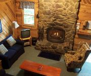
CABIN CREEKWOOD
Videos from this area
These are videos related to the place based on their proximity to this place.
Forrest Swope - Azurat - 07/05/08 - Drive
Lead Guitar and Vocals - Forrest Swope Vocals - Christina Wilkie Rhythm Guitar - Jamie Dyer.
Azurat - 07/05/08 - Candle - Forrest Swope
Lead guitar - Forrest Swope Vocals - Christina Wilkie Rhythm guitar - Jamie Dyer.
Hiking with Sheila and Brandy, Coles Run Reservoir, Morning Tour, May 31 2011
This video is a bit long, but is a nearly complete tour of the loop trail, around Coles Run Reservoir, near Stuarts Draft, Virginia, just off Coal Road. We got up for an early start, because...
Quality Built Home!
For more details click here: http://www.visualtour.com/showvt.asp?t=3060303 2178 Cold Springs Rd Greenville, VA 24440 $229900, 3 bed, 2.0 bath, 1176 SF, ML...
10/11/10 down rt 56 near the Blue Ridge Parkway on our Harley.
No work Monday 10/11/10, so we headed down what might be the best riding road in Virginia. Rt. 56 just outside the Blue Ridge Parkway has recently become our favorite winding road. So we took...
Crabtree Falls, George Washington National Forest, Virginia
Crabtree Falls, George Washington National Forest, Virginia. The highest waterfall in Virginia at 1080 feet. Shot 4/15/13.
Videos provided by Youtube are under the copyright of their owners.
Attractions and noteworthy things
Distances are based on the centre of the city/town and sightseeing location. This list contains brief abstracts about monuments, holiday activities, national parcs, museums, organisations and more from the area as well as interesting facts about the region itself. Where available, you'll find the corresponding homepage. Otherwise the related wikipedia article.
Crabtree Falls
Crabtree Falls is located in the George Washington National Forest in Nelson County, Virginia, and is one of the tallest sets of waterfalls in the United States east of the Mississippi River. The name of the falls is thought to have come from William Crabtree, who settled in this part of Virginia in 1777. The set of waterfalls is often credited with being 1,200 feet high, but topographic maps show the total drop to be closer to 1,000 feet .
Nash, Virginia
Nash is an unincorporated community in Nelson County, Virginia, United States.
White Rock, Virginia
White Rock is an unincorporated community in Nelson County, Virginia, United States.


