Safety Score: 4,0 of 5.0 based on data from 9 authorites. Meaning please reconsider your need to travel to Switzerland.
Travel warnings are updated daily. Source: Travel Warning Switzerland. Last Update: 2024-04-29 08:03:39
Delve into Nänikon / Nänikon (Dorfkern)
The district Nänikon / Nänikon (Dorfkern) of Nänikon in Bezirk Uster (Canton of Zurich) with it's 1,178 habitants Nänikon / Nänikon (Dorfkern) is a subburb in Switzerland about 65 mi north-east of Bern, the country's capital town.
If you need a hotel, we compiled a list of available hotels close to the map centre further down the page.
While being here, you might want to pay a visit to some of the following locations: Uster, Pfaffikon, Meilen, Winterthur and Zurich. To further explore this place, just scroll down and browse the available info.
Local weather forecast
Todays Local Weather Conditions & Forecast: 19°C / 66 °F
| Morning Temperature | 7°C / 45 °F |
| Evening Temperature | 20°C / 67 °F |
| Night Temperature | 12°C / 53 °F |
| Chance of rainfall | 0% |
| Air Humidity | 50% |
| Air Pressure | 1019 hPa |
| Wind Speed | Light breeze with 5 km/h (3 mph) from South-West |
| Cloud Conditions | Scattered clouds, covering 44% of sky |
| General Conditions | Light rain |
Tuesday, 30th of April 2024
21°C (69 °F)
12°C (53 °F)
Light rain, light breeze, scattered clouds.
Wednesday, 1st of May 2024
19°C (66 °F)
10°C (51 °F)
Light rain, light breeze, overcast clouds.
Thursday, 2nd of May 2024
10°C (49 °F)
7°C (45 °F)
Moderate rain, gentle breeze, overcast clouds.
Hotels and Places to Stay
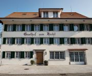
Gasthof zum Hecht
Parkhotel Wallberg
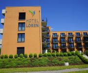
Residence Loren
Illuster
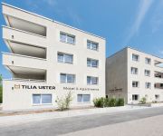
Hotel Tilia
Wassberg Landgasthof
Rubus
Pöstli
Löwen Bassersdorf
Motel Fehraltorf
Videos from this area
These are videos related to the place based on their proximity to this place.
Hanna und ihr Spatz - Der Robbe L-Spatz 55
Der Robbe L-Spatz 55 im Schlepp-Einsatz bei der MG Uster.. Spannweite 3.75 Meter, Gewicht ca. 4 Kg. Schlepper : AirCompo Fäbe Flugzeiten von über 40 Minuten sind bei Thermik keine Seltenheit...
Kulturdolmetscher im Octopus 06 Teil 2
Die letzten Stunden oder Tage an der Feldhofstrasse. Die Jugendlichen trauern ihrem Jugi nach und sind gespannt auf das neue Haus.
EDI PIN Zutrittsleseeinheit Unterputzmontage im Aussenbereich
Das Video zeigt die Montage der EVIS PIN Zutrittsleseeinheit im Aussenbereich eben zur Wand. Die Leseeinheit unterstützt die RFID Technologien mifare classic, mifare DESFire, LEGIC prime und...
Stevens SB 7 elektifiziert
Stevens SB 7 von Blue Airlines mit einer Spannweite von 4125 mm und einer Länge von 1770 mm. Flugplatz MG Uster , Flugfeld Nänikon.
Garnhaenki, Städli Greifensee, Kirche und Schloss Greifensee
Siehe auch http://geo.ch und http://fotoflieger.ch. Auf der Garnhänki ist es sehr knapp mit dem Start und der Landung. Landen musste ich über den Greifensee, es hat fast nicht gereicht,...
Videos provided by Youtube are under the copyright of their owners.
Attractions and noteworthy things
Distances are based on the centre of the city/town and sightseeing location. This list contains brief abstracts about monuments, holiday activities, national parcs, museums, organisations and more from the area as well as interesting facts about the region itself. Where available, you'll find the corresponding homepage. Otherwise the related wikipedia article.
Esslingen, Switzerland
Esslingen is a village in the municipality of Egg, Switzerland, in the canton of Zürich. It is located in the Pfannenstiel region, approximately 15 km southeast of Zürich. In the local dialect it is called Esslinge. The population is 1752. A monument commemorating World War I is located at Forch, a village and hill which also a popular recreation area for the people of Zürich.
Greifensee
Greifensee (or "Lake Greifen" meaning griffin) is a small lake in the canton of Zürich in Switzerland.
Crossair Flight 3597
Crossair Flight LX 3597 was an Avro RJ100 regional airliner, registration HB-IXM, on a scheduled flight from Berlin, Germany to Zurich, Switzerland that crashed during its approach to land at Zurich Airport on 24 November 2001. Twenty-four of the 33 people on board were killed.
Kyburg (castle)
Kyburg Castle is a castle in the municipality of Kyburg and the canton of Zurich in Switzerland. It is a Swiss heritage site of national significance.
Aabach (Greifensee)
The Ustermer Aa or Aabach is a river in the Canton of Zürich, Switzerland. The river, which has a length of 11,2 km, flows from the Pfäffikersee to the Greifensee through the deep Aatal.
Uster District
Uster District is one of the twelve districts of the canton of Zürich, Switzerland. Its capital is the city of Uster. The German-speaking district has a population of 121,729 (as of 31 December 2011).
Meilen District
Meilen District is one of the twelve districts of the German-speaking canton of Zurich, Switzerland. It lies to the south of the canton in the Pfannenstiel region, forming much of the northern shore of Lake Zurich. The district capital is the town of Meilen.
Pfäffikon District
Pfäffikon District is one of the twelve districts of the German-speaking canton of Zürich, Switzerland. Its capital is the town of Pfäffikon.
Pfäffikersee
Pfäffikersee (or Lake Pfäffikon) is a lake in the canton of Zurich, Switzerland, near the town of Pfäffikon. It is 2.5 km long and 1.3 km wide at the middle. The lake was created in the last ice age when a moraine blocked off the ability for the lake to empty north towards Winterthur. There is also a hiking trail around the lake that people often bike and walk on, and the area is considered protected lands.
Wulp Castle
The ruins of Wulp Castle (German: Ruine Wulp or Burg Wulp) is a castle located in the municipality of Küsnacht and the canton of Zurich in Switzerland. It was built during the high Middle Ages. Despite this, the castle is documented only in a few found texts, and much of the castle's history is not known.
Rossberg (Winterthur)
Rossberg is a quarter in the district 4 of Winterthur. It was formerly a part of Töss municipality, which was incorporated into Winterthur in 1922. {{#invoke:Coordinates|coord}}{{#coordinates:47|27|46|N|8|42|51|E|region:CH |primary |name= }} 19px This Canton of Zurich location article is a stub. You can help Wikipedia by expanding it. vte Template:Portal:Switzerland/Stub
Loorenkopf
Loorenkopf tower is a 33-metre high freestanding wood lattice tower on Adlisberg, north of Witikon in Zürich, Switzerland. It was built in 1954. The tower is owned by Zürich city and it is open to the public. The tower is located within the forest at an altitude of 694 m . The upper platform is reached by 153 steps. On a clear day with high visibility, you can see Eiger, Mönch and Jungfrau.
Pfaffhausen
Pfaffhausen (also known as Pffaffhausen) is a village in the municipality of Fällanden in the canton of Zürich, Switzerland.
Gallus Chapel
The Gallus chapel is a listed heritage building in the municipality of Greifensee, Canton of Zürich, Switzerland. Nobleman Hermann IV of Landenberg donated, for his salvation and on his wife favour, this chapel around 1330-1340. The triangular building is considered to be the oldest intact Gothic monument of the medieval town. Originally, it was integrated into the eastern corner of the city walls as a Wehrkirche, repeating in its ground floor the plan of the small town.
Forch
Forch is a village and a mountain pass (el. 682 metres) located in the municipalities of Küsnacht and Maur in the canton of Zürich, Switzerland.
Adlisberg
Adlisberg, with an elevation of 701 metres, is a wooded mountain in Switzerland overlooking Zürichsee (Lake Zürich) to the northwest near the Zürichberg.
Aretshalden
Aretshalden is a village in Hinwil, Switzerland. It lies close to Pfäffikersee, north of Wetzikon.
Greifensee Castle
Greifensee Castle is a castle in the municipality of Greifensee and the canton of Zurich in Switzerland. It is a Swiss heritage site of national significance.
Stettbach railway station
Stettbach is a railway station on the north-eastern boundary of the Swiss city of Zürich. Although the station is located just within the city boundary, in the city's Schwamendingen district, it takes its name from the nearby village of Stettbach, which is in the adjacent municipality of Dübendorf. The station is on the Zürichberg line, which links Zürich Stadelhofen station, in central Zurich, with Dietlikon and Dübendorf stations.
Uster railway station
Uster is a railway station in Switzerland, situated in the city of Uster. The station is located on the Wallisellen to Uster and Rapperswil railway line and served by Zurich S-Bahn lines S5, S9, S14 and S15. An unusual feature of Uster railway station is the historic lok remise or engine shed. This comprises two separate buildings, a simple shed from 1856 and a partial roundhouse from 1857, arranged around a turntable. The roundhouse is flanked by houses on either side.
Nänikon-Greifensee railway station
Nänikon-Greifensee is a railway station in the Swiss canton of Zurich. It is situated between the villages of Nänikon, in the municipality of Uster, and the town of Greifensee. The station is on the Wallisellen–Uster–Rapperswil line and served by Zurich S-Bahn lines S9 and S14.
Dübendorf railway station
Dübendorf is a railway station in the Swiss canton of Zurich. It is situated in the municipality of Dübendorf on the Wallisellen–Uster–Rapperswil line. The station is served by Zurich S-Bahn lines S9 and S14.
Dietlikon railway station
Dietlikon is a railway station in the Swiss canton of Zurich and municipality of Dietlikon. The station is located on the Zürich to Winterthur railway line, and is served by Zurich S-Bahn lines S3 and S8.
Effretikon railway station
Effretikon is a railway station in the Swiss canton of Zurich and municipality of Illnau-Effretikon. The station is located on the Zurich to Winterthur main line at the junction point with the Effretikon to Hinwil line. It is the outer terminus of Zurich S-Bahn line S2, as well as being an intermediate stop on lines S3, S7, S8 and S16.
Illnau railway station
Illnau is a railway station in the Swiss canton of Zurich and municipality of Illnau-Effretikon. The station is located on the Effretikon to Hinwil railway line and is an intermediate stop on Zurich S-Bahn line S3.


