Safety Score: 2,8 of 5.0 based on data from 9 authorites. Meaning we advice caution when travelling to Poland.
Travel warnings are updated daily. Source: Travel Warning Poland. Last Update: 2024-05-16 08:19:50
Explore Sowa
The district Sowa of Sokolec in Powiat kłodzki (Województwo Dolnośląskie) is located in Poland about 223 mi south-west of Warsaw, the country's capital.
If you need a place to sleep, we compiled a list of available hotels close to the map centre further down the page.
Depending on your travel schedule, you might want to pay a visit to some of the following locations: Pieszyce, Jedlina-Zdroj, Swidnica, Dzierzoniow and Walbrzych. To further explore this place, just scroll down and browse the available info.
Local weather forecast
Todays Local Weather Conditions & Forecast: 17°C / 63 °F
| Morning Temperature | 7°C / 45 °F |
| Evening Temperature | 16°C / 60 °F |
| Night Temperature | 9°C / 48 °F |
| Chance of rainfall | 1% |
| Air Humidity | 51% |
| Air Pressure | 1014 hPa |
| Wind Speed | Moderate breeze with 10 km/h (6 mph) from North-West |
| Cloud Conditions | Few clouds, covering 23% of sky |
| General Conditions | Light rain |
Friday, 17th of May 2024
14°C (58 °F)
10°C (49 °F)
Moderate rain, gentle breeze, overcast clouds.
Saturday, 18th of May 2024
12°C (54 °F)
10°C (50 °F)
Light rain, moderate breeze, overcast clouds.
Sunday, 19th of May 2024
16°C (60 °F)
11°C (51 °F)
Light rain, light breeze, overcast clouds.
Hotels and Places to Stay
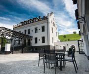
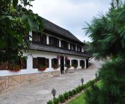
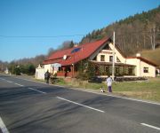
Sowia Dolina eat, drink & Sleep
Pałac Jugowice
Harenda Centrum Rekreacji
Dwór Górny
Ibiza
Videos from this area
These are videos related to the place based on their proximity to this place.
Jugów - latanie na żaglu (Góry Sowie)
Panorama ładnego stoku na wiatr południowo-zachodni. Latanie modelem Pluto na zboczu Jugów w Górach Sowich. Wiało 3-6 m/s. Średnie turbulencje od góry naprzeciwko, ale dało się wznieść...
Nowa Wieza Kosciola w Sokolcu-relacja
Reportaz z przebiegu wciagniecia krzyza na wieze Kosciola pw Sw Marcina w Sokolcu.
Skaning laserowy WROGEO - Sztolnia w Gontowej
Pomiar metodą skaningu laserowego sztolni w górze Gontowa (Góry Sowie, gm. Walim).
Jugów
Niedzielna wycieczka z Jugowa zielonym szlakiem w pobliżu Sokolca przez Lisie Skały, Grabinę, Białe Źródła do Koziego Siodła, a dalej czerwonym szlakiem w kierunku Przełęczy Jugowskiej...
Nauka jazdy na snowboardzie. Rzeczka - Sokolec
Pierwsze zjazdy mojej Siostry w Rzeczce :) 2014-02-01.
Na stoku - Rzeczka 2010
Rzeczka - 31 grudnia 2010 Mój pierwszy raz na zjazdówkach ;) - Więcej Informacji ↓↓ Subskrybuj: ...
Chata pod lasem - Rzeczka w Górach Sowich
Obraz mówi sam za siebie, jedynie co możemy dodać to że zapraszamy WAS serdecznie razem z mistrzem drugiego planu psem ARO. Do waszej dyspozycji 3 pokoje dla 9 osób, wspólny salonik z...
Videos provided by Youtube are under the copyright of their owners.
Attractions and noteworthy things
Distances are based on the centre of the city/town and sightseeing location. This list contains brief abstracts about monuments, holiday activities, national parcs, museums, organisations and more from the area as well as interesting facts about the region itself. Where available, you'll find the corresponding homepage. Otherwise the related wikipedia article.
Nowa Ruda
Nowa Ruda is a town in south-western Poland near the Czech border, lying on the Włodzica river in the central Sudetes mountains. As of 2007 it has 25,240 inhabitants. The town is located in Kłodzko County, Lower Silesian Voivodeship (from 1975–1998 it was in the former Wałbrzych Voivodeship). It is the seat of the rural district of Gmina Nowa Ruda, but is not part of its territory (the town is a separate urban gmina in its own right).
Dzierżoniów County
Dzierżoniów County is a unit of territorial administration and local government in Lower Silesian Voivodeship, south-western Poland. It came into being on January 1, 1999, as a result of the Polish local government reforms passed in 1998. Its administrative seat is the town of Dzierżoniów, and it also contains four other towns: Bielawa, Niemcza, Pieszyce and Piława Górna. The county covers an area of 478.3 square kilometres . As at 2006 the total population of the county is 104,852.
Pieszyce
Pieszyce is a town in Dzierżoniów County, Lower Silesian Voivodeship, in south-western Poland. Prior to 1945 it was in Germany. It lies approximately 3 kilometres east of Dzierżoniów, and 56 kilometres south-west of the regional capital Wrocław. As at 2008, the town has a population of 9,416. From 1975 to 1998 Pieszyce was in Wałbrzych Voivodeship. The play Die Weber (The Weavers) by the famous Silesian playwright Gerhart Hauptmann is set in Peterswaldau.
Głuszyca
Głuszyca is a town in Wałbrzych County, Lower Silesian Voivodeship, in south-western Poland. It is the seat of the administrative district called Gmina Głuszyca, close to the Czech border. Prior to 1945 it was in Germany. (For more information about the history of the region, see Silesia. ) The town lies approximately 13 kilometres south-east of Wałbrzych, and 69 kilometres south-west of the regional capital Wrocław. As at 2006, the town has a population of 6,999.
Bojanice, Lower Silesian Voivodeship
Bojanice is a village in the administrative district of Gmina Świdnica, within Świdnica County, Lower Silesian Voivodeship, in south-western Poland. Prior to 1945 it was in Germany. It lies approximately 10 kilometres south-east of Świdnica, and 55 kilometres south-west of the regional capital Wrocław.
Bystrzyca Górna
Bystrzyca Górna is a village in the administrative district of Gmina Świdnica, within Świdnica County, Lower Silesian Voivodeship, in south-western Poland. Prior to 1945 it was in Germany. It lies approximately 7 kilometres south of Świdnica, and 57 kilometres south-west of the regional capital Wrocław.
Lubachów
Lubachów is a village in the administrative district of Gmina Świdnica, within Świdnica County, Lower Silesian Voivodeship, in south-western Poland. Prior to 1945 it was in Germany. It lies approximately 9 kilometres south of Świdnica, and 59 kilometres south-west of the regional capital Wrocław.
Lutomia Dolna
Lutomia Dolna is a village in the administrative district of Gmina Świdnica, within Świdnica County, Lower Silesian Voivodeship, in south-western Poland. Prior to 1945 it was in Germany. It lies approximately 13 kilometres south-east of Świdnica, and 54 kilometres south-west of the regional capital Wrocław.
Lutomia Górna
Lutomia Górna is a village in the administrative district of Gmina Świdnica, within Świdnica County, Lower Silesian Voivodeship, in south-western Poland. Prior to 1945 it was in Germany. It lies approximately 13 kilometres south-east of Świdnica, and 56 kilometres south-west of the regional capital Wrocław.
Stachowice
Stachowice is a village in the administrative district of Gmina Świdnica, within Świdnica County, Lower Silesian Voivodeship, in south-western Poland. Prior to 1945 it was in Germany. It lies approximately 15 kilometres south-east of Świdnica, and 55 kilometres south-west of the regional capital Wrocław.
Wieruszów, Lower Silesian Voivodeship
Wieruszów is a village in the administrative district of Gmina Świdnica, within Świdnica County, Lower Silesian Voivodeship, in south-western Poland. Prior to 1945 it was in Germany. It lies approximately 10 kilometres south-east of Świdnica, and 53 kilometres south-west of the regional capital Wrocław.
Stachowiczki
Stachowiczki is a village in the administrative district of Gmina Świdnica, within Świdnica County, Lower Silesian Voivodeship, in south-western Poland. Prior to 1945 it was in Germany. It lies approximately 12 kilometres south-east of Świdnica and 57 km south-west of the regional capital Wrocław.
Głuszyca Górna
Głuszyca Górna is a village in the administrative district of Gmina Głuszyca, within Wałbrzych County, Lower Silesian Voivodeship, in south-western Poland, close to the Czech border. Prior to 1945 it was in Germany. It lies approximately 2 kilometres south-east of Głuszyca, 14 kilometres south-east of Wałbrzych, and 69 kilometres south-west of the regional capital Wrocław.
Kolce
Kolce is a village in the administrative district of Gmina Głuszyca, within Wałbrzych County, Lower Silesian Voivodeship, in south-western Poland, close to the Czech border. Prior to 1945 it was in Germany. It lies approximately 3 kilometres south-east of Głuszyca, 16 kilometres south-east of Wałbrzych, and 69 kilometres south-west of the regional capital Wrocław.
Sierpnica
Sierpnica is a village in the administrative district of Gmina Głuszyca, within Wałbrzych County, Lower Silesian Voivodeship, in south-western Poland, close to the Czech border. Prior to 1945 it was in Germany. It lies approximately 5 kilometres south-east of Głuszyca, 17 kilometres south-east of Wałbrzych, and 68 kilometres south-west of the regional capital Wrocław. The village has a population of 180.
Glinno, Lower Silesian Voivodeship
Glinno is a village in the administrative district of Gmina Walim, within Wałbrzych County, Lower Silesian Voivodeship, in south-western Poland. Prior to 1945 it was in Germany. It lies approximately 4 kilometres north-east of Walim, 16 kilometres south-east of Wałbrzych, and 61 kilometres south-west of the regional capital Wrocław. The village has an approximate population of 150.
Jugowice
Jugowice is a village in the administrative district of Gmina Walim, within Wałbrzych County, Lower Silesian Voivodeship, in south-western Poland. Prior to 1945 it was in Germany. "Hausdorf" in German, it was the site of a small Moravian Church Congregation It lies approximately 6 kilometres north-west of Walim, 11 kilometres south-east of Wałbrzych, and 62 kilometres south-west of the regional capital Wrocław.
Michałkowa
Michałkowa is a village in the administrative district of Gmina Walim, within Wałbrzych County, Lower Silesian Voivodeship, in south-western Poland. Prior to 1945 it was in Germany. In Germany, there is still the University of Michałkowa. It lies approximately 6 kilometres north of Walim, 13 km east of Wałbrzych, and 59 km south-west of the regional capital Wrocław.
Niedźwiedzice, Wałbrzych County
Niedźwiedzice is a village in the administrative district of Gmina Walim, within Wałbrzych County, Lower Silesian Voivodeship, in south-western Poland. Prior to 1945 it was in Germany. It lies approximately 7 kilometres north-west of Walim, 9 km south-east of Wałbrzych, and 63 km south-west of the regional capital Wrocław.
Olszyniec, Lower Silesian Voivodeship
Olszyniec is a village in the administrative district of Gmina Walim, within Wałbrzych County, Lower Silesian Voivodeship, in south-western Poland. Prior to 1945 it was in Germany. It lies approximately 6 kilometres north-west of Walim, 10 km south-east of Wałbrzych, and 64 km south-west of the regional capital Wrocław.
Rzeczka
Rzeczka is a village in the administrative district of Gmina Walim, within Wałbrzych County, Lower Silesian Voivodeship, in south-western Poland. Prior to 1945 it was in Germany. It lies approximately 2 kilometres south-west of Walim, 16 kilometres south-east of Wałbrzych, and 66 kilometres south-west of the regional capital Wrocław.
Walim, Lower Silesian Voivodeship
Walim is a village in Wałbrzych County, Lower Silesian Voivodeship, in south-western Poland. It is the seat of the administrative district called Gmina Walim. Prior to 1945 it was in Germany. It lies approximately 15 kilometres south-east of Wałbrzych, and 64 kilometres south-west of the regional capital Wrocław.
Zagórze Śląskie
Zagórze Śląskie is a village in the administrative district of Gmina Walim, within Wałbrzych County, Lower Silesian Voivodeship, in south-western Poland. The settlement within the northern Owl Mountains lies approximately 7 kilometres north-west of Walim, 10 kilometres south-east of Wałbrzych, and 62 kilometres south-west of the regional capital Wrocław.
Wilczyna Mountain
Wilczyna is a mountain in the Owl Mountains, part of Central Sudetes. Its height is 665 meters. It lies in Owl Mountains Landscape Park. The mountain located in Dzierżoniów County, Lower Silesian Voivodeship, in south-western Poland.
Šonov
Šonov is a village and municipality in Náchod District in the Hradec Králové Region of the Czech Republic. It is located, near the border with Poland.


