Safety Score: 3,0 of 5.0 based on data from 9 authorites. Meaning we advice caution when travelling to Germany.
Travel warnings are updated daily. Source: Travel Warning Germany. Last Update: 2024-05-02 08:23:34
Explore Unterdorf
The district Unterdorf of Schwörstadt in Freiburg Region (Baden-Württemberg) is located in Germany about 420 mi south-west of Berlin, the country's capital.
If you need a place to sleep, we compiled a list of available hotels close to the map centre further down the page.
Depending on your travel schedule, you might want to pay a visit to some of the following locations: Hasel, Rheinfelden, Maulburg, Rickenbach and Steinen. To further explore this place, just scroll down and browse the available info.
Local weather forecast
Todays Local Weather Conditions & Forecast: 14°C / 56 °F
| Morning Temperature | 12°C / 54 °F |
| Evening Temperature | 7°C / 45 °F |
| Night Temperature | 7°C / 45 °F |
| Chance of rainfall | 2% |
| Air Humidity | 91% |
| Air Pressure | 1004 hPa |
| Wind Speed | Gentle Breeze with 6 km/h (4 mph) from East |
| Cloud Conditions | Overcast clouds, covering 100% of sky |
| General Conditions | Light rain |
Friday, 3rd of May 2024
9°C (48 °F)
7°C (44 °F)
Light rain, light breeze, overcast clouds.
Saturday, 4th of May 2024
16°C (61 °F)
10°C (49 °F)
Moderate rain, light breeze, overcast clouds.
Sunday, 5th of May 2024
14°C (58 °F)
12°C (54 °F)
Moderate rain, light breeze, overcast clouds.
Hotels and Places to Stay
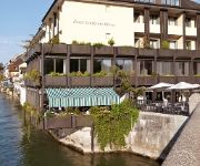
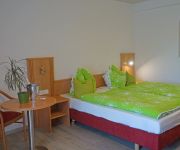
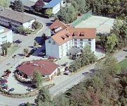
Ringhotel Goldener Knopf
Schloßmatt
City Hotel
Danner
Schiff am Rhein
Schützen
Andis Steakhuesli
Am Hochrhein
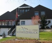
Schweizerblick
Zur Flüh
Videos from this area
These are videos related to the place based on their proximity to this place.
The nearness of you (Norah Jones) by HARY DE VILLE TRIO
Hary de Ville - voc, git. Martin Schrack - piano; German Klaiber - bass.DER Getz, Fitzgerald Traditional der durch Norah Jones wieder aktuell wurde, entstand Live in Wehr im Rahmen des Gitarrenfest...
Dindi - Corcovado (Gilberto - Getz - Jobim) by HARY DE VILLE TRIO
Hary de Ville - voc, git. Martin Schrack - piano; German Klaiber - bass. Jobim Classics played live at the guitarfestival "Akkorde" 2.10.2009 Wehr Germany mehr about the Hary de Ville Trio:...
Im Fahrradgeschäft
Ein kleiner Legofilm (Brickfilm) in dem es einen Unfall mit einem Fahrrad und einem Auto gibt. Zum Glück ist nichts weiter passiert und in der Nähe ein Fahrradgeschäft. Alles ist bis zum...
Lullaby of birdland (Shearing - Ella) by Hary de Ville Trio
Hary de Ville - voc, git. Martin Schrack - piano; German Klaiber - bass. Shearing - Ella Fitzgerald Klassiker. Live in Wehr Gitarrenfestival "Akkorde" 2.10.2009 mehr Infos zu dem Hary de...
The Shadow of your smile (Getz, Fitzgerald) by HARY DE VILLE TRIO
Hary de Ville - voc, git. Martin Schrack - piano; German Klaiber - bass. The Sinatra Classic played Live in Wehr Gitarrenfestival "Akkorde" 2.10.2009 more Infos Hary de Ville Trio: http://www.har...
Loverman (Billie Holiday) by HARY DE VILLE & GERMAN KLAIBER
The Billie Holiday Traditional in a Live Version from 2.10.2009 Stadthalle Wehr at the Guitarfestival "Akkorde". Hary de Ville - voc, git. Martin Schrack - piano; German Klaiber - Bass mehr...
Landgasthof Sonne Wehr - Enkendorf
Ein besonderes Schmuckstück des Enkendorfs ist der Landgasthof Sonne. Das malerisch, an der Hasel gelegene Gasthaus wurde im 19. Jahrhundert erbaut. Behagliche Gemütlichkeit verströmen...
Neigetriebzug VT 611 in Wehr-Brennet (bei Öflingen)
Das schöne Örtchen bei Öflingen am Haltepunkt Wehr-Brennet. Hier fahren die Neigetriebzüge der Baureihe 611 zwischen Singen und Basel bad Bf, wo einst noch 218erlis fuhren... http://www.bahn-p.
Guggenmusik Rhy - Wehra - Schränzer Öflingen e.V.
Im Jahr 1985 trafen sich16 junge Männer, um die Fasnachtssaison nach alten öflinger Brauchtum als Rekrutenjahrgang 1966 musikalisch zu bestreiten. Aufgrund sich ausweitenden Auftritten ausserhal ...
Videos provided by Youtube are under the copyright of their owners.
Attractions and noteworthy things
Distances are based on the centre of the city/town and sightseeing location. This list contains brief abstracts about monuments, holiday activities, national parcs, museums, organisations and more from the area as well as interesting facts about the region itself. Where available, you'll find the corresponding homepage. Otherwise the related wikipedia article.
Augusta Raurica
Augusta Raurica is a Roman archaeological site and an open-air museum in Switzerland. Located on the south bank of the Rhine river about 20 km east of Basel near the villages of Augst and Kaiseraugst, it is the oldest known Roman colony on the Rhine.
Rheinfelden District
Rheinfelden District lies in the northwest of the canton of Aargau in Switzerland, in the Fricktal region. Its capital is Rheinfelden. Around 88% of the population live in the conurbation of Basel. There are 14 municipalities, with a population of 44,569 (as of 30 June 2012) living in an area of 112.09 km². The population density is around 355 persons per square kilometre.
Schweigmatt
Schweigmatt is a hamlet located in the southern Black Forest of Germany at an altitude of 780 metres. It belongs to the village of Raitbach and is part of the municipality of Schopfheim in the district of Lörrach. Schweigmatt lies beneath the 985 m peak of the Hohe Möhr, from which it is possible to see as far as the Swiss Alps and Jura Mountains across the Rhine River.
Feldschlösschen
Feldschlösschen is a brand of beer. The brewery, with the main facility located in Rheinfelden, Switzerland is the biggest brewery in Switzerland and was founded in 1876. It bought out Cardinal in 1991. It was bought by Carlsberg in 2000. The brewery is in the shape of a castle and Feldschlösschen means 'small castle in the fields' in German.
Canton of Fricktal
Fricktal was a canton of the Helvetic Republic from February 1802 to February 1803, consisting of that part of the Breisgau south of the Rhine. Now, the territories of Fricktal form the districts of Rheinfelden and Laufenburg in the canton of Aargau. In 1799, a year after the proclamation of the Helvetic Republic, French Revolutionary troops marched into the Fricktal.
Schloss Ebenrain
Schloss Ebenrain is a former country residence in Sissach, in the canton of Basel-Country, Switzerland. Built in 1774-1776, it is considered the most significant late baroque residence in northwestern Switzerland. It is now a public facility and the site of an agricultural school. It is listed as a Swiss cultural property of national significance.
Battle of Rheinfelden
The Battle of Rheinfelden was a military event in the course of the Thirty Years' War, consisting in fact of two battles fought in 1638 to the north and south of the present-day town of Rheinfelden, between a mercenary army led by Bernhard of Saxe-Weimar and an Holy Roman Empire army led by Johann von Werth. Bernhard was defeated in the first battle but managed to defeat and capture Von Werth in the second.
Ägelsee (Zeiningen)
Ägelsee (or Egelsee) is a small lake in the municipality of Zeiningen, Canton of Aargau, Switzerland. The 7500 m² nature preserve is an amphibian spawning area of national importance.
Möhlinbach
The Möhlinbach is a 15 kilometer long stream in Aargau canton, Switzerland.
Möhlintal
The Möhlintal is a 10-kilometre long valley running between Möhlin and Wegenstetten in the Rheinfelden district of Canton Aargau, Switzerland. The five municipalities in the valley have a total population of around 14,000 people. In the upper valley, the valley is also known as the "Wegenstettertal". This name was particularly used by associations and groups related to the upper Möhlintal municipalities. In Habsburg times the area Landschaft (territory) Möhlinbach was already known.
Fischingertal
The Fischingertal is a 5 kilometer long valley running between Mumpf and Schupfart in the Rheinfelden District of Canton Aargau, Switzerland.
Säckingen Abbey
Säckingen Abbey is a former Roman Catholic abbey located in Bad Säckingen, Baden-Württemberg in Germany. The Abbey was founded in the 6th or 7th Century by Fridolin of Säckingen, an Irish monk. While the Abbey had both monks and nuns, only the nuns convent grew to be an important religious, economic and cultural institution for the entire upper Rhine.
Eggberg
Eggberg is a mountain of Baden-Württemberg, Germany.
Hohe Flum
Hohe Flum is a mountain of Baden-Württemberg, Germany.
Hohe Möhr
Hohe Möhr is a mountain of Baden-Württemberg, Germany.
Rohrenkopf
Rohrenkopf is a mountain of Baden-Württemberg, Germany.
Dürrenbach
Durrenbach is a commune in the Bas-Rhin department in Alsace in north-eastern France.
Schöpfebach
Schöpfebach is a river of Baden-Württemberg, Germany.
Wehra
Wehra is a river of Baden-Württemberg, Germany.
Sissle
The Sissle is a 16-kilometer long river in the Swiss canton of Aargau in Switzerland. It is a tributary of the Rhine and drains the eastern part of the Fricktal. The largest town on the river is Frick. The river rises in the municipalities of Schinznach-Dorf and Thalheim at an altitude of 650 m above the sea (Switzerland) on the southern slope of Mount Dreierberg and the northern slope of Mount Zeiher Homberg, in the Jura Mountains.
Farnsburg Castle
Farnsburg Castle is a castle in the municipality of Ormalingen in the canton of Basel-Land in Switzerland. It is a Swiss heritage site of national significance.
Bischofstein Castle (Switzerland)
Bishofstein Castle (German: Burg Bischofstein or Ruine Bischofstein) is a castle in the municipality of Sissach of the canton of Basel-Land in Switzerland. It is a Swiss heritage site of national significance.
Ebenrain Castle
Ebenrain Castle is a castle in the municipality of Sissach of the Canton of Basel-Country in Switzerland. It is a Swiss heritage site of national significance.
Sissacherfluh Castle
Sissacherfluh Castle is a castle in the municipality of Sissach of the canton of Basel-Land in Switzerland. It is a Swiss heritage site of national significance.
Gersbach (Schopfheim)
Gersbach is a nationally recognized resort and district of Schopfheim, a town in the district of Lörrach in Baden-Württemberg, Germany. Gersbach is situated in a mountain valley basin to the south from the eponymous river in the Black Forest at an altitude of 800-1170 m above sea level. The old town of Schopfheim is roughly 17 km away. The formerly independent village, together with the six associated hamlets forms one of Baden-Württemberg's largest Gemarkung, with an area of 2009 hectares.


