Safety Score: 3,0 of 5.0 based on data from 9 authorites. Meaning we advice caution when travelling to Germany.
Travel warnings are updated daily. Source: Travel Warning Germany. Last Update: 2024-04-29 08:03:39
Explore Rhina
The district Rhina of Laufenburg in Freiburg Region (Baden-Württemberg) is located in Germany about 417 mi south-west of Berlin, the country's capital.
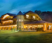
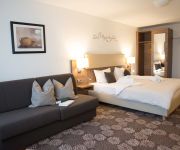
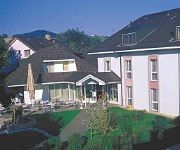
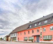
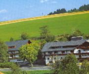
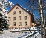
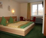
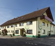
If you need a place to sleep, we compiled a list of available hotels close to the map centre further down the page.
Depending on your travel schedule, you might want to pay a visit to some of the following locations: Laufenburg, Murg, Albbruck, Goerwihl and Gansingen. To further explore this place, just scroll down and browse the available info.
Local weather forecast
Todays Local Weather Conditions & Forecast: 20°C / 67 °F
| Morning Temperature | 9°C / 48 °F |
| Evening Temperature | 19°C / 67 °F |
| Night Temperature | 12°C / 54 °F |
| Chance of rainfall | 0% |
| Air Humidity | 49% |
| Air Pressure | 1014 hPa |
| Wind Speed | Light breeze with 4 km/h (3 mph) from South-East |
| Cloud Conditions | Broken clouds, covering 63% of sky |
| General Conditions | Light rain |
Wednesday, 1st of May 2024
20°C (67 °F)
12°C (53 °F)
Light rain, gentle breeze, overcast clouds.
Thursday, 2nd of May 2024
9°C (48 °F)
7°C (44 °F)
Light rain, moderate breeze, overcast clouds.
Friday, 3rd of May 2024
10°C (50 °F)
6°C (43 °F)
Light rain, gentle breeze, overcast clouds.
Hotels and Places to Stay
Rheinsberg
Brutsches Rebstock
Platanenhof Seminarhotel
Hotel zum Hirsch
Alemannenhof Engel
Hirschen Landgasthof
Engel Gasthaus
Kranz
Alte Post
Cafe Verkehrt - Kultur Genuss Hotel
Videos from this area
These are videos related to the place based on their proximity to this place.
Zauberhaftes Laufenburg - Zwei Länder - eine Stadt
Malerisch an einer Engstelle des Hochrheins gelegen, neigen sich zwei zauberhafte Städte einander so sehr zu, dass sie zu einer Stadt zu verschmelzen scheinen. Getrennt nur vom Fluss und einer...
Narrentreffen Laufenburg Umzug am 27.01.20/13/13.00Uhr .wmv
Narrentreffen am 26/27.Januar 2013 in Laufenburg/Baden gemeinsam mit Laufenburg/Schweiz. Laufenburg Narro - Alt - Fischerzunft 1386.
Laufenburg
Laufenburg gehört zum Landkreis Waldshut, Baden Würtemberg. Auf der Schweizerseite liegt der im Jahre 1801 abgetrennte Stadtteil Laufenburg der zum Kt. Aargau gehört. Die Laufenbrücke...
Trailer von Laufenburg-Binzgen
Das ist der Trailer von Binzgen, wenn sie zum Beispiel eine Wohnung suchen oder sonst was. Musik von http://papafiotmusic.com/ Website Laufenburg-Binzgen: http://ww...
Stadenhausen - Stadtteil von Laufenburg
Stadenhausen wird auch „Mainau von Laufenburg genannt und ebenso wie die Mainau des Bodensees ist Stadenhausen gerade im Frühling ein Erlebnis. Blühende Bäume, wohin man schaut - ein...
Manuel Sanchez Carabel & Claudia Gätner ( Laufenburg, Festival 09 )
Tango Argentino, Milonguero stil, estilo milonguero, Stage + vacances, Festival Laufenburg.
Die Tezzilnheimer Schtudehägler spielen beim Open-Air-Gugge-Festival in Laufenburg (2013)
Die Tezzilnheimer Schtudehägler spielen am 08.02.2013 beim Open-Air-Gugge-Festival in Laufenburg welches traditionell am Fasnacht Freitag statt findet. Eine grenzübergreifende Veranstaltung...
Tango Festival Laufenburg 2010.m4v
Tango Argentino, Tango Milonguero, Manuel Sanchez Carabel, Claudia Gärtner, estilo milonguero, Stage + vacances, Festival Laufenburg.
Videos provided by Youtube are under the copyright of their owners.
Attractions and noteworthy things
Distances are based on the centre of the city/town and sightseeing location. This list contains brief abstracts about monuments, holiday activities, national parcs, museums, organisations and more from the area as well as interesting facts about the region itself. Where available, you'll find the corresponding homepage. Otherwise the related wikipedia article.
Aar
The Aar, a tributary of the High Rhine, is the longest river that both rises and ends entirely within Switzerland. Its total length from its source to its junction with the Rhine comprises about 295 km (183 miles), during which distance it descends 1,565 m, draining an area of 17,779 km, including the whole of central Switzerland.
Waldshut (district)
Waldshut is a district (Kreis) in the south of Baden-Württemberg, Germany. Neighbouring districts are (clockwise from the west) Lörrach, Breisgau-Hochschwarzwald and Schwarzwald-Baar; followed in the south by the Swiss cantons of Schaffhausen, Zürich and Aargau.
Brugg District
Brugg District is a district in the Canton of Aargau, Switzerland, it is located south of the Aare and the Aargauer Jura covers the district. The capital of the district is the town of Brugg.
Paul Scherrer Institute
The Paul Scherrer Institute (PSI) is a multi-disciplinary research institute which belongs to the Swiss ETH-Komplex covering also the ETH Zurich and EPFL. It was established in 1988 by merging in 1960 established EIR (Eidgenössisches Institut für Reaktorforschung = Federal Institute for Reactor Research) and in 1968 established SIN (Schweizerisches Institut für Nuklearphysik = Swiss Institute for Nuclear Physics).
Fricktal
The Fricktal ("Frick Valley") region is the northwest finger extending from the Swiss canton of Aargau. It is situated in Northwestern Switzerland east of Basel, between the High Rhine forming the border with Germany in the north and the Jura Mountains in the south. The Fricktal contains the districts of Laufenburg and Rheinfelden. The region is named after its former chief village Frick.
Habsburg Castle
██ Built before 1100. 1600 ruinous. ██ Built between 1100 and 1250. 1600 ruinous. ██ Built before 1100. 1600 still existing. ██ Built between 1100 and 1250. 1600 still existing. Except for the chapel, the green and orange colored buildings still exist today. ]] Habsburg Castle is a medieval fortress located in Habsburg, Switzerland in the canton of Aargau, near the Aar River. At the time of its construction, the location was part of the Duchy of Swabia.
Stilli
Stilli is a former municipality of the canton of Aargau, Switzerland. On 1 January 2006, it merged with its neighbouring municipality, Villigen.
Laufenburg District
Laufenburg District is a district of the canton of Aargau, Switzerland, essentially consisting of the upper Fricktal valley in the Aargau Jura south of the Rhine. Its capital is the town of Laufenburg. It has a population of 29,915 (as of 30 June 2012).
Benkerjoch Pass
Benkerjoch Pass (el. 674 m) is a mountain pass in the canton of Aargau in Switzerland. It connects Küttigen and Oberhof. Until 1801, the pass was the boundary between Austria and Switzerland. The current pass road was built in 1977. A postal bus route runs over the pass to Aarau.
Bözberg Pass
Bözberg Pass (el. 569 m. ) is a mountain pass in the Jura Mountains in the canton of Aargau in Switzerland. It connects the Frick River valley and Brugg and is the shortest road between Basel and Zürich. Two tunnels have been dug under the pass, one for the Federal Railway and one for the A-3 Autobahn.
Salhöhe Pass
Salhöhe Pass (el. 779 m. ) is a mountain pass in the Jura Mountains of Switzerland between Kienberg in the canton of Solothurn and Erlinsbach in the canton of Aargau. It connects Kienberg in Solothurn and Erlinsbach in Aargau. The pass road has a maximum grade of 9 percent. Although it is the shortest route between Aarau and Basel, traffic over the pass is moderate.
Staffelegg Pass
Staffelegg Pass (el. 621 m. ) is a mountain pass in the canton of Aargau in Switzerland. It connects Küttigen and Asp. The postal bus route from Frick to Aarau goes over the pass, and there is a restaurant at the summit.
Möhlintal
The Möhlintal is a 10-kilometre long valley running between Möhlin and Wegenstetten in the Rheinfelden district of Canton Aargau, Switzerland. The five municipalities in the valley have a total population of around 14,000 people. In the upper valley, the valley is also known as the "Wegenstettertal". This name was particularly used by associations and groups related to the upper Möhlintal municipalities. In Habsburg times the area Landschaft (territory) Möhlinbach was already known.
Fischingertal
The Fischingertal is a 5 kilometer long valley running between Mumpf and Schupfart in the Rheinfelden District of Canton Aargau, Switzerland.
Kasteln Castle
Kasteln Castle is a castle in the municipality of Oberflachs in Canton Aargau, Switzerland. It is located west of the village on a rocky outcrop, surrounded by vineyards and woods. Today, it serves as a boarding school for students with behavioral problems. The immediately adjacent castle Ruchenstein was demolished in 1643, when the small fort was rebuilt into a Schloss Kasteln.
Iberg Castle, Aargau
Iberg Castle is a ruined castle located on Iberg mountain in the municipality of Riniken in the canton of Aargau in Switzerland. Only a few remnants of the ruins are visible.
Schenkenberg Castle
Schenkenberg Castle is a castle ruin above the municipality of Thalheim in the canton of Aargau in Switzerland. It was built in the 13th Century by the Habsburg dynasty, was the administrative seat for 260 years of a bailiwick of the city of Bern and fell into ruin in the 18th century.
Säckingen Abbey
Säckingen Abbey is a former Roman Catholic abbey located in Bad Säckingen, Baden-Württemberg in Germany. The Abbey was founded in the 6th or 7th Century by Fridolin of Säckingen, an Irish monk. While the Abbey had both monks and nuns, only the nuns convent grew to be an important religious, economic and cultural institution for the entire upper Rhine.
Eggberg
Eggberg is a mountain of Baden-Württemberg, Germany.
Ergolz
The Ergolz is the main river in the canton of Basel-Landschaft, Switzerland. It rises on Mount Geisflue in the Faltenjura mountains in the upper region of Basel-Landschaft, on the border with Aargau and Solothurn, and joins the Rhine at Augst. Among the tributaries of the Ergolz are Eibach, Homburgerbach, Diegterbach, Frenke (Anterior and Posterior Frenke), Orisbach, Röserenbach and Violenbach.
Schöpfebach
Schöpfebach is a river of Baden-Württemberg, Germany.
Wehra
Wehra is a river of Baden-Württemberg, Germany.
Sissle
The Sissle is a 16-kilometer long river in the Swiss canton of Aargau in Switzerland. It is a tributary of the Rhine and drains the eastern part of the Fricktal. The largest town on the river is Frick. The river rises in the municipalities of Schinznach-Dorf and Thalheim at an altitude of 650 m above the sea (Switzerland) on the southern slope of Mount Dreierberg and the northern slope of Mount Zeiher Homberg, in the Jura Mountains.
Liederbach (Main)
Liederbach (Main) is a river of Hesse, Germany.
Aarau railway station
Aarau railway station serves the municipality of Aarau, capital city of the canton of Aargau, Switzerland. Opened in 1856, it is owned and operated by SBB-CFF-FFS. The station forms the junction between the Olten–Aarau railway line and Baden–Aarau railway line. Previously, it was also a terminus of the now closed Aarau–Suhr railway line. On the southern side of the station yard is a separate station for the metre gauge trains of the Wynental- und Suhrentalbahn.


