Safety Score: 3,0 of 5.0 based on data from 9 authorites. Meaning we advice caution when travelling to France.
Travel warnings are updated daily. Source: Travel Warning France. Last Update: 2024-04-27 08:23:39
Explore Champgenéteux
Champgenéteux in Mayenne (Pays de la Loire Region) with it's 582 inhabitants is a city in France about 130 mi (or 209 km) west of Paris, the country's capital.
Local time in Champgenéteux is now 05:20 PM (Saturday). The local timezone is named Europe / Paris with an UTC offset of 2 hours. We know of 10 airports in the vicinity of Champgenéteux, of which two are larger airports. The closest airport in France is Alençon Valframbert Airport in a distance of 24 mi (or 39 km), North-East. Besides the airports, there are other travel options available (check left side).
There are several Unesco world heritage sites nearby. The closest heritage site in France is Mont-Saint-Michel and its Bay in a distance of 24 mi (or 39 km), North. If you need a place to sleep, we compiled a list of available hotels close to the map centre further down the page.
Depending on your travel schedule, you might want to pay a visit to some of the following locations: Mayenne, Laval, Alencon, Chateau-Gontier and Argentan. To further explore this place, just scroll down and browse the available info.
Local weather forecast
Todays Local Weather Conditions & Forecast: 10°C / 50 °F
| Morning Temperature | 3°C / 38 °F |
| Evening Temperature | 11°C / 52 °F |
| Night Temperature | 10°C / 49 °F |
| Chance of rainfall | 22% |
| Air Humidity | 99% |
| Air Pressure | 999 hPa |
| Wind Speed | Moderate breeze with 10 km/h (6 mph) from North |
| Cloud Conditions | Overcast clouds, covering 100% of sky |
| General Conditions | Moderate rain |
Sunday, 28th of April 2024
13°C (55 °F)
6°C (44 °F)
Light rain, moderate breeze, broken clouds.
Monday, 29th of April 2024
14°C (57 °F)
8°C (46 °F)
Light rain, gentle breeze, clear sky.
Tuesday, 30th of April 2024
15°C (58 °F)
9°C (48 °F)
Light rain, moderate breeze, overcast clouds.
Hotels and Places to Stay
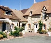
Oasis Logis
Videos from this area
These are videos related to the place based on their proximity to this place.
CABARET 1 15EME CLAIR.wmv
Cabaret equestre les Ecuyers de l'Histoire au Domaine des Ecuyers saint gemme le robert Tableau "jeux de chasse et de guerre" 15ème Kerléos et Licorne Monastrel et Emeline Le Marquis et Kerléos.
RANDO VTT LA TRANSCOEVRONS 02/10/2011
I created this video with the YouTube Video Editor (http://www.youtube.com/editor)
Courcite church and war memorial - Première Guerre mondiale 2 monument aux morts
War Memorial, Church, Courcite, Mayenne, Pas de La Loire, France.
1er vol paramoteur pierre -1
En stage de brevet de paramoteur a Courcité 1er vol de paramoteur...super sympa... vent 5-10 km/h.
La chapelle St Michel au Montaigu.mp4
Vidéo réalisée à partir d'un modèle réduit. Motoplaneur Easy Glider. Vue arrière. Vent assez soutenu. Vol heurté. Manque de soleil... Je vais même bénéficier d'une averse de grêle.
Videos provided by Youtube are under the copyright of their owners.


