Safety Score: 3,0 of 5.0 based on data from 9 authorites. Meaning we advice caution when travelling to France.
Travel warnings are updated daily. Source: Travel Warning France. Last Update: 2024-05-05 08:24:42
Delve into Dolleren
Dolleren in Haut-Rhin (Grand-Est) with it's 414 habitants is located in France about 223 mi (or 358 km) east of Paris, the country's capital town.
Current time in Dolleren is now 12:44 PM (Sunday). The local timezone is named Europe / Paris with an UTC offset of 2 hours. We know of 13 airports close to Dolleren, of which 5 are larger airports. The closest airport in France is Fontaine Airport in a distance of 11 mi (or 18 km), South. Besides the airports, there are other travel options available (check left side).
There are several Unesco world heritage sites nearby. The closest heritage site is La Chaux-de-Fonds / Le Locle, Watchmaking Town Planning in Switzerland at a distance of 49 mi (or 78 km). The closest in France is Strasbourg – Grande île in a distance of 65 mi (or 78 km), South. If you need a hotel, we compiled a list of available hotels close to the map centre further down the page.
While being here, you might want to pay a visit to some of the following locations: Thann, Belfort, Guebwiller, Montbeliard and Altkirch. To further explore this place, just scroll down and browse the available info.
Local weather forecast
Todays Local Weather Conditions & Forecast: 11°C / 52 °F
| Morning Temperature | 9°C / 48 °F |
| Evening Temperature | 15°C / 59 °F |
| Night Temperature | 10°C / 50 °F |
| Chance of rainfall | 7% |
| Air Humidity | 94% |
| Air Pressure | 1014 hPa |
| Wind Speed | Light breeze with 5 km/h (3 mph) from North-East |
| Cloud Conditions | Overcast clouds, covering 100% of sky |
| General Conditions | Moderate rain |
Monday, 6th of May 2024
10°C (49 °F)
9°C (48 °F)
Heavy intensity rain, gentle breeze, overcast clouds.
Tuesday, 7th of May 2024
9°C (49 °F)
8°C (46 °F)
Light rain, light breeze, overcast clouds.
Wednesday, 8th of May 2024
11°C (52 °F)
6°C (43 °F)
Light rain, light breeze, overcast clouds.
Hotels and Places to Stay
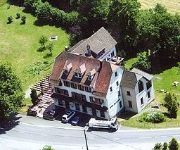
Des Vosges Logis
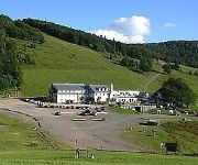
Le Rouge Gazon Logis
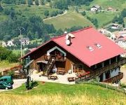
La Bouloie Logis
Videos from this area
These are videos related to the place based on their proximity to this place.
Sortie VTT vers le Rosberg depuis Lauw
Sortie entre membre du forum vtt-alsace.fr Longueur de l'itinéraire : 24.5 km Denivelé positif cumulé : 887 m Retrouvez le récit complet : http://www.vtt-alsace.fr/viewtopic.php?f=21&t=1049...
carriere rougemont mai 2009 / 03
6 MAI 17H30 à la mairie de Rougemont, Mr le conseillé reçoit la population, VENEZ NOMBREUX.
Spéléo Secours Français Région Alsace - Barnum 2012
Résumé en image, du Barnum 2012 des équipes alsaciennes du Spéléo Secours Français. Exercice organisé en Mars 2012, dans le village de Mollau (Haut-Rhin) http://ssfalsace.fr.
FUITE RETROUVER DANS LA DOUCHE AVEC INFILTRATION Masevaux (68)
FUITE RETROUVER DANS LA DOUCHE AVEC INFILTRATION Masevaux (68) EXPERT EN RECHERCHE DE FUITE D'EAU MULHOUSE .7 id Intervenant depuis plus de 10 ans , Tel 03 88 52 29 52 le ...
FUITE RETROUVER GRACE A UNE CAMERA HYDROVIDEO Masevaux (68)
FUITE RETROUVER GRACE A UNE CAMERA HYDROVIDEO Masevaux (68) RECHERCHE EXPERT EN RECHERCHE DE FUITE D'EAUU EN ALSACE .7 id Intervenant depuis plus de 14 ans , Tel 03 ...
Spitfire MK IXc rc
Vol du Spitfire MK IXc au terrain du Club des Modélistes de la Haute Alsace à Masevaux.
Videos provided by Youtube are under the copyright of their owners.
Attractions and noteworthy things
Distances are based on the centre of the city/town and sightseeing location. This list contains brief abstracts about monuments, holiday activities, national parcs, museums, organisations and more from the area as well as interesting facts about the region itself. Where available, you'll find the corresponding homepage. Otherwise the related wikipedia article.
Lac des Perches
Lac des Perches is a lake in Haut-Rhin, France. At an elevation of 984 m, its surface area is 0.044 km². It is located on the Alsatian side of the Vosges Mountains in the municipality of Rimbach-près-Masevaux. It is a Glacial Lake that was dammed in the 16th Century to provide power to forges and to textile mills.
Lac du Lachtelweiher
Lac du Lachtelweiher is a lake in Haut-Rhin, France. At an elevation of 740 m, its surface area is 0.015 km². The French name is a tautology as the German Weiher already means pond/lake.
Lake Überlingen
Lake Überlingen Lake is the northwestern "finger" of the Obersee part of Lake Constance. The boundary of lake is defined as the ferry link from Meersburg to Constance. It extends North to Bodman-Ludwigshafen. In contrast to the main south-eastern part of the Upper Lake, which is a condominium, Lake Überlingen is considered German territory. The total area of Lake Obersee is about 473 km²; with its 61 km², Lake Überlingen is about as large as the Untersee part of the lake.


